Delve into Palmwoods
The district Palmwoods of in Sunshine Coast (Queensland) is a district located in Australia about 636 mi north of Canberra, the country's capital town.
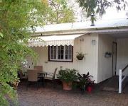
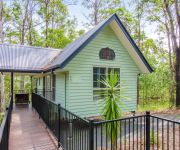
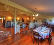
In need of a room? We compiled a list of available hotels close to the map centre further down the page.
Since you are here already, you might want to pay a visit to some of the following locations: Sunshine Coast, Brisbane, Carrolls Creek, and . To further explore this place, just scroll down and browse the available info.
Local weather forecast
Todays Local Weather Conditions & Forecast: 26°C / 79 °F
| Morning Temperature | 16°C / 62 °F |
| Evening Temperature | 23°C / 73 °F |
| Night Temperature | 15°C / 60 °F |
| Chance of rainfall | 0% |
| Air Humidity | 48% |
| Air Pressure | 1019 hPa |
| Wind Speed | Gentle Breeze with 6 km/h (4 mph) from West |
| Cloud Conditions | Scattered clouds, covering 45% of sky |
| General Conditions | Scattered clouds |
Monday, 25th of November 2024
26°C (79 °F)
17°C (63 °F)
Light rain, light breeze, broken clouds.
Tuesday, 26th of November 2024
27°C (81 °F)
18°C (65 °F)
Sky is clear, light breeze, clear sky.
Wednesday, 27th of November 2024
28°C (83 °F)
21°C (69 °F)
Light rain, light breeze, broken clouds.
Hotels and Places to Stay
Bli Bli House Luxury Bed & Breakfast
Red Bridge Motor Inn
Amytis Gardens Retreat Spa and Cooking School
Poppies Bed and Breakfast
The Falls Montville
Alaya Escape
Altitude on Montville
Bendles Cottages and Country Villas
Montville Attic
Nambour Heights Motel
Videos from this area
These are videos related to the place based on their proximity to this place.
19 Magnolia Street, Nambour RE/MAX Sunshine Coast real estate Lee Sutherland 0499 99 33 11
Historic Home will Delight! 19 Magnolia Street, Nambour for sale by RE/MAX Sunshine Coast real estate Lee Sutherland 0499 99 33 11 This elegant home built circa 1935 stands proudly on beautiful...
Exceptional Cosmetic Dentistry in Sunshine Coast At Smiles Nambour
http://www.smilesnambour.com.au/exceptional-cosmetic-dentistry-in-sunshine-coast-at-smiles-nambour/ Exceptional Cosmetic Dentistry in Sunshine Coast At Smiles Nambour Why Should You Go For.
Dental Implants in Nambour: Reasons Why You Should Get Dental Implants Instead
http://www.smilesnambour.com.au/dental-implants-in-nambour-reasons-why-you-should-get-dental-implants-instead Dental Implants in Nambour: Reasons Why You Should Get Dental Implants ...
Nambour Dentist Video Tips: What Are The Early Signs Of Oral Cancer?
http://www.smilesnambour.com.au/nambour-dentist-video-tips-what-are-the-early-signs-of-oral-cancer Nambour Dentist Video Tips: What Are The Early Signs Of Oral Cancer? Awareness is the most...
Hair Salon Nambour Call Us On 07 5441 1462
http://www.hair-salon-nambour.com/ Hair Salon Nambour Call On 07 5441 1462 - The Best Hair Salon in Currie Street Nambour QLD 4560. Call our hair salon on 07 5441 1462 and discover why we ...
Nambour TV - The Shack - Dale Dowler
Bridget Kraft has a chat with Dale Dowler, the Community Relations Officer, in Price Street, Nambour to find out that the shack is a non denominational christian community centre focussed...
Hair Salon Nambour Call Us On 07 5441 1462
http://www.hair-salon-nambour.com/ Hair Salon Nambour Call On 07 5441 1462 - The Best Hair Salon in Currie Street Nambour QLD 4560. Call our hair salon on 07 5441 1462 and discover why we ...
Preserve Your Smile With Dental Fissure Sealants In Sunshine Coast At Smiles Nambour
http://www.smilesnambour.com.au/preserve-your-smile-with-dental-fissure-sealants-in-sunshine-coast-at-smiles-nambour Preserve Your Smile With Dental Fissure Sealants In Sunshine Coast At ...
SOLD by Lee Sutherland 0417 077 847 Sunshine Coast RE/MAX Best Real Estate Agent Nambour. Smakk Me
Sold 52 Blackall Range Road Woombye Marketed by Lee Sutherland, RE/MAX 0417 077 847 Custom Designed Acreage Living...Idyllic Setting Features: 4 bedrooms, 3 bathrooms, 4 car, 6 x 9m shed,...
Videos provided by Youtube are under the copyright of their owners.
Attractions and noteworthy things
Distances are based on the centre of the city/town and sightseeing location. This list contains brief abstracts about monuments, holiday activities, national parcs, museums, organisations and more from the area as well as interesting facts about the region itself. Where available, you'll find the corresponding homepage. Otherwise the related wikipedia article.
Eudlo Creek National Park
Eudlo Creek is a national park in Queensland, Australia, 85 km north of Brisbane. North west of the park is the rural township of Palmwoods.
Triunia National Park
Triunia is a national park in South East Queensland, Australia, 92 km north of Brisbane. The Administration is Wildlife Service of Queensland
Nambour, Queensland
Nambour is a town in South East Queensland, Australia, 101 kilometres north of the state capital, Brisbane. The town lies in the sub-tropical hinterland of the Sunshine Coast at the foot of the Blackall Range and has a population of 10,221. It was the administrative centre and capital of the Maroochy Shire and is now the administrative centre of the Sunshine Coast Region.
Palmwoods, Queensland
Palmwoods is a town in Queensland, Australia, situated near Nambour. At the 2006 census, Palmwoods had a population of 3,576. The small town was previously named Merriman Flats in 1881 by the Kuskopfs who were early European settlers in the area. Palmwoods railway station was opened leading to the nearby town to be renamed Palmwoods after the Piccabeen Palm groves growing in the area. It is situated close to popular family tourist attractions such as The Big Pineapple.
Eudlo railway station
Eudlo is a railway station on the Nambour and Gympie North Line of South East Queensland, Australia. It is part of the Queensland Rail City network. The station is in Zone 15 of the TransLink integrated public transport system. Eudlo has a short platform and can only accommodate three cars at a time. Passengers wishing to use Eudlo should always ensure that they are in the front three cars of any train.
Palmwoods railway station
Palmwoods is a railway station at Palmwoods on the Nambour and Gympie North Line of South East Queensland, Australia. It is part of the Queensland Rail City network. The station is in Zone 16 of the TransLink integrated public transport system.
Woombye railway station
Woombye is a railway station on the Nambour and Gympie North Line of South East Queensland, Australia. It is part of the Queensland Rail City network. The station is in Zone 16 of the TransLink integrated public transport system. Woombye's platform has been extended to accommodate 6 carriage trains. Before the extension, Woombye could only accommodate 4 cars.
Nambour railway station
Nambour is a railway station on the Nambour and Gympie North Line of South East Queensland, Australia. It is part of the Queensland Rail City network. The station is in Zone 17 of the TransLink integrated public transport system. It is the terminus for the Nambour trains, with peak-hour and limited weekend services continuing to stations further north. The station is also serviced by a number of local bus routes to Noosa, Maroochydore and Mooloolaba also included in the Translink Network.
Big Pineapple
The Big Pineapple is a tourist attraction on the Sunshine Coast in South East Queensland, Australia. It is 16 metre high and was originally opened on the 15 of August 1971. It is situated on a 165 hectare site. The Big Pineapple features two rides: One on a Nut Mobile, the other on a small train that takes passengers on a tour of the plantation and lets them optionally disembark at a small zoo situated on the property.
Shire of Maroochy
The Shire of Maroochy was a local government area about 100 kilometres north of Brisbane in the Sunshine Coast region of South East Queensland, Australia. The shire covered an area of 1,162.7 square kilometres, and existed as a local government entity from 1890 until 2008, when it amalgamated with its neighbours to the north and south to form the Sunshine Coast Region.
Avatar's Abode
Avatar's Abode is a 99-acre spiritual retreat about 115 km north of Brisbane, Australia dedicated to Meher Baba. The site has a panoramic view of the Pacific Ocean to the east and over valleys, farmlands to the north and south and looks toward rolling blue hills to the west. By Meher Baba's wish, Avatar's Abode can never be sold, but must be kept as a place of pilgrimage.
Sunshine Coast Grammar School
The Sunshine Coast Grammar School is a private Christian school located in Forest Glen, a some-what rural town on Queensland's Sunshine Coast. The school has a student body of over 1200, from prep to grade 12. The school was established in 1997. It is owned by Presbyterian and Methodist Schools Association, which operates several other schools in Queensland.
Woombye, Queensland
Woombye is a town located on the Sunshine Coast hinterland in Queensland, Australia, approximately 100 km north of the Brisbane CBD. The name is derived from words from the local Aboriginal language - a place (wumbai) of black snake or (wambai) black myrtle or axe handle made from black myrtle. Woombye has a population of 2,094, as measured in the 2006 census. The small township of Woombye is surrounded by what were once pineapple farms, which today are acreage properties and gated communities.
Forest Glen, Queensland
Forest Glen is a suburb of the Sunshine Coast, Queensland, Australia, and is part of the Buderim urban centre. It is the home to the Sunshine Coast Grammar School and the Moonshine Valley Winery, and it is near the Forest Glen Deer Sanctuary in Mons, Queensland. Forest Glen is also the birthplace of Hugh Sawrey, famous Australian artist and founder of the Australian Stockman's Hall of Fame, who was born there in 1919.
Eudlo, Queensland
Eudlo is a small hinterland town on the Sunshine Coast in Queensland, Australia. The name originated from the fresh water eel (Anguilla reinhardtii). At the 2006 census, Eudlo had a population of 852.
Burnside, Queensland
Burnside is a suburb in the Sunshine Coast, Queensland, Australia. In 1979, the Burnside State High School opened.
Coes Creek, Queensland
Coes Creek is a suburb in the Sunshine Coast, Queensland, Australia.
West Woombye, Queensland
West Woombye is a suburb in the Sunshine Coast, Queensland, Australia. The surrounding suburbs include Towen Mountain, Hunchy, Dulong, Palmwoods and Coes Creek. There is farming within the area with crops such as lychees, macedamias, mangoes and avocados grown. The main road running through West Woombye is Blackall Range Road. This road turns into Dulong Road once in the suburb of Dulong. As the area incorporates the Blackall Range leading up to Montville, the area is noted for its scenery.
Chevallum, Queensland
Chevallum is a suburb in the Sunshine Coast, Queensland, Australia. It had a population of 438 at the 2011 Australian Census. Part of the western boundary of the suburb is marked by the Bruce Highway. Eudlo Creek, a tributary of the Maroochy River courses through the suburb. Chevallum is known for its strawberries and participates in the local Strawbfest. It has a local permaculture group devoted to organic and sustainable farming, which holds regular meetings at Chevallum School.
Kiels Mountain, Queensland
Kiels Mountain is a suburb of Woombye, Queensland, Australia about 100 kilometres north of Brisbane. At the summit of Kiels Mountain is Avatar's Abode, a 99-acre spiritual retreat dedicated to Meher Baba (1894-1969) who stayed there in 1958. Avatar's Abode is the oldest and longest-running Eastern retreat in Queensland. A large private school, Suncoast Christian College, and its associated Christian Outreach Centre is located by the juncture of the Kiels Mountain road and the old Bruce Highway.
Death of Daniel Morcombe
Daniel James Morcombe (19 December 1989 – c. 7 December 2003) was a 13-year-old Australian boy who was abducted from the Sunshine Coast, Queensland, on 7 December 2003. In August 2011, Brett Peter Cowan, a former Sunshine Coast resident, was charged with Morcombe's murder. In the same month, DNA tests confirmed bones found in an area being searched by the SES under the guidance of the police were Morcombe's.
Nambour State High School
Nambour State High School is a co-educational, state high school located in Nambour, Queensland, Australia. Established on 2 February 1953, in 2006 the school had enrolment figures of 1,367, including adult students. Previously, the Nambour State Rural School had operated from 1940 to 8 January 1953; it was then split into a primary school and the high school. The school's first Principal was George William Lockie, who was given the title of "acting principal".
Burnside State High School
Burnside State High School is a secondary education institution in Burnside, Queensland, Australia, with 425 students (as of 2010) that caters for grades 8 through to 12. The school was opened in 1979.
St John's College, Nambour
St John's College is a co-educational, Catholic high school located in Nambour, Queensland, Australia.
Hunchy, Queensland
Hunchy is a suburb in the Sunshine Coast, Queensland, Australia. Situated in the foothills of the Blackall Range, Hunchy was first called Hunchback. There is farming within the area with crops such as pineapples, lychees, macadamias, mangoes, bananas, citrus, avocados and a small quantity of coffee beans grown. Some of the older settlers trialled Shiraz grapes in the region but it did not rate in James Halliday's Wine Companions. Livestock include cattle, alpacas and honey-bees.


