Delve into Kulangoor
The district Kulangoor of in Sunshine Coast (Queensland) is a subburb in Australia about 643 mi north of Canberra, the country's capital town.
If you need a hotel, we compiled a list of available hotels close to the map centre further down the page.
While being here, you might want to pay a visit to some of the following locations: Sunshine Coast, Brisbane, Carrolls Creek, and . To further explore this place, just scroll down and browse the available info.
Local weather forecast
Todays Local Weather Conditions & Forecast: 23°C / 73 °F
| Morning Temperature | 19°C / 67 °F |
| Evening Temperature | 19°C / 67 °F |
| Night Temperature | 19°C / 66 °F |
| Chance of rainfall | 10% |
| Air Humidity | 69% |
| Air Pressure | 1021 hPa |
| Wind Speed | Gentle Breeze with 6 km/h (4 mph) from North-West |
| Cloud Conditions | Overcast clouds, covering 100% of sky |
| General Conditions | Moderate rain |
Friday, 22nd of November 2024
21°C (70 °F)
18°C (64 °F)
Moderate rain, light breeze, overcast clouds.
Saturday, 23rd of November 2024
26°C (78 °F)
18°C (64 °F)
Light rain, gentle breeze, clear sky.
Sunday, 24th of November 2024
24°C (75 °F)
18°C (65 °F)
Light rain, light breeze, broken clouds.
Hotels and Places to Stay
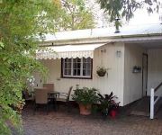
Bli Bli House Luxury Bed & Breakfast
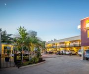
Nambour Heights Motel
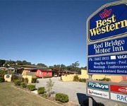
Red Bridge Motor Inn
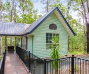
Amytis Gardens Retreat Spa and Cooking School
Hotel Beach House Nambour
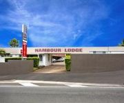
Nambour Lodge Motel
Rivershore Resort
Waterfront Hotel
Videos from this area
These are videos related to the place based on their proximity to this place.
5 Important Reasons Why You Need To Visit Smiles Nambour Dental Regularly
http://www.smilesnambour.com.au/5-important-reasons-why-you-need-to-visit-smiles-nambour-dental-regularly/ 5 Important Reasons Why You Need To Visit Smiles Nambour Dental Regularly If you...
Exceptional Cosmetic Dentistry in Sunshine Coast At Smiles Nambour
http://www.smilesnambour.com.au/exceptional-cosmetic-dentistry-in-sunshine-coast-at-smiles-nambour/ Exceptional Cosmetic Dentistry in Sunshine Coast At Smiles Nambour Why Should You Go For.
Nambour Dentist Video Tips: What Are The Early Signs Of Oral Cancer?
http://www.smilesnambour.com.au/nambour-dentist-video-tips-what-are-the-early-signs-of-oral-cancer Nambour Dentist Video Tips: What Are The Early Signs Of Oral Cancer? Awareness is the most...
87 Duhs Road Nambour 4560 QLD by Ben Wilson
Property Video shoot of 87 Duhs Road Nambour 4560 QLD by PlatinumHD http://www.platinumhd.tv for Ray White Lifestyle.
Preserve Your Smile With Dental Fissure Sealants In Sunshine Coast At Smiles Nambour
http://www.smilesnambour.com.au/preserve-your-smile-with-dental-fissure-sealants-in-sunshine-coast-at-smiles-nambour Preserve Your Smile With Dental Fissure Sealants In Sunshine Coast At ...
Dentist Sunshine Coast: How To Make Your Child Overcome Dental Phobia
http://www.smilesnambour.com.au/dentist-sunshine-coast-how-to-make-your-child-overcome-dental-phobia/ Dentist Sunshine Coast: How To Make Your Child Overcome Dental Phobia Come and visit ...
Dentist Sunshine Coast 7 Habits That Damage Teeth
http://www.smilesnambour.com.au/7-habits-that-damage-teeth/ Come and visit your dentist in Sunshine Coast today. Book your appointment online or call us on (07) 5441 4438 and claim your FREE...
7 Simple Ways to Fight Dental Cavities
http://www.smilesnambour.com.au/7-simple-ways-to-fight-dental-cavities/ 7 Simple Ways to Fight Dental Cavities The tooth enamel helps you enjoy eating your favourite foods, especially the...
Sunshine Coast Photographer Lara D
Lara D Sunshine Coast Photography Services Learn more about Lara D here http://LaraDPhotography.com.au Lara offers the following Sunshine Coast photography services: Maternity Photography...
Sold by Lee Sutherland 0417 077 847 for RE/MAX Sunshine Coast Real estate suggests Smakk Media video
Sold 6 Impression Drive Nambour : Marketed by Lee Sutherland 0417 077 847 Features: 4 double bedrooms, 2 bathrooms, Open plan living areas, alfresco entertainment area, sun patio, privacy...
Videos provided by Youtube are under the copyright of their owners.
Attractions and noteworthy things
Distances are based on the centre of the city/town and sightseeing location. This list contains brief abstracts about monuments, holiday activities, national parcs, museums, organisations and more from the area as well as interesting facts about the region itself. Where available, you'll find the corresponding homepage. Otherwise the related wikipedia article.
Ferntree Creek National Park
Ferntree Creek is a national park in Queensland, Australia, 97 km north of Brisbane.
Nambour, Queensland
Nambour is a town in South East Queensland, Australia, 101 kilometres north of the state capital, Brisbane. The town lies in the sub-tropical hinterland of the Sunshine Coast at the foot of the Blackall Range and has a population of 10,221. It was the administrative centre and capital of the Maroochy Shire and is now the administrative centre of the Sunshine Coast Region.
Division of Fairfax
The Division of Fairfax is an Australian Electoral Division in Queensland. The division was created in 1984 and is named for Ruth Fairfax, founder of the Country Women's Association. It is located in the Sunshine Coast region north of Brisbane and includes the towns of Coolum, Maroochydore, Buderim, Nambour, Montville, Kenilworth and Eumundi. Since 1990 it has been a safe seat for the Liberal Party.
Yandina, Queensland
Yandina is a Sunshine Coast hinterland town just off the Bruce Highway. Its name comes from 'yan', meaning "to go", and 'dinna', meaning "feet". At the 2011 census, Yandina had a population of 2,221. Aboriginal people have lived in the Yandina district for over 40,000 years. They belonged to the Gubbi Gubbi language group which consisted of a number of tribes occupying traditional resource areas.
Woombye railway station
Woombye is a railway station on the Nambour and Gympie North Line of South East Queensland, Australia. It is part of the Queensland Rail City network. The station is in Zone 16 of the TransLink integrated public transport system. Woombye's platform has been extended to accommodate 6 carriage trains. Before the extension, Woombye could only accommodate 4 cars.
Nambour railway station
Nambour is a railway station on the Nambour and Gympie North Line of South East Queensland, Australia. It is part of the Queensland Rail City network. The station is in Zone 17 of the TransLink integrated public transport system. It is the terminus for the Nambour trains, with peak-hour and limited weekend services continuing to stations further north. The station is also serviced by a number of local bus routes to Noosa, Maroochydore and Mooloolaba also included in the Translink Network.
Bli Bli, Queensland
Bli Bli is a locality and hamlet on the Sunshine Coast, Queensland, Australia. A few kilometres inland from the Maroochydore urban area, Bli Bli rises above the wetlands which were, for many years, the home of the Sunshine Coast sugar cane industry. Whilst this industry is all but gone, state government legislation ensures the wetlands will remain an undeveloped "Green Space" (See Qld Plan). At the 2006 census, Bli Bli had a population of 5,345.
Yandina railway station
Yandina is a railway station on the Nambour and Gympie North Line of South East Queensland, Australia. It is part of the Queensland Rail City network. The station is in Zone 19 of the TransLink integrated public transport system. It is the closest railway station to the Buderim Ginger Factory at Yandina. The line through the area was completed in 1891. However a station office building wasn't operational until a while later.
Shire of Maroochy
The Shire of Maroochy was a local government area about 100 kilometres north of Brisbane in the Sunshine Coast region of South East Queensland, Australia. The shire covered an area of 1,162.7 square kilometres, and existed as a local government entity from 1890 until 2008, when it amalgamated with its neighbours to the north and south to form the Sunshine Coast Region.
Yandina Creek, Queensland
Yandina Creek is a suburb in the Sunshine Coast, Queensland, Australia. Its name comes from 'yan', meaning "to go", and 'dinna', meaning "feet".
North Arm, Queensland
North Arm is a suburb on the Sunshine Coast in Queensland, Australia.
Maroochy River, Queensland
Maroochy River is a hinterland suburb on the Sunshine Coast, Queensland, Australia.
Rosemount, Queensland
Rosemount is a suburb in the Sunshine Coast, Queensland, Australia. It is located immediately east of Nambour, bordered on its north and south by the Petrie and Paynter Creeks. It extends about six km east to Bli Bli, reaching the Bruce Highway. Upper Rosemount Road roughly follows the ridge of the Rosemount Spur, which is a watershed for both the creeks. 'Rosemount' was an early cane farm on Petrie Creek. Rosemount covers an area of about 1160 hectares or around 12 km².
Ninderry, Queensland
Ninderry is a suburb in the Sunshine Coast, Queensland, Australia.
Valdora, Queensland
Valdora is a suburb in the Sunshine Coast, Queensland, Australia. At the 2011 Australian Census the suburb had a population of 380. All dwellings in Valdora consist of separate houses.
Parklands, Queensland
Parklands is a suburb in the Sunshine Coast, Queensland, Australia, located adjacent to and north of the larger town of Nambour. At the 2011 Australian Census the suburb recorded a population of 235. The suburb is bisected by the Bruce Highway. A large section of bushland in eastern Parklands, called the Parklands Conservation Park, has been set aside for recreational use and is very popular for mountainbiking, with a number of defined and marked trails.
Image Flat, Queensland
Image Flat is a suburb in the Sunshine Coast, Queensland, Australia. At the 2011 Australian Census the suburb had a population of 462.
Highworth, Queensland
Highworth is a suburb in the Sunshine Coast, Queensland, Australia. The suburb had a population of 307 at the 2011 Australian Census. All dwellings in the suburb were separate houses.
Burnside, Queensland
Burnside is a suburb in the Sunshine Coast, Queensland, Australia. In 1979, the Burnside State High School opened.
Coes Creek, Queensland
Coes Creek is a suburb in the Sunshine Coast, Queensland, Australia.
Wappa Dam
Wappa Dam is an Australian Dam located on the South Maroochy River at AMTD 32.1 km, approximately 6.5 km upstream of its confluence with the North Maroochy River. The mean annual rainfall for the catchment is approximately 1,700 mm. It has a catchment area of 72.4 km²
Poona Dam
Maroochy Shire Council owns and operates three water supply dams – Poona Dam, Wappa Dam and Cooloolabin Dams. Poona Dam is predominantly used as operational storage just upstream of the water treatment plant.
Nambour State High School
Nambour State High School is a co-educational, state high school located in Nambour, Queensland, Australia. Established on 2 February 1953, in 2006 the school had enrolment figures of 1,367, including adult students. Previously, the Nambour State Rural School had operated from 1940 to 8 January 1953; it was then split into a primary school and the high school. The school's first Principal was George William Lockie, who was given the title of "acting principal".
Burnside State High School
Burnside State High School is a secondary education institution in Burnside, Queensland, Australia, with 425 students (as of 2010) that caters for grades 8 through to 12. The school was opened in 1979.
St John's College, Nambour
St John's College is a co-educational, Catholic high school located in Nambour, Queensland, Australia.


