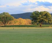
Delve into Bald Mountain
Bald Mountain in Southern Downs (Queensland) is located in Australia about 470 mi (or 757 km) north of Canberra, the country's capital town.
Current time in Bald Mountain is now 05:02 PM (Monday). The local timezone is named Australia / Brisbane with an UTC offset of 10 hours. We know of 9 airports close to Bald Mountain, of which one is a larger airport. The closest airport in Australia is Stanthorpe Airport in a distance of 20 mi (or 32 km), North. Besides the airports, there are other travel options available (check left side).
If you need a hotel, we compiled a list of available hotels close to the map centre further down the page.
While being here, you might want to pay a visit to some of the following locations: Carrolls Creek, Brisbane, Sunshine Coast, and . To further explore this place, just scroll down and browse the available info.
Local weather forecast
Todays Local Weather Conditions & Forecast: 27°C / 81 °F
| Morning Temperature | 13°C / 56 °F |
| Evening Temperature | 26°C / 79 °F |
| Night Temperature | 16°C / 61 °F |
| Chance of rainfall | 0% |
| Air Humidity | 39% |
| Air Pressure | 1016 hPa |
| Wind Speed | Gentle Breeze with 7 km/h (5 mph) from South-West |
| Cloud Conditions | Clear sky, covering 0% of sky |
| General Conditions | Sky is clear |
Tuesday, 26th of November 2024
28°C (83 °F)
17°C (63 °F)
Sky is clear, gentle breeze, clear sky.
Wednesday, 27th of November 2024
29°C (85 °F)
19°C (65 °F)
Sky is clear, gentle breeze, clear sky.
Thursday, 28th of November 2024
29°C (85 °F)
19°C (67 °F)
Overcast clouds, gentle breeze.
Hotels and Places to Stay
Wisteria Cottage and Cabins
Radiance On Lyra
Videos from this area
These are videos related to the place based on their proximity to this place.
Ballandean Estate - Creek to Coast May 2009
Ballandean Estate Wines, established in 1967, was featured on the "Creek to Coast" progam in May 2009. This is a quick insight into this traditional family winery and their love of wine, food...
Girraween National Park 2019. 1112m.
Recently completed the Sphinx track at Girraween National Park. Total elevation 1112m. ✌️
Videos provided by Youtube are under the copyright of their owners.
Attractions and noteworthy things
Distances are based on the centre of the city/town and sightseeing location. This list contains brief abstracts about monuments, holiday activities, national parcs, museums, organisations and more from the area as well as interesting facts about the region itself. Where available, you'll find the corresponding homepage. Otherwise the related wikipedia article.
Wallangarra, Queensland
Wallangarra is a village on the border between Queensland and New South Wales in Australia. It is the third most southerly town in Queensland, 258 km south west of Brisbane. Wallangarra is on the Queensland side of the border and Jennings is on the New South Wales side. At the 2006 census, Wallangarra had a population of 385. The name, originally Wallan-Garra, these are Aboriginal words meaning "plenty of water".
Jennings, New South Wales
Jennings is a town on the Northern Tablelands region of New South Wales, Australia. The town is located in the Tenterfield Shire local government area, 718 kilometres from the state capital, Sydney and 256 kilometres from Brisbane. It is separated by the state border from its neighbouring town of Wallangarra in Queensland. At the 2006 census, Jennings had a population of 130. The New England Highway and the Main North railway line cross the state border at Jennings.


