Explore Deception Bay
The district Deception Bay of in Moreton Bay (Queensland) with it's 16,090 inhabitants Deception Bay is located in Australia about 604 mi north of Canberra, the country's capital.
If you need a place to sleep, we compiled a list of available hotels close to the map centre further down the page.
Depending on your travel schedule, you might want to pay a visit to some of the following locations: Brisbane, Sunshine Coast, Carrolls Creek, and . To further explore this place, just scroll down and browse the available info.
Local weather forecast
Todays Local Weather Conditions & Forecast: 27°C / 80 °F
| Morning Temperature | 21°C / 70 °F |
| Evening Temperature | 25°C / 78 °F |
| Night Temperature | 21°C / 70 °F |
| Chance of rainfall | 0% |
| Air Humidity | 67% |
| Air Pressure | 1014 hPa |
| Wind Speed | Gentle Breeze with 7 km/h (4 mph) from South-West |
| Cloud Conditions | Overcast clouds, covering 88% of sky |
| General Conditions | Light rain |
Thursday, 28th of November 2024
29°C (83 °F)
22°C (71 °F)
Broken clouds, gentle breeze.
Friday, 29th of November 2024
27°C (81 °F)
22°C (72 °F)
Light rain, gentle breeze, overcast clouds.
Saturday, 30th of November 2024
26°C (78 °F)
22°C (71 °F)
Light rain, gentle breeze, overcast clouds.
Hotels and Places to Stay
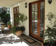
Best Western Plus North Lakes Hotel
HarbourSide B&B
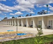
Kallangur Motel
Videos from this area
These are videos related to the place based on their proximity to this place.
A stinking hot TV antenna installation at Deception Bay.
Shortly after the making of this video I burst into flames. Join me in Deception Bay while I take on the competition. I turn up, quote accordingly and get the job done straight away. Honesty,...
94 Cross Street, Deception Bay by Clare Robins
Property Video shoot of 94 Cross Street Deception Bay 4508 QLD by PlatinumHD http://www.platinumhd.tv for Ray White Deception Bay.
13 Aberfoyle Drive - Deception Bay (4508) Queensland by Clar...
Property Video shoot of 13 Aberfoyle Drive - Deception Bay (4508) Queensland by PlatinumHD http://www.platinumhd.tv for Ray White Deception Bay.
Ps David and Cheryl Rauchle 25 years of Pastoring Deception Bay
Ps David and Cheryl Rauchle 25 years of Pastoring Deception Bay.
Farmer Pats - march 2015
One stop shop ,butcher,deli,groceries and fresh fruit and veg (deception bay QLD)
Palm Lake Care - Bethania
Palm Lake Care is setting the benchmark in providing a vast choice of living and caring solutions for all older Australians. If you are looking for the ideal level of care combined with freedom,...
SOLD by MICHAEL VONDER for Ray White Warner Real Estate and Property Agents Smakk Media
Sold Sold Sold Sold 70 Possum Parade, North Lakes Sold Sold Sold Due To The Seller Being Heavily Committed Elsewhere, This Beautiful Home Must Be Sold In The Next Month. Regretably There...
19 Whitebeech Court North Lakes 4509 QLD by Chris Bowmaker
Property Video shoot of 19 Whitebeech Court North Lakes 4509 QLD by PlatinumHD http://www.platinumhd.tv for Bowmaker Realty.
40 Couples Street North Lakes 4509 QLD by Chris Bowmaker
Property Video shoot of 40 Couples Street North Lakes 4509 QLD by PlatinumHD http://www.platinumhd.tv for Bowmaker Realty.
Videos provided by Youtube are under the copyright of their owners.
Attractions and noteworthy things
Distances are based on the centre of the city/town and sightseeing location. This list contains brief abstracts about monuments, holiday activities, national parcs, museums, organisations and more from the area as well as interesting facts about the region itself. Where available, you'll find the corresponding homepage. Otherwise the related wikipedia article.
Freshwater National Park
Freshwater is a national park in Queensland, Australia, 34 km north of Brisbane. The park is west of Redcliffe, near Deception Bay, within Caboolture Shire. The park's vegetation is a remnant of the Open Sclerophyll Woodland which was once common in this area. The dominant trees are Eucalyptus species, notably Scribbly Gum - E.
Division of Petrie
The Division of Petrie is an Australian Electoral Division in Queensland. The division was created in 1949 and named after Andrew Petrie (1798–1872), a noted civil engineer, pioneer and explorer, and the first free settler in Brisbane (1837). The electorate has a higher-than-average percentage of pensioners and self-funded retirees, and is mainly residential, with some light industrial and commercial activities.
Narangba railway station
Narangba is a railway station on the Caboolture Line of Brisbane, Australia. It is part of the QR Citytrain network. It is located in Zone 7 of the TransLink integrated public transport system.
Deception Bay, Queensland
Deception Bay is a suburb north of Brisbane, Queensland, Australia. Its Local Government Area is the Moreton Bay Region and is located approximately 32 km north of Brisbane in the south-eastern corner of the bay of the same name which separates the Redcliffe peninsula and Bribie Island. Deception Bay was named in 1823 by Lt John Oxley, who thought the bay was a river and because of his mistake and the shallowness, named it Pumice Stone River; he later changed the name to Deception Bay.
Grace Lutheran College
Grace Lutheran College (GLC), founded in 1978, is a co-educational, private high school based in Rothwell and Caboolture in Queensland, Australia. Grace Lutheran Primary School is located in Clontarf, approximately a 10 minute drive from the main Grace College Campus at Rothwell. The current Principal is Mrs Ruth Butler, who took up the post in 2010 after the founding Principal, Mr Fred Stoltz, retired. The college's enrolment at the start of the 2011 school year was over 1800.
Kippa-Ring, Queensland
Kippa-Ring is a residential and light industrial suburb of the Moreton Bay Region at the center of the Redcliffe peninsula, approximately 27 kilometres north-northeast of Brisbane, the state capital of Queensland, Australia. Designated as the commercial, retail & financial centre for the Redcliffe region, Kippa-Ring houses the bulk of the commercial and retail sectors on the Peninsula including the largest shopping centres.
Deception Bay State High School
Deception Bay State High School is a co-educational, state run high school located in Deception Bay, Queensland, Australia. The School services the Deception Bay area's high school students- years 8 to 12. The school first opened its doors to students in 1992. Today, there are approximately 850 students enrolled in the school. The school principal is David Friis. The school motto is "We Care, We Learn, We Prosper".
North Lakes, Queensland
Your have found the North Lakes, Queensland page. For North Lakes estate in New South Wales, see Cameron Park, New South Wales.
The Lakes College (Queensland)
The Lakes College (also known as TLC) is located on a 15 hectare site at North Lakes.
Westfield North Lakes
Westfield North Lakes is a shopping centre in North Lakes on the northern outskirts of Brisbane. The centre first opened in on 7 August 2003 and initially included around 80 stores including Target and Coles. In early 2007, construction began on a major extension that was set to bring the total number of stores in the centre to over 200.
Rothwell, Queensland
Rothwell is a residential suburb of the Moreton Bay Region in the west of the Redcliffe peninsula, approximately 28 kilometres north-northeast of Brisbane, the state capital of Queensland, Australia. Saltwater Creek marks the suburb's southern and western border.
Alma Park Zoo
Alma Park Zoo is a 40-acre zoo located north of Brisbane, Australia, in Dakabin on Alma Road. The small 20-acre park is filled with Australian and exotic species. Alma Park zoo is fully landscaped with walking paths through tropical gardens under a canopy of rainforest trees and plants. A number of enclosures are walkthrough, such as the fallow deer and kangaroo enclosures. Koalas can be patted and photographed twice daily.
Dakabin, Queensland
Dakabin is a suburb 26 kilometres north of Brisbane, the state capital of Queensland, Australia. Its local government area is the Moreton Bay Region. The origin of the suburb name is from the Yugarabul Aboriginal language meaning grass tree or grass root. Alma Park Zoo is a tourist attraction in Dakabin, it is a 20-acre park which contains Australian and exotic species as well as tropical gardens.
Newport, Queensland
Newport is a residential suburb of the Moreton Bay Region at the north of the Redcliffe peninsula, approximately 29 kilometres north-northeast of Brisbane, the state capital of Queensland, Australia.
Narangba, Queensland
Narangba is a suburb north of Brisbane, Queensland, Australia. It is located in the Moreton Bay Region. This suburb has rural origins, but is being redeveloped as a residential suburb on the outskirts of the greater Brisbane metropolitan area.
Beachmere, Queensland
Beachmere is a suburb north of Brisbane, the state capital of Queensland, Australia. Its Local Government Area is the Moreton Bay Region with a population of 3,597 (2006 census). The origin of the suburb name is from an early residence by the name of Beachmere meaning a beach upon marshy ground.
Mango Hill, Queensland
Mango Hill is a suburb north of Brisbane, Queensland, Australia. Its Local Government Area is the Moreton Bay Region. The area was named Mango Hill on 1 September 1980, after the mango trees lining Anzac Avenue as it passes through the area. Although the streets are named after different species or breeds of birds and celestial objects. In March 2006, the northern part of the suburb was subdivided to form the suburb of North Lakes by the Department of Natural Resources, Mines and Water.
Northpine Christian College
Northpine Christian College (NCC) is a P-12 co-educational primary and secondary school, located at Dakabin, Queensland, Australia. The College is owned and operated by the Seventh-day Adventist Church, South Queensland District, and has a sister college, Noosa Christian College, at Cooroy, approximately 1 hour north of Dakabin.
Caboolture South, Queensland
Caboolture South is a suburb 45 kilometres north north of Brisbane, the state capital of Queensland, Australia. Its Local Government Area is the Moreton Bay Region. The origin of the suburb name is from the Yugarabul Aboriginal language meaning place of carpet snake which is located south of the original Caboolture township.
Dakabin State High School
Dakabin State High School is a large secondary school located at Dakabin, north of Brisbane, Queensland, Australia. Dakabin is a co-educational school with approximately 1,100 students enrolling every year.
Caboolture River
The Caboolture River is a small river in South East Queensland. It rises in the D'Aguilar Range near Ocean View and flows through Caboolture and Morayfield before entering Deception Bay at Beachmere. The catchment covers 468 km². There are no dams on the waterway, except for a weir and the only major crossing is the Bruce Highway bridge. The Caboolture River is tidal for 19 km upstream to the Caboolture Weir. At the river mouth a sand bar reduces the impact of tidal energy.
Burpengary Creek
Burpengary Creek is located about 40 kilometres north of Brisbane, in Queensland, Australia and has a total catchment area of 7,960 hectares. Burpengary Creek is an area serviced by Moreton Bay Regional Council. The Burpengary Creek catchment forms part of the larger Deception Bay catchment and encompasses two distinctive creeks–Little Burpengary Creek (6,360ha) and Burpengary Creek (6, 360ha).
Talobilla Park
Talobilla Park is a sporting facility located in the suburb of Kippa-Ring, Queensland in Australia. Sports include baseball, canoeing, dragon boating, football (soccer), rugby league and softball. Talobilla Park also contains an Automated Weather Observing System for the Australian Bureau of Meteorology. It is built on an old landfill reserve.
Saltwater Creek
Saltwater Creek is a creek in Rothwell, Queensland. It flows north from Hays Inlet and separates Mango Hill from Rothwell, creating a border for Redcliffe City. Its name derives from the water being, in fact, salt water.
North Lakes State College
The North Lakes State College is a co-educational school located in North Lakes, Queensland, Australia. The college educates students from preparatory to year 12.


