Explore Eimeo
The district Eimeo of in Mackay (Queensland) is located in Australia about 984 mi north of Canberra, the country's capital.
If you need a place to sleep, we compiled a list of available hotels close to the map centre further down the page.
Depending on your travel schedule, you might want to pay a visit to some of the following locations: Bowen, , , and . To further explore this place, just scroll down and browse the available info.
Local weather forecast
Todays Local Weather Conditions & Forecast: 25°C / 77 °F
| Morning Temperature | 22°C / 72 °F |
| Evening Temperature | 25°C / 77 °F |
| Night Temperature | 23°C / 74 °F |
| Chance of rainfall | 0% |
| Air Humidity | 64% |
| Air Pressure | 1016 hPa |
| Wind Speed | Gentle Breeze with 8 km/h (5 mph) from West |
| Cloud Conditions | Clear sky, covering 7% of sky |
| General Conditions | Sky is clear |
Wednesday, 6th of November 2024
25°C (77 °F)
24°C (75 °F)
Sky is clear, gentle breeze, clear sky.
Thursday, 7th of November 2024
26°C (78 °F)
24°C (75 °F)
Sky is clear, moderate breeze, clear sky.
Friday, 8th of November 2024
26°C (80 °F)
25°C (76 °F)
Sky is clear, moderate breeze, clear sky.
Hotels and Places to Stay
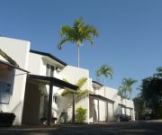
Comfort Resort Blue Pacific
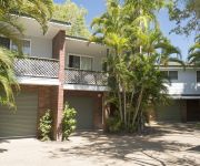
The Shores Holiday Apartments
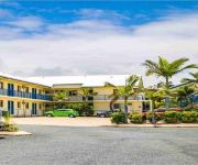
SEABREEZE MACKAY
The Seabreeze Hotel
Clarion Hotel Mackay Marina
Videos from this area
These are videos related to the place based on their proximity to this place.
Plantation Palms, Mackay Stage 3a Construction
Here is a short video of Plantation Palms construction in stage 3a. Situated in the Northern beaches of Mackay, we are excited to be apart of this development and look forward to our clients...
The Beautiful Eimeo Beach - Mackay - 25.9.11
The Beautiful Eimeo Beach - Mackay, Queensland, Australia.
ULTIMATE REEF FISHING TRIP ON THE GREAT BARRIER REEF!!!
http://www.reefari.com The perfect fishing trip, perfect weather, heaps of fish including coral trout, red emporer, nannygai, spanish mackeral, grassy sweetlip, Goldspot cod, sharks and heaps...
Reds!! Reds!! Reds!! Mothershipping Part1
http://www.reefari.com You wanna see big Reds, What a mothershipping Trip with heaps of Reds and Big Reds at that, with three going well over 10kg and some of the best reef fishing ever, Make...
Videos provided by Youtube are under the copyright of their owners.
Attractions and noteworthy things
Distances are based on the centre of the city/town and sightseeing location. This list contains brief abstracts about monuments, holiday activities, national parcs, museums, organisations and more from the area as well as interesting facts about the region itself. Where available, you'll find the corresponding homepage. Otherwise the related wikipedia article.
Reliance Creek National Park
Reliance Creek is a national park in Queensland, Australia, 818 km northwest of Brisbane.
Round Top Island National Park
Round Top Island is a national park in North Queensland, Australia, 797 km northwest of Brisbane.
Mackay, Queensland
Mackay is a city on the eastern coast of Queensland, Australia, about 970 kilometres north of Brisbane, on the Pioneer River. Mackay is nicknamed the sugar capital of Australia because its region produces more than a third of Australia's cane sugar.
St Patrick's College, Mackay
St Patrick's College is a co-educational Catholic school in Mackay, Queensland, Australia . St Patrick's is the only school in Queensland that offers education only to Years 11 and 12. The college's motto is "Seek Christ", which reflects one of the College's main aims, to develop the person spiritually. The current principal is Eamon Hannan.
Slade Point, Queensland
Slade Point is a peninsular suburb north of Mackay, Queensland, Australia. Slade Point, a prominent coastal feature was named by Captain James Cook.
Thomas Slade
Sir Thomas Slade (1703/4–1771) was an English naval architect, most famous for designing HMS Victory, Lord Nelson's flagship at the Battle of Trafalgar in 1805.
Zinc 101.9
thumbnail 40x40pxThis article may require cleanup to meet Wikipedia's quality standards. No cleanup reason has been specified. Please help improve this article if you can. ZINC FM 101.9 Mackay And The Whitsundays File:Zinc FM logo. pngCity of license Mackay, Queensland, AustraliaFrequency 101.9FM Mackay, 90.7FM Airlie Beach, 92.3FM Nebo & Surrounding Areas, Glenden 91.7FMFirst air date 2009Callsign meaning MackayFormer callsigns 4MKFMOwner Prime Media Group LimitedWebsite http://www. radiozinc.
Pioneer River
The Pioneer River is a river system in Queensland, Australia that flows through the city of Mackay. 120 km in length, the river rises in the Pinnacle Ranges near Epsom, 63 km south-west of Mackay. The river flows in a northerly direction into the Pioneer Valley, one of Australia's richest sugar cane areas. At Mirani, the river swings around to the east before flowing into the Pacific Ocean at Mackay. The catchment covers an area of 1500 km².
St Francis Xavier Parish, Mackay
St Francis Xavier Parish is a Catholic parish, serving the needs of the Catholic communities living in the western and southern suburbs of Mackay, Queensland. The parish has existed since 1947, but the Church was blessed and dedicated in 1962. St Francis Xavier Parish has grown into a large parish, servicing Church needs, community functions, and operating a primary school.
City of Mackay
The City of Mackay was a local government area located in the Central Queensland region of Queensland, Australia, encompassing the regional city of Mackay and the surrounding region. The City was created as a municipal borough in 1869, and prior to amalgamation with the Shire of Pioneer in 1994, the City was limited to the central suburbs on the south shore of the Pioneer River. From 1994 until 2008, the City covered an area of 2,897.5 square kilometres .
Mackay Region
The Mackay Region is a local government area located in North Queensland, Queensland, Australia. Established in 2008, it was preceded by three previous local government areas with histories extending back as far as 1869. It has an estimated operating budget of A$118 million.
Shire of Pioneer
The Shire of Pioneer was a local government area surrounding the city of Mackay and including all but its innermost suburbs. The shire, administered from Mackay itself, covered an area of 2,820.1 square kilometres, and existed as a local government entity from 1879 until 1994, when it was dissolved and amalgamated with City of Mackay.
ABC Tropical North
ABC Tropical North is an ABC Local Radio station based in Mackay and broadcasting to the surrounding region in Queensland. This includes the towns of Proserpine, Sarina, Bowen and the Whitsunday Islands. The station began broadcasting as 4QA in 1951 on 756 AM, originally as a relay of the national program. Studios were then built and local programs began in 1955.
4RGM
4RGM, operating as Sea FM, is an Australian radio station in Queensland. It broadcasts in Mackay on 98.7 MHz, and in Airlie Beach on 92.3 MHz. The studio is located in the Suncorp building on Victoria Street in Mackay. The station began broadcasting on 21 September 1999.
Te Kowai, Queensland
Te Kowai is a suburb in the Mackay Regional Council in Queensland, Australia. Its population at the 2006 census was 666 people. The name of the suburb is derived from a former railway station, itself derived from a nearby sugar plantation named after a New Zealand tree, kowhai. The name was shortened and the Māori definite article "Te" added. A sugar mill was established in the area in 1874 and operated until 1894 when it amalgamated with the Palms Mill.
Mackay Courthouse
Mackay Courthouse is located at 12 Brisbane Street, Mackay in Queensland, Australia. The complex contains the current and former courthouses as well as police residences and other police buildings.
Pioneer State High School
Pioneer State High School is located in Andergrove, Mackay, Queensland and was established in 1989.
Mackay Base Hospital
The Mackay Base Hospital is the major hospital for the Central Queensland Region situated in Mackay, Queensland, Australia. It is located around 4 km from Mackay city centre. The Hospital offers general services to a population of approximately 135 000 throughout Mackay and the surrounding areas including referrals from Moranbah and parts of the Bowen region. The Hospital has a wide range of medical and allied health services.
Forgan Bridge
The Forgan Bridge is a road bridge over the Pioneer River in Mackay, Queensland, Australia. The construction of the duplication and replacement of the old Forgan Bridge commenced in May 2008 and was completed in August 2011.
Mackay North State High School
Mackay North State High School is located in North Mackay, Queensland, Australia and was established in 1964. It is the largest secondary school in the Mackay District with over 1,500 students and over 100 staff. the school motto is 'Meliora Sequimur' which translates to 'We strive for the best'.
Caneland Central
Caneland Central is a large regional shopping centre located adjacent to the CBD in Mackay, Queensland, Australia. The centre boasts major anchor stores such as a Myer department store, Coles and Woolworths supermarkets, Big W and Target discount department stores, Best & Less and Pillowtalk stores as well as Dick Smith and JB Hi-Fi electronics stores. The centre is home to over 230 specialty stores, of which the majority are fashion related.
Stadium Mackay
Stadium Mackay, currently known as its sponsored name Virgin Australia Stadium, is a rectangular football stadium situated in Mackay, Queensland, Australia. The stadium is home to the Queensland Cup's Mackay Cutters and Queensland State League's Whitsunday Miners.
Repulse Bay to Ince Bay Important Bird Area
The Repulse Bay to Ince Bay Important Bird Area is a disjunct stretch of coastline comprising a series of relatively sheltered beaches in the Mackay-Whitsunday region of Central Queensland, north-eastern Australia. With an area of 134 km, it extends for about 180 km from Repulse Bay in the north through the city of Mackay to Ince Bay and Cape Palmerston in the south. It is an important site for waders, or shorebirds.
Ray Mitchell Oval
Ray Mitchell Oval (also known as Harrup Park) is a cricket ground in the city of Mackay, Queensland, Australia. The first recorded match on the ground came when a Queensland Country XI played the touring West Indians in 1968. In 1978, the ground staged a single World Series Cricket "Country Cavaliers" match. The ground held its first two List A one day matches in 1988 when Queensland played the touring Pakistanis on 3rd and 4th of December 1988.
Mackay railway station
Mackay is a railway station on the North Coast railway line in Queensland, Australia. The station is serviced four times a week by the Diesel Tilt Train service between Brisbane and Cairns, as well as daily by The Sunlander service.


