Touring Waterford West
The district Waterford West of in Logan (Queensland) with it's 6,160 residents Waterford West is a subburb located in Australia about 575 mi north-east of Canberra, the country's capital place.
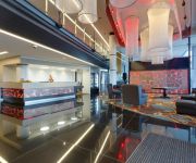
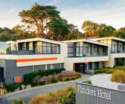
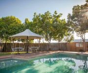
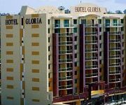
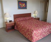
Need some hints on where to stay? We compiled a list of available hotels close to the map centre further down the page.
Being here already, you might want to pay a visit to some of the following locations: Brisbane, Sunshine Coast, Carrolls Creek, and . To further explore this place, just scroll down and browse the available info.
Local weather forecast
Todays Local Weather Conditions & Forecast: 26°C / 78 °F
| Morning Temperature | 18°C / 65 °F |
| Evening Temperature | 23°C / 73 °F |
| Night Temperature | 18°C / 64 °F |
| Chance of rainfall | 0% |
| Air Humidity | 49% |
| Air Pressure | 1019 hPa |
| Wind Speed | Gentle Breeze with 7 km/h (5 mph) from West |
| Cloud Conditions | Broken clouds, covering 77% of sky |
| General Conditions | Broken clouds |
Monday, 25th of November 2024
26°C (78 °F)
19°C (66 °F)
Broken clouds, gentle breeze.
Tuesday, 26th of November 2024
27°C (81 °F)
19°C (67 °F)
Broken clouds, gentle breeze.
Wednesday, 27th of November 2024
28°C (83 °F)
22°C (72 °F)
Broken clouds, gentle breeze.
Hotels and Places to Stay
Calamvale Suites and Conference Centre
Flinders Hotel
Logan City Motor Inn
McNevins Loganholme Motel
Springwood Motor Inn
Gloria
Springwood Hotel
Econo Lodge Waterford
SPRINGWOOD TOWER APARTMENT HOTEL
Calamvale Hotel Suites
Videos from this area
These are videos related to the place based on their proximity to this place.
Maryanne Arici - All Suburbs Real Estate
Sales Professional Phone: 07 3200 7799 Mobile: 0438 192 166 Email: maryanne@allsuburbsrealestate.com.au, rob@allsuburbsrealestate.com.au In 2004 Maryanne chose a career in real estate...
Ktm450sxf smoke show exhaust flames glowing header
Only way to deal with a old tyre your bike will love you for it.
Nate Muavae - Waterford U14s vs Carina(1st Half)
Nate playing at centre for Waterford Demons U14s(D4). I created this video with the YouTube Video Editor (http://www.youtube.com/editor)
Nate Muavae #3 - Waterford vs Redlands2. 19/8/12.wmv
Nathanial playing rugby league for Waterford Demons vs Redlands U14s. Final round before playoffs.
Nate Muavae #3 Waterford U14s vs Wynnum.wmv
Nathanial playing for Waterford Demons U14s against Wynnum. 22/07/12,
Nate Muavae #3 Waterford U14s vs Greenbank.wmv
Nathanial playing centre for Waterford Demons U14s vs Greenbank. 3 Aug 2012. Missing some footage during game due to camera memory card playing up.
Club day Logan City Marine Modellers
Club day on Sunday 7/8/11 with sailing boats , tugboats, PT boats and pleasure boats, all enjoying a great time on the lake.
Logan City Marine Modellers 12th Feb 2012
Just another day at Tygum Lagoon, a boat sinks, a few warships, a boogie board airboat, a part built large scale harbour tug and a few other bits and pieces.
929 Kingston Road, Waterford West Queensland By Jim Payne
Property Video shoot of 929 Kingston Road, Waterford West Queensland by PlatinumHD http://www.platinumhd.tv for Ray White Commercial Southport.
Videos provided by Youtube are under the copyright of their owners.
Attractions and noteworthy things
Distances are based on the centre of the city/town and sightseeing location. This list contains brief abstracts about monuments, holiday activities, national parcs, museums, organisations and more from the area as well as interesting facts about the region itself. Where available, you'll find the corresponding homepage. Otherwise the related wikipedia article.
Logan City
Logan City is a local government area in South East Queensland, Australia. The city is situated between the City of Brisbane to the north and Gold Coast to the south. The city also borders the Scenic Rim, the City of Ipswich and Redland City.
Bethania, Queensland
Bethania is located in Logan City from March 15, 2008. It is situated on the main southern suburban railway and lies south of the Logan River. It occasionally suffers floods. A separate branch railway leaves the South Coast railway line at Bethania and runs to Beaudesert. It has been out of commission since August 2004.
Kingston railway station, Brisbane
Kingston is a railway station on the Beenleigh Line of Brisbane, Australia. It is part of the Queensland Rail City network. It is in a transition precinct between Zone 5 and Zone 6 of the TransLink integrated public transport system. Nearby landmarks include the Kingston Buttery Factory, as well as the Kingston Park Raceway.
Loganlea railway station
Loganlea is a railway station on the Beenleigh Line of Brisbane, Australia. It is part of the Queensland Rail City network. It is in Zone 6 of the TransLink integrated public transport system.
Bethania railway station
Bethania is a railway station on the Beenleigh Line of Brisbane, Australia. It is part of the Queensland Rail City network. It is in a transition precinct between Zone 6 and Zone 7 of the TransLink integrated public transport system. It is the branching point for the Beaudesert line.
Logan Hyperdome
Logan Hyperdome Shopping Centre in Shailer Park, Queensland is the largest shopping centre in Logan City and one of the largest single story shopping centres in Australia. The Queensland Police Service operates a police beat shopfront in the centre. The Logan City Council has a library in shopping centre. The Logan Hyperdome contains a food court with many outlets. Birch Carol & Coyle operate a cinema complex within the centre.
Eden's Landing railway station
Eden's Landing is a railway station on the Beenleigh Line of Brisbane, Australia. It is part of the Queensland Rail City network. It is in Zone 7 of the TransLink integrated public transport system.
Loganholme bus station
The Loganholme Bus Station, at Shailer Park, is serviced by TransLink bus routes. It is part of the Logan Hyperdome and is a major interchange for TransLink's Southern Region. It is in Zone 6 of the TransLink integrated public transport system.
Metroad 6 (Brisbane)
Metroad 6 in Brisbane, Queensland, Australia, is a major urban road corridor. It connects Tanah Merah to Drewvale via the Logan Motorway.
Crestmead, Queensland
Crestmead is a suburb of Logan City, Queensland, Australia.
Logan Central, Queensland
Logan Central is a suburb of Logan City, Queensland, Australia. Once forming part of Woodridge, Logan Central is the official central business district of Logan City and is a major activity centre, with many shops and local businesses operating in the area, mostly along the Wembley Road corridor. Woodridge railway station is located in Logan Central.
Logan Reserve, Queensland
OVERVIEW Logan Reserve is a suburb of Logan City, Queensland, Australia. Logan Reserve offers wonderful acreage bushland homes and a few suburban-style streets to its north. Most properties here range from two to ten acres, with dwelling types varying between cottage style, Tudor, large western red cedar and large country estates.
Kingston, Queensland
Kingston is a suburb of Logan City, Queensland, Australia. Kingston is a predominantly residential suburb, with a low mix of commercial and retail areas. It is the home of the Kingston Butter Factory. Kingston was also the site of an environmental disaster similar to Love Canal in Niagara Falls in the USA.
Loganlea, Queensland
Loganlea is a suburb of Logan City, Queensland, Australia.
Marsden, Queensland
Marsden is a suburb of Logan City, Queensland, in Australia. At the 2011 Australian census the suburb had a population of 11,278. The northern boundary of the suburb roughly runs parallel to the Logan Motorway.
Meadowbrook, Queensland
Meadowbrook is a suburb of Logan City, Queensland, Australia. The Loganlea Golf Course and Logan campus of Griffith University are located in Meadowbrook. Logan Hospital is located in this suburb.
Tanah Merah, Queensland
Tanah Merah is a suburb of Logan City, Queensland, Australia. Tanah Merah means 'red earth' in Indonesian/Malay. This type of soil is found across the local area. The land was once owned by the Murray family who sold it off in sections to developers. The Murray farm still exists in Tanah Merah and is located at the end of Murrays Road. The Pacific Motorway borders the suburb and the Logan Motorway divides it.
Waterford West, Queensland
Waterford West is a suburb of Logan City, Queensland, Australia.
Canterbury College (Waterford)
Canterbury College is an independent, co-educational, day school affiliated with the Anglican Church of Australia. The campus is located on 32 hectares in Waterford, between Beenleigh and Loganlea.
Marsden State High School
Marsden State High School (MSHS) is a secondary school in Logan City, Queensland for students between years 8 and 12. Marsden State High School is located on Muchow Road between the suburbs of Marsden and Waterford West. The school was established in 1987 and, as of 2011, has 1,789 students. From the school's opening, in 1987, until 2010, the motto was Success Through Industry, however, since 2010 the motto has been Empowering Individuals, Expanding Horizons, Creating Futures.
Bahrs Scrub, Queensland
Bahrs Scrub is a suburb of Logan City, Queensland, Australia. As the name suggests, the area was originally scrub land. It consists predominantly of acreage blocks although recent developments have seen suburbia encroach on the otherwise serene suburb.
Kingston College (Queensland)
Kingston College is a college located in Kingston, a suburb of Logan City, Queensland, Australia. It incorporates a center for continuing secondary education.
Mayes Cottage
Mayes Cottage is an historic house and museum in Kingston, Queensland, Australia. Built in 1887, Mayes Cottage was originally home to the Mayes family and known as "Pleasant Place". The house—located at 36 Mawarra Street—was built 16 years after John and Emily Mayes first arrived in Australia. John and Emily Mayes and their two small children, Joshua and Ruth, arrived in Brisbane from England aboard the SS Indus in 1871.
Waterford, Queensland
Waterford is a suburb in Logan City, Queensland, Australia with a population of 845 in the 2006 Census. The suburb includes Woodlands Estate.
Logan Hospital
Logan Hospital is located at Cnr Armstrong and Loganlea Roads in Meadowbrook, Queensland, Australia. Logan Hospital has grown from a 48 bed hospital in 1990 to approximately 330 beds currently.


