Explore Holmview
The district Holmview of in Logan (Queensland) is located in Australia about 574 mi north-east of Canberra, the country's capital.
If you need a place to sleep, we compiled a list of available hotels close to the map centre further down the page.
Depending on your travel schedule, you might want to pay a visit to some of the following locations: Brisbane, Sunshine Coast, Carrolls Creek, and . To further explore this place, just scroll down and browse the available info.
Local weather forecast
Todays Local Weather Conditions & Forecast: 26°C / 79 °F
| Morning Temperature | 19°C / 66 °F |
| Evening Temperature | 22°C / 72 °F |
| Night Temperature | 17°C / 62 °F |
| Chance of rainfall | 0% |
| Air Humidity | 51% |
| Air Pressure | 1019 hPa |
| Wind Speed | Gentle Breeze with 7 km/h (4 mph) from West |
| Cloud Conditions | Few clouds, covering 11% of sky |
| General Conditions | Few clouds |
Monday, 25th of November 2024
26°C (78 °F)
17°C (63 °F)
Scattered clouds, gentle breeze.
Tuesday, 26th of November 2024
27°C (80 °F)
19°C (66 °F)
Light rain, gentle breeze, few clouds.
Wednesday, 27th of November 2024
28°C (82 °F)
21°C (70 °F)
Scattered clouds, gentle breeze.
Hotels and Places to Stay
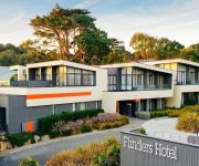
Flinders Hotel
McNevins Loganholme Motel
Logan City Motor Inn
Econo Lodge Waterford
Videos from this area
These are videos related to the place based on their proximity to this place.
Sunstate Roller Girls (SSRG) Golden Roughs vs Liquorice Short Shorts 24/4/2010
See one of the refs do a roll. Sorry for the shakes, this was done with a cheap camera and it was all so whoop arse which kept the blood pumping !
Finger Food Caterers - REVIEWS - Brisbane, Catering Reviews
Reviewed Finger Food Caterers is a top reviewed catering specialist in Brisbane, Qld. This video shows some of the excellent reviews and testimonials that have been offered...
APR Bookkeeping commercial accounting
http://www.aprbookkeeping.com provides more than just general bookkeeping and bas agent services, Financial reporting, Cash flow reporting and monitoring, Payroll including Superannuation and...
SSRG 2010 Final.
Catch all the action as the Golden Roughs and Licorice Short Shorts face off for the final time. It's the end of an era and the start of something new and exciting for 2011. Thanks to...
Windaroo Rise Estate - Bahrs Scrub
Windaroo Rise is a new and exclusive 35 lot Housing Estate between Brisbane and the Gold Coast. The blocks of land are over 2000m2 and selling for an average of $140 m2. Multiple builders...
PADDINGTON, Brisbane, Aus
http://oztube.com.au Brisbane's paddington has it all. From Shopping to fun. Check out oztube.com.au for further videos like this.
National Seniors Australia with Michael O'Neill
Chief Executive Michael O'Neill talks about how National Seniors Australia represents the more than 6.3 million Australian's aged over 50.
Tiarna Gibbons Hallelujah (Jeff Buckley)
Hi guys! back in @Florea Productions Studio this time with a Jeff Buckley cover. Don't forget to Subscribe for more to come. http://www.fpilive.com/
Anjali Raj Rather Be (Clean Bandit feat. Jess Glynne)
Hi Guys! Anjali & JP back in @Florea Productions Studio with the second of three covers we made. Don't forget to Subscribe to receive notifications of new uploads. http://www.fpilive.com/ ...
Videos provided by Youtube are under the copyright of their owners.
Attractions and noteworthy things
Distances are based on the centre of the city/town and sightseeing location. This list contains brief abstracts about monuments, holiday activities, national parcs, museums, organisations and more from the area as well as interesting facts about the region itself. Where available, you'll find the corresponding homepage. Otherwise the related wikipedia article.
Division of Forde
The Division of Forde is an Australian Electoral Division in Queensland. The division was created in 1984 and is named for Frank Forde, who was briefly Prime Minister of Australia in 1945. When it was created it was a marginal seat in the southern suburbs of Brisbane, but it now has no territory in common with the original seat and is located in semi-rural areas south of the city, including Beenleigh, Beaudesert, Boonah and Loganlea.
Bethania, Queensland
Bethania is located in Logan City from March 15, 2008. It is situated on the main southern suburban railway and lies south of the Logan River. It occasionally suffers floods. A separate branch railway leaves the South Coast railway line at Bethania and runs to Beaudesert. It has been out of commission since August 2004.
Loganlea railway station
Loganlea is a railway station on the Beenleigh Line of Brisbane, Australia. It is part of the Queensland Rail City network. It is in Zone 6 of the TransLink integrated public transport system.
Bethania railway station
Bethania is a railway station on the Beenleigh Line of Brisbane, Australia. It is part of the Queensland Rail City network. It is in a transition precinct between Zone 6 and Zone 7 of the TransLink integrated public transport system. It is the branching point for the Beaudesert line.
Holmview railway station
Holmview is a railway station on the Beenleigh Line of Brisbane, Australia. It is part of the Queensland Rail City network. The station serves the northern and western parts of Beenleigh. It is in Zone 7 of the TransLink integrated public transport system.
Beenleigh railway station
Beenleigh is a railway station on the Beenleigh Line of Brisbane, Australia. It is part of the Queensland Rail City network. It is the terminus for the Beenleigh Line. From 1889 to 1964 it was a stop on the South Coast Line and since 1996 has served as a stop on the Gold Coast Line.
Logan Hyperdome
Logan Hyperdome Shopping Centre in Shailer Park, Queensland is the largest shopping centre in Logan City and one of the largest single story shopping centres in Australia. The Queensland Police Service operates a police beat shopfront in the centre. The Logan City Council has a library in shopping centre. The Logan Hyperdome contains a food court with many outlets. Birch Carol & Coyle operate a cinema complex within the centre.
Eden's Landing railway station
Eden's Landing is a railway station on the Beenleigh Line of Brisbane, Australia. It is part of the Queensland Rail City network. It is in Zone 7 of the TransLink integrated public transport system.
Metroad 6 (Brisbane)
Metroad 6 in Brisbane, Queensland, Australia, is a major urban road corridor. It connects Tanah Merah to Drewvale via the Logan Motorway.
Rivermount College
Rivermount College is a non-denominational, co-educational Christian College situated in Yatala, Queensland, Australia. The school serves students from Prep through to Year 12. Since its first year Rivermount College has expanded with not only extra staff, equipment and buildings but a diversity of cultures are included in the student population.
Crestmead, Queensland
Crestmead is a suburb of Logan City, Queensland, Australia.
Loganholme, Queensland
Loganholme is a suburb of Logan City, Queensland, Australia. A major landmark in the area is the Logan Hyperdome shopping centre. A bus interchange is located adjacent to the Logan Hyperdome. The area is also home to the Loganholme State School.
Meadowbrook, Queensland
Meadowbrook is a suburb of Logan City, Queensland, Australia. The Loganlea Golf Course and Logan campus of Griffith University are located in Meadowbrook. Logan Hospital is located in this suburb.
Tanah Merah, Queensland
Tanah Merah is a suburb of Logan City, Queensland, Australia. Tanah Merah means 'red earth' in Indonesian/Malay. This type of soil is found across the local area. The land was once owned by the Murray family who sold it off in sections to developers. The Murray farm still exists in Tanah Merah and is located at the end of Murrays Road. The Pacific Motorway borders the suburb and the Logan Motorway divides it.
Waterford West, Queensland
Waterford West is a suburb of Logan City, Queensland, Australia.
Canterbury College (Waterford)
Canterbury College is an independent, co-educational, day school affiliated with the Anglican Church of Australia. The campus is located on 32 hectares in Waterford, between Beenleigh and Loganlea.
Edens Landing, Queensland
Edens Landing is a residential suburb located south-west of Brisbane, Queensland, Australia, within the Logan City municipality.
Bahrs Scrub, Queensland
Bahrs Scrub is a suburb of Logan City, Queensland, Australia. As the name suggests, the area was originally scrub land. It consists predominantly of acreage blocks although recent developments have seen suburbia encroach on the otherwise serene suburb.
Windaroo, Queensland
Windaroo is a residential suburb in the outer southern areas of Logan City in Queensland, Australia, in the outer southern metropolitan area of Greater Brisbane.
Mount Warren Park, Queensland
Mount Warren Park is a residential suburb in the outer southern areas of Logan City in Queensland, Australia the outer southern region of the Greater Brisbane Area.
Buccan, Queensland
Buccan is a suburb of Logan City, Queensland, Australia. Once part of the Shire of Beaudesert, Buccan has now been included in Logan City and is a low density semi-rural suburb with larger acreage bushland type blocks. Buccan does not have a formalised town centre or shopping facilities with its residents relying on Logan Village, Waterford and Beenleigh to access such services.
Trinity College, Beenleigh
Trinity College Beenleigh is a co-educational, Roman Catholic secondary school in Beenleigh, Queensland, Australia. Mrs Catherine Thompson is the school's principal.
Beenleigh State High School
Beenleigh State High School (BSHS) is a public, co-educational high school located in Beenleigh, Queensland.
Waterford, Queensland
Waterford is a suburb in Logan City, Queensland, Australia with a population of 845 in the 2006 Census. The suburb includes Woodlands Estate.
Logan Hospital
Logan Hospital is located at Cnr Armstrong and Loganlea Roads in Meadowbrook, Queensland, Australia. Logan Hospital has grown from a 48 bed hospital in 1990 to approximately 330 beds currently.


!['[HD] Queensland Rail - 2x Holmview Videos' preview picture of video '[HD] Queensland Rail - 2x Holmview Videos'](https://img.youtube.com/vi/5snZifv05iI/mqdefault.jpg)


