Discover Woodend
The district Woodend of in Ipswich (Queensland) is a district in Australia about 572 mi north of Canberra, the country's capital city.
Looking for a place to stay? we compiled a list of available hotels close to the map centre further down the page.
When in this area, you might want to pay a visit to some of the following locations: Brisbane, Sunshine Coast, Carrolls Creek, and . To further explore this place, just scroll down and browse the available info.
Local weather forecast
Todays Local Weather Conditions & Forecast: 27°C / 81 °F
| Morning Temperature | 19°C / 66 °F |
| Evening Temperature | 24°C / 74 °F |
| Night Temperature | 20°C / 67 °F |
| Chance of rainfall | 0% |
| Air Humidity | 42% |
| Air Pressure | 1018 hPa |
| Wind Speed | Gentle Breeze with 7 km/h (5 mph) from West |
| Cloud Conditions | Scattered clouds, covering 40% of sky |
| General Conditions | Scattered clouds |
Monday, 25th of November 2024
28°C (82 °F)
17°C (63 °F)
Sky is clear, gentle breeze, clear sky.
Tuesday, 26th of November 2024
23°C (74 °F)
18°C (65 °F)
Overcast clouds, gentle breeze.
Wednesday, 27th of November 2024
29°C (85 °F)
20°C (67 °F)
Few clouds, gentle breeze.
Hotels and Places to Stay
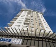
OAKS ASPIRE
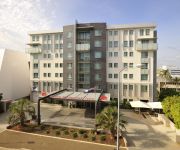
Metro Hotel Ipswich Int
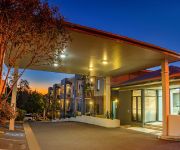
BEST WESTERN IPSWICH
QUEST IPSWICH SERVICED APTS
COUNTRY COMFORT MOTOR INN IPSWICH
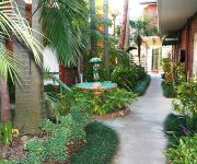
Cumquat House
Videos from this area
These are videos related to the place based on their proximity to this place.
Police honoured with Key to the City of Ipswich
Queensland Police Service received the Key to the City on Wednesday, November 19 in recognition of the valuable contribution made to Ipswich during 150 years of policing.
Award winning tourist attraction in Ipswich
You thought The Workshops Rail Museum was just for kids? Think again! BIG LOUD FUN and wholly interactive, The Workshops Rail Museum is an award winning heritage and cultural tourism ...
Winter holiday fun at The Workshops Rail Museum
Warm up with the wonderful Wizards Express these holidays at The Workshops Rail Museum www.theworkshops.qm.qld.gov.au.
Wivenhoe Dam, Information Centre and Picnic Ground Becky-boo's photos around Lake Wivenhoe
Preview of Becky-boo's blog at TravelPod. Read the full blog here: http://www.travelpod.com/travel-blog-entries/becky-boo/5/1267848749/tpod.html This blog preview was made by TravelPod using...
BB18 ¼ 1079 and AC16 221A Mayne Transfer - 4.12.2008
On a hot Thursday Morning, steam locomotives BB18 ¼ 1079 and AC16 221A were transferred to Mayne Railway Yard in Brisbane in preparation for a weekend on steam train excursions around ...
Model Railway at the Workshops Railway Museum, Ipswich, Queensland.
Model Railway at the Workshops Railway Museum, Ipswich, Queensland. HOn3.5 gauge.
C17 974 - The Toylands Express - 8.04.2008
Steam locomotive C17 974 brings up a train into the Workshops Rail Museum on a "Toylands Express" charter.
Ipswich Connect - December 2014
Construction update on Robelle Lagoon at Springfield Central - Adoption Drive at the Animal Welfare League's Ipswich Shelter - Western Gateway Christmas Spectacular at Goodna's Shiloh Church.
Steam Engine BB18¼ CLASS --NO.1089
Steam Locomotive BB18¼ CLASS -- NO.1089, 2nd of October 2013. Ipswich, Queensland, Australia.
Ipswich Toy Run 2012 - highlights
Edited highlights of the run from Brassall Shopping Centre to Ipswich Showgrounds. Looks like a near record number of bikes and toys donated to the Salvation Army.
Videos provided by Youtube are under the copyright of their owners.
Attractions and noteworthy things
Distances are based on the centre of the city/town and sightseeing location. This list contains brief abstracts about monuments, holiday activities, national parcs, museums, organisations and more from the area as well as interesting facts about the region itself. Where available, you'll find the corresponding homepage. Otherwise the related wikipedia article.
Ipswich, Queensland
Ipswich is a city in South-East Queensland, Australia. Along the Bremer River Valley, it is approximately 40 km west of the Brisbane CBD. The locality of the same name forms its Central Activities District, business and administrative centre. Ipswich is the administrative centre of the City of Ipswich both of which according to the Australian Bureau of Statistics share an estimated population of 172,700 at the 2011 census.
Ipswich Grammar School
Ipswich Grammar School is an independent, non-denominational, day and boarding school for boys, located in Ipswich, a city situated on the Bremer River in South East Queensland, Australia. The school is sited on the eponymous Grammar School Hill, with its original buildings occupying the crown of the hill. Founded in 1863, Ipswich Grammar was the first secondary school established in the colony of Queensland.
East Ipswich railway station
East Ipswich Station is a railway station on the Ipswich Line of Brisbane, Australia. It is part of the Queensland Rail City network. It is in Zone 7 of the TransLink integrated public transport system.
Ipswich railway station, Brisbane
Ipswich Station is a railway station on the Ipswich Line of Brisbane, Australia. It was the first railway station built in Queensland, as the first terminus for the Rosewood railway line. It is now part of the Queensland Rail City network. It is the terminus for the Ipswich and Rosewood lines. It is located in the city of Ipswich in South East Queensland. It is also one of the few Citytrain stations with buildings built over itself for other purposes.
Thomas Street railway station
Thomas Street Station is a railway station on the Rosewood Line of South East Queensland, Australia. It is part of the Queensland Rail City network. It is in Zone 7 of the TransLink integrated public transport system. Thomas Street has a short platform and can only fit 3 carriages, thus passengers on 6-car trains are generally advised to board the front three cars.
Wulkuraka railway station
Wulkuraka Station is a railway station on the Rosewood Line of South East Queensland, Australia. It is part of the Queensland Rail City network. It is in a transition precinct between Zone 7 and Zone 8 of the TransLink integrated public transport system. Wulkuraka has a short platform and can only fit 3 carriages, thus passengers on 6-car trains are generally advised to board the front three cars.
Bell Street bus station
The Bell Street Bus Station, at Ipswich, Queensland, Australia, is serviced by TransLink bus routes. It is adjacent to the Ipswich railway station and is the main rail/bus interchange for TransLink's Western Region. It is in Zone 7 of the TransLink integrated public transport system.
Ipswich Girls' Grammar School
Ipswich Girls' Grammar School (IGGS) is an independent, Non-denominational, day and boarding school for girls, in Ipswich, Queensland, Australia. The school is one of the eight original 'Queensland Grammar Schools'. These schools are independent, non-denominational, not-for-profit statutory bodies of the Queensland Government. They are not linked to, administered, or governed by any religious organisation or specific style of education.
North Ipswich Reserve
North Ipswich Reserve presently known as Qld Group Stadium and formally Bendigo Bank Oval due to naming rights. It is based in Ipswich, Queensland and is home to the Ipswich Jets, who play in the Queensland Wizard Cup. There is talk of the venue being re-developed into a stadium with a capacity of around 15,000 people not to dissimilar to Parramatta Stadium the home of NRL team Parramatta Eels.
Riverlink Shopping Centre
Riverlink is a shopping centre located in the northern area of the CBD of Ipswich, Queensland, Australia. Stage One (Riverlink West) was opened on 5 April 2007, whereas Stage 2 (Riverlink East) opened on 31 May 2007.
City of Ipswich
The City of Ipswich is a Local Government Area within the Brisbane metropolitan area in South East Queensland, covering an area of 65.7 square kilometres along the coast about 40 kilometres southwest of Brisbane, the capital of Queensland. The City of Ipswich has a population of 172,700 (2012)
St Edmund's College, Ipswich
St Edmund's College is a Roman Catholic, secondary day school for boys', located in Ipswich, Queensland, Australia. The school is member of the Associated Independent Colleges of the Greater Brisbane region along with Marist College Ashgrove, Iona College (Queensland), Padua College, Villanova College, St Patrick's College, Shorncliffe, St Laurence's College and St. Peters Lutheran College. St Edmund’s College is conducted in the tradition of Edmund Ignatius Rice.
St. Mary's College, Ipswich
St Mary's College is an Australian Catholic secondary school for girls, located in Ipswich, Queensland, Australia. The school accepts girl students from year 8 to year 12, drawing from a wide area of Ipswich, Queensland. The total enrolment of the school is approximately 650 YTD. St Mary's College was established by Sisters of Mercy in 1863 as part of St Mary’s Parish. Sisters of Mercy left in the early 1990s.
North Ipswich, Queensland
North Ipswich is a suburb of Ipswich, Queensland, Australia. This is the birthplace of Queensland Rail. The original site is now the site of Riverlink shopping centre on The Terrace and the current site is used as a joint facility containing the very popular multi award winning Rail Workshop Museum. Raymonds Hill is a locality within the suburb of North Ipswich.
Basin Pocket, Queensland
Basin Pocket is a small residential suburb of Ipswich, Queensland, Australia. The suburb is bordered to the north and west by the Bremer River, and the remainder by East Ipswich. It contains a small set of shops on the corner of Chermside Rd and Jacaranda Street providing basic services. The origin of the suburb name is derived from "The Basin", an enlarged natural widening used by river steamers to turn before or after berthing at Ipswich, which the suburb is adjacent to.
Leichhardt, Queensland
Leichhardt is a suburb of Ipswich, Queensland, Australia. The origin of the suburb name is from Friedrich Wilhelm Ludwig Leichhardt, an explorer and naturalist from Prussia (now known as Germany). He led major expeditions throughout Australia. The suburb name was implemented after a request by local residents to the City of Ipswich in 1953.
Woodend, Queensland
Woodend is an inner-city suburb of Ipswich, Queensland, Australia. Its northern border is defined by the meandering course of the Bremer River. The origin of the suburb name is from the name given to the residence of Arthur Macalister, a Scottish migrant who became the second Premier of Queensland.
Coalfalls, Queensland
Coalfalls is a suburb of Ipswich, Queensland, Australia. The origin of the suburb name is from the sighting of coal in this area, most notably along the riverbank.
Sadliers Crossing, Queensland
Sadliers Crossing is a suburb of Ipswich, Queensland, Australia. The origin of the suburb name is from an early property owner by the name of Thomas Sadlier.
West Ipswich, Queensland
West Ipswich is a suburb of Ipswich, Queensland, Australia.
Raymonds Hill, Queensland
Raymonds Hill is a suburb of Ipswich, Queensland, Australia.
Ipswich Courthouse
The Ipswich Courthouse in Ipswich, Queensland opened in 2009/2010. The five-storey complex is the third courthouse for the city and replaced the second courthouse located in East Street, Ipswich that had been constructed in 1982.
Ipswich (suburb), Queensland
Ipswich is the innermost suburb of Ipswich, Queensland, Australia. The suburb situated on the Bremer River. It is split between the Ipswich CBD in the north, parkland to the east and a mixture of health, educations and residential areas to the south.
Ipswich State High School
Ipswich State High School is a State Secondary school in the suburb of Brassall, Ipswich, Queensland, Australia, established in 1963. Simon Riley is the current Principal.
Ipswich Hospital, Queensland
Ipswich Hospital, in Ipswich, Queensland, Australia, is a medium outer metropolitan teaching hospital affiliated with University of Queensland. Administratively it is part of the Darling Downs West Moreton Health Services District.


