Explore Silkstone
The district Silkstone of in Ipswich (Queensland) with it's 3,413 inhabitants Silkstone is located in Australia about 572 mi north of Canberra, the country's capital.
If you need a place to sleep, we compiled a list of available hotels close to the map centre further down the page.
Depending on your travel schedule, you might want to pay a visit to some of the following locations: Brisbane, Sunshine Coast, Carrolls Creek, and . To further explore this place, just scroll down and browse the available info.
Local weather forecast
Todays Local Weather Conditions & Forecast: 28°C / 82 °F
| Morning Temperature | 19°C / 66 °F |
| Evening Temperature | 25°C / 77 °F |
| Night Temperature | 17°C / 63 °F |
| Chance of rainfall | 0% |
| Air Humidity | 42% |
| Air Pressure | 1017 hPa |
| Wind Speed | Gentle Breeze with 7 km/h (4 mph) from West |
| Cloud Conditions | Clear sky, covering 5% of sky |
| General Conditions | Light rain |
Tuesday, 26th of November 2024
26°C (78 °F)
20°C (67 °F)
Broken clouds, gentle breeze.
Wednesday, 27th of November 2024
32°C (89 °F)
21°C (70 °F)
Few clouds, gentle breeze.
Thursday, 28th of November 2024
29°C (85 °F)
22°C (72 °F)
Overcast clouds, gentle breeze.
Hotels and Places to Stay
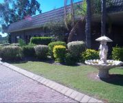
COUNTRY COMFORT MOTOR INN IPSWICH
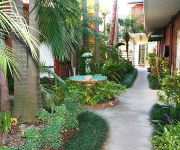
BEST WESTERN IPSWICH
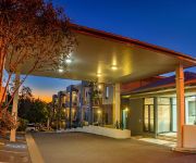
QUEST IPSWICH SERVICED APTS
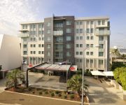
Metro Hotel Ipswich Int
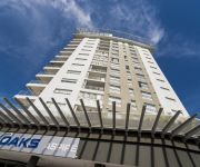
OAKS ASPIRE
Cumquat House
Videos from this area
These are videos related to the place based on their proximity to this place.
Ipswich Men's Shed - Roger's Story
Roger Overell sharing what motivated his joining the Ipswich Men's Shed. Ipswich Men's Shed is located at 3A Mining St, Bundamba Queensland 4305.
How to Make a Pottery House with Clay
A step by step guide showing you how to make a Pottery House with Clay,(1).
108 Jacaranda Street North Booval 4304 QLD by Trent Quinn
This one ticks all the boxes:• A fully renovated colonial• Quarter acre block• Large swimming pool• ...
The Journey of Ipswich - a poem by Rupert McCall
Orginally recorded in 2006, this version includes some updapted images. After a hiatus, it was played recently (in 2012) at couple of civic functions and has attracted renewed interest from...
15 Green Street, Booval Queensland By John Galloway
Property Video shoot of 15 Green Street, Booval Queensland by PlatinumHD http://www.platinumhd.tv for Ray White Ipswich.
New Seasons seedlings, Greens, Tomatoes & Ice Cream Bean + A visit ti Canada
Have been busy getting a few rounds of seeds & starts into the patch for our up coming cool weather crops.. Have the usual suspects like brassicas, tomatoes, greens on the go, as well as some...
Videos provided by Youtube are under the copyright of their owners.
Attractions and noteworthy things
Distances are based on the centre of the city/town and sightseeing location. This list contains brief abstracts about monuments, holiday activities, national parcs, museums, organisations and more from the area as well as interesting facts about the region itself. Where available, you'll find the corresponding homepage. Otherwise the related wikipedia article.
Ipswich, Queensland
Ipswich is a city in South-East Queensland, Australia. Along the Bremer River Valley, it is approximately 40 km west of the Brisbane CBD. The locality of the same name forms its Central Activities District, business and administrative centre. Ipswich is the administrative centre of the City of Ipswich both of which according to the Australian Bureau of Statistics share an estimated population of 172,700 at the 2011 census.
Bremer River (Queensland)
The Bremer River is a sub-catchment of the Brisbane River. The Bremer river drains several Scenic Rim valleys in south-east Queensland, including the Fassifern Valley. The river was discovered in 1824 by John Oxley and Allan Cunningham. This river and its tributaries cover an area of approximately 2032 km². Most valleys within the catchment have extensive river terraces. The Bremer River system is extremely degraded.
Bundamba State Secondary College
Bundamba State Secondary College (previously Bundamba State High School) is a Queensland public secondary school in the Ipswich suburb of Bundamba. Bundamba State Secondary College is known for its multiculturalism with many of the students coming from cultural backgrounds as diverse as Indigenous Australian, Polynesian, Torres Strait Islanders, Chinese, German, Indian, African and Russian.
Bundamba railway station
Bundamba Station is a railway station on the Ipswich Line of Brisbane, Australia. It is part of the Queensland Rail City network. It is in a transition precinct between Zone 6 and Zone 7 of the TransLink integrated public transport system.
East Ipswich railway station
East Ipswich Station is a railway station on the Ipswich Line of Brisbane, Australia. It is part of the Queensland Rail City network. It is in Zone 7 of the TransLink integrated public transport system.
Booval railway station
Booval Station is a railway station on the Ipswich Line of Brisbane, Australia. It is part of the Queensland Rail City network. It is in Zone 7 of the TransLink integrated public transport system.
Ipswich railway station, Brisbane
Ipswich Station is a railway station on the Ipswich Line of Brisbane, Australia. It was the first railway station built in Queensland, as the first terminus for the Rosewood railway line. It is now part of the Queensland Rail City network. It is the terminus for the Ipswich and Rosewood lines. It is located in the city of Ipswich in South East Queensland. It is also one of the few Citytrain stations with buildings built over itself for other purposes.
Bell Street bus station
The Bell Street Bus Station, at Ipswich, Queensland, Australia, is serviced by TransLink bus routes. It is adjacent to the Ipswich railway station and is the main rail/bus interchange for TransLink's Western Region. It is in Zone 7 of the TransLink integrated public transport system.
Ipswich Girls' Grammar School
Ipswich Girls' Grammar School (IGGS) is an independent, Non-denominational, day and boarding school for girls, in Ipswich, Queensland, Australia. The school is one of the eight original 'Queensland Grammar Schools'. These schools are independent, non-denominational, not-for-profit statutory bodies of the Queensland Government. They are not linked to, administered, or governed by any religious organisation or specific style of education.
North Ipswich Reserve
North Ipswich Reserve presently known as Qld Group Stadium and formally Bendigo Bank Oval due to naming rights. It is based in Ipswich, Queensland and is home to the Ipswich Jets, who play in the Queensland Wizard Cup. There is talk of the venue being re-developed into a stadium with a capacity of around 15,000 people not to dissimilar to Parramatta Stadium the home of NRL team Parramatta Eels.
City of Ipswich
The City of Ipswich is a Local Government Area within the Brisbane metropolitan area in South East Queensland, covering an area of 65.7 square kilometres along the coast about 40 kilometres southwest of Brisbane, the capital of Queensland. The City of Ipswich has a population of 172,700 (2012)
North Ipswich, Queensland
North Ipswich is a suburb of Ipswich, Queensland, Australia. This is the birthplace of Queensland Rail. The original site is now the site of Riverlink shopping centre on The Terrace and the current site is used as a joint facility containing the very popular multi award winning Rail Workshop Museum. Raymonds Hill is a locality within the suburb of North Ipswich.
Basin Pocket, Queensland
Basin Pocket is a small residential suburb of Ipswich, Queensland, Australia. The suburb is bordered to the north and west by the Bremer River, and the remainder by East Ipswich. It contains a small set of shops on the corner of Chermside Rd and Jacaranda Street providing basic services. The origin of the suburb name is derived from "The Basin", an enlarged natural widening used by river steamers to turn before or after berthing at Ipswich, which the suburb is adjacent to.
Moores Pocket, Queensland
Moores Pocket is a suburb of Ipswich, Queensland, Australia. The origin of the suburb name is from Thomas Moore, an early blacksmith in the area.
North Booval, Queensland
North Booval is a suburb of Ipswich, Queensland, Australia. North Booval is largely defined by the courses of the Bremer River and Bundamba Creek between which it lies; and the rail Rosewood-Brisbane rail line to the south.
East Ipswich, Queensland
East Ipswich is a residential inner-city suburb of Ipswich, Queensland, Australia. One of the older suburbs, East Ipswich is predominantly made up of weatherboard and fibro houses punctuated with larger heritage houses, and newer townhouses and flats. The suburb is bordered on the north and west by two sections of the Bremer River (split by the small suburb of Basin Pocket); and to the south by Brisbane Road, the city's main arterial link to the Ipswich Motorway.
Newtown, Queensland (Ipswich)
Newtown is a small residential suburb of Ipswich, Queensland, Australia. It is bordered by Queens Park to the west, to the north by Brisbane Road, the city's main arterial link to the Ipswich Motorway. A small set of shops lies on the five-ways intersection where Brisbane Road, Queen Victoria Parade, Glebe Road and Chermside Road meet.
Eastern Heights, Queensland
Eastern Heights is a residential suburb of Ipswich, Queensland, Australia. It is bordered to the west by Queens and Limestone Park The origin of the suburb name is from a high ridge on the eastern side of the Ipswich CBD.
Raceview, Queensland
Raceview is a suburb of Ipswich, Queensland, Australia. The origin of the suburb name is from an early racecourse in the area which was located at the end of Grange Road.
Booval, Queensland
Booval is a suburb of Ipswich, Queensland, Australia, containing both residential and commercial areas. Booval straddles Brisbane Rd, the main arterial link to the Ipswich Motorway. The Booval Fair shopping centre, located on Brisbane Rd, contains a number of major chain stores, including Woolworths and Big W, while a number of smaller businesses line South Station Rd and Brisbane Rd. The largest privately owned business in Booval is Llewellyn Motors.
Silkstone, Queensland
Silkstone is a suburb of Ipswich, Queensland, Australia.
Flinders View, Queensland
Flinders View is a suburb of Ipswich, Queensland, Australia. The origin of the suburb name is from the view and proximity to Flinders Peak from the suburb of Flinders View. Flinders View consists of four estates, Fairview Rise, Kensington Hills, Jacana Place and Flinders Crest.
Elizabeth Grove, South Australia
Elizabeth Grove is a suburb in the northern extent of Adelaide, South Australia. It was established in 1955.
Ipswich (suburb), Queensland
Ipswich is the innermost suburb of Ipswich, Queensland, Australia. The suburb situated on the Bremer River. It is split between the Ipswich CBD in the north, parkland to the east and a mixture of health, educations and residential areas to the south.
Denmark Hill Insect Bed
The Denmark Hill Insect Bed is a Triassic fossil locality in the Denmark Hill Conservation Park of Ipswich, Queensland, Australia. It belongs to the Blackstone Formation (Ipswich Coal Measures Group) dated to the Carnian age (228.0 - 216.5 million years ago). Its coordinates are {{#invoke:Coordinates|coord}}{{#coordinates:27.6|S|152.8|E||||| |primary |name= }}. Its paleogeographic coordinates are {{#invoke:Coordinates|coord}}{{#coordinates:59.0|S|105.8|E||||| | |name= }}.


