Delve into Purga
The district Purga of in Ipswich (Queensland) is a district located in Australia about 567 mi north of Canberra, the country's capital town.
In need of a room? We compiled a list of available hotels close to the map centre further down the page.
Since you are here already, you might want to pay a visit to some of the following locations: Brisbane, Sunshine Coast, Carrolls Creek, and . To further explore this place, just scroll down and browse the available info.
Local weather forecast
Todays Local Weather Conditions & Forecast: 25°C / 77 °F
| Morning Temperature | 18°C / 64 °F |
| Evening Temperature | 23°C / 74 °F |
| Night Temperature | 16°C / 61 °F |
| Chance of rainfall | 0% |
| Air Humidity | 57% |
| Air Pressure | 1020 hPa |
| Wind Speed | Gentle Breeze with 6 km/h (4 mph) from West |
| Cloud Conditions | Broken clouds, covering 68% of sky |
| General Conditions | Light rain |
Sunday, 24th of November 2024
25°C (78 °F)
17°C (63 °F)
Overcast clouds, gentle breeze.
Monday, 25th of November 2024
25°C (78 °F)
18°C (64 °F)
Light rain, gentle breeze, overcast clouds.
Tuesday, 26th of November 2024
27°C (80 °F)
19°C (65 °F)
Sky is clear, gentle breeze, clear sky.
Hotels and Places to Stay
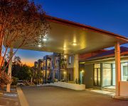
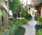
QUEST IPSWICH SERVICED APTS
BEST WESTERN IPSWICH
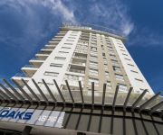
OAKS ASPIRE
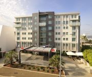
Metro Hotel Ipswich Int
COUNTRY COMFORT MOTOR INN IPSWICH
Cumquat House
Videos from this area
These are videos related to the place based on their proximity to this place.
PB15-448@Bundamba(20-Sep-2009).
Ex Queensland Railways steam loco PB15-448 (restored over a 12 year period, and owned and operated by Queensland Pioneer Steam Railway (QPSR)) runs around the train at Bundamba ...
Yamanto Hub Office Park LJ Hooker Ipswich Michael Rossiter Office Space in Ipswich FOR RENT or SALE
Yamanto Hub is located in the City of Ipswich, approximately 35 kilometres from the Brisbane CBD. Ipswich is entering an era of unprecedented growth, with the region ear marked as a key growth...
Welcome to the RAAF Amberley Aviation Heritage Centre
The RAAF Amberley Aviation Heritage Centre is a must-visit attraction in south east Queensland. If you have always wanted to see and touch historic aircraft, and even inspect some beautifully...
Part (6) making the furniture for your Pottery House
Part (6) making the furniture for your Pottery House.
2011 Flood Ipswich - Tuesday
flooding in QLD begins. Massive flood as large as a historic flood in Ipswich, however wide spread across large areas in QLD (Australia). This is the account of one person in the area, a part...
How to use taggit!
taggit! is a mobile locator app that allows you to find and tag your current location on the map as a point of interest, to be able to find it again later. It works great as a car locator or...
Videos provided by Youtube are under the copyright of their owners.
Attractions and noteworthy things
Distances are based on the centre of the city/town and sightseeing location. This list contains brief abstracts about monuments, holiday activities, national parcs, museums, organisations and more from the area as well as interesting facts about the region itself. Where available, you'll find the corresponding homepage. Otherwise the related wikipedia article.
Ipswich Grammar School
Ipswich Grammar School is an independent, non-denominational, day and boarding school for boys, located in Ipswich, a city situated on the Bremer River in South East Queensland, Australia. The school is sited on the eponymous Grammar School Hill, with its original buildings occupying the crown of the hill. Founded in 1863, Ipswich Grammar was the first secondary school established in the colony of Queensland.
Ipswich railway station, Brisbane
Ipswich Station is a railway station on the Ipswich Line of Brisbane, Australia. It was the first railway station built in Queensland, as the first terminus for the Rosewood railway line. It is now part of the Queensland Rail City network. It is the terminus for the Ipswich and Rosewood lines. It is located in the city of Ipswich in South East Queensland. It is also one of the few Citytrain stations with buildings built over itself for other purposes.
Thomas Street railway station
Thomas Street Station is a railway station on the Rosewood Line of South East Queensland, Australia. It is part of the Queensland Rail City network. It is in Zone 7 of the TransLink integrated public transport system. Thomas Street has a short platform and can only fit 3 carriages, thus passengers on 6-car trains are generally advised to board the front three cars.
Wulkuraka railway station
Wulkuraka Station is a railway station on the Rosewood Line of South East Queensland, Australia. It is part of the Queensland Rail City network. It is in a transition precinct between Zone 7 and Zone 8 of the TransLink integrated public transport system. Wulkuraka has a short platform and can only fit 3 carriages, thus passengers on 6-car trains are generally advised to board the front three cars.
Karrabin railway station
Karrabin Station is a railway station on the Rosewood Line of South East Queensland, Australia. It is part of the Queensland Rail City network. It is in Zone 8 of the TransLink integrated public transport system. Karrabin has a short platform and can only fit 3 carriages, thus passengers on 6-car trains are generally advised to board the front three cars.
Bell Street bus station
The Bell Street Bus Station, at Ipswich, Queensland, Australia, is serviced by TransLink bus routes. It is adjacent to the Ipswich railway station and is the main rail/bus interchange for TransLink's Western Region. It is in Zone 7 of the TransLink integrated public transport system.
Amberley, Queensland
Amberley is a small community located in South East Queensland, south of Ipswich. The origin of the suburb name is from Amberley in the United Kingdom. The name was used by James and Martha Collett for their residence in the 1850s as it was their hometown. Australia's biggest air force base, the RAAF Base Amberley is situated here and the Bureau of Meteorology has a weather observation station in Amberley. To the south of Amberley is the Fassifern Valley.
St Edmund's College, Ipswich
St Edmund's College is a Roman Catholic, secondary day school for boys', located in Ipswich, Queensland, Australia. The school is member of the Associated Independent Colleges of the Greater Brisbane region along with Marist College Ashgrove, Iona College (Queensland), Padua College, Villanova College, St Patrick's College, Shorncliffe, St Laurence's College and St. Peters Lutheran College. St Edmund’s College is conducted in the tradition of Edmund Ignatius Rice.
St. Mary's College, Ipswich
St Mary's College is an Australian Catholic secondary school for girls, located in Ipswich, Queensland, Australia. The school accepts girl students from year 8 to year 12, drawing from a wide area of Ipswich, Queensland. The total enrolment of the school is approximately 650 YTD. St Mary's College was established by Sisters of Mercy in 1863 as part of St Mary’s Parish. Sisters of Mercy left in the early 1990s.
Willowbank Raceway
Willowbank Raceway is a drag racing facility in Queensland, Australia. It is located approximately 30 - 45 minutes drive west of Brisbane. It is part of the Ipswich Motorsport Precinct, which includes a kart racing track; Ipswich Sprint Racing Circuit, a short circuit dirt racetrack; Ipswich Motor Sport Complex and bitumen racetrack Queensland Raceway. It is the home of the Winternationals, one of the largest drag racing festivals in the southern hemisphere.
Churchill, Queensland
Churchill is a suburb of Ipswich, Queensland, Australia.
Yamanto, Queensland
Yamanto is a suburb of Ipswich, Queensland, Australia. The origin of the suburb is from a former cotton plantation which was originally spelt as Yamahanto. Previous names used for this area were Loamside and Mine Accident. The names were given to the railway station in the Yamanto area on the now defunct Fassifern railway line.
One Mile, Queensland
One Mile is a suburb of Ipswich, Queensland, Australia. The origin of the suburb name is from its approximate distance from the Ipswich CBD.
Leichhardt, Queensland
Leichhardt is a suburb of Ipswich, Queensland, Australia. The origin of the suburb name is from Friedrich Wilhelm Ludwig Leichhardt, an explorer and naturalist from Prussia (now known as Germany). He led major expeditions throughout Australia. The suburb name was implemented after a request by local residents to the City of Ipswich in 1953.
Sadliers Crossing, Queensland
Sadliers Crossing is a suburb of Ipswich, Queensland, Australia. The origin of the suburb name is from an early property owner by the name of Thomas Sadlier.
West Ipswich, Queensland
West Ipswich is a suburb of Ipswich, Queensland, Australia.
Wulkuraka, Queensland
Wulkuraka is a suburb of Ipswich, Queensland, Australia. The origin of the suburb name is from an Aboriginal word meaning either red flowering gum tree or plenty of kookaburras.
Karrabin, Queensland
Karrabin is a suburb of Ipswich, Queensland, Australia. The origin of the suburb name is from the Bundjalung Aboriginal language meaning red gum.
Willowbank, Queensland
Willowbank is a suburb of Ipswich, Queensland, Australia. At the 2011 Australian Census the suburb recorded a population of 1,254. The Cunningham Highway passes through the suburb from north to south. Both the Willowbank Raceway and Queensland Raceway are located in the Ipswich Motorsport Precinct at Willowbank.
Shire of Moreton
The Shire of Moreton was a local government area in South East Queensland, Australia, located about 50 kilometres southwest of Queensland's capital, Brisbane. It represented an area surrounding but not including Ipswich, and existed from 1917 until 1995, when it merged into the City of Ipswich, City of Brisbane, and Esk Shire.
Ipswich Courthouse
The Ipswich Courthouse in Ipswich, Queensland opened in 2009/2010. The five-storey complex is the third courthouse for the city and replaced the second courthouse located in East Street, Ipswich that had been constructed in 1982.
Ipswich (suburb), Queensland
Ipswich is the innermost suburb of Ipswich, Queensland, Australia. The suburb situated on the Bremer River. It is split between the Ipswich CBD in the north, parkland to the east and a mixture of health, educations and residential areas to the south.
Deebing Heights, Queensland
Deebing Heights is a semi-rural suburb located in Queensland, Australia. The area that is now Deebing Heights has been an important settlement since Queensland's early colonial history, but was only gazetted as a locality in 2000 and then a suburb in 2004, previously being part of Purga. It is home of the heritage listed Deebing Creek Mission Aboriginal Reserve located at the southern end of Grampian Drive which acted as a home to the Jagera tribe until its closing in 1915.
Ipswich Hospital, Queensland
Ipswich Hospital, in Ipswich, Queensland, Australia, is a medium outer metropolitan teaching hospital affiliated with University of Queensland. Administratively it is part of the Darling Downs West Moreton Health Services District.
Bremer State High School
Bremer State High School (Bremer SHS) is a public, co-educational high school located in Ipswich, Queensland.


