Explore Karrabin
The district Karrabin of in Ipswich (Queensland) is located in Australia about 571 mi north of Canberra, the country's capital.
If you need a place to sleep, we compiled a list of available hotels close to the map centre further down the page.
Depending on your travel schedule, you might want to pay a visit to some of the following locations: Brisbane, Sunshine Coast, Carrolls Creek, and . To further explore this place, just scroll down and browse the available info.
Local weather forecast
Todays Local Weather Conditions & Forecast: 25°C / 77 °F
| Morning Temperature | 18°C / 64 °F |
| Evening Temperature | 23°C / 74 °F |
| Night Temperature | 16°C / 61 °F |
| Chance of rainfall | 0% |
| Air Humidity | 57% |
| Air Pressure | 1020 hPa |
| Wind Speed | Gentle Breeze with 6 km/h (4 mph) from West |
| Cloud Conditions | Broken clouds, covering 68% of sky |
| General Conditions | Light rain |
Sunday, 24th of November 2024
25°C (78 °F)
17°C (63 °F)
Overcast clouds, gentle breeze.
Monday, 25th of November 2024
25°C (78 °F)
18°C (64 °F)
Light rain, gentle breeze, overcast clouds.
Tuesday, 26th of November 2024
27°C (80 °F)
19°C (65 °F)
Sky is clear, gentle breeze, clear sky.
Hotels and Places to Stay
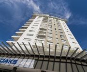
OAKS ASPIRE
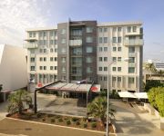
Metro Hotel Ipswich Int
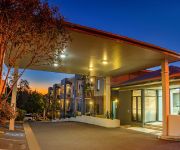
QUEST IPSWICH SERVICED APTS
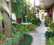
BEST WESTERN IPSWICH
COUNTRY COMFORT MOTOR INN IPSWICH
Cumquat House
Videos from this area
These are videos related to the place based on their proximity to this place.
IPSC Grand Slam @ Ipswich Pistol Club - January 20, 2013
This is my first 'real' IPSC competition. I'm shooting in Production Division, D Grade. The gun is a Glock 17A with Meprolite Tru-Glo sights & 25 cent trigger job. Ammo is 135gr Westcastings...
2 Butterfield Road - Karrabin (4306) Queensland by Ali Briscoe
Property Video shoot of 2 Butterfield Road - Karrabin (4306) Queensland by PlatinumHD http://www.platinumhd.tv for.
ADF Basic Fire Fighter Course 01/2011
A quick look into the Australian Army and RAAF fire fighter training course. A 20 week course covering such things as confined space rescue, structural fires, aviation crash rescue, and motor...
CHOICE HOMES DISPLAY HOME - BRASSALL
A display home from Choice Homes, a Queensland property investment builder based on the Gold Coast.
6 Dorsey Chase - Brassall (4305) Queensland by Ali Briscoe
Property Video shoot of 6 Dorsey Chase - Brassall (4305) Queensland by PlatinumHD http://www.platinumhd.tv for.
31 Bishop Street Wulkuraka 4305 QLD by Shane Miners
The owners have spoken - “We just want it gone!”. So whether you're a first home buyer or looking to enter the investment market, you will be hard pressed to find a better buy than...
17 Jupiter Street Wulkuraka 4305 QLD by Trent Quinn
If low maintenance & solid construction are key criteria to your next purchase then this is certainly worth due consideration. An extra living room extension is what sets this one apart...
Intro video
So this is the first video that I have done. It's a bit of a miss mash of introduction, random bits and pieces as to why I started my weightloss journey, and what ...
Videos provided by Youtube are under the copyright of their owners.
Attractions and noteworthy things
Distances are based on the centre of the city/town and sightseeing location. This list contains brief abstracts about monuments, holiday activities, national parcs, museums, organisations and more from the area as well as interesting facts about the region itself. Where available, you'll find the corresponding homepage. Otherwise the related wikipedia article.
Ipswich Grammar School
Ipswich Grammar School is an independent, non-denominational, day and boarding school for boys, located in Ipswich, a city situated on the Bremer River in South East Queensland, Australia. The school is sited on the eponymous Grammar School Hill, with its original buildings occupying the crown of the hill. Founded in 1863, Ipswich Grammar was the first secondary school established in the colony of Queensland.
Thomas Street railway station
Thomas Street Station is a railway station on the Rosewood Line of South East Queensland, Australia. It is part of the Queensland Rail City network. It is in Zone 7 of the TransLink integrated public transport system. Thomas Street has a short platform and can only fit 3 carriages, thus passengers on 6-car trains are generally advised to board the front three cars.
Wulkuraka railway station
Wulkuraka Station is a railway station on the Rosewood Line of South East Queensland, Australia. It is part of the Queensland Rail City network. It is in a transition precinct between Zone 7 and Zone 8 of the TransLink integrated public transport system. Wulkuraka has a short platform and can only fit 3 carriages, thus passengers on 6-car trains are generally advised to board the front three cars.
Karrabin railway station
Karrabin Station is a railway station on the Rosewood Line of South East Queensland, Australia. It is part of the Queensland Rail City network. It is in Zone 8 of the TransLink integrated public transport system. Karrabin has a short platform and can only fit 3 carriages, thus passengers on 6-car trains are generally advised to board the front three cars.
Bell Street bus station
The Bell Street Bus Station, at Ipswich, Queensland, Australia, is serviced by TransLink bus routes. It is adjacent to the Ipswich railway station and is the main rail/bus interchange for TransLink's Western Region. It is in Zone 7 of the TransLink integrated public transport system.
M2, Brisbane
The M2 in Brisbane, Queensland, Australia, is a major motorway route and southern bypass of Brisbane. It connects the Warrego Highway A2 at Brassall to the M1 at Eight Mile Plains via the following corridors: Northern Ipswich Bypass from Brassall to Dinmore Ipswich Motorway from Dinmore to Gailes Logan Motorway from Gailes to Drewvale Gateway Motorway from Drewvale to Eight Mile Plains
Riverlink Shopping Centre
Riverlink is a shopping centre located in the northern area of the CBD of Ipswich, Queensland, Australia. Stage One (Riverlink West) was opened on 5 April 2007, whereas Stage 2 (Riverlink East) opened on 31 May 2007.
Amberley, Queensland
Amberley is a small community located in South East Queensland, south of Ipswich. The origin of the suburb name is from Amberley in the United Kingdom. The name was used by James and Martha Collett for their residence in the 1850s as it was their hometown. Australia's biggest air force base, the RAAF Base Amberley is situated here and the Bureau of Meteorology has a weather observation station in Amberley. To the south of Amberley is the Fassifern Valley.
St Edmund's College, Ipswich
St Edmund's College is a Roman Catholic, secondary day school for boys', located in Ipswich, Queensland, Australia. The school is member of the Associated Independent Colleges of the Greater Brisbane region along with Marist College Ashgrove, Iona College (Queensland), Padua College, Villanova College, St Patrick's College, Shorncliffe, St Laurence's College and St. Peters Lutheran College. St Edmund’s College is conducted in the tradition of Edmund Ignatius Rice.
St. Mary's College, Ipswich
St Mary's College is an Australian Catholic secondary school for girls, located in Ipswich, Queensland, Australia. The school accepts girl students from year 8 to year 12, drawing from a wide area of Ipswich, Queensland. The total enrolment of the school is approximately 650 YTD. St Mary's College was established by Sisters of Mercy in 1863 as part of St Mary’s Parish. Sisters of Mercy left in the early 1990s.
One Mile, Queensland
One Mile is a suburb of Ipswich, Queensland, Australia. The origin of the suburb name is from its approximate distance from the Ipswich CBD.
Leichhardt, Queensland
Leichhardt is a suburb of Ipswich, Queensland, Australia. The origin of the suburb name is from Friedrich Wilhelm Ludwig Leichhardt, an explorer and naturalist from Prussia (now known as Germany). He led major expeditions throughout Australia. The suburb name was implemented after a request by local residents to the City of Ipswich in 1953.
Woodend, Queensland
Woodend is an inner-city suburb of Ipswich, Queensland, Australia. Its northern border is defined by the meandering course of the Bremer River. The origin of the suburb name is from the name given to the residence of Arthur Macalister, a Scottish migrant who became the second Premier of Queensland.
Brassall, Queensland
Brassall is a suburb of Ipswich, Queensland, Australia. Brassall is located within the Brisbane metropoliton area. The origin of the suburb name is unknown. Was also known as Hungry Flats, as was a stop over for bullock teams that were transporting logs from Pine Mountain to Hancocks saw mill at North Ipswich. It was named by an early surveyor by the name of James Warner although he never gave its meaning or origin.
Coalfalls, Queensland
Coalfalls is a suburb of Ipswich, Queensland, Australia. The origin of the suburb name is from the sighting of coal in this area, most notably along the riverbank.
Sadliers Crossing, Queensland
Sadliers Crossing is a suburb of Ipswich, Queensland, Australia. The origin of the suburb name is from an early property owner by the name of Thomas Sadlier.
West Ipswich, Queensland
West Ipswich is a suburb of Ipswich, Queensland, Australia.
Wulkuraka, Queensland
Wulkuraka is a suburb of Ipswich, Queensland, Australia. The origin of the suburb name is from an Aboriginal word meaning either red flowering gum tree or plenty of kookaburras.
Karrabin, Queensland
Karrabin is a suburb of Ipswich, Queensland, Australia. The origin of the suburb name is from the Bundjalung Aboriginal language meaning red gum.
Raymonds Hill, Queensland
Raymonds Hill is a suburb of Ipswich, Queensland, Australia.
Muirlea, Queensland
Muirlea is a suburb of Ipswich, Queensland, Australia.
Blacksoil, Queensland
Blacksoil is a suburb of Ipswich, Queensland, Australia.
Ipswich Courthouse
The Ipswich Courthouse in Ipswich, Queensland opened in 2009/2010. The five-storey complex is the third courthouse for the city and replaced the second courthouse located in East Street, Ipswich that had been constructed in 1982.
Ipswich State High School
Ipswich State High School is a State Secondary school in the suburb of Brassall, Ipswich, Queensland, Australia, established in 1963. Simon Riley is the current Principal.
Ipswich Hospital, Queensland
Ipswich Hospital, in Ipswich, Queensland, Australia, is a medium outer metropolitan teaching hospital affiliated with University of Queensland. Administratively it is part of the Darling Downs West Moreton Health Services District.


