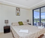
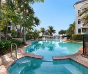
Discover Paradise Point
The district Paradise Point of in Gold Coast (Queensland) is a district in Australia about 569 mi north-east of Canberra, the country's capital city.
Looking for a place to stay? we compiled a list of available hotels close to the map centre further down the page.
When in this area, you might want to pay a visit to some of the following locations: Brisbane, Sunshine Coast, Carrolls Creek, and . To further explore this place, just scroll down and browse the available info.
Local weather forecast
Todays Local Weather Conditions & Forecast: 23°C / 74 °F
| Morning Temperature | 20°C / 68 °F |
| Evening Temperature | 22°C / 72 °F |
| Night Temperature | 20°C / 69 °F |
| Chance of rainfall | 1% |
| Air Humidity | 63% |
| Air Pressure | 1021 hPa |
| Wind Speed | Moderate breeze with 10 km/h (6 mph) from West |
| Cloud Conditions | Clear sky, covering 9% of sky |
| General Conditions | Light rain |
Sunday, 24th of November 2024
23°C (74 °F)
21°C (69 °F)
Light rain, gentle breeze, few clouds.
Monday, 25th of November 2024
23°C (74 °F)
21°C (70 °F)
Light rain, gentle breeze, scattered clouds.
Tuesday, 26th of November 2024
24°C (75 °F)
21°C (70 °F)
Sky is clear, gentle breeze, clear sky.
Hotels and Places to Stay
Sea World Resort
Palazzo Versace
Gold Coast Sheraton Grand Mirage Resort
Azzura Greens Resort
InterContinental Hotels SANCTUARY COVE RESORT
Ramada Couran Cove Island Resort
Aqualine Apartments
Beaconlea Tower Apartments
The Grand Apartments - Labrador
Sandcastles on the Broadwater
Videos from this area
These are videos related to the place based on their proximity to this place.
14 Clemantis Avenue Hollywell 4216 QLD by Adam Merkur
Builders, developers, investors and first home buyers - take note.This is your opportunity to make you mark with this ideally located property. Hollywell is currently undergoing a rejuvenation,...
Laser Sailing Boat doing 15 plus knots
http://Gold-Coast-Holiday.info Laser Sailing Boats screaming down the Gold Coast broadwater doing 15 plus knots. This extreme reaching would have to be almost top speed in this class of yacht.
Tour of Paradise Point - Gold Coast QLD AUSTRALIA 27 01 2011 HD
Another fun play area decorates the esplanade at Paradise Point , part of the Gold Coast city council parklands project. It makes you want to be a kid again, while the mature visitors can stroll...
Are You A Water Baby? 3 Wills Court, Paradise Point QLD 4216
For some of us it's instilled right from birth, the need to live, love and laugh where you can instantly access a large volume of water. LIVE, North East facing to water within a quiet...
Paradise Point afloat
Beautiful watercraft at Paradise Point on the Gold Coast. I recommend using the highest viewing quality to see the benefits of the 4K Panasonic camera that was used to take this little video.
PARADISE POINT HOUSE SOLD! 30 O'Grady Drive, Paradise Point
PARADISE POINT HOUSE SOLD! http://www.platinumre.com.au.
Apartment 2407 2 Ephraim Island Paradise Point 4216 QLD by M...
Spaciously designed and finished with top quality fittings, this stylish apartment boasts stunning Marina and Broadwater views. An ideal entertainer this immaculate property is a cut above...
Lot 3 4 Marina Promenade Paradise Point 4216 QLD by Steven K...
This new waterfront retail precinct consists six shops with sixty plus metres of absolute waterfront North views.There is potential to split the existing lot into six individual lots. ...
5/18 Maiala Close, Paradise Point
http://www.platinumre.com.au/property/details/819 Come inside one of the largest villas in the beautiful lifestyle destination that is Paradise Point. Located in a small complex of only 5...
Videos provided by Youtube are under the copyright of their owners.
Attractions and noteworthy things
Distances are based on the centre of the city/town and sightseeing location. This list contains brief abstracts about monuments, holiday activities, national parcs, museums, organisations and more from the area as well as interesting facts about the region itself. Where available, you'll find the corresponding homepage. Otherwise the related wikipedia article.
South Stradbroke Island
South Stradbroke Island is an Australian island in the state of Queensland, south of Brisbane and forms the northern end of Gold Coast. The 21 km by 2.5 km sized island is the smaller one of the two Stradbroke Islands and lies very close to the mainland. The island has hundreds of wild wallabies that are usually human orientated. They are also well known for stealing bread from tents and cabins, and joining campers at their fires.
Harbour Town
Harbour Town refers to the shopping centre concept to collocate factory outlets in one centre. There are presently four such centres operating in Australia. They are especially popular with tourists, although many locals also shop there. As at September 2009, there were four locations: Biggera Waters, on Queensland's Gold Coast; Water Front City, Docklands in Melbourne, Victoria; Adelaide Airport, in South Australia and at West Perth, in Western Australia.
Gold Coast Seaway
The Gold Coast Seaway or Southport Seaway is the main navigation entrance from the Pacific Ocean into the Gold Coast Broadwater and southern Moreton Bay and is one of Australia’s most significant coastal engineering projects. It is located at the northern end of the Southport Spit.
Helensvale railway station
Helensvale is a railway station on the Gold Coast Line of South East Queensland, Australia. It is part of the Queensland Rail City network. The station was opened in 1996 when the railway between Brisbane and the Gold Coast re-opened.
Helensvale, Queensland
Helensvale is a suburb on the Gold Coast in Queensland, Australia and was named after Helena White. At the 2006 Census, Helensvale had a population of 14,767. In the next five years, Helensvale is expected to develop further as a transport hub, with the current linking of the Gold Coast Highway and Pacific Motorway, the two most important road routes on the Gold Coast with Helensvale Railway Station at Westfield Helensvale.
Coomera River
The Coomera River is a river situated in South East Queensland. The upper reaches of the river flow from the Lamington plateau and the Lamington National Park. Here are the spectacular Coomera Falls in the Coomera Gorge. The river was first discovered by Patrick Logan in May 1827. The waterway was originally named the River Arrowsmith after a London cartographic firm by Robert Dixon, a government surveyor.
Biggera Waters, Queensland
Biggera Waters is a suburb located on the western side of The Broadwater and is north of the suburb of Labrador, on the Gold Coast in Queensland, Australia. At the 2006 Census, Biggera Waters had a population of 5,391. Its namesake, Biggera Creek, flows through the suburb itself and past a point known locally as "Land's End". Subdivided in the late 19th century, the area was originally settled by several fishing and agricultural families.
Coombabah, Queensland
Coombabah is a suburb on the Gold Coast in Queensland, Australia. At the 2006 census, Coombabah had a population of 9,303. The word 'Coombabah' is an English corruption of the Aboriginal word, and can have three alternate translations. The first, 'Koomboobah', means 'place of the cobra worms'. The second, 'Koombabah' means 'place of the turtles and the third, Coombabah is an aboriginal word meaning 'home of the turtles', or a pocket of land.
Hope Island, Queensland
Hope Island is a suburb on the Gold Coast in Queensland, Australia. At the 2006 Census, Hope Island had a population of 5,396. Hope Island is popular due to its close proximity to both the Gold Coast beaches and Brisbane city. The area was named after colonial aristocrat Captain Louis Hope, who was granted approximately 1,800 acres of land at the mouth of the Coomera River in recognition of his contribution in developing the sugar industry in Queensland.
Ephraim Island
Ephraim Island is luxury residential development located in the suburb of Paradise Point in the north of Gold Coast, Australia. The development is a joint-venture between Lewis Land and Mirvac. The island has an area of 9.6 hectares and was once covered by mangroves. The development is distinctive for inhabiting an artificial island in the Broadwater, connecting to the mainland by a 400 metre bridge.
Gold Coast University Hospital
Gold Coast University Hospital is a major health facility for the Gold Coast, Australia, due for completion in 2013. It involves building a new tertiary hospital on a greenfields site adjacent to the Griffith University Gold Coast campus at a cost of $1.55 billion. Construction commenced on Tuesday, 16 December 2008 when Queensland Premier, Anna Bligh turned the first sod. Bovis Lend Lease are building the hospital.
Juice107.3
Juice107.3 is a Christian radio station on the Gold Coast, Queensland, Australia. It broadcasts at 107.3 MHz. The station's motto is Good Taste Radio. The station offers a ratio of 60% Christian Music to 40% Mainstream. As well as playing music, Juice107.3 offers news, sport and general talk programs.
Harbour Town bus station
The Harbour Town Bus Station, at Biggera Waters, is serviced by TransLink bus routes. It is part of the Harbour Town Shopping Centre. It is in Zone 12 of the TransLink integrated public transport system.
Sanctuary Cove, Queensland
Sanctuary Cove is a gated community, in the suburb of Hope Island in the Gold Coast area of Queensland, Australia. It was the first of such developments in Australia and is notable for its impact in planning legislation in Queensland which had to be altered to allow it to proceed, due to the privatisation of such large areas of urban land. It covers an area of 474 hectares.
Loders Creek
Loders Creek is a creek that separates Southport and Labrador in the mid Gold Coast. There is a retention basin in the upper reaches that prevents flooding of the tidal reaches. This creek was the first catchment to establish a formal community catchment management group on the Gold coast.
Biggera Creek Dam
The Biggera Creek Flood Mitigation Dam is owned by Gold Coast City Council. The height of the dam wall is 15 m.
Coombabah Lake
Coombabah Lake is located 5 km from the coast and 8 km North West of Southport on the Gold Coast of southeast Queensland, Australia. The lake, which comprises the Coombabah Lake Nature Reserve and borders the Ivan Gibbs Wetland Reserve, is classified as a Fish Habitat Area within the Moreton Bay Marine Park and serves as an important wildlife corridor between the Nerang State Forest and the coast.
Pimpama River
The Pimpama River is a river situated in South East Queensland, with its catchment located in the northern part of Gold Coast City. It is bounded by the Logan/Albert River catchment to the north, the Coomera River catchment to the south and the Broadwater in the east. The Pimpama River originates in the Darlington Range and major tributaries of the river include Hotham Creek and McCoys Creek. The total area of the catchment is 171 km².
Southport State High School
Southport State High School is a school situated on the Gold Coast, Queensland in Australia. It was the first public high school on the Gold Coast to be opened, originally established in 1916 and moved to its current position in 1954. It is known for raising exceptional students, including past students such as Clive Palmer (Australia's 5th richest man and Queensland's wealthiest), Vice Admiral Russ Crane (Chief of the Royal Australian Navy) and many others.
Coombabah State School
Coombabah State School is a P-7 state primary school located in Coombabah, Queensland, Australia. It serves the suburbs of Hope Island, Paradise Point, Hollywell, Runaway Bay and Coombabah. The school, that was established in 1981, had 879 students and 61 prep students as of May 2007.
Paradise Point, Queensland
Paradise Point is a suburb on the Gold Coast in Queensland, Australia. At the 2006 Census, Paradise Point had a population of 19,139. The suburb lies on the Broadwater and has direct access to the Coomera River, and therefore the suburb is well serviced by boats ramps and marinas. Paradise Point is a fairly up market suburb, with many properties worth in excess of 10 million dollars. The area is protected by South Stradbroke Island which lies off the coast.
Sovereign Islands, Queensland
Sovereign Islands is a very affluent community within the suburb of Paradise Point on the Gold Coast in Queensland, Australia. At the 2006 Census, the area had a population of 19,139. Sovereign Islands are located toward the northern end of the Gold Coast and are connected to Paradise Point by bridge. The prestigious island is made up of luxury homes with deepwater moorings and direct ocean access for the boating enthusiasts.
Helensvale State High School
Helensvale State High School is a public secondary school located in the northern suburb of Helensvale on the Gold Coast, Queensland Australia. It is situated on the corner of Discovery Drive and Helensvale Road. The school first opened in 1990 with Rod Cassidy as the foundation principal. The School motto is Endeavour, Discover, Succeed.
Castaway Bay (Sea World)
Castaway Bay is a themed area at the Sea World amusement park on the Gold Coast, Queensland, Australia. It consists of three distinct attractions: Battle Boats (formerly Battle Sails), Sky Climb, and Sky Fortress.
Coomera, Queensland
Coomera is a suburb on the Gold Coast in Queensland, Australia. At the 2006 Census, Coomera had a population of 1,420. The name Coomera comes from the Aboriginal word for fern. Coomera has long been earmarked as a new satellite growth suburb, similar in many ways to Robina.


