Delve into Gilston
The district Gilston of in Gold Coast (Queensland) is a district located in Australia about 558 mi north-east of Canberra, the country's capital town.
In need of a room? We compiled a list of available hotels close to the map centre further down the page.
Since you are here already, you might want to pay a visit to some of the following locations: Brisbane, Sunshine Coast, Carrolls Creek, and . To further explore this place, just scroll down and browse the available info.
Local weather forecast
Todays Local Weather Conditions & Forecast: 23°C / 74 °F
| Morning Temperature | 17°C / 62 °F |
| Evening Temperature | 21°C / 70 °F |
| Night Temperature | 15°C / 59 °F |
| Chance of rainfall | 0% |
| Air Humidity | 58% |
| Air Pressure | 1021 hPa |
| Wind Speed | Gentle Breeze with 6 km/h (4 mph) from West |
| Cloud Conditions | Overcast clouds, covering 91% of sky |
| General Conditions | Light rain |
Sunday, 24th of November 2024
24°C (76 °F)
15°C (60 °F)
Broken clouds, gentle breeze.
Monday, 25th of November 2024
26°C (79 °F)
17°C (62 °F)
Few clouds, gentle breeze.
Tuesday, 26th of November 2024
26°C (79 °F)
17°C (63 °F)
Sky is clear, gentle breeze, clear sky.
Hotels and Places to Stay
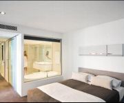
Q1 RESORT & SPA
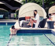
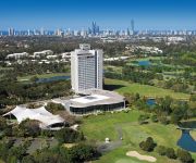
Mercure Gold Coast Resort
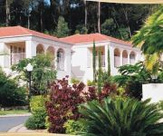
Royal Woods Resort
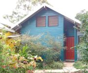
Mountain Edge Studios
Hinterland Hotel
The Village B&B
Griffith University Village
RACV ROYAL PINES RESORT
Videos from this area
These are videos related to the place based on their proximity to this place.
Nerang Plumber Checklist
Nerang Plumbers: There are many different plumbers in Nerang - be sure you know what to ask them before your ring. https://www.youtube.com/watch?v=y4kLXy3ITm4 http://www.NerangPlumber.com.
Nerang Plumbers: Hiring the right one
How Can I Be Sure to Hire the Right Nerang Plumber for My Needs? Read on ... http://www.NerangPlumber.com Do not make the mistake of just hiring the first plumber in Nerang you come...
277 Beaudesert-Nerang Road Nerang 4211 QLD by Jodie Took
Set on a manicured 6 acres of creekfront land, this stunning 4 bedroom, 2 bathroom home captures the views over the damn, bushland and paddocks. Open plan living and a stunning stone kitchen...
Worlds Greatest Shave | Kellie | My Centre Nerang ( Gold Coast )
The World's Greatest Shave was done by Kellie who works at the Chemmart (store) within My Centre Nerang (on the Gold Coast). Also featured are various other bold brave people who donated...
Gold Coast Printers UDESIGN Nerang (07) 5596 1238
Gold Coast Printing UDESIGN is a leading Gold Coast imaging solutions company offering a full range of innovative, integrated printing and signage services plus creative artwork and web site...
BMX Australia 2015 [ Nerang - Round 2 Final ] Boys 11yrs
BMX Australia - Queensland Racing Nerang BMX - Round 2 - January 4th 2015 Boys 11yrs Final.
Circa Nundah Village by CBRE Project Marketing Gold Coast
Circa Nundah Village - Brand new apartments now selling located in one of Brisbane's hottest employment and growth precincts. Circa Nundah Village by Property Solutions - creators of James...
Riverlea Waters Estate 73 Riverlea Waters Drive, Nerang QLD By Geraldine Brunner
Property Video shoot of Riverlea Waters Estate 73 Riverlea Waters Drive, Nerang QLD by PlatinumHD http://www.platinumhd.tv for GB Realty.
Videos provided by Youtube are under the copyright of their owners.
Attractions and noteworthy things
Distances are based on the centre of the city/town and sightseeing location. This list contains brief abstracts about monuments, holiday activities, national parcs, museums, organisations and more from the area as well as interesting facts about the region itself. Where available, you'll find the corresponding homepage. Otherwise the related wikipedia article.
Carrara Stadium
Carrara Stadium (known commercially as Metricon Stadium) is a sporting venue on the Gold Coast in Queensland, Australia, located in the suburb of Carrara. It received substantial redevelopment work prior to the entry of the Brisbane Bears to the VFL/AFL in 1987, but since the Bears relocated to the Gabba in 1993, it has been used for other sports including rugby league, rugby union and even baseball. The stadium will host the opening and closing ceremonies of the 2018 Commonwealth Games.
Mudgeeraba, Queensland
Mudgeeraba is a suburb of Queensland, situated in the Gold Coast Hinterland. Mudgeeraba is remnant of the type of township that characterises the rural hinterland of the Gold Coast. Subdivision of land was conventional and buildings were traditionally rural or rural commercial. Mudgeeraba, like other areas, was an early centre, which rose to some prominence with the coming of the railway.
Division of Moncrieff
The Division of Moncrieff is an Australian Electoral Division in Queensland. The division was created in 1984 and is named for Gladys Moncrieff, an Australian singer who resided in the area. Moncrieff is located in south east Queensland, and is based on the central portion of the Gold Coast, including Surfers Paradise. It has always been a very safe Liberal seat.
Nerang railway station
Nerang railway station is a railway station on the Gold Coast Line of South East Queensland, Australia. It is part of the Queensland Rail City network.
Robina railway station
Robina railway station is a railway station on the Gold Coast Line of South East Queensland, Australia. It is part of the Queensland Rail City network and is the site of a medium sized out stabling yard, capable of storing 10 electric multiple units. The station was the terminus of the Gold Coast line between 1998 and 2009, when a 4.1 km extension south to Varsity Lakes opened in December of that year.
Robina Stadium
Robina Stadium, currently known as its sponsored name Skilled Park, is a rectangular football stadium in the Gold Coast suburb of Robina, Queensland. It is the home ground to the National Rugby League's Gold Coast Titans. Starting in 2011, it will also become the home of the Gold Coast Sevens, the country's leg of the IRB Sevens World Series.
Hinze Dam
Hinze Dam, also known as Advancetown Lake, supplies most of the water provided to Gold Coast City in Queensland, Australia. It was completed in 1976 and expanded in 1989 and 2011. Advancetown Lake is a popular recreational facility for Gold Coast residents. Hinze Dam was first managed by Gold Coast Water with management of the dam now handled by Seqwater. The dam also provides the benefit of flood mitigation to populated areas along the Nerang River downstream of the dam.
Carrara, Queensland
Carrara is a suburb of the Gold Coast in Queensland, Australia on the southern bank of the Nerang River. At the 2006 Census, Carrara had a population of 10,687. It is most known as being the home of Carrara Stadium (also known as Metricon Stadium), the purpose built cricket and Australian rules football ground where the Gold Coast Suns began playing matches in 2011, as well as the Carrara Markets. The name Carrara comes from the Aboriginal word 'Karara' meaning 'long flat'. http://www.
Molendinar, Queensland
Molendinar also known as Silver Bridle is a small, mainly industrial suburb on the Gold Coast in Queensland, Australia. At the 2006 Census, Molendinar had a population of 5,606. On Monday 2 April 2012 an official dedication of the Lynne Richardson Community Centre was held by The Gold Coast City Council The area was a Queensland State Government project supported by the Gold Coast City, with initial development beginning circa 1969.
Trinity Lutheran College (Queensland)
Trinity Lutheran College is a primary, middle, and high school in Ashmore, Gold Coast, Australia. In January 1981, Trinity Lutheran Primary School was founded and The Ashmore Road Campus was founded in 1987.
Gold Coast Regional Botanic Gardens
The Gold Coast Regional Botanic Gardens, formerly known as the Rosser Park Regional Botanic Gardens, and before that simply Rosser Park, are located on Ashmore Road, Benowa, Gold Coast, Australia. The development of the master plan for the botanic gardens involved more than 18 months' investigation, site analysis and community consultation. The plan was adopted by Gold Coast City in 2002 and the first plantings took place in 2003.
Nerang State High School
Nerang State High School (NSHS) is a state high school located on the Gold Coast of Queensland, Australia.
William Duncan State School
William Duncan State School (WDSS) is a state school located Gold Coast, Queensland, Australia. The school was opened in 1987 with just 186 students enrolled, which has now grown to approximately 800 in the present day.
Benowa State High School
Benowa State High School (BSHS) is a co-educational school located in Gold Coast, Australia, which was founded in 1980. It is part of the Council of International Schools (CIS) and hosts exchange students from Asia, America and Europe. It commenced a French Immersion program in 1985 and was the first school to offer Marine Biology as a subject in the Queensland Education curriculum.
Shire of Albert
The Shire of Albert was a local government area in Queensland, located south of the capital, Brisbane, and taking in areas to the north and west of the Gold Coast. It was named after the Prince Consort of the United Kingdom, and husband of Queen Victoria, Prince Albert. When created in 1948, it was primarily a rural area, but its growth started in earnest in the late 1960s with the development of Logan on Brisbane's southern frontier.
Surfers Paradise International Raceway
Surfers Paradise International Raceway was a motor racing complex at Gold Coast, Queensland, Australia. The circuit was designed and built by Keith Williams, a motor racing enthusiast. It was located opposite the Surfers Paradise Ski Gardens at Carrara. The complex included a dragstrip along the main straight, with a very fast right-hander under a Dunlop Bridge leading to a tight corner that turned the track back to a medium-length straight.
Queensland Independent College
Queensland Independent College is a private, primary school in Merrimac, Gold Coast, Australia. It was founded in 2008 as the Queensland Montessori College, with a view to creating a sustainable school to replace a previous Montessori school that had closed down. The first intake of students occurred at the start of 2009. The school is coeducational, non-denominational and emphasises specialised educational attention in a relaxed, supportive environment.
Clagiraba, Queensland
Clagiraba is a suburb of Gold Coast City, Queensland, Australia approximately 25 km west of Surfers Paradise in the Gold Coast's hinterland. It is nestled between Mount Nathan and Witheren and also encompasses the southern end of Mount Tamborine. Though zoned rural, it is a comparatively short (10-15 minute) drive to more populous suburbs such as Nerang, Oxenford and Pacific Pines.
Carrara Indoor Stadium
Carrara Indoor Stadium is a multi-purpose arena located at Carrara on Queenslands Gold Coast and can accommodate 1,600 fans, with additional seating provided if required which can push total capacity for events such as basketball up to 2,962. The stadium stands next door to the 25,000 seat Metricon Stadium and forms part of the Carrara Sports Complex.
Palm Meadows
Palm Meadows International Baseball Facility is an Australian baseball field located on the Gold Coast, Queensland. It is owned by Hungtat Worldwide Pty Ltd (Trading as Palm Meadows Golf course) and is leased through Gold Coast city council. It is currently home to the Major League Baseball Australian Academy Program (MLBAAP).
Robina Hospital
Robina Hospital, located in Robina, Queensland is a teaching hospital for Bond University and Griffith University.
Emmanuel College (Queensland)
Emmanuel College is an independent, co-educational, multi-denominational Christian school located in the suburb of Carrara on the Gold Coast, Queensland, Australia. The College caters for students from Preparatory through to Year 12. Emmanuel College is a privately owned and operated educational institute run by the Emmanuel Ministry of Education (Pty) Ltd.
Nerang National Park
Nerang National Park (commonly referred to as Nerang State Forest) is a national park in Queensland, Australia situated on the Gold Coast. The protected area is located 12 km from Surfers Paradise on Nerang’s north-west outskirts. Nerang National Park is known for its variety of birds, trails, and views. Making it a popular place for mountain bike riders, bushwalkers and bird watchers.
Advancetown, Queensland
Advancetown is a small outer suburb of the Gold Coast in South East Queensland. It is situated in the Gold Coast hinterland. At the 2006 Census the population was 360. It is the location of the Advancetown Lake and Hinze Dam, which supplies water for most of the citizens of the Gold Coast. The suburb was part of the Shire of Albert until it was amalgamated into the Gold Coast City in 1995.
Gilston, Queensland
Gilston is a suburb of the City of Gold Coast local government area in South East Queensland, Australia. According to the 2011 census it had a population of 1,449, an increase of almost 900 since the previous census in 2006. The western boundary of the suburb is marked by the Nerang River.






!['BMX Australia 2015 [ Nerang - Round 2 Final ] Boys 11yrs' preview picture of video 'BMX Australia 2015 [ Nerang - Round 2 Final ] Boys 11yrs'](https://img.youtube.com/vi/LopN1SIsOgQ/mqdefault.jpg)


