Delve into Advancetown
The district Advancetown of in Gold Coast (Queensland) is a subburb in Australia about 555 mi north-east of Canberra, the country's capital town.
If you need a hotel, we compiled a list of available hotels close to the map centre further down the page.
While being here, you might want to pay a visit to some of the following locations: Brisbane, Carrolls Creek, Sunshine Coast, and . To further explore this place, just scroll down and browse the available info.
Local weather forecast
Todays Local Weather Conditions & Forecast: 28°C / 82 °F
| Morning Temperature | 15°C / 60 °F |
| Evening Temperature | 23°C / 73 °F |
| Night Temperature | 18°C / 64 °F |
| Chance of rainfall | 1% |
| Air Humidity | 46% |
| Air Pressure | 1016 hPa |
| Wind Speed | Light breeze with 5 km/h (3 mph) from South |
| Cloud Conditions | Overcast clouds, covering 98% of sky |
| General Conditions | Light rain |
Tuesday, 19th of November 2024
19°C (67 °F)
17°C (62 °F)
Moderate rain, calm, overcast clouds.
Wednesday, 20th of November 2024
17°C (63 °F)
17°C (62 °F)
Moderate rain, gentle breeze, overcast clouds.
Thursday, 21st of November 2024
19°C (66 °F)
18°C (65 °F)
Light rain, gentle breeze, overcast clouds.
Hotels and Places to Stay
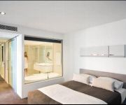
Q1 RESORT & SPA
Hinterland Hotel
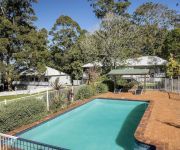
Aaronlee Retreat
Videos from this area
These are videos related to the place based on their proximity to this place.
GCCC Swamp Work with a Lynex
Gold Coast City Council have some very wet areas that need regular maintenance but the ground is uneven and in some places ankle deep in water which is dangerous when you are using a hand ...
53 Veronica Drive - Tallai (4213) Queensland
Amber Wyatt presents: It's very quiet and peaceful sitting on the veranda of this three-plus bedroom home at 53 Veronica drive in Tallai. All you can see and hear is the trees rustle...
Where to cycle Gold Coast Springbrook Road
An introduction to one of the cycling gems on the Gold Coast.
Surgical Weight Loss Gold Coast How to Lose Weight Surgically
Visit http://loseweightsurgically.info to register for the live seminar and start your weight loss journey today. In the seminar the newest surgical weight loss techniques will be revealed...
Hinterland Wedding Video - Ecostudio Fellini - Gold Coast
An awesome day at Ecostudio Fellini on the Gold Coast in the hinterland.
581 Gold Coast Springbrook Road - Mudgeeraba (4213) Queensland by Glenn Shillig
The property is approximately 3.35 hectares and the improvements are Pancho's Mexican Restaurant, a five bedroom house and a four bedroom log cabin. The famous licensed restaurant currently...
Little Nerang Dam Road Horse Track Walk
Hike along a horse trail along some walking paths at little Nerang Dam Road.
Videos provided by Youtube are under the copyright of their owners.
Attractions and noteworthy things
Distances are based on the centre of the city/town and sightseeing location. This list contains brief abstracts about monuments, holiday activities, national parcs, museums, organisations and more from the area as well as interesting facts about the region itself. Where available, you'll find the corresponding homepage. Otherwise the related wikipedia article.
Springbrook National Park
Springbrook National Park is a national park at Springbrook on the McPherson Range in the Gold Coast hinterland of Queensland,, 96 km south of Brisbane.
Numinbah Correctional Centre
Numinbah Correctional Centre is an open prison on a 1,800-acre reserve 100 km south of Brisbane in the Numinbah Valley. The centre houses 104 male prisoners in separate rooms and in an annex 25 female prisoners, a mix of short and long-term.
Mudgeeraba, Queensland
Mudgeeraba is a suburb of Queensland, situated in the Gold Coast Hinterland. Mudgeeraba is remnant of the type of township that characterises the rural hinterland of the Gold Coast. Subdivision of land was conventional and buildings were traditionally rural or rural commercial. Mudgeeraba, like other areas, was an early centre, which rose to some prominence with the coming of the railway.
Nerang railway station
Nerang railway station is a railway station on the Gold Coast Line of South East Queensland, Australia. It is part of the Queensland Rail City network.
Hinze Dam
Hinze Dam, also known as Advancetown Lake, supplies most of the water provided to Gold Coast City in Queensland, Australia. It was completed in 1976 and expanded in 1989 and 2011. Advancetown Lake is a popular recreational facility for Gold Coast residents. Hinze Dam was first managed by Gold Coast Water with management of the dam now handled by Seqwater. The dam also provides the benefit of flood mitigation to populated areas along the Nerang River downstream of the dam.
Somerset College
Somerset College is a private, non-denominational Christian school located in Mudgeeraba, Gold Coast, Australia.
Canungra, Queensland
Canungra is a small picturesque rural township in South East Queensland, Australia. Its economy depends on tourism, being a popular destination for short drives from the Gold Coast and Brisbane. Canungra, also called the "Valley of the Owls", is situated in the Gold Coast hinterland, 35 kilometres west of the Gold Coast and 90 kilometres south of Brisbane. At the 2011 census, Canungra had a population of 746.
Hot Tomato
Hot Tomato is a radio station (102.9 FM) in Gold Coast, Queensland, Australia. The current breakfast line-up consists of Paul Holmes ex Sydney and Melbourne radio legend, teamed with Sean Flanagan, comedic writer for TV and radio. Nova 106.9 announcer Emily-Jade O'Keefe was among the founding breakfast crew when the station first launched. Malcolm Lees, most famous as a member of Sydney MMM's (and Triple J) Club Veg, is partnered with Luke Bradnam for the Local Drive Home show.
Little Nerang Dam
The Little Nerang Dam is a secondary source of water supply to Gold Coast City in Queensland, Australia. It was completed in 1962 and is managed by Gold Coast Water. It is located on the Little Nerang Creek directly upstream from the Hinze Dam. Its catchment includes the Springbrook Plateau. Prior to the completion of the Hinze Dam, the Little Nerang Creek Gravity Scheme supplied the water requirements of the Gold Coast area.
Scenic Rim
The Scenic Rim is a group of forested mountain ranges of the Great Dividing Range straddling the border between south-eastern Queensland and north-eastern New South Wales, Australia.
Nerang State High School
Nerang State High School (NSHS) is a state high school located on the Gold Coast of Queensland, Australia.
William Duncan State School
William Duncan State School (WDSS) is a state school located Gold Coast, Queensland, Australia. The school was opened in 1987 with just 186 students enrolled, which has now grown to approximately 800 in the present day.
Numinbah Valley
The Numinbah Valley is an area of the Gold Coast hinterland in South East Queensland, Australia. This Scenic Rim valley contains many rocky outcrops, waterfalls, rainforest walks, and good hinterland scenery. Compared to other areas of the Gold Coast the Numinbah Valley has remained largely undeveloped in recent decades. To the east is the Springbrook plateau.
Jazz Radio 94.1FM
Jazz Radio 94.1 FM is a community radio station based in Sanctuary Cove on the Gold Coast in Australia. They broadcast to a wide audience from Northern NSW to South Brisbane and play jazz and swing 24 hours a day. The radio station is run primarily by volunteers and supported by sponsors and government grants. The station has over 800 paid up members.
Kokoda Barracks
Kokoda Barracks is an Australian Army base located in Queensland at Canungra. The Australian Army Intelligence Corps has training facilities known as the Defence Intelligence Training Centre and the Australian Army Land Warfare Centre, Canungra located here.
Beechmont, Queensland
Beechmont is a residential village located in the Gold Coast hinterland of eastern Australia. The suburb is positioned on a forested ridge leading from the Lamington Plateau to Tambourine Mountain. Outstanding views in nearly all directions means that on a clear day Cunninghams Gap and other Scenic Rim landforms are visible as well as Flinders Peak, Moogerah Peaks and the D'Aguilar Range to the north west of Brisbane.
Benowa State High School
Benowa State High School (BSHS) is a co-educational school located in Gold Coast, Australia, which was founded in 1980. It is part of the Council of International Schools (CIS) and hosts exchange students from Asia, America and Europe. It commenced a French Immersion program in 1985 and was the first school to offer Marine Biology as a subject in the Queensland Education curriculum.
Shire of Albert
The Shire of Albert was a local government area in Queensland, located south of the capital, Brisbane, and taking in areas to the north and west of the Gold Coast. It was named after the Prince Consort of the United Kingdom, and husband of Queen Victoria, Prince Albert. When created in 1948, it was primarily a rural area, but its growth started in earnest in the late 1960s with the development of Logan on Brisbane's southern frontier.
Queensland Independent College
Queensland Independent College is a private, primary school in Merrimac, Gold Coast, Australia. It was founded in 2008 as the Queensland Montessori College, with a view to creating a sustainable school to replace a previous Montessori school that had closed down. The first intake of students occurred at the start of 2009. The school is coeducational, non-denominational and emphasises specialised educational attention in a relaxed, supportive environment.
Mount Nimmel
Mount Nimmel is a small mountain located in Austinville, Queensland in Australia. Nimmel is an Australian indigenous word meaning 'Conspicuous Mountain', which is ironic, considering it is very small when compared to the nearby Springbrook Mountain, Tamborine Mountain and Mount Cougal's twin peaks.
90.9 Sea FM
90.9 Sea FM (callsign 4SEA) is a radio station on the Gold Coast, Queensland, Australia. It is part of the Southern Cross Media Hit Music Network, and is also the network hub for the Hit Music Stream, broadcasting shows from 4pm - 12am across the Sea, Star and Hot FM Networks across Australia. The Sea FM brand name and logo was created by Gold Coast Broadcasters Pty Ltd for just the one station - 90.9 Sea FM - after the Gold Coast was granted a new commercial FM licence.
Robina Hospital
Robina Hospital, located in Robina, Queensland is a teaching hospital for Bond University and Griffith University.
Nerang National Park
Nerang National Park (commonly referred to as Nerang State Forest) is a national park in Queensland, Australia situated on the Gold Coast. The protected area is located 12 km from Surfers Paradise on Nerang’s north-west outskirts. Nerang National Park is known for its variety of birds, trails, and views. Making it a popular place for mountain bike riders, bushwalkers and bird watchers.
Advancetown, Queensland
Advancetown is a small outer suburb of the Gold Coast in South East Queensland. It is situated in the Gold Coast hinterland. At the 2006 Census the population was 360. It is the location of the Advancetown Lake and Hinze Dam, which supplies water for most of the citizens of the Gold Coast. The suburb was part of the Shire of Albert until it was amalgamated into the Gold Coast City in 1995.
Gilston, Queensland
Gilston is a suburb of the City of Gold Coast local government area in South East Queensland, Australia. According to the 2011 census it had a population of 1,449, an increase of almost 900 since the previous census in 2006. The western boundary of the suburb is marked by the Nerang River.


