Delve into Capella
Capella in Central Highlands (Queensland) is a town located in Australia about 845 mi (or 1,360 km) north of Canberra, the country's capital town.
Time in Capella is now 05:05 PM (Sunday). The local timezone is named Australia / Brisbane with an UTC offset of 10 hours. We know of 8 airports closer to Capella. The closest airport in Australia is Clermont Airport in a distance of 33 mi (or 54 km), North-West. Besides the airports, there are other travel options available (check left side).
In need of a room? We compiled a list of available hotels close to the map centre further down the page.
Since you are here already, you might want to pay a visit to some of the following locations: Bowen, , , and . To further explore this place, just scroll down and browse the available info.
Local weather forecast
Todays Local Weather Conditions & Forecast: 30°C / 86 °F
| Morning Temperature | 19°C / 67 °F |
| Evening Temperature | 33°C / 91 °F |
| Night Temperature | 22°C / 71 °F |
| Chance of rainfall | 0% |
| Air Humidity | 34% |
| Air Pressure | 1016 hPa |
| Wind Speed | Moderate breeze with 12 km/h (8 mph) from South-West |
| Cloud Conditions | Few clouds, covering 21% of sky |
| General Conditions | Few clouds |
Monday, 25th of November 2024
30°C (86 °F)
22°C (71 °F)
Sky is clear, moderate breeze, clear sky.
Tuesday, 26th of November 2024
30°C (86 °F)
24°C (75 °F)
Broken clouds, moderate breeze.
Wednesday, 27th of November 2024
29°C (84 °F)
25°C (77 °F)
Scattered clouds, fresh breeze.
Hotels and Places to Stay
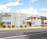
MAS Country Dooleys Capella Tavern & Motel
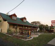
Capella Coach Inn
Bottlebrush Motel
Attractions and noteworthy things
Distances are based on the centre of the city/town and sightseeing location. This list contains brief abstracts about monuments, holiday activities, national parcs, museums, organisations and more from the area as well as interesting facts about the region itself. Where available, you'll find the corresponding homepage. Otherwise the related wikipedia article.
Capella, Queensland
Capella is a small town in Central Highlands, Queensland midway between Emerald and Clermont on the Gregory Highway. At the 2006 census, the town had a population of 796. It was founded in the late 1860s by graziers influenced by the good reports of Ludwig Leichhardt. Today, it is a service town catering to the large coal-mining interests in the area as well as pastoralists. Sport is a very big part of the town, especially Rugby League and Union.
Shire of Peak Downs
Shire of Peak Downs was a local government area in the Central Highlands of Queensland, Australia, 320 km west of both Rockhampton and Mackay. In 2008, the Shire was amalgamated into the Central Highlands Regional Council. It had about 4,000 inhabitants, the primary economic activities in the shire are coal mining, farming and grazing. The Shire is part of the Bowen Basin, a major coal deposit.


