Explore Smithfield Heights
The district Smithfield Heights of in Cairns (Queensland) is located in Australia about 1,293 mi north of Canberra, the country's capital.
If you need a place to sleep, we compiled a list of available hotels close to the map centre further down the page.
Depending on your travel schedule, you might want to pay a visit to some of the following locations: Bowen, , , and . To further explore this place, just scroll down and browse the available info.
Local weather forecast
Todays Local Weather Conditions & Forecast: 28°C / 83 °F
| Morning Temperature | 23°C / 73 °F |
| Evening Temperature | 25°C / 77 °F |
| Night Temperature | 22°C / 72 °F |
| Chance of rainfall | 1% |
| Air Humidity | 61% |
| Air Pressure | 1012 hPa |
| Wind Speed | Moderate breeze with 9 km/h (6 mph) from West |
| Cloud Conditions | Scattered clouds, covering 41% of sky |
| General Conditions | Light rain |
Monday, 25th of November 2024
28°C (83 °F)
22°C (72 °F)
Light rain, gentle breeze, scattered clouds.
Tuesday, 26th of November 2024
28°C (82 °F)
23°C (73 °F)
Light rain, gentle breeze, scattered clouds.
Wednesday, 27th of November 2024
30°C (86 °F)
23°C (74 °F)
Light rain, gentle breeze, few clouds.
Hotels and Places to Stay
Sea Change Beachfront Apartments
Bellevue At Trinity Beach
Half Moon Bay
Coral Sands Beachfront Resort
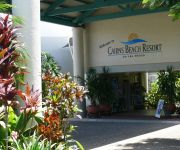
Cairns Beach Resort
Amaroo at Trinity
Vue Apartments Trinity Beach
Kewarra Beach Resort & Spa
Roydon Beachfront Apartments
Beachfront Apartments on Trinity Beach
Videos from this area
These are videos related to the place based on their proximity to this place.
Kuranda mit Railway & Skyrail
Der vielleicht beliebteste Tagesausflug von Cairns aus führt in das Dorf Kuranda, welches im Regenwald auf der Great Dividing Range liegt. Am besten fährt man morgens mit der Scenic Railway,...
Sky-rail ned fra Kuranda.
Fantastisk tur med gondolbane ned fra Kuranda. Turen er på 7,5 kilometer og det er innlagt to stopp i regnskogen,
The Kuranda Range (more).3gp
Driving up Kuranda Range( with camera in car)Far North Queensland. Australia.Starts at 2.44min kids at beginning.
Coastal Systems: Beaches 1
In the field with Simon Haslett, Professor of Physical Geography at the University of Wales, Newport, and author of Coastal Systems (2008, Routledge). Please leave a comment if you found this...
Majestic Palms, Cairns QLD
These magnificent 2 bedroom / 2 bathroom apartments are perfectly suited to both the astute investor and those seeking a sea change lifestyle. Featuring a contemporary open plan design,...
Coastal Systems: Waves 8
In the field with Simon Haslett, Professor of Physical Geography at the University of Wales, Newport, and author of Coastal Systems (2008, Routledge). Please leave a comment if you found this...
The People of Cairns have their say on the Aquis Casino proposal-Stuart Vella
Stuart Vella, the General Manager of Yorkeys Knob Boating Club and Marine tells us how he sees Aquis and YKBC will be working in harmony.
Cairns: Northern Beaches
Obwohl Cairns das Zentrum des Fremdenverkehrs im Tropischen Nordqueensland ist, hat es keinen eigenen Badestrand. Doch einige Kilometer weiter nördlich, nördlich des Airports und des Barron...
The People of Cairns have their say on the Aquis Casino proposal- Danielle Jobling
Danielle Jobling of LJ Hooker Cairns Marlin Coast tells us how much the market has improved.
Videos provided by Youtube are under the copyright of their owners.
Attractions and noteworthy things
Distances are based on the centre of the city/town and sightseeing location. This list contains brief abstracts about monuments, holiday activities, national parcs, museums, organisations and more from the area as well as interesting facts about the region itself. Where available, you'll find the corresponding homepage. Otherwise the related wikipedia article.
Barron Gorge National Park
Barron Gorge National Park is a national park in Queensland, Australia, 1,404 km northwest of Brisbane and 2 km from Kuranda. Barron Gorge is part of the Wet Tropics World Heritage Area. The Kuranda Scenic Railway line passes through the park with a station at Barron Falls. One train runs from and returns to Cairns daily. The original weir, constructed in 1934 at the top of the falls, is visible from the station lookout.
Freshwater Christian College
Freshwater Christian College is a private interdenominational School located in the suburb of Brinsmead, near Cairns, in Far North Queensland, Australia. It is a co-educational school with all grades from Kindergarten to Year 12. It was renamed from Cairns Christian College to Freshwater Christian College in 2008, but has no relation to the nearby Freshwater Creek.
Kuranda, Queensland
Kuranda is a town on the Atherton Tableland in Far North Queensland, Australia, it is 25 kilometres from Cairns, via the Kuranda Range road. It is surrounded by tropical rainforest and adjacent to the Wet Tropics World Heritage listed Barron Gorge National Park. At the 2006 census, Kuranda had a population of 1,611.
Skyrail Rainforest Cableway
Skyrail Rainforest Cableway is a scenic cableway running above the Barron Gorge National Park from the Cairns suburb of Caravonica to Kuranda, Queensland. The development of Skyrail was controversial as some local residents believed that damage may be done to World Heritage listed rainforest. Following seven years of planning and approvals, and 14 months of construction, Skyrail opened to the public in August 1995.
Yirrganydji people
The Yirrganydji people (aka Irukandji) are a group of Australian Aborigines who are the Traditional Owners and original custodians of a narrow coastal strip within Djabugay country that runs northwards from Cairns, Queensland to Port Douglas (Mowbray River), Queensland.
Clifton Beach, Queensland
Clifton Beach is a dormitory suburb of Cairns, Queensland, Australia located on the shores of the Coral Sea.
Barron Falls
Barron Falls is where the Barron River makes its descent from the Atherton Tablelands to the Cairns coastal plain, in Queensland, Australia. Protected within the Barron Gorge National Park, the volume of water seen in the upper photo only occurs after substantial rainfall during the wet season.
Stoney Creek Falls
Stoney Creek Falls are found in the Barron Gorge National Park, north-east of Cairns, in Queensland, Australia. The falls are formed where Stoney Creek starts to descend in steps from the shoulders of the gorge. The falls are best known for the curved lattice railway bridge that passes in front of them. This gives passengers aboard the Kuranda Scenic Railway and The Savannahlander an excellent view of the falls as their train crosses the creek.
Australian Butterfly Sanctuary
The Australian Butterfly Sanctuary is a butterfly zoo and exhibit situated in the centre of Kuranda, Queensland, Australia. Kuranda Butterfly Sanctuary is listed by the Guinness Book of Records as Australia’s largest butterfly flight aviary and exhibit. The sanctuary was conceived, designed, and built by Paul and Susan Wright in 1987. The sanctuary rears only native butterflies of Australia that are bred on the premises.
Smithfield State High School
Smithfield State High School is a secondary school located in Smithfield, Queensland, in Australia. It attracts students primarily from Cairns and Kuranda. The school has about 850 students. The current principal is Barry Courtney.
Kuranda Scenic Railway
The Kuranda Scenic Railway is a name for the railway line that runs from Cairns, Queensland, Australia to the nearby town of Kuranda. The tourist railway snakes its way up the Macalister Range and is no longer used for regular commuter services. It passes through the suburbs of Stratford, Freshwater (stopping at Freshwater Station) and Redlynch before reaching Kuranda. The line is used for some freight services and other passenger services, such as The Savannahlander.
Smithfield, Queensland
Smithfield, about 15 km to the north of Cairns, Queensland, Australia was first established in 1876, and was a rival for dominance of the area to Cairns at that time. However, after a devastating flooding of the Barron River on which the settlement was situated during a cyclone, the original site was abandoned. It is now a suburb of Cairns, and is the business and trade centre of the Cairns 'Northern Beaches'.
Kuranda Range road
The Kuranda Range road is an informally named section of the Kennedy Highway, located near Cairns that traverses the Macalister Range. The 11.5 kilometres section of road connects Smithfield and Kuranda, after which it is named, at an altitude of about 360 metres . Traffic is primarily limited to one lane each way, with overtaking lanes at various points. The Kuranda Skyrail cableway crosses the road twice.
Yorkeys Knob, Queensland
Yorkeys Knob is one of the beach suburbs of Cairns, the regional capital of Far North Queensland, Australia. It is approximately 13 km north of the centre of Cairns, and is the third beach suburb after Machans Beach and Holloways Beach.
Palm Cove, Queensland
Palm Cove is a beach community in Far North Queensland, Australia located 27 kilometres north of the city of Cairns. It is named after the palm trees that line the beach. At the 2006 census, Palm Cove had a population of 1,215.
Lake Placid, Queensland
Lake Placid is a suburb of Cairns in far northern Queensland, Australia. It is named after a natural pond in the Barron River, created by a rock barrage. Lake Placid is the entrance to the Barron Gorge National Park.
Rainforestation Nature Park
Rainforestation Nature Park is situated 5 minutes from Kuranda, North Queensland, Australia. Set on 100 acres in the midst of World Heritage rainforest, the park (formerly Mountain Groves) opened in 1976. The site had previously been used as a coffee and orange plantation. Rainforestation has since expanded significantly to give visitors insight into indigenous culture, Australian native wildlife and World Heritage-listed rainforest.
Holloways Beach, Queensland
Holloways Beach is a 12 minute drive north of Cairns, Queensland, Australia. The population is about 3,000. It has a lifeguard for much of the year. There are several restaurants including Strait on the Beach and Coolums. There is a pub, Bogies, and a sports club. There is a newsagent, convenience store, launderette and video shop. Cairns Beach Resort has affordable accommodation and is opposite the beach.
Freshwater, Queensland
Freshwater is a suburb of Cairns, Queensland in Australia. The Kuranda Scenic Railway has a stop in the suburb. The suburb once belonged to the Shire of Mulgrave but was amalgamated into the City of Cairns. At the 2006 census, Freshwater had a population of 1,976. The European history of Freshwater is a long and proud one, dating back to 1877.
Peace Lutheran College
Peace Lutheran College is a co-educational, private school located in Kamerunga in the city of Cairns, Queensland, Australia. The school educates students from "prep" to 12th grade and first opened in 1994. The school offers boarding facilities. The school is part of the Lutheran Church of Australia.
Cairns Tropical Zoo
Cairns Tropical Zoo is a 6-hectare tropical zoo in Cairns, Queensland, Australia. It has a small collection of native and introduced species, and is a member of the Zoo and Aquarium Association (ZAA).
Stratford, Queensland
Stratford is a suburb 7 kilometres (5 mi) north of Cairns, Queensland, Australia. The population is about 2,000. It is at the base of Mount Whitfield and Lumley Hill and on the banks of the Barron River. There are several restaurants, a pub, The Barron River Hotel, a service station, a newsagent, convenience store, launderette, a pizza shop and deli.
Caravonica, Queensland
Caravonica is a suburb of Cairns, Queensland approximately 7 miles from the City Centre. Caravonica lies in the foothills of the Queensland tropical rain forests. The actual village itself is 0.75 miles in length from its most northern point to its most southern point. The boundary of the suburb can be found as far north as the Tjapukai Aboriginal Culture Park and the Skyrail Rainforest Cableway's southern terminal is known as the Caravonica Terminal.
Trinity Beach, Queensland
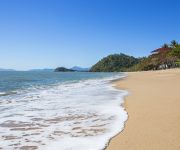
Trinity Beach is a suburb of Cairns approximately 20 kilometres from the city centre. Trinity Beach is also a beach stretching for about a mile on the eastern coast of Australia. The suburb itself is approximately 1 and a half miles wide. At the time of the 2006 census, Trinity Beach had a population of 3971.
William Walter Mason Bridge
The William Walter Mason Memorial Bridge (also known as Barron River Bridge) is a road bridge over the Barron River on the Captain Cook Highway in Stratford, Queensland, Australia. The first Barron River Bridge was built by John Holland Constructions in 1977. On 12 August 1978 it was named after William Walter Mason, the first settler who bought a land on the north side of the Barron River in 1882.


