Explore Wooloowin
The district Wooloowin of in Brisbane (Queensland) with it's 5,486 inhabitants Wooloowin is located in Australia about 590 mi north-east of Canberra, the country's capital.
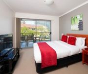
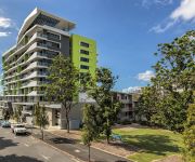
If you need a place to sleep, we compiled a list of available hotels close to the map centre further down the page.
Depending on your travel schedule, you might want to pay a visit to some of the following locations: Brisbane, Sunshine Coast, Carrolls Creek, and . To further explore this place, just scroll down and browse the available info.
Local weather forecast
Todays Local Weather Conditions & Forecast: 24°C / 75 °F
| Morning Temperature | 19°C / 66 °F |
| Evening Temperature | 23°C / 74 °F |
| Night Temperature | 20°C / 68 °F |
| Chance of rainfall | 1% |
| Air Humidity | 60% |
| Air Pressure | 1021 hPa |
| Wind Speed | Gentle Breeze with 8 km/h (5 mph) from West |
| Cloud Conditions | Overcast clouds, covering 87% of sky |
| General Conditions | Light rain |
Sunday, 24th of November 2024
25°C (77 °F)
21°C (70 °F)
Broken clouds, gentle breeze.
Monday, 25th of November 2024
27°C (80 °F)
21°C (70 °F)
Light rain, gentle breeze, clear sky.
Tuesday, 26th of November 2024
26°C (79 °F)
22°C (72 °F)
Few clouds, gentle breeze.
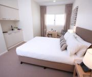
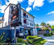
Hotels and Places to Stay
DOMAIN SERVICED APARTMENTS
BRISBANE RIVERVIEW HOTEL
Direct Hotels - Pavilion and Governor on Brookes
Airport Ascot Motel
RYDGES FORTITUDE VALLEY
Domain Serviced Apartments
Quality Hotel Airport International
BREAKFREE FORTITUDE VALLEY
Code Apartments
Oaks Mews Apartments
Videos from this area
These are videos related to the place based on their proximity to this place.
zombie army trilogy village of the dead ep 3
hay guys hope yous like watching our crew clips don't for get to have a look at our other clips we post most days of the week like and sub to us helps us out lots by getting our clips out...
65 Hillside Crescent - Hamilton (4007) Queensland by Treston Bam...
Property Video shoot of 65 Hillside Crescent - Hamilton (4007) Queensland by PlatinumHD http://www.platinumhd.tv for.
zombie army trilogy village of the dead gameplay
hay guys hope yous like watching our crew clips don't for get to have a look at our other clips we post most days of the week like and sub to us helps us out lots by getting our clips out...
Early morning paddle with the Bats
Breakfast Creek , Brisbane 5am...just as the fruit bats are returning to roost...
Cure for Diabetes
Giving information, statistics, links to useful videos and information in regards to raw food. Reasons why it's valuable and the positives. http://www.rawfor30days.com/index4.html http://www.jenn...
Rosco Canoes and Kayaks Brisbane
Rosco Canoes and Kayak, Brisbane, Australia, is Australia's leading paddle sport store. With a huge range of canoes and kayaks, Rosco Canoes can give you the right advice, first time. A family...
157 Abbotsford Road Bowen Hills
Commercial Property available at 157 Abbotsord Rd Bowen Hills To Lease call Peter Brown 0417700058 Produced By http:skyjellyfish.com.au.
107 Victoria Street, Windsor - SOLD by the Ray White Pahl Team
SOLD 107 Victoria Street Windsor real estate for sale by Qld real estate agent Stephen Pahl RE/MAX Brisbane 0404 266 085 Directions: http://goo.gl/maps/8a8As Every now and then, true opportunity...
Videos provided by Youtube are under the copyright of their owners.
Attractions and noteworthy things
Distances are based on the centre of the city/town and sightseeing location. This list contains brief abstracts about monuments, holiday activities, national parcs, museums, organisations and more from the area as well as interesting facts about the region itself. Where available, you'll find the corresponding homepage. Otherwise the related wikipedia article.
Windsor railway station, Brisbane
Windsor is a railway station on the Ferny Grove Line of Brisbane, Australia. It is part of the Queensland Rail City network. It is in a transition precinct between Zone 1 and Zone 2 of the TransLink integrated public transport system.
Eagle Junction railway station
Eagle Junction is a railway station in Brisbane, the state capital of Queensland, Australia. It is part of the Queensland Rail City network. The station forms the branching point for the Caboolture/Shorncliffe line, the Doomben line and the Airport line, and is in Zone 2 of the TransLink integrated public transport system.
Wooloowin railway station
Wooloowin is a railway station in Brisbane, the state capital of Queensland, Australia. It is part of the Queensland Rail City network, located in Zone 2 of the TransLink integrated public transport system.
Albion railway station, Brisbane
Albion is a railway station in Brisbane, the state capital of Queensland, Australia. It is part of the Queensland Rail City network, located in Zone 1/2 of the TransLink integrated public transport system.
Clayfield railway station
Clayfield railway station is a railway station on the Doomben line in Clayfield, Queensland, a northern suburb of Brisbane, the state capital of Queensland, Australia. It is part of the Queensland Rail City network, in Zone 2 of the TransLink integrated public transport system.
Hendra railway station
Hendra is a railway station on the Doomben line in Hendra, a northern suburb of Brisbane, state capital of Queensland, Australia. A part of Queensland Rail's City network, the station falls within Zone 2 of the TransLink integrated public transport system.
Albion, Queensland
Albion is an inner north-eastern suburb of Brisbane, the state capital of Queensland, Australia.
Gordon Park, Queensland
Gordon Park is a small residential area in the middle of Brisbane's northern suburbs and the smallest suburb within Brisbane City Council. Without any major shopping centres or business, it seems like a small town instead of being close to the centre of a major city.
Wooloowin, Queensland
Wooloowin is an inner-north suburb of Brisbane, Australia located approximately 5–6 km north of the city's central business district. The suburb derives its name from a local Indigenous Australian term for "pigeon". It was the home of Brisbane's first Resident Judge, Alfred Lutwyche. The suburb is serviced by Brisbane City Council buses and contains two train stations, Eagle Junction and Wooloowin.
Clayfield, Queensland
Clayfield is an inner-northern suburb of Brisbane, located approximately 7 kilometres from the CBD. Clayfield is bordered to the north by Nundah, to the East by Ascot and Hendra, to the west by Wooloowin and to the South by Albion. Its name derives from the fine white-grey sedimentary clay mined in Albion, between Morgan and Sykes Street, used in the brickworks that once existed between Oriel Road and Reeve Street near Sandgate Road.
Kedron State High School
Kedron State High School is a Queensland public secondary school which is located in the inner-northern suburb of Wooloowin in Brisbane, Australia. The school was opened in 1956, to meet the needs of the rapidly expanding North Brisbane population whose children were members of the post-World War II baby boomer generation.
Lutwyche, Queensland
Lutwyche is an inner-city residential suburb of Brisbane, located 5 km north of the city's central business district. The suburb is named after Alfred Lutwyche, a judge of the Supreme Court of New South Wales who was appointed as Supreme Court judge at Moreton Bay on 21 February 1859, shortly before Queensland was granted self-government. On 12 January 1864, Lutwyche purchased the site for what was to become St.
Kedron, Queensland
Kedron is a northern suburb of Brisbane, Australia, centred on Gympie Road and Kedron Brook. It is close to Westfield Chermside shopping centre in the neighbouring suburb of Chermside. Kedron is an inner-northern suburb that neighbours Stafford, Chermside, Wavell Heights, Wooloowin, Lutwyche, and Nundah.
Windsor, Queensland
Windsor is an inner northern suburb of Brisbane, located about 3.5 km from the CBD. It is largely residential, featuring many old Queenslanders, although there is also considerable retail commercial activity, primarily concentrated along Lutwyche and Newmarket Roads.
Newstead House, Brisbane
Newstead House is Brisbane’s oldest surviving residence and is located on the Breakfast Creek bank of the Brisbane River, in the northern Brisbane suburb of Newstead, in Queensland, Australia. Built as a small cottage in the Colonial-Georgian style in 1846, the cottage was extended and today is painted and furnished in a late Victorian style. Newstead House is the oldest house in Brisbane, but not the oldest surviving building.
Allan Border Field
Allan Border Field is a small cricket ground in the Brisbane suburb of Albion in Queensland. The Australian Cricket Academy has been based at the oval since 2004 using it as a base for the development of elite cricketers throughout Australia. It was formerly known as Neumann Oval and was home to Fortitude Valley Diehards rugby league team from 1909 until 1995.
Clayfield College
Clayfield College is an independent, Uniting Church and Presbyterian, day and boarding school, predominantly for girls, located in Clayfield, an inner-northern suburb of Brisbane, Queensland, Australia. Founded in 1931, the college has a non-selective enrolment policy and caters for approximately 945 students from Prep to Year 12, including 110 boarders from Years 5 to 12. Boys are enrolled from Prep to Year 5, and girls from Pre-Prep to Year 12.
Airport Link, Brisbane
The Airport Link is a tunnelled, motorway grade, toll road in the northern suburbs of Brisbane, Queensland, Australia. It connects the Brisbane central business district and the Clem Jones Tunnel to the East-West Arterial Road which leads to the Brisbane Airport. It was built in conjunction with the Windsor to Kedron section of the Northern Busway in approximately the same corridor.
St Margaret's Anglican Girls' School
St Margaret's Anglican Girls' School is an independent, Anglican, day and boarding school for girls, located in Ascot, an inner-northern suburb of Brisbane, Queensland, Australia. Founded in 1895 by the Sisters of the Society of the Sacred Advent, the school has a non-selective enrolment policy and currently caters for approximately 900 students from Pre-Prep to Year 12, including 160 boarders from Years 7 to 12.
Kalinga Park
Kalinga Park is a park located on northside of Brisbane, Australia. It is community park land associated with the locality of Kalinga, in the suburbs of Clayfield and Wooloowin.
Centro Lutwyche
Centro Lutwyche is a neighbourhood shopping centre located in Lutwyche, a suburb of the city of Brisbane in Queensland, Australia. It is anchored by a Coles and Aldi plus over 40 specialty stores, including Homeart and a Crazy Clark's discount variety store, Diner's Life food court, Fresh Life fresh food precinct, and several government office suites.
St Rita's College, Clayfield
St Rita's College is a Catholic, all-girls high school located in Clayfield, Queensland, Australia. The school was founded in 1926 and follows in the tradition of the Presentation Sisters, and currently educates approximately 800 girls from grades 8–12. The school's motto is Latin, Virtute Non Verbis, which translates to English as Actions Not Words.
Breakfast Creek
Breakfast Creek ("Yawagara")is a small tributary of the Brisbane River. It joins the river at Newstead, next to Newstead Park. The aboriginal name for the waterway was Barrambin. Travelling up the Brisbane River the creek is the first to join the river on its northern banks. Upstream from the Three Mile Scrubs in Kelvin Grove, Breakfast Creek is known as Enoggera Creek.
Wooloowin State School
Wooloowin State School, a public, co–educational primary school with classes from prep through to year seven, is located on Lutwyche Rd, Lutwyche, Queensland, Australia.
Breakfast Creek Hotel
The Breakfast Creek Hotel is a heritage-listed hotel located at 2 Kingsford Smith Drive, Breakfast Creek, Brisbane, Queensland, Australia.


