Delve into Nundah
The district Nundah of in Brisbane (Queensland) is a district located in Australia about 592 mi north-east of Canberra, the country's capital town.
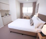
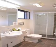
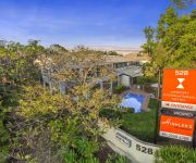
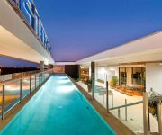
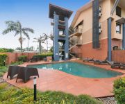
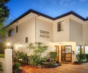
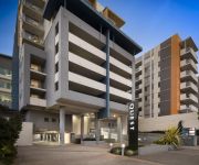
In need of a room? We compiled a list of available hotels close to the map centre further down the page.
Since you are here already, you might want to pay a visit to some of the following locations: Brisbane, Sunshine Coast, Carrolls Creek, and . To further explore this place, just scroll down and browse the available info.
Local weather forecast
Todays Local Weather Conditions & Forecast: 26°C / 78 °F
| Morning Temperature | 18°C / 65 °F |
| Evening Temperature | 23°C / 74 °F |
| Night Temperature | 20°C / 68 °F |
| Chance of rainfall | 0% |
| Air Humidity | 49% |
| Air Pressure | 1019 hPa |
| Wind Speed | Gentle Breeze with 7 km/h (5 mph) from West |
| Cloud Conditions | Scattered clouds, covering 39% of sky |
| General Conditions | Scattered clouds |
Monday, 25th of November 2024
26°C (79 °F)
21°C (69 °F)
Broken clouds, gentle breeze.
Tuesday, 26th of November 2024
27°C (80 °F)
22°C (71 °F)
Few clouds, gentle breeze.
Wednesday, 27th of November 2024
27°C (80 °F)
23°C (74 °F)
Light rain, gentle breeze, broken clouds.
Hotels and Places to Stay
Pullman Brisbane Airport
DOMAIN SERVICED APARTMENTS
Pegasus Motor Inn and Serviced Apartments
Quality Hotel Airport International
Novotel Brisbane Airport
KINGSFORD SMITH MOTEL
QUEST ASCOT SERVICED APTS
Quest Chermside
BEST WESTERN AIRPORT 85 MOTEL
Comfort Inn & Suites Northgate Airport
Videos from this area
These are videos related to the place based on their proximity to this place.
Bob's Cambridge Weight Plan Weight loss Journey WEEK 0 (Day 1)
So I decided the other week I was going to start my weight loss journey and lose an unwanted 10kgs and explain situations and challenges that happen as I undertake this. This was me on day...
Unit 16, 5 Wongara Street - Clayfield (4011) Queensland by Clint...
Property Video shoot of Unit 16, 5 Wongara Street - Clayfield (4011) Queensland by PlatinumHD http://www.platinumhd.tv for.
Unit 3, 56 Eliza Street - Clayfield (4011) Queensland by Cli...
Property Video shoot of Unit 3, 56 Eliza Street - Clayfield (4011) Queensland by PlatinumHD http://www.platinumhd.tv for Northside First National.
Home for Rent in West End Clayfield Home 4BR/2BA by West End Property Management
Call 07 3844 8399 or go to http://www.metrocityrealty.com.au/ to know more about "West End Property Management". Visit http://www.metrocityrealty.com.au/search/rentals for a list of our available...
For Rent - 13/78 Melton Road Nundah - Property Management Nundah
http://rentalexpresspropertymanagement.com.au/rental-properties/rental-display/3-bedroom-unit-for-rent-nundah,4239 This Chic and Stylish apartment is located at the very heart of all that...
Spacious, Secure & Private ... a must see Nundah Unit!!
Walk to everything Nundah has to offer *Relax on your private southeastern balcony *Functional roomy combined living & dining *Live the Nundah Village Lifestyle *Affordable Strata Levies.
SOLD by ANGELA DUNCAN for Ray White Boondall Real Estate and Property Agents Smakk Media
SOLD SOLD SOLD 6/29 Collins Street, Nundah SOLD SOLD SOLD Whether moving in or renting out, this neat and tidy unit will be a secure investment for years to come. Convenient, easy, low ...
9a Westhoff Road - Northgate (4013) Queensland by Clint Devereau...
Days on market: 19 Amount of offers: 4 Number of enquiries: 26 Number of inspections: 12.
Hardware Store Northgate QLD | 1800177615
http://isuppli.com.au Hardware Store Northgate QLD 1800177615 We are a Brisbane manufacturer and wholesaler, operating from our Northgate factory and warehouse. As you look through our store,...
Videos provided by Youtube are under the copyright of their owners.
Attractions and noteworthy things
Distances are based on the centre of the city/town and sightseeing location. This list contains brief abstracts about monuments, holiday activities, national parcs, museums, organisations and more from the area as well as interesting facts about the region itself. Where available, you'll find the corresponding homepage. Otherwise the related wikipedia article.
Eagle Junction railway station
Eagle Junction is a railway station in Brisbane, the state capital of Queensland, Australia. It is part of the Queensland Rail City network. The station forms the branching point for the Caboolture/Shorncliffe line, the Doomben line and the Airport line, and is in Zone 2 of the TransLink integrated public transport system.
Wooloowin railway station
Wooloowin is a railway station in Brisbane, the state capital of Queensland, Australia. It is part of the Queensland Rail City network, located in Zone 2 of the TransLink integrated public transport system.
Clayfield railway station
Clayfield railway station is a railway station on the Doomben line in Clayfield, Queensland, a northern suburb of Brisbane, the state capital of Queensland, Australia. It is part of the Queensland Rail City network, in Zone 2 of the TransLink integrated public transport system.
Hendra railway station
Hendra is a railway station on the Doomben line in Hendra, a northern suburb of Brisbane, state capital of Queensland, Australia. A part of Queensland Rail's City network, the station falls within Zone 2 of the TransLink integrated public transport system.
Toombul railway station
Toombul is a railway station in Brisbane, the state capital of Queensland, Australia. It is part of the Queensland Rail City network, located in Zone 2 of the TransLink integrated public transport system.
Nundah railway station
Nundah (formerly German) is a railway station in Brisbane, Queensland, Australia. A part of the Queensland Rail City network, it is located in Zone 2 of the TransLink integrated public transport system. The station was opened in 1882 and named German, but was renamed Nundah only six weeks of opening.
Northgate railway station
Northgate is a railway station at Northgate, Brisbane, the state capital of Queensland, Australia. It is part of the Queensland Rail City network, in a transition precinct between Zone 2 and Zone 3 of the TransLink integrated public transport system. The station forms the branching point between the Caboolture and Shorncliffe lines.
Bindha railway station
Bindha is a railway station on the Shorncliffe Line in Banyo, a northern suburb of Brisbane, the state capital of Queensland, Australia. It is part of the Queensland Rail City network, within Zone 3 of the TransLink integrated public transport system. The station is built directly behind the Golden Circle cannery, and the station was originally built to provide a stop for the many factory workers.
Virginia railway station
Virginia Station is a railway station at Virginia on the Caboolture Line of Brisbane, Australia. It is part of the QR Citytrain network. The station is in Zone 3 of the TransLink integrated public transport system.
Wooloowin, Queensland
Wooloowin is an inner-north suburb of Brisbane, Australia located approximately 5–6 km north of the city's central business district. The suburb derives its name from a local Indigenous Australian term for "pigeon". It was the home of Brisbane's first Resident Judge, Alfred Lutwyche. The suburb is serviced by Brisbane City Council buses and contains two train stations, Eagle Junction and Wooloowin.
Clayfield, Queensland
Clayfield is an inner-northern suburb of Brisbane, located approximately 7 kilometres from the CBD. Clayfield is bordered to the north by Nundah, to the East by Ascot and Hendra, to the west by Wooloowin and to the South by Albion. Its name derives from the fine white-grey sedimentary clay mined in Albion, between Morgan and Sykes Street, used in the brickworks that once existed between Oriel Road and Reeve Street near Sandgate Road.
Nundah, Queensland
Nundah (previously called German Station) is an inner suburb in the city of Brisbane, Australia, approximately 8 kilometres north-east of the Brisbane central business district, in the local government area of the City of Brisbane. Prior to European settlement, Nundah was inhabited by Aboriginal people from the Turrbul tribe. Nundah is primarily a residential suburb, which straddles Sandgate Road, one of the major arterial roads of Brisbane's north.
Toombul bus interchange
Toombul is a bus interchange adjacent to Centro Toombul and Toombul railway station, located on Sandgate Road. The interchange is an island, similar to an island platform, made up of six bus stops with an extra two stops on Sandgate Road.
Hendra, Queensland
Hendra is a suburb of the city of Brisbane, Queensland, Australia. It lies roughly six kilometres north-east of Brisbane central business district.
Clayfield College
Clayfield College is an independent, Uniting Church and Presbyterian, day and boarding school, predominantly for girls, located in Clayfield, an inner-northern suburb of Brisbane, Queensland, Australia. Founded in 1931, the college has a non-selective enrolment policy and caters for approximately 945 students from Prep to Year 12, including 110 boarders from Years 5 to 12. Boys are enrolled from Prep to Year 5, and girls from Pre-Prep to Year 12.
Airport Link, Brisbane
The Airport Link is a tunnelled, motorway grade, toll road in the northern suburbs of Brisbane, Queensland, Australia. It connects the Brisbane central business district and the Clem Jones Tunnel to the East-West Arterial Road which leads to the Brisbane Airport. It was built in conjunction with the Windsor to Kedron section of the Northern Busway in approximately the same corridor.
Centro Toombul
Centro Toombul is a regional shopping centre located in the locality of Toombul which is part of Nundah, a suburb of the city of Brisbane in the state of Queensland, Australia. The centre is currently anchored by a Target Discount Department Store, Kmart discount department store, Coles supermarket, BI-LO supermarket, Aldi Food Store and 8 Event Cinemas plus over 140 specialty stores including Lincraft and Best & Less. The centre was built and opened on 11 October 1967 by The Westfield Group.
Kalinga Park
Kalinga Park is a park located on northside of Brisbane, Australia. It is community park land associated with the locality of Kalinga, in the suburbs of Clayfield and Wooloowin.
Northgate, Queensland
Northgate is a suburb of Brisbane, Australia located 9 km north of the Brisbane CBD. The land area comprises industrial and residential areas. Inter war homes can be found on Northgate Hill—elevated land that rises west of the railway station; and post World War II real estate on "the flat" -- the large arc of flat land that extends to Moreton Bay at Nudgee Beach with most of the housing stock being post WWII.
St Rita's College, Clayfield
St Rita's College is a Catholic, all-girls high school located in Clayfield, Queensland, Australia. The school was founded in 1926 and follows in the tradition of the Presentation Sisters, and currently educates approximately 800 girls from grades 8–12. The school's motto is Latin, Virtute Non Verbis, which translates to English as Actions Not Words.
Aviation High (Clayfield, Queensland)
Aviation High, formerly Hendra Secondary College, is a high school in Clayfield, Queensland, Australia. The principal is Mr. Phil Cooper. The two deputy principals are Mrs Mandy Forbes and Mr. Glen Donald.
Wavell State High School
Wavell State High School is a high school in Wavell Heights, Queensland, Australia, a suburb of Brisbane. Founded in 1959, it is named after the community where it is located, Wavell Heights. The suburb, in turn, is named after Field Marshal Archibald Percival Wavell, 1st Earl Wavell (5 May 1883 – 24 May 1950), a World War II veteran and former Viceroy of India. Wavell state High school currently has about 1300 students and is an excellence school in Netball, Rugby League and Music
Nundah Cemetery
Nundah Cemetery is located in Hedley Avenue in the suburb of Nundah, Queensland in the city of Brisbane.
Airport Flyover, Brisbane
The Airport Flyover is a road bridge over the Gateway Motorway in Brisbane, Queensland, Australia. The Airport Flyover will link the Airport Link toll road with Airport Drive providing direct access to Brisbane Airport terminals. The east bound lanes were opened in early November 2010, more than a year earlier than originally planned. The westbound lanes were opened on 28 February 2011. The Airport Flyover is a four lane, 750 m long cantilever bridge over the Gateway Motorway overpass.
Charlie Earp Bridge
The Charlie Earp Bridge is a road bridge over the Airport Drive in Brisbane, Queensland, Australia. The bridge constructed over the main access road to the Brisbane Airport is less than 1 kilometre from the Gateway Motorway and the Airport Flyover. It provides access to the Airport Village and the shopping centre with its anchor tenant Direct Factory Outlets.


