Discover Morningside
The district Morningside of in Brisbane (Queensland) with it's 9,399 citizens Morningside is a district in Australia about 588 mi north-east of Canberra, the country's capital city.
Looking for a place to stay? we compiled a list of available hotels close to the map centre further down the page.
When in this area, you might want to pay a visit to some of the following locations: Brisbane, Sunshine Coast, Carrolls Creek, and . To further explore this place, just scroll down and browse the available info.
Local weather forecast
Todays Local Weather Conditions & Forecast: 20°C / 68 °F
| Morning Temperature | 19°C / 66 °F |
| Evening Temperature | 19°C / 66 °F |
| Night Temperature | 18°C / 65 °F |
| Chance of rainfall | 14% |
| Air Humidity | 93% |
| Air Pressure | 1022 hPa |
| Wind Speed | Gentle Breeze with 7 km/h (4 mph) from North-West |
| Cloud Conditions | Overcast clouds, covering 100% of sky |
| General Conditions | Moderate rain |
Saturday, 23rd of November 2024
25°C (77 °F)
20°C (68 °F)
Light rain, gentle breeze, broken clouds.
Sunday, 24th of November 2024
26°C (79 °F)
21°C (69 °F)
Light rain, gentle breeze, clear sky.
Monday, 25th of November 2024
26°C (79 °F)
21°C (70 °F)
Light rain, gentle breeze, few clouds.
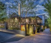
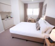
Hotels and Places to Stay
Spicers Balfour Hotel
BRISBANE RIVERVIEW HOTEL
DOMAIN SERVICED APARTMENTS
Goldsborough Place Apartments
Heal House
BEST WESTERN AIRPORT 85 MOTEL
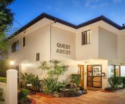
QUEST ASCOT SERVICED APTS
Domain Serviced Apartments
Link Portside Apart'Hotel
Pegasus Motor Inn and Serviced Apartments
Videos from this area
These are videos related to the place based on their proximity to this place.
F/A-18 Super Hornet Flypast over Brisbane River
The Royal Australian Air Force celebrated the delivery of the last four F-18F Super Hornets fighter jets by having a flypast over Brisbane.
Chicco Liteway Plus Travel System
Watch our review of the Chicco Liteway Plus Travel System - Including the Chicco Liteway Plus Stroller and the Latest Chicco Keyfit Capsule by Bubs n Grubs.
Northshore Hamilton fly-through video 2014
Northshore Hamilton is Australia's largest waterfront urban renewal project. It is located 5 kilometres from Brisbane Airport, and is a 304 hectare master-planned community with easy access...
Chicco Cortina Magic Travel System Review by Bubs n Grubs
The Chicco Cortina Magic Travel System is super light and comes loaded with features both mother and baby will love and enjoy. http://www.youtube.com/watch?v=KQJQtIW3w14 The Chicco Cortina...
39 Salaria Drive, Seven Hills, QLD 4170 (AU) by Roger Carr
Architecturally designed contemporary family home has been completed with sophisticated designer fine finishes. Spread over three levels, this brand new residence is perfect for entertaining...
51 D Arcy Road, Seven Hills QLD By Ian Thompson
Property Video shoot of 51 D Arcy Road, Seven Hills QLD by PlatinumHD http://www.platinumhd.tv for Ian Thompson Properties.
57A Riding Road Hawthorne Brisbane
Images of property for sale at 57A Riding Road Hawthorne Brisbane, Australia. For more information: http://brisbane.gumtree.com.au/brisbane/76/23279376.html.
'Whispers At Morningside' - 43 Jersey Street
Close to the vibrant social hubs of Morningside and Bulimba these fantastic open plan townhouses offer modern living areas flowing through to private decks w...
50 Village Circuit - Murarrie (4172) Queensland by Jason Devantier
This contemporary, Mirvac built home is six years old and has a large, open plan living area with the kitchen and dining area opening out to the fully fenced yard through glass sliding doors....
1501/118 Parkside Circuit - Hamilton (4007) Queensland by De...
On the top level of Watermarque, this brand new apartment is supreme luxury in an elite riverfront position. Immaculately appointed, the apartment comprises 2 bedrooms and 2 bathrooms, open...
Videos provided by Youtube are under the copyright of their owners.
Attractions and noteworthy things
Distances are based on the centre of the city/town and sightseeing location. This list contains brief abstracts about monuments, holiday activities, national parcs, museums, organisations and more from the area as well as interesting facts about the region itself. Where available, you'll find the corresponding homepage. Otherwise the related wikipedia article.
Morningside, Queensland
Morningside is a suburb in the south-east of Brisbane, Australia, surrounded by Cannon Hill, Norman Park and Hawthorne. Morningside's postal code is 4170. The old suburb of Colmslie was merged into Morningside. At the corner of Bennetts and Wynnum Roads is the historic Bulimba Cemetery (also known as the Balmoral Cemetery) dating from 1875. Morningside started off as a rural area with small dairy and tobacco farms before becoming a popular residential area in the post-war boom.
Norman Park railway station
Norman Park Station is a railway station on the Cleveland Line of Brisbane, Australia. It is part of the Queensland Rail City network. It is in Zone 2 of the TransLink integrated public transport system. Between 1912 and 1926 it was the junction for the Belmont Tramway. The steam tram was inititally operated by the Belmont Shire Council and after 1925 by the Brisbane City Council.
Morningside railway station
Morningside Station is a railway station on the Cleveland Line in Brisbane, Australia. It is part of the QR Citytrain network. It is in Zone 2 of the TransLink integrated public transport system.
Cannon Hill railway station
Cannon Hill Station is a railway station on the Cleveland Line of Brisbane, Australia. It lies in the suburb of the same name and is part of the QR Citytrain network. It is in a transition precinct between Zone 2 and Zone 3 of the TransLink integrated public transport system. It is located on Barrack Road, near the Barrack Road corner store.
New Farm Park
New Farm Park is a public park located in the suburb of New Farm, in Brisbane, Queensland, Australia. The park covers 15 hectares and is situated at the south-eastern end of the New Farm peninsula on a bend in the Brisbane River. The Powerhouse arts centre is located at the eastern end of the park.
Seven Hills, Queensland
Seven Hills is a suburb located on the inner eastern side of Brisbane, surrounded by the suburbs of Norman Park, Morningside and Carina. Between 1912 and 1926 the southern edge of the suburb was serviced by a steam tram which connected with the Queensland Government Railway at Norman Park. Initially the service was operated by the Belmont Shire Council. The service was suspended in 1924.
Norman Park, Queensland
Norman Park is a suburb in Brisbane, Australia. It is located 4 km east of the Brisbane central business district. Norman Park has numerous parks and recreational areas for residents in the area. Bordered by East Brisbane, Coorparoo, Camp Hill, Morningside and Hawthorne, Norman Park offers limited housing along the Brisbane River.
Morningside Australian Football Club
Morningside Australian Football Club, also known as Morningside AFC or the Panthers, is an Australian Rules football club based at Jack Esplen Oval in the suburb of Hawthorne in Brisbane. The club consists of both Junior and Senior football sections. Its senior team competes in the AFL Queensland Australian rules football competition, while its junior sides compete in the AFL Brisbane Juniors (AFLBJ) competition.
Bretts Wharf
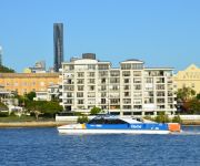
Bretts is a ferry wharf in the suburb of Hamilton used by the CityCat on the Brisbane River. It was the terminus for downstream CityCat services until Apollo Road reopened in 2008. In January 2011 the wharf sustained a minor damage during the devastating floods; it was repaired and reopened on 14 February 2011.
Bulimba ferry wharf
Bulimba is a ferry wharf in the suburb of Bulimba used by the CityCat and the CityFerry on the Brisbane River. In January 2011 the wharf sustained a minor damage during the devastating floods; it was repaired and reopened on 14 February 2011.
Hawthorne ferry wharf
Hawthorne is a ferry wharf in the suburb of Hawthorne used by the CityCat on the Brisbane River. In January 2011 the wharf sustained a minor damage during the devastating floods; it was repaired and reopened on 14 February 2011.
New Farm Park ferry wharf
New Farm Park is a ferry wharf in the suburb of New Farm used by the CityCat and the CityFerry on the Brisbane River. In January 2011 the wharf sustained a moderate damage during the devastating floods; it was repaired and reopened on 14 February 2011.
Teneriffe, Queensland
Teneriffe is an inner city suburb in Brisbane, Australia. Situated next to Teneriffe are the suburbs of Newstead, Fortitude Valley, Bowen Hills and New Farm. Teneriffe, until Jan 2010 was not officially designated as a suburb and lay within the Brisbane suburb of Newstead, however the Brisbane City Council approved the designation of Teneriffe as a suburb in February 2010. There is a ferry servicing Teneriffe from the Teneriffe Ferry Wharf on the Brisbane River.
Portside Wharf
Portside Wharf is the international cruise terminal, residential and retail development at Hamilton, Brisbane, Queensland, Australia. The Wharf is Brisbane's world-class commercial international cruise terminal. It is also an upscale residential and retail precinct including restaurants, shops, a large fish shop/cafe, a supermarket, Dendy cinema complex and a public plaza. The precinct is commonly filled with tourists who arrive by ship, in addition to locals who often arrive by CityCat.
Bulimba, Queensland
Bulimba is an inner suburb of Brisbane, Australia. It is 4 kilometres (direct distance) south-east of the CBD, and is located on the southern bank of the Brisbane River. Bulimba means magpie lark, which is the name also given to Bulimba Creek. The suburb is occasionally seen in Australian media as the electorate of the Member for Griffith and former Prime Minister Kevin Rudd, covers Bulimba.
Hawthorne, Queensland
Hawthorne is an inner suburb of Brisbane, Queensland, Australia located in the City of Brisbane. It is 4 kilometres east of the Brisbane central business district. Hawthorne started as a farming district in the 1860s, and was gradually subdivided as Brisbane grew. This was helped by the introduction of ferry and tram services. The suburb's name is from Hawthorne Bushes that were planted in on Galloways hill by the original settler William Baynes.
Balmoral, Queensland
Balmoral is an inner suburb of Brisbane, Australia, located 9 kilometres east of the CBD. Balmoral is an anglicisation of Baile Mhoireil' which is Scottish Gaelic for ‘beautiful residence’ or ‘majestic castle’. Balmoral has one high school called Balmoral State High School. A famous person to come out of this particular suburb is Laurel Edwards who is a presenter on the 4KQ Brisbane Breakfast Show and also a presenter on Channel 7's The Great South East.
Cannon Hill, Queensland
Cannon Hill is an inner suburb of Brisbane, Queensland, Australia located in the City of Brisbane. It is located 7 kilometres east of the Brisbane CBD. Cannon Hill was named after the Weedon family home 'Cannon Hill House'. Built in 1867, the house, which had extensive grounds and a maze, burnt down in 1927.
Norman Park ferry wharf
Norman Park is a ferry wharf in the suburb of Norman Park used by the CityFerry on the Brisbane River. The wharf and cross river service closed in 2000 due to poor patronage, but reopened on 15 January 2007.
Balmoral State High School
Balmoral State High School is a secondary school situated in Balmoral, Queensland, Australia. The school opened in January 1958 having been built as part of the rush for science of that area. It currently services over five hundred and fifty students and is a part of the Gateway Learning Community. (GLC) The GLC consists of seven local schools; six primary and Balmoral State High School. The GLC is committed to improving education and learning throughout the local community.
Cannon Hill Anglican College
Cannon Hill Anglican College (familiarly known as CHAC) is an independent, co-educational, day school affiliated with the Anglican Church of Australia.
Merthyr, Queensland
Merthyr is a named locality within the Brisbane, Queensland suburb of New Farm centred around Merthyr Road. It is the northside terminus of Tranlink Bus route 196, Fairfield Gardens to City to New Farm (Merthyr). It is also served by route 199, West End to City to New Farm. There is a small commercial precinct around the intersection of Merthyr Road and Brunswick Street, that includes Merthyr Village.
Apollo Road ferry wharf
Apollo Road is a ferry wharf in the suburb of Bulimba used by the CityCat on the Brisbane River. The wharf and the cross river service to Bretts Wharf were closed in December 1998 due to declining profit margins. It was reopened as an extension to the CityCat service in February 2008. In January 2011, the wharf sustained minor damage during the devastating floods. It was repaired and reopened on 14 February 2011.
Kingsford Smith Drive, Brisbane
Kingsford Smith Drive is a major road in Brisbane. The road was named after the aviator Charles Kingsford Smith. It connects the suburb of Pinkenba to the Brisbane central business district at the Breakfast Creek.
Queensland State Hockey Centre
Queensland State Hockey Centre is a multi-purpose stadium in Brisbane, Australia. It is currently used for field hockey and is home to the Queensland Blades who play in the Australian Hockey League.


