Explore Doomben
Doomben in Brisbane (Queensland) is located in Australia about 590 mi (or 950 km) north-east of Canberra, the country's capital.
Local time in Doomben is now 07:56 PM (Saturday). The local timezone is named Australia / Brisbane with an UTC offset of 10 hours. We know of 8 airports in the wider vicinity of Doomben, of which one is a larger airport. The closest airport in Australia is Brisbane International Airport in a distance of 4 mi (or 6 km), North-East. Besides the airports, there are other travel options available (check left side).
Also, if you like golfing, there are multiple options in driving distance. If you need a place to sleep, we compiled a list of available hotels close to the map centre further down the page.
Depending on your travel schedule, you might want to pay a visit to some of the following locations: Brisbane, Sunshine Coast, Carrolls Creek, and . To further explore this place, just scroll down and browse the available info.
Local weather forecast
Todays Local Weather Conditions & Forecast: 24°C / 75 °F
| Morning Temperature | 19°C / 66 °F |
| Evening Temperature | 23°C / 74 °F |
| Night Temperature | 20°C / 68 °F |
| Chance of rainfall | 1% |
| Air Humidity | 60% |
| Air Pressure | 1021 hPa |
| Wind Speed | Gentle Breeze with 8 km/h (5 mph) from West |
| Cloud Conditions | Overcast clouds, covering 87% of sky |
| General Conditions | Light rain |
Sunday, 24th of November 2024
25°C (77 °F)
21°C (70 °F)
Broken clouds, gentle breeze.
Monday, 25th of November 2024
27°C (80 °F)
21°C (70 °F)
Light rain, gentle breeze, clear sky.
Tuesday, 26th of November 2024
26°C (79 °F)
22°C (72 °F)
Few clouds, gentle breeze.
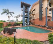
Hotels and Places to Stay
BRISBANE RIVERVIEW HOTEL
Pullman Brisbane Airport
DOMAIN SERVICED APARTMENTS
KINGSFORD SMITH MOTEL
Novotel Brisbane Airport
Link Portside Apart'Hotel
Quality Hotel Airport International
Airport Ascot Motel
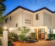
QUEST ASCOT SERVICED APTS
Pegasus Motor Inn and Serviced Apartments
Videos from this area
These are videos related to the place based on their proximity to this place.
KINGSFORD SMITH DRIVE, EAGLE FARM.
In the early hours of the morning, i came across this smash. Not sure who was in the right or wrong but what ever, you just never know what is around the corner. From what i can see, its looking...
Brisbane Kermesse powered by Tineli; course preview.
Kangaroo Point Cycling Club is proud to introduce Queensland's newest open road race; the Brisbane Kermesse powered by Tineli. This never before raced spectator friendly 3.5km circuit just...
Hectic Go Kart Drift Battle
This is a battle between myself and my good friend Callum Whatmore (in the yellow shirt). A slippery track, unpredictable traffic, and a pride fuelled rivalry make for an enjoyable video. The...
Mimiki Race Day 2010
The Mimiki Foundation Race Day. The place to be on 9 October 2010 at Eagle Farm. Tickets only $150 All inclusive: Entry to the races, Beer, Wine & Champagne, Cocktail food and dedicated totes...
ADS Slat Wall Brisbane
http://www.advdis.com.au/shopfittings-and-displays/slat-wall Advanced Display System, a shop fittings supplier in Brisbane offers a wide selection of slat wall and slat wall accessories. Watch...
Eat Street Markets, Brisbane
Eat Street Markets is the hottest foodie destination in Brisbane on Friday, Saturday and Sunday nights. 80+ shipping containers have been converted into foodie's paradise near Portside Wharf...
2006 BTC Doomben 10000
Replay BTC Doomben 10000 _ 27 May 2006 Full result http://www.racingvictoria.net.au/racing/race.aspx?meet_code=725869&race_code=791194.
Northshore Hamilton fly-through video 2014
Northshore Hamilton is Australia's largest waterfront urban renewal project. It is located 5 kilometres from Brisbane Airport, and is a 304 hectare master-planned community with easy access...
33B Harbour Road Hamilton 4007 QLD by Matt Lancashire
Property Video shoot of 33B Harbour Road Hamilton 4007 QLD by PlatinumHD http://www.platinumhd.tv for Ray White New Farm.
Videos provided by Youtube are under the copyright of their owners.
Attractions and noteworthy things
Distances are based on the centre of the city/town and sightseeing location. This list contains brief abstracts about monuments, holiday activities, national parcs, museums, organisations and more from the area as well as interesting facts about the region itself. Where available, you'll find the corresponding homepage. Otherwise the related wikipedia article.
Ascot railway station, Brisbane
Ascot is a railway station on the Doomben line in Ascot, a northern suburb of Brisbane, state capital of Queensland, Australia. It is part of the Queensland Rail City network, in Zone 2 of the TransLink integrated public transport system. The station is adjacent to the Eagle Farm Racecourse.
Hendra railway station
Hendra is a railway station on the Doomben line in Hendra, a northern suburb of Brisbane, state capital of Queensland, Australia. A part of Queensland Rail's City network, the station falls within Zone 2 of the TransLink integrated public transport system.
Doomben railway station
Doomben is a railway station and the terminus of the Doomben line in Ascot, a northeast suburb of Brisbane, the capital of Queensland, Australia. It is part of the Queensland Rail City network and terminus for passenger services on the Pinkenba line. It is in Zone 2 of the TransLink integrated public transport system. The station is nearby to the Doomben Racecourse, after which it is named.
Ascot, Queensland
Ascot is a predominantly affluent residential suburb of Brisbane, Queensland, Australia, characterised by large Queenslander homes. Located 7 kilometres from Brisbane, the suburb is well catered for in terms of public transport with many bus and train services departing from Ascot railway station.
Eagle Farm, Queensland
Eagle Farm is a largely industrial suburb of Brisbane in Queensland, Australia, situated around six kilometres from the Brisbane central business district. It is the former site of Eagle Farm Airport, Brisbane's main airport until the opening of the Brisbane Airport. Eagle Farm was also the site of the disused Eagle Farm railway station. The locality of Whinstanes is located in Eagle Farm.
Hendra, Queensland
Hendra is a suburb of the city of Brisbane, Queensland, Australia. It lies roughly six kilometres north-east of Brisbane central business district.
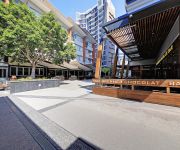
Portside Wharf
Portside Wharf is the international cruise terminal, residential and retail development at Hamilton, Brisbane, Queensland, Australia. The Wharf is Brisbane's world-class commercial international cruise terminal. It is also an upscale residential and retail precinct including restaurants, shops, a large fish shop/cafe, a supermarket, Dendy cinema complex and a public plaza. The precinct is commonly filled with tourists who arrive by ship, in addition to locals who often arrive by CityCat.
Hamilton, Queensland
Hamilton is an inner northern suburb of Brisbane, Australia, lying on the north bank of the Brisbane River along Bulimba Reach. The area is hilly with views of the Brisbane central business district. Major roads in the suburb are Kingsford Smith Drive and Racecourse Road.
St Rita's College, Clayfield
St Rita's College is a Catholic, all-girls high school located in Clayfield, Queensland, Australia. The school was founded in 1926 and follows in the tradition of the Presentation Sisters, and currently educates approximately 800 girls from grades 8–12. The school's motto is Latin, Virtute Non Verbis, which translates to English as Actions Not Words.
Aviation High (Clayfield, Queensland)
Aviation High, formerly Hendra Secondary College, is a high school in Clayfield, Queensland, Australia. The principal is Mr. Phil Cooper. The two deputy principals are Mrs Mandy Forbes and Mr. Glen Donald.
Electoral district of Hamilton (Queensland)
Hamilton was an electoral district of the Legislative Assembly in the Australian state of Queensland from 1932 to 1950. The district was based in the inner northeastern suburbs of Brisbane, and included the suburbs of Albion, Ascot, Eagle Farm, Hamilton and Hendra. It was a safe seat for the non-Labor parties in the Assembly throughout its existence.
Airport Flyover, Brisbane
The Airport Flyover is a road bridge over the Gateway Motorway in Brisbane, Queensland, Australia. The Airport Flyover will link the Airport Link toll road with Airport Drive providing direct access to Brisbane Airport terminals. The east bound lanes were opened in early November 2010, more than a year earlier than originally planned. The westbound lanes were opened on 28 February 2011. The Airport Flyover is a four lane, 750 m long cantilever bridge over the Gateway Motorway overpass.


