Discover Archer
The district Archer of in Palmerston (Northern Territory) is a district in Australia about 1,939 mi north-west of Canberra, the country's capital city.
Looking for a place to stay? we compiled a list of available hotels close to the map centre further down the page.
When in this area, you might want to pay a visit to some of the following locations: Darwin, Lospalos, , and . To further explore this place, just scroll down and browse the available info.
Local weather forecast
Todays Local Weather Conditions & Forecast: 32°C / 89 °F
| Morning Temperature | 26°C / 79 °F |
| Evening Temperature | 33°C / 91 °F |
| Night Temperature | 27°C / 81 °F |
| Chance of rainfall | 5% |
| Air Humidity | 61% |
| Air Pressure | 1009 hPa |
| Wind Speed | Light breeze with 4 km/h (3 mph) from South |
| Cloud Conditions | Overcast clouds, covering 100% of sky |
| General Conditions | Moderate rain |
Sunday, 24th of November 2024
26°C (80 °F)
27°C (80 °F)
Moderate rain, light breeze, overcast clouds.
Monday, 25th of November 2024
33°C (91 °F)
28°C (82 °F)
Moderate rain, light breeze, scattered clouds.
Tuesday, 26th of November 2024
32°C (89 °F)
27°C (81 °F)
Moderate rain, light breeze, broken clouds.
Hotels and Places to Stay
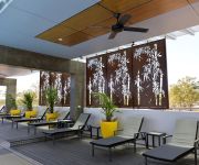
RYDGES PALMERSTON DARWIN
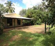
ShortStays Bush Escapes - Howard Springs
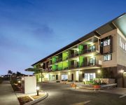
Quest Berrimah
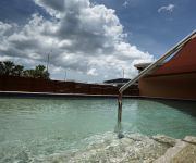
QUEST PALMERSTON
Videos from this area
These are videos related to the place based on their proximity to this place.
Darwin, NT Australia - Lightning Storm Timelapse
Time-lapse composed from all the photos the camera took during my first attempt at remote shuttering on my camera. This is what I had to sit through in order to get 4 good photos to upload...
Exercise Kakadu 2012 KRI 368 Frans Kaisiepo leaves Fort Hill Wharf, Darwin, NT, Australia
Sigma Class Corvette of Indonesian navy.
Darwin Balintawak
John Russell and I went to Darwin for a week, to escape the winter cold in Sydney. While we were training on Darwin Wharf (nice cool sea-breeze), a Filipino man Ely Baera asked if he could...
Darwin Harbour, Northern Territory
See Darwin Harbour, Northern Territory and Australia- travel guides - videos, photos, accommodation and holiday information.
When Will The Birds Return?
From The Film Australia Collection. Made by Film Australia 1975. Directed by Bob Kingsbury, Brian Hannant, Greg Reading, John Shaw, Norman Godbold, David Haythornthwaite and John Noble. Immediately...
2008 DAE Australian Nitro Buggy Speedway Championships (Dirt Oval)
Onboard video at the OCR Raceway dirt oval Nats.
Take offs at Darwin : Jet & prop power taking to the sky : SONY VEGAS stabiliser
A variety of aircraft seen taking off at Darwin airport in the tropical haze and heat shimmer of northern Australia. The clips were assembled using SONY VEGAS pro 11 and all were stabilised...
Videos provided by Youtube are under the copyright of their owners.
Attractions and noteworthy things
Distances are based on the centre of the city/town and sightseeing location. This list contains brief abstracts about monuments, holiday activities, national parcs, museums, organisations and more from the area as well as interesting facts about the region itself. Where available, you'll find the corresponding homepage. Otherwise the related wikipedia article.
Palmerston, Northern Territory
Palmerston is a planned satellite city of Darwin; the capital and largest city in Australia's Northern Territory. Palmerston is situated near Darwin Harbour and has an urban population of 23,614 on the 2006 Census night and making it the second largest city in the territory. Palmerston is currently the fastest growing city in the Northern Territory and has briefly in the past held the title of the fastest growing city in Australia.
Don Dale Juvenile Detention Centre
The Don Dale Juvenile Detention Centre, an Australian maximum security prison for juvenile males and females, is located in Berrimah, Northern Territory, Australia.
Robertson Barracks
For the Robertson Barracks, Norfolk, England see RAF Swanton Morley Robertson Barracks Knuckey LagoonMunicipality of LitchfieldNorthern Territory Type Australian Army base Currentowner Australian Army Garrison 1st Brigade1st Aviation RegimentB Coy, 1st Military Police BattalionJoint Movements Control Office - DarwinJoint Logistics Unit (North) Robertson Barracks is a major Australian Army base located in the outer Darwin, Northern Territory suburb of Holtze in the Municipality of Litchfield.
City of Palmerston
The City of Palmerston is a Local Government Area of the Northern Territory. It contains the suburbs of Darwin's satellite city, Palmerston, and is situated between the outer industrial areas of Darwin and the rural areas of Howard Springs. The City covers an area of 56.3 km² and has a population of about 25,000. The Palmerston City Council consists of the Mayor and six aldermen. The city is not divided into wards, thus each alderman represents constituents from the entire city.
Palmerston City, Northern Territory
Palmerston City is an inner suburb of Palmerston, Northern Territory, Australia, located within the City of Palmerston. Its postcode is 0830. It contains the Palmerston Shopping Centre, the City of Palmerston council offices, Frances Mira Mall, a sporting complex, a library and bus terminal. Its main core is bounded by University Avenue to the northwest, Chung Wah Terrace to the southwest, Rolyat Street and Temple Terrace to the southeast and Roystonea Avenue to the northeast.
Gunn, Northern Territory
Gunn is an inner-city suburb of Palmerston, Northern Territory, Australia. It is 23 km SE of the Darwin CBD. Its Local Government Area is the City of Palmerston. Gunn is bounded to the north by the Stuart Highway, to the west is Chung Wah Terrace, and to the south and east is Roystonea Avenue. The suburb is mostly composed of developments from the mid-1970s after Cyclone Tracy struck Darwin in 1974.
Archer, Northern Territory
Archer is a relatively new and still sparsely populated suburb in the southwestern part of Palmerston. It is 25 km SE of the Darwin CBD and 5.4 km from Palmerston City. Its Local Government Area is the City of Palmerston. Archer is the largest suburb of Palmerston by area. It is named after James C. Archer.
Bakewell, Northern Territory
Bakewell is an inner-city suburb of Palmerston, Australia. It is 24.9 km SE of the Darwin CBD. Its Local Government Area is the City of Palmerston. Bakewell is bounded to the north by Buscall Avenue, to the west is Chung Wah Terrace, and to the south and east is Lambrick Avenue. Development of the area dates from the 1990s. Bakewell is named after Edward Howard Bakewell, an original land owner.
Bellamack, Northern Territory
Bellamack is a rural outer suburb of Palmerston. It is 26.5 km SE of the Darwin CBD. Its Local Government Area is the City of Palmerston.
Durack, Northern Territory
Durack is an inner-city suburb of Palmerston. It is 22 km SE of the Darwin CBD. Its Local Government Area is the City of Palmerston. Durack is bounded to the north by the Stuart Highway, to the west and south is University Ave and to the east is Roystonea Avenue. The suburb is mostly composed of recent developments during the early 1990s. The Durack area was left unnamed when Palmerston was divided into suburbs as the area was set aside for a University.
Driver, Northern Territory
Driver is an inner-city suburb of Palmerston. It is 23 km SE of the Darwin CBD. Its Local Government Area is the City of Palmerston. Durack is bounded to the north by University Ave, to the west Elrundie Avenue, to the east Temple Terrace and to the south Tilston Avenue. The suburb is mostly composed of developments from the early 1980s.
Farrar, Northern Territory
Farrar is an outer eastern suburb of Palmerston. It is 21 km SE of the Darwin CBD. Its Local Government Area is the City of Palmerston. Farrar is bounded to the north and east by the Stuart Highway, to the west Roystonea Avenue. Farrar was originally part of the Gunn when Palmerston was divided into suburbs in 1984. The development of Palmerston's eastern suburbs did not start in the 1990s as designed in 1984 and the suburb of Gunn of 1998 was larger.
Gray, Northern Territory
Gray is an inner-city suburb of Palmerston. It is 23 km SE of the Darwin CBD. Its Local Government Area is the City of Palmerston. Gray is bounded to the north and west by Temple Terrace, to the east is Chung Wah Terrace, and to the south and east is Emery Avenue. The suburb of Gray is named after William Henry Gray who was born in London in 1808 and who after becoming interested in the scheme of colonizing South Australia in 1834.
Marlow Lagoon, Northern Territory
Marlow Lagoon is an outer western suburb of Palmerston. It is 24 km SE of the Darwin CBD. Its Local Government Area is the City of Palmerston. Marlow Lagoon is bounded to the west by the Adelaide-Darwin Railway, and east by Elrundie Ave. The suburb is named after Joseph Marlow.
Holtze, Northern Territory
Holtze is an outer rural area of Darwin. It is 22km SE of the Darwin CBD. Its Local Government Area is the Municipality of Litchfield. The suburb is mostly a rural area, just north Palmerston, Australia. In September 2010 the Northern Territory Government announced that new Darwin’s prison precinct, Doug Owston Correctional Centre, will be built in Holtze about four kilometres north of Howard Springs Road.
Mitchell, Northern Territory
Mitchell is an outer city suburb of Palmerston, Australia. It is 27 km SE of the Darwin CBD. Its Local Government Area is the City of Palmerston. Mitchell is bounded to the north and east by the Stuart Highway, to the west is Roystonea Avenue, and to the south is Channel Island Road. The area of Mitchell is fairly new with new developments over the past couple of years.
Moulden, Northern Territory
Moulden is an outer-city suburb of Palmerston, Australia. It is 24.9 kilometres southeast of the Darwin CBD by road, about 16 kilometres as the crow flies. Its Local Government Area is the City of Palmerston. Moulden is a newly residential area. Moulden is bounded by Tilston Avenue in the north, Temple Terrace in the east, to the south is Chung Wah Terrace and Elrundie Avenue in the west.
Virginia, Northern Territory
Virginia is an outer rural area of Darwin. It is 31 kilometres south east of the Darwin CBD. Its Local Government Area is the Litchfield Municipality. The suburb is mostly a rural area, but has been experiencing strong growth in population and development. Settlement of the suburb began in 1869, after George McLachlan surveyed the small satellite town. Virginia has been used as a name for the area since the 1870s.
Woodroffe, Northern Territory
Woodroffe is an inner-city suburb of Palmerston. It is 25 km SE of the Darwin CBD and 2.1 km from Palmerston City. Its Local Government Area is the City of Palmerston. This suburb is named after George WOODROFFE Goyder, Surveyor-General of South Australia from 1861 to 1893. In 1868/69 Goyder was appointed by the South Australian Government to carry out a survey of land in the Northern Territory.
Rosebery, Northern Territory
Rosebery is an outer southern suburb of Palmerston. It is 26 km SE of the Darwin CBD. Its Local Government Area is the City of Palmerston. This suburb is named after the Fifth Earl of Rosebery, Archibald Philip Primrose, a then British statesman who visited South Australia in 1884. A decade later he became the Prime Minister of the United Kingdom. It was during his overseas visit, that the South Australian Government decided to name additional Counties in the Top End.
Yarrawonga, Northern Territory
Yarrawonga is an outer northern suburb of Palmerston. It is 21 km SE of the Darwin CBD and 2.1 km from Palmerston City. Its Local Government Area is the City of Palmerston. Yarrawonga is named after the Yarrawonga Zoo which was established in the area in 1965. It is believed that the name came from the Victorian town of Yarrawonga in the northern part of the state. The area is one of Palmerston's Industrial Suburbs, along with Pinelands.
Darwin's 97 Seven
Darwin's 97 Seven is a radio station that aims to broadcast the Christian message of salvation to the Darwin and Palmerston region. Along with broadcasting a wide variety of Christian music, 97 Seven carries content from other Christian radio stations and ministries including Focus on the Family, Adventures in Odyssey and 'Enjoying Everyday Life'. It was previously known as "97.7 Rhema FM".
Elizabeth River Bridge
The Elizabeth River Bridge is a bridge crossing Elizabeth River in Palmerston, Northern Territory, 17 km South from Darwin, Northern Territory. It carries both the Channel Island road and the Adelaide-Darwin railway. It is 510 m long.
Pinelands, Northern Territory
Pinelands is an outer northern suburb of Palmerston, Northern Territory, Australia. It is 21 km SE of the Darwin CBD and 2.1 km from Palmerston City. Its Local Government Area is the City of Palmerston. The area is one of Palmerston's Industrial Suburbs, along with Yarrawonga, Northern Territory.
Berrimah Road
Berrimah Road is a major arterial road in the outer eastern suburbs of Darwin, Northern Territory Australia. The road provides an important transport corridor to access the port facilities at East Arm as well as the northernmost passenger and freight terminals on the Adelaide-Darwin railway. It has undergone recent upgrades as part of the Tiger Brennan Drive extension works between 2009 and 2012.


