Discover Woodlands
The district Woodlands of Fitzroy in Wingecarribee (New South Wales) is a district in Australia about 94 mi north-east of Canberra, the country's capital city.
Looking for a place to stay? we compiled a list of available hotels close to the map centre further down the page.
When in this area, you might want to pay a visit to some of the following locations: Katoomba, Parramatta, Sydney, Canberra and . To further explore this place, just scroll down and browse the available info.
Local weather forecast
Todays Local Weather Conditions & Forecast: 22°C / 71 °F
| Morning Temperature | 14°C / 57 °F |
| Evening Temperature | 17°C / 63 °F |
| Night Temperature | 15°C / 59 °F |
| Chance of rainfall | 0% |
| Air Humidity | 58% |
| Air Pressure | 1021 hPa |
| Wind Speed | Moderate breeze with 9 km/h (6 mph) from South-West |
| Cloud Conditions | Broken clouds, covering 50% of sky |
| General Conditions | Light rain |
Sunday, 17th of November 2024
27°C (81 °F)
16°C (60 °F)
Heavy intensity rain, moderate breeze, overcast clouds.
Monday, 18th of November 2024
22°C (72 °F)
9°C (48 °F)
Light rain, gentle breeze, clear sky.
Tuesday, 19th of November 2024
20°C (68 °F)
11°C (52 °F)
Light rain, gentle breeze, scattered clouds.
Hotels and Places to Stay
Bowral Road Bed and Breakfast
MITTAGONG RSL MOTEL
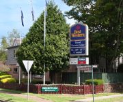
BEST WESTERN GRAND COUNTRY LDG
The Imperial Motel
Berida Hotel
Fitzroy Inn Historic Retreat
Oxley Motel
PEPPERS CRAIGIEBURN
Videos from this area
These are videos related to the place based on their proximity to this place.
A chat with ... Moira Mevissen (Vin Santo Mittagong)
Moira Mevissen co-owns and manages an authentic Italian trattoria in the heart of historic Mittagong in the beautiful Southern Highlands of New South Wales, 80 minutes from the centre of Sydney....
Pacific National sleeper train at Mittagong
28.08.2010 1525hrs 48100 and 8160 work a sleeper train south through Mittagong.
Marilyn Keller
Just a Closer Walk With Thee Bourbon Street Parade When the Saints Come Marching In Jazz Festival April 2013 Mittagong Australia.
The Beaumont
The Beaumont is on display at Renwick Estate, Mittagong 4 bedroom, ensuite, walk through robe to master bedroom, large laundry, wrap around verandah, double garage, perfect design for corner...
The Monash Caprice
The Monash Caprice is on display at Renwick Estate, Mittagong 4 bedroom, ensuite, walk in robe to master bedroom, home theatre, raked ceiling, walk in pantry, double garage. Other floorplans...
Southern Highlands Passengers
Passenger trains from both of RailCorp's operating brands, CityRail and CountryLink, are seen in the Southern Highlands on the clear Autumn morning of Saturday May 11th, 2013. First is the...
Making Building Ezi 1: How to attach Framing Brackets to Boxspan Steel Beams
Making Building Ezi 1: This video demonstrates how to attach framing brackets on Boxspan beams as part of a Spantec steel floor frame kit. Spantec designs, manufactures and delivers steel floor...
This Week in the Highlands - 5 March 2015
Jen discusses this weeks events from watching the Spud race at the Robertson Show to visiting Wirrimbirra sanctuary reptile day. So much to see and do in the Southern Highlands.
Videos provided by Youtube are under the copyright of their owners.
Attractions and noteworthy things
Distances are based on the centre of the city/town and sightseeing location. This list contains brief abstracts about monuments, holiday activities, national parcs, museums, organisations and more from the area as well as interesting facts about the region itself. Where available, you'll find the corresponding homepage. Otherwise the related wikipedia article.
Southern Highlands (New South Wales)
The Southern Highlands, also locally referred to as the Highlands, is a geographical region and district in New South Wales, Australia and is 110 km south-west of Sydney. The entire region is under the local government area of the Wingecarribee Shire. The region is also considered a wine region. The region specifically is the area centered around the commercial towns of Mittagong, Bowral, Moss Vale, Bundanoon and Robertson as well as the historic town of Berrima.
Frensham School
Frensham School is an independent, non-denominational, secondary, day and boarding school for girls, located at Mittagong, south of Sydney, in the Southern Highlands of New South Wales, Australia. Established in 1913 by Winifred West, the school has a non-selective enrolment policy and currently caters for approximately 300 students from Years 7 to 12, including 222 boarders. Students come to Frensham from Sydney, rural New South Wales, interstate, overseas and the Southern Highlands.
Capital Country
Capital Country is the name of one of the 16 regions of New South Wales, Australia. This geographical division is made for improving commerce, specifically tourism, in the state. The Capital area is one of the oldest settled areas of NSW and is touted for its convenience; it is the area enveloping Canberra, the nation’s capital, and is close to Sydney. It encompasses the Southern Highlands and the Southern Tablelands.
Bowral
Bowral /ˈbaʊrəl/ is the largest town in the Southern Highlands of New South Wales, Australia, in the Wingecarribee Shire. It has a population at the 2011 Census of 12,154 and the largest business and entertainment precinct in the Highlands. In a past era, Bowral served as a rural retreat for the elite gentry of Sydney, resulting in the establishment of many historic estates and manor houses in the district.
Berrima, New South Wales
Berrima is a historic village in the Southern Highlands of New South Wales, Australia, in Wingecarribee Shire. The village, once a major town, is located on the Old Hume Highway between Canberra and Sydney. It was previously known officially as the Town of Berrima. It is close to the three major towns of the Southern Highlands; Mittagong, Bowral and Moss Vale.
Mittagong, New South Wales
Mittagong is a town located in the Southern Highlands of New South Wales, Australia, in Wingecarribee Shire. At the 2011 census, Mittagong had a population of 8,103 people. The town acts as the gateway to the Southern Highlands when coming from Sydney. Mittagong is situated at an elevation on 635 metres/2,083 feet. The town is close to Bowral, Berrima, Moss Vale and the Northern Villages such as Yerrinbool and Colo Vale.
Aylmerton, New South Wales
Aylmerton (pronounced with a stress on "Ayl") is a Northern Village of the Southern Highlands of New South Wales, Australia in Wingecarribee Shire. It is located north-east of Mittagong. The only buildings in Aylmerton are a fire station and houses, many of which are on farms. There is also an Aylmerton in Norfolk, England.
Mittagong railway station
Mittagong Railway Station is a station on the Southern Highlands line of the CityRail intercity network, serving the large town of Mittagong, New South Wales, Australia. The station opened on 1 March 1867. The station has two platforms that serve the diesel railcars that use the line as well as CountryLink services between Sydney, Canberra and Griffith. The platforms are connected by a pedestrian overbridge. There is no Easy Access for wheelchairs.
Bowral railway station
Bowral Railway Station is a station on the Southern Highlands line of the CityRail intercity network, serving the large town of Bowral, New South Wales, Australia. The station opened on 2 December 1867. The station has two platforms that serve the diesel railcars that use the line as well as CountryLink services between Sydney, and Melbourne, Canberra, and Griffith. The platforms are not connected, and passengers are required to cross the tracks on an adjoining footbridge.
Burradoo railway station
Burradoo Railway Station is a station on the Southern Highlands line of the CityRail intercity network, serving the small town of Burradoo, New South Wales, Australia. The station opened in 1870, although it was closed in 1975, but reopened one year later. The station has two platforms that serve the diesel railcars that use the line.
Willow Vale, New South Wales (Wingecarribee)
Willow Vale is a Northern Village of the Southern Highlands of New South Wales, Australia, in Wingecarribee Shire. It is located 1 km north of Mittagong and is often considered part of Braemar along with its neighbour Balaclava. At the 2006 census, Willow Vale had a population of 623.
Wingecarribee Shire
Wingecarribee Shire is the local government area of the Southern Highlands in the state of New South Wales, Australia. The Wingecarribee Shire is around 110 kilometres southwest of the Sydney central business district and is part of regional Capital Country and to some extent can be considered part of the Southern Tablelands. Wingecarribee Shire covers an area of 2,700 square kilometres that is typically referred to as the Southern Highlands.
Auscape International Photo Library
Auscape International is a stock photography library based in Australia with a collection of almost 250,000 images, specialising in wildlife and landscapes. It was founded by Jean-Paul Ferrero, a French photographer who moved to Australia in 1982 and established the agency in 1985. His immense body of iconic images forms the basis of the Auscape collection that has now grown to include the work of almost 200 of the world's foremost nature photographers.
Balaclava, New South Wales
Balaclava is a Northern Village of the Southern Highlands of New South Wales, Australia in Wingecarribee Shire. It is 1 km north-east of Mittagong. The village includes a service station, real estate, pre-school, nursery and antiques store. It is located in Wingecarribee Shire and is often considered part of Braemar along with its neighbour Willow Vale (Pop. 1189 - Census 2001).
Colo Vale, New South Wales
Colo Vale is a Northern Village of the Southern Highlands of New South Wales, Australia, in Wingecarribee Shire. It is situated 2 km north-west of Aylmerton, 5 km from the Hume Highway and 12 km drive to Mittagong. According to the 2006 census, Colo Vale had a population of 1,212 people. The surrounding area is part of the Parish of Colo which includes the villages of Aylmerton, Willow Vale, Alpine and Yerrinbool.
Welby, New South Wales
Welby is a small town in the Southern Highlands of New South Wales, Australia, in Wingecarribee Shire. The town is located 1 km west of Mittagong and houses the local Southern Highlands RTA office. At the 2006 census, Welby had a population of 777. The town used to be known as Fitzroy. The old Fitzroy Progress Association Hall which was built in 1931 is still standing. It is now an antique shop - The Merchant of Welby.
Woodlands, New South Wales
Woodlands is a small village situated at the T-intersection of Wombeyan Caves Road and Spring Hill Road in the Southern Highlands of New South Wales, Australia, in Wingecarribee Shire. At the 2006 census, Woodlands had a population of 303.
Berrima Parish
The Parish of Berrima is a parish of the County of Camden in the Southern Highlands region of New South Wales. Berrima is the largest town in the parish, and the parish includes the land to the north and north-east of this town. The Wingecarribee River forms part of the boundary of the parish in the south, although some of the land near Berrima that is to the south of the river is also included in the parish.
Mittagong Parish
The Parish of Mittagong is a parish of the County of Camden in the Southern Highlands region of New South Wales. It includes the town of Bowral and the southern parts of Mittagong.
Colo Parish
The Parish of Colo is a parish of the County of Camden in the Southern Highlands region of New South Wales. It is centred around the town of Colo Vale, and includes Aylmerton, Willow Vale, Alpine and Yerrinbool. It also includes the northern parts of Mittagong that are north of the Old Hume Highway. The new Hume Highway runs through the parish from south-west to north-east. Its western boundary is the Nattai River and part of Gibbergunyah (Gibraltar) creek.
Bowral High School
Bowral High School is a secondary public school in Bowral, New South Wales, Australia. The school is one of two major public high schools in the Southern Highlands, the other being Moss Vale High School. The school was built in 1929 as a tribute to the ANZACs of World War I. Bowral High caters as a school for a wide area, the main locations are: Bowral & East Bowral. Mittagong Northern Villages such as Braemar, Colo Vale, Hill Top and Yerrinbool.
Braemar railway station, New South Wales
Braemar is a former railway station which was located on the Picton – Mittagong loop railway line. It served Braemar, a small town in the Macarthur Region of New South Wales, Australia.
Bradman Oval
Bradman Oval is situated at Bowral in the southern highlands area of New South Wales, Australia. It was named after cricketer Don Bradman, who lived locally and played at the ground in the 1920s. His ashes are scattered on and near the Oval. It is an attractive ground, with a white picket fence and an old fashioned pavilion. The Camden Woollybutt is the main gum tree species surrounding the playing surface.
Fitzroy Iron Works
The Fitzroy Iron Works was the first Iron Smelting works in Australia, built in 1848 years before the rail industry was founded.
The Maltings
Located at the North end of Mittagong town


