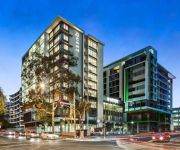
Delve into Chatswood West
The district Chatswood West of in Willoughby (New South Wales) with it's 1,426 habitants Chatswood West is a district located in Australia about 155 mi north-east of Canberra, the country's capital town.
In need of a room? We compiled a list of available hotels close to the map centre further down the page.
Since you are here already, you might want to pay a visit to some of the following locations: Sydney, Parramatta, Katoomba, Canberra and . To further explore this place, just scroll down and browse the available info.
Local weather forecast
Todays Local Weather Conditions & Forecast: 25°C / 78 °F
| Morning Temperature | 16°C / 61 °F |
| Evening Temperature | 23°C / 73 °F |
| Night Temperature | 19°C / 67 °F |
| Chance of rainfall | 0% |
| Air Humidity | 46% |
| Air Pressure | 1019 hPa |
| Wind Speed | Moderate breeze with 13 km/h (8 mph) from South-West |
| Cloud Conditions | Clear sky, covering 0% of sky |
| General Conditions | Sky is clear |
Sunday, 24th of November 2024
26°C (78 °F)
20°C (67 °F)
Overcast clouds, moderate breeze.
Monday, 25th of November 2024
26°C (80 °F)
21°C (69 °F)
Light rain, moderate breeze, few clouds.
Tuesday, 26th of November 2024
28°C (83 °F)
21°C (71 °F)
Light rain, fresh breeze, broken clouds.
Hotels and Places to Stay
Wyndel Apartments - Clarke Street
Wyndel Apartments - Bertram
Wyndel Apartments - Encore
Wyndel Apartments - Abode
Wyndel Apartments - Shoremark
Wyndel Apartments - Herbert
QUEST MACQUARIE PARK
Courtyard Sydney-North Ryde
BEST WESTERN TWIN TOWERS INN
Quest Chatswood
Videos from this area
These are videos related to the place based on their proximity to this place.
Car hit bike - BP Lane Cove - on cycleway - Jan 9th 2014
Motorist looking for motor traffic to the east, didn't look west for cycleway traffic and pulled out as group of riders were in front of vehicle. Approx 07:15 - bikes heading east.
Goanna in Lane Cove National Park. Lane Cove River Tourist Park
Visit http://www.caravanandcampingsydney.com.au for more information. This Goanna wanders around the edge of the Lane Cove River Tourist Park. I'm sure he will surprise a camper one day by...
Ducklings Lane Cove River Tourist Park Sydney. Will they all survive? Lane Cove National Park
If you like a bit of suspense watch this video to the end. Will all the ducklings survive their first swimming lesson in our pool?? Visit http://www.caravanandcampingsydney.com.au for more...
Carter's Creek, A, Lane Cove National Park
Popular picnic area for hire in Lane Cove River National Park.
Lane Cove Neighbourhood by Stone Real Estate
Property Video shoot of 144 Longueville Road Lane Cove 2066 NSW by PlatinumHD http://www.platinumhd.tv for Stone Lane Cove Sales.
18 Orion Rd, Lane Cove, Sydney - NOW LEASING
18 Orion Road, Lane Cove comprises an 8500 square metre landmark 9-level office tower with sweeping views from a striking glazed facade, ensuring this iconic building stands out from its competito...
Better Business Access Guide - Don't miss out on customers!
Improving the accessibility of your business makes dollars and sense. Find out how you can improve your businesses accessibility by watching this short explainer. Better Business Partnership...
Videos provided by Youtube are under the copyright of their owners.
Attractions and noteworthy things
Distances are based on the centre of the city/town and sightseeing location. This list contains brief abstracts about monuments, holiday activities, national parcs, museums, organisations and more from the area as well as interesting facts about the region itself. Where available, you'll find the corresponding homepage. Otherwise the related wikipedia article.
TEN (TV station)
TEN is the callsign of Network Ten's flagship Sydney television station. It was originally owned and operated by United Telecasters Sydney Limited (UTSL), and began transmission on 5 April 1965 with the highlight of the opening night being the variety special TV Spells Magic.
Lindfield, New South Wales
Lindfield is a suburb on the Upper North Shore of Sydney in the state of New South Wales, Australia 13 kilometres north-west of the Sydney Central Business District in the local government area of Ku-ring-gai Council.
Chatswood, New South Wales
Chatswood is a suburb on the North Shore of Sydney, in the state of New South Wales, Australia 10 kilometres north of the Sydney central business district. It is the administrative centre of the local government area of the City of Willoughby. Chatswood West is a separate suburb. It is a well-known ethnic Chinese hotspot, second only to Haymarket, New South Wales.
Chatswood railway station
Chatswood railway station is an important CityRail station in Sydney, Australia, serving the North Shore business centre of Chatswood. The station is served by the North Shore line and Northern line.
City of Willoughby
The City of Willoughby is a local government area on the North Shore of Sydney, in the state of New South Wales, Australia. It is located 6 kilometres north of the Sydney central business district. The main commercial centre of the City of Willoughby is Chatswood, home to one of Sydney's suburban skyscraper clusters. Other commercial centres are the suburbs of Willoughby, St Leonards and Artarmon.
ATN
ATN is the Sydney flagship television station of the Seven Network in Australia. The licence, issued to a company named Amalgamated Television Services, a subsidiary of Fairfax, was one of the first four licences (two in Sydney, two in Melbourne) to be issued for commercial television stations in Australia. It began broadcasting on 2 December 1956. The station formed an affiliation with GTV-9 Melbourne in 1957, in order to share content.
101.7 WSFM
101.7 WSFM is a FM band radio station broadcasting in Sydney, Australia. Its main content is commercial music, in particular classic hits from the 1960s to the Early 2000s, with a greater focus on the 1970s, 1980s and 1990s. The station is owned by the Australian Radio Network, a 50/50 joint venture between Clear Channel Communications of the U.S. , and APN News & Media Ltd. Its target market is all people aged 39–54.
2Day FM
2Day FM is a commercial FM radio station broadcasting in Sydney, New South Wales, Australia, on a frequency of 104.1 MHz, and part of Austereo's Today Network.
Lindfield railway station
Lindfield railway station is part of the CityRail, Sydney network, located on the North Shore line in the suburb of Lindfield. The station has a separate terminating platform.
Roseville railway station
Roseville is a railway station on the CityRail network, Sydney, Australia. The station serves the North Shore suburb of Roseville and is used by Roseville College. As the station is connected to the adjacent streets on either side via stairs, Easy Access for wheelchairs is not available.
Chatswood Oval
Chatswood Oval is located south of the Chatswood railway station in northern Sydney, Australia. It has four small pavilions and seating surrounding the oval. It is one of the Lower North Shore's largest sportsgrounds, and the home ground of the Gordon Rugby Football Club and Gordon District Cricket Club. One of the largest crowds was 8,127 when Gordon Rugby played Randwick in 1976. Gordon Rugby have been playing at Chatswood Oval since 1936.
West Lindfield, New South Wales
West Lindfield is a locality in the suburb of Lindfield, a suburb of Sydney, in the state of New South Wales, Australia. It is located is located 13 kilometres north-west of the Sydney Central Business District in the local government area of Ku-ring-gai Council.
Roseville, New South Wales
Roseville is a suburb on the Upper North Shore of Sydney in the state of New South Wales, Australia 12 kilometres north-west of the Sydney central business district. It is within the local government areas of Ku-ring-gai and Willoughby. Roseville Chase is a separate suburb to the east.
Chatswood West, New South Wales
Chatswood West is a suburb on the lower North Shore of Sydney, in the state of New South Wales, Australia. Chatswood West is located 11 kilometres north-west of the Sydney central business district, in the local government areas of the City of Willoughby and the City of Ryde on the western shore of the Lane Cove River. Chatswood is a separate suburb.
Mix 106.5
For the American radio stations that carry this branding, see KEZR, WHLK or WWMX.
Lane Cove North, New South Wales
Lane Cove North is a suburb of Sydney, in the state of New South Wales, Australia. Lane Cove North is located 11 kilometres north-west of the Sydney central business district, in the local government areas of the Municipality of Lane Cove and the City of Willoughby. Lane Cove and Lane Cove West are separate suburbs. Boundaries are Pacific Highway in east, Epping Road in the south, Lane Cove River in the west and Chatswood Golf Course in the north. The Local Government boundary is Mowbray Road.
Lane Cove Tunnel
The Lane Cove Tunnel is a A$1.1 billion, 3.6 km twin tunnel tollway in Sydney, Australia, connecting the M2 Motorway at North Ryde with the Gore Hill Freeway at Artarmon. It forms part of Sydney Metroad 2 and the 110 km Sydney Orbital Network. Connector Motorways was the owner and manager of the Lane Cove Tunnel and Falcon Street Gateway and were going to operate the tunnel concession until 2037.
Chatswood High School
Chatswood High School is a public, co-educational, semi-selective (bi-modal) high school, located in Chatswood, a suburb of Sydney, New South Wales, Australia. With an enrolment of approximately 1100, Chatswood High School is situated on Centennial Avenue on the former Carr-Horden estate and is surrounded by bushland.
2CBA
2CBA (identified on air and in print as Hope 103.2) is a Christian radio station in Sydney, Australia, transmitting on the FM dial at 103.2 MHz. Founded by the Rev. Vernon Turner, it commenced broadcasting on 5 March 1979 and cemented itself as Australia's first Christian FM radio station. The station provides a mix of contemporary Christian and mainstream music. Its programming includes Sunday evening talk show, Open House, which explores life, faith and culture from a Christian perspective.
Roseville College
Roseville College is an independent, (or more strictly an 'inter-dependent') Anglican day school for girls, located in the suburb of Roseville, on the North Shore of Sydney, New South Wales, Australia. It is a member school of the Sydney Anglican Schools Corporation. Established by Isobel Davies in 1908, Roseville has a non-selective enrolment policy and currently caters for approximately 820 students from Kindergarten to Year 12.
Westfield Chatswood
Westfield Chatswood is a large shopping centre in the suburb of Chatswood in the North Shore area of Sydney. It is owned and managed by The Westfield Group. It originally opened in 1987 and was redeveloped in 1999 to incorporate a previously free standing Grace Bros store (later renamed Myer). Major stores in the centre include Myer, Coles, Aldi, Target, Toys 'R' Us, JB Hi-Fi and Rebel Sport. The centre also includes a 6 screen Hoyts cinema complex.
St Pius X College
St Pius X College is a Roman Catholic, non-selective, independent high school for boys, located in Chatswood, a North Shore suburb of Sydney, Australia. Located in the heart of the Chatswood central business district, the school is relatively close to Westfield Shopping Centre and Chatswood railway station.
2MMM
2MMM (identified on air and in print as Triple M) is a radio station broadcasting in Sydney, Australia. Triple M Sydney is part of the Austereo Triple M network and broadcasts on the 104.9 MHz frequency.
Chatswood Public School
Chatswood Public School is a primary and public school that was founded in 1883, located in the suburb of Chatswood in Sydney, New South Wales, Australia. This school provides a playground which has been changed throughout the years, an Astroturf oval and four buildings.
St Andrew's, Roseville
St Andrew's Anglican church, Roseville is an active Anglican church on the corner of Bancroft Avenue and Hill Street in Roseville, New South Wales, Australia. It is part of the Diocese of Sydney. The foundation stone for the current building was laid by Archbishop Howard Mowll in 1935. The rector of the time was W. J. Roberts. The building was designed by C. C. Finch, and built by S. C. Molineaux, and seats around 350. The original cost of the building was about £5500.


