Explore Killarney Heights
The district Killarney Heights of in Warringah (New South Wales) with it's 4,453 inhabitants Killarney Heights is located in Australia about 158 mi north-east of Canberra, the country's capital.
If you need a place to sleep, we compiled a list of available hotels close to the map centre further down the page.
Depending on your travel schedule, you might want to pay a visit to some of the following locations: Sydney, Parramatta, Katoomba, Canberra and . To further explore this place, just scroll down and browse the available info.
Local weather forecast
Todays Local Weather Conditions & Forecast: 26°C / 78 °F
| Morning Temperature | 16°C / 61 °F |
| Evening Temperature | 23°C / 73 °F |
| Night Temperature | 20°C / 68 °F |
| Chance of rainfall | 0% |
| Air Humidity | 47% |
| Air Pressure | 1019 hPa |
| Wind Speed | Moderate breeze with 13 km/h (8 mph) from South-West |
| Cloud Conditions | Clear sky, covering 2% of sky |
| General Conditions | Sky is clear |
Sunday, 24th of November 2024
26°C (79 °F)
20°C (68 °F)
Overcast clouds, moderate breeze.
Monday, 25th of November 2024
25°C (77 °F)
21°C (69 °F)
Broken clouds, fresh breeze.
Tuesday, 26th of November 2024
27°C (81 °F)
21°C (70 °F)
Overcast clouds, moderate breeze.
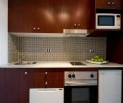
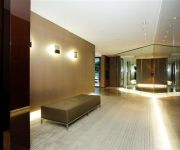
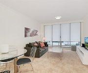
Hotels and Places to Stay
Castlepeak HomeStyle Accommodation
PARK REGIS CONCIERGE APARTMENTS
Wyndel Apartments - Herbert
Wyndel Apartments - Abode
Wyndel Apartments - Encore
Wyndel Apartments - Clarke Street
Wyndel Apartments - Shoremark
Wyndel Apartments - Leura
BEST WESTERN TWIN TOWERS INN
MANTRA CHATSWOOD
Videos from this area
These are videos related to the place based on their proximity to this place.
Chatswood Communicators - About Us
A short video about Chatswood Communicators Toastmasters Club. A bit about what we enjoy about Toastmasters and how we can help you to become a better speaker and leader.
Grooming and Boarding at The Chatswood Cat Palace
I am Dr. Kim Kendall, Cat Vet and creator of http://www.thecatpalace.com.au in Roseville, Sydney. I've discovered there are three things that indicate to you that your cat needs a deep, cleansing...
The Ride V2
The Ride is a journey! Taking you to the heart of the Sydney bush-land. Watch as the combination of visual effects and slow-motion capture what riders experience while mountain biking. Feel...
MY EXTRA 330 RC AIRPLANE AT ROSEVILLE CHASE
This was a snap trip to an oval in Roseville on the way to the pub.
Allambie Heights Bathroom Remodeling - Tai Irwin Plumbing
We are available on call for immediate action with quotes on all your plumbing and draining requirements. We are geared to provide fast action when required. If you need emergency service,...
Allambie Heights Emergency Plumbing - Tai Irwin Plumbing
We are available on call for immediate action with quotes on all your plumbing and draining requirements. We are geared to provide fast action when required. If you need emergency service,...
Dentures Sydney | Call 02 8094 9639
For Dentures Sydney Click Here: http://www.northernbeachesdentureclinic.com Northern Beaches Denture Clinic located on Sydneys Northern Beaches supplies Full and Partial Dentures Natural-looking...
Videos provided by Youtube are under the copyright of their owners.
Attractions and noteworthy things
Distances are based on the centre of the city/town and sightseeing location. This list contains brief abstracts about monuments, holiday activities, national parcs, museums, organisations and more from the area as well as interesting facts about the region itself. Where available, you'll find the corresponding homepage. Otherwise the related wikipedia article.
Castlecrag, New South Wales
Castlecrag is a suburb on the lower North Shore of Sydney, in the state of New South Wales, Australia 8 kilometres north of the Sydney central business district, in the local government area of the City of Willoughby. Castlecrag is a suburb of historical significance that is bounded to the north, east and south by Middle Harbour and to the west by the heavily congested Eastern Valley Way.
Seaforth, New South Wales
Seaforth is a suburb of northern Sydney, in the state of New South Wales, Australia. Seaforth is located 12 kilometres north-east of the Sydney central business district in the local government area of Manly Council and is part of the Northern Beaches region. Seaforth overlooks Middle Harbour and is linked south to Mosman by the Spit Bridge. To the west, Seaforth overlooks Sugarloaf Bay across to the suburbs of Northbridge, Castlecrag and Castle Cove.
Frenchs Forest, New South Wales
Frenchs Forest is a suburb of northern Sydney, in the state of New South Wales, Australia. Frenchs Forest is 13 kilometres north of the Sydney central business district in the local government area of Warringah Council. Frenchs Forest is part of the Northern Beaches region and also considered to be part of the Forest District, colloquially known as The Forest.
Allambie, New South Wales
Allambie is a location in the Warringah local government area, in Sydney, New South Wales, Australia. It has been designated an "Urban Place" by the Geographical Names Board of New South Wales.
Allambie Heights, New South Wales
Allambie Heights is a suburb of northern Sydney, in the state of New South Wales, Australia 17 kilometres north-east of the Sydney central business district in the local government area of Warringah Council. It is part of the Northern Beaches region.
Division of Warringah
The Division of Warringah is an Australian Electoral Division in the state of New South Wales. It is located in the Northern Beaches region of Sydney, and covers most of the land between Middle Harbour and the Pacific Ocean. It extends from Port Jackson in the south to the suburb of Dee Why in the north. It includes the suburbs of Mosman, Balgowlah, Manly, Brookvale, Beacon Hill and Forestville.
Forestville, New South Wales
Forestville is a suburb of northern Sydney, in the state of New South Wales, Australia. Forestville is 15 kilometres north-east of the Sydney central business district in the local government area of Warringah Council. Forestville is part of the Northern Beaches region and also considered to be part of the Forest District, colloquially known as The Forest.
Willoughby, New South Wales
Willoughby is a suburb on the lower North Shore of Sydney, in the state of New South Wales, Australia 8 kilometres north of the Sydney central business district, in the local government area of the City of Willoughby. The City of Willoughby takes its name from the suburb but its administrative centre is located in the adjacent suburb of Chatswood, which is the local area's major commercial centre.
Roseville Chase, New South Wales
Roseville Chase is a suburb on the Upper North Shore of Sydney in the state of New South Wales, Australia 11 kilometres north-west of the Sydney central business district, in the local government areas of Ku-ring-gai Council. Roseville is a separate suburb to the west.
North Balgowlah, New South Wales
North Balgowlah is a suburb of northern Sydney, in the state of New South Wales, Australia. North Balgowlah is located 13 kilometres north-east of the Sydney central business district, in the local government area of Warringah Council, and part of the Northern Beaches region. North Balgowlah shares the postcode 2093 with the adjacent Balgowlah and Balgowlah Heights.
Middle Cove, New South Wales
Middle Cove is a suburb on the Lower North Shore of Sydney, in the state of New South Wales, Australia 7 kilometres north of the Sydney central business district, in the local government area of the City of Willoughby. Middle Cove is bounded to the north, east and south by Middle Harbour and to the west by Eastern Valley Way. Middle Cove shares its postcode, 2068, with the surrounding suburbs of Castlecrag and Willoughby North.
Killarney Heights, New South Wales
Killarney Heights is a suburb of northern Sydney, in the state of New South Wales, Australia. Killarney Heights is 15 kilometres north-east of the Sydney central business district in the local government area of Warringah Council. Killarney Heights is part of the North Shore and also considered to be part of the Forest District, colloquially known as The Forest. Killarney Heights has panoramic views of Middle Harbour from a few locations.
East Lindfield, New South Wales
East Lindfield is a suburb on the Upper North Shore of Sydney in the state of New South Wales, Australia. East Lindfield is located 13 kilometres north-west of the Sydney Central Business District in the local government area of Ku-ring-gai Council.
North Willoughby, New South Wales
North Willoughby is a suburb on the lower North Shore of Sydney, in the state of New South Wales, Australia 9 kilometres north of the Sydney central business district, in the local government area of the City of Willoughby. Willoughby and Willoughby East are separate suburbs.
Willoughby East, New South Wales
Willoughby East is a suburb on the lower North Shore of Sydney, in the state of New South Wales, Australia. Willoughby East is located 9 kilometres north of the Sydney central business district, in the local government area of the City of Willoughby.
Bantry Bay (New South Wales)
Bantry Bay in Sydney, Australia, is located just off Middle Harbour in the Garigal National Park. It was named after Bantry Bay in Ireland.
Killarney Heights High School
Killarney Heights High School is a coeducational, comprehensive high school located on Starkey Street, Killarney Heights near the Northern Beaches of Sydney. The school is situated in a quiet bushland setting within 20 minutes drive of the Sydney central business district. The school has a strong tradition of high academic achievement, catering for individual student needs and providing a broad co-curricular program.
Spit Bridge
The Spit Bridge is a bascule bridge that carries Spit Road over Middle Harbour in Sydney, New South Wales, Australia, at a point called "The Spit", 10 km north-east of the CBD. It connects the suburbs of Mosman, on the south bank and Seaforth, on the north bank. It also carries Metroad 10 (future A8).
Roseville Bridge
Roseville Bridge crosses Middle Harbour in Sydney, Australia. It is the only crossing besides Spit Bridge. The bridge is 17.4 metres overhead. However, the adjacent Pipe Bridge has only 11 metres. This limitation, combined with only 1.5 metres depth of water, make it out of reach for most cruising vessels.
Willoughby Girls High School
Willoughby Girls' High School (WGHS) is a public, secondary, day school for girls, located in Willoughby, a lower North Shore suburb of Sydney, New South Wales, Australia. Established in 1934, Willoughby Girls' High currently enrols around 931 students from Years 7 to 12, and is the only comprehensive government girls' school situated on the lower north shore of Sydney.
Davidson High School (New South Wales)
Davidson High School, (abbreviation DHS) is a school located in Frenchs Forest, Sydney, New South Wales, Australia, on Mimosa Street. It is a co-educational high school operated by the New South Wales Department of Education and Communities with students from years 7 to 12. The school was established in 1972 as a result of the growing population in the Frenchs Forest and Belrose areas.
Wakehurst Public School
Wakehurst Public School is a co-educational primary school located in the Sydney suburb of Belrose, and draws its students predominantly from the surrounding suburbs of Belrose, Davidson and Frenchs Forest. The school has approximately 335 enrolled pupils from kindergarten to Year 6.
The Forest High School
The Forest High School, (abbreviation TFHS) is a government day school located in Frenchs Forest, Sydney, New South Wales, Australia, on Frenchs Forest Road. It is a co-educational secondary school operated by the New South Wales Department of Education with students ranging from grades 7 to 12. The school was established in 1961 as a secondary school for the Northern Beaches area. Students at the school come from the North Shore and Northern Beaches regions.
Mimosa Public School
Mimosa Public School, is a school located in Frenchs Forest Sydney, New South Wales, Australia. It is a co-educational Public school operated by the New South Wales Department of Education and Training with students from years K to 6. Students at the school come from the suburbs of Belrose, Davidson, Frenchs Forest in Northern Beaches region of Sydney.
Lindfield East Public School
Lindfield East Public School, (abbreviation LEPS) is a school located in East Lindfield Sydney, New South Wales, Australia. It is a co-educational Public school operated by the New South Wales Department of Education and Training with students from years Kindergarten to 6. It is the local government school for the East Lindfield and East Killara suburbs.


