Discover Kenthurst
The district Kenthurst of in The Hills Shire (New South Wales) with it's 5,250 citizens Kenthurst is a district in Australia about 155 mi north-east of Canberra, the country's capital city.
Looking for a place to stay? we compiled a list of available hotels close to the map centre further down the page.
When in this area, you might want to pay a visit to some of the following locations: Parramatta, Sydney, Katoomba, Canberra and . To further explore this place, just scroll down and browse the available info.
Local weather forecast
Todays Local Weather Conditions & Forecast: 33°C / 92 °F
| Morning Temperature | 18°C / 65 °F |
| Evening Temperature | 27°C / 81 °F |
| Night Temperature | 20°C / 69 °F |
| Chance of rainfall | 0% |
| Air Humidity | 20% |
| Air Pressure | 1015 hPa |
| Wind Speed | Moderate breeze with 9 km/h (6 mph) from South-West |
| Cloud Conditions | Overcast clouds, covering 100% of sky |
| General Conditions | Overcast clouds |
Monday, 25th of November 2024
33°C (92 °F)
21°C (71 °F)
Broken clouds, moderate breeze.
Tuesday, 26th of November 2024
37°C (98 °F)
23°C (74 °F)
Overcast clouds, moderate breeze.
Wednesday, 27th of November 2024
36°C (96 °F)
22°C (71 °F)
Light rain, moderate breeze, few clouds.
Hotels and Places to Stay
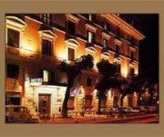
Grand Mercure The Hills Lodge
QUEST CASTLE HILL SERVICED APTS
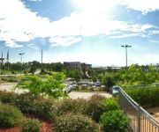
Novotel Sydney Norwest
Relaxin
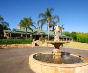
Cutmore Cottages - Bagala Bungalow
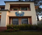
L'Auberge Angara Bed and Breakfast
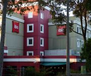
ibis Sydney Thornleigh
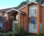
Meurants Manor Bed and Breakfast
Adina Norwest Sydney
Videos from this area
These are videos related to the place based on their proximity to this place.
ADP-92Y overtaking on double centre lines Cattai Ridge Road Glenorie.
Sorry about the language but people that drive like this make me mad! You have his Rego number look out for him on your side of the road! Cattai Ridge Road Glenorie. Dash Cam55 is everywhere!...
Sheikh Hassan Elsetohy - Keys to Understanding the Tafsir of Quran Lecture 1
On the back of a beautiful month of Ramadan and following on from the successful series run by Sheikh Hassan Elsetohy on the Keys to Understanding the Sunnah and Seerah, HDMS and the World...
The ranger isn't in Dural today
The ranger only comes to Dural once a week because this is Hornsby Shire Council area and it's a long way to drive! I saw him on Tuesday! Dash Cam55 is everywhere! Dash Cam55 sees everything!...
New South Wales Fire Brigade illegal parking Quarry Rd Dural
This is what you can call a total disregard of the law, note the "NO STOPPING" signs on the footpath they start from 200 meters behind the fire truck and stop in front of the fire truck. The...
I own a Merc and the road NSW Rego OO-2112
The rules state like the sign you can see on the left of the screen GIVE WAY TO VEHICLES ALREADY ON ROUNDABOUT. Merc drivers have that special licence that exempts them from the road rules!...
Lost it on the roundabout!
Bloody car drivers just can't handle the wet. They go too fast! Bet the home owner was pissed off big time! If you don't like what I do, don't lower yourself by posting comments! Dash Cam55...
Turbo BMW BTK-45X
Turbo BMW doing illegal U turn in front of me! If you don't like what I do, don't lower yourself by posting comments! Dash Cam55 is everywhere! Dash Cam55 sees everything! Dash Cam55 displays!...
Electricians Journey Ep. 1- First Video!
Today I begin a series on the modpack found on the Void Launcher called Electricians Journey. Please leave a comment on how you think I went and tell me how to improve in future videos! Electrici...
Videos provided by Youtube are under the copyright of their owners.
Attractions and noteworthy things
Distances are based on the centre of the city/town and sightseeing location. This list contains brief abstracts about monuments, holiday activities, national parcs, museums, organisations and more from the area as well as interesting facts about the region itself. Where available, you'll find the corresponding homepage. Otherwise the related wikipedia article.
Castle Hill, New South Wales
Castle Hill is a suburb in the north-west of Sydney, in the state of New South Wales, Australia. Castle Hill is located 31 kilometres north-west of the Sydney central business district, in the Hills District of the Greater Western Sydney region. Castle Hill is the administrative centre of the local government area of The Hills Shire and part of the suburb is located in the local government area of Hornsby Shire.
Dural, New South Wales
Dural is a semi-rural suburb of Sydney, in the state of New South Wales, Australia 36 kilometres north-west of the Sydney central business district in the local government areas of Hornsby Shire and The Hills Shire. Dural is part of the Hills District, in Northern Sydney. Round Corner is a locality in the south-western part of Dural.
Cherrybrook, New South Wales
Cherrybrook is a suburb of Sydney, in the state of New South Wales, Australia 27 kilometres north-west of the Sydney central business district in the local government area of Hornsby Shire. Cherrybrook is located in the Hills District of Sydney.
Annangrove, New South Wales
Annangrove is a suburb of Sydney, in the state of New South Wales, Australia 42 kilometres north-west of the Sydney central business district in the local government area of The Hills Shire and part of the Hills District region.
Arcadia, New South Wales
Arcadia is a suburb of Sydney, in the state of New South Wales, Australia 42 kilometres north-west of the Sydney central business district in the local government area of Hornsby Shire. Arcadia is in the Upper North Shore region.
Division of Mitchell
The Division of Mitchell is an Australian Electoral Division in the state of New South Wales. It is located in the north-west suburbs of Sydney, and includes the entire suburbs of Baulkham Hills, Beaumont Hills, Bella Vista, Box Hill, Kellyville, Nelson and Winston Hills. The division also includes parts of Castle Hill, North Rocks, Northmead, Maraylya, Rouse Hill and West Pennant Hills.
Galston, New South Wales
Galston is a suburb of northern Sydney, in the state of New South Wales, Australia. Galston is located 36 kilometres north-west of the Sydney central business district, in the local government area of Hornsby Shire and is part of the North Shore region.
Nelson, New South Wales
Nelson is a suburb of Sydney, in the state of New South Wales, Australia 42 kilometres north-west of the Sydney central business district in the local government area of The Hills Shire. It is part of the Hills District.
Middle Dural, New South Wales
Middle Dural is a semi-rural suburb of Sydney, in the state of New South Wales, Australia 37 kilometres north-west of the Sydney central business district in the local government areas of Hornsby Shire and The Hills Shire. Dural is in the Upper North Shore region. Dural is a separate suburb to the south.
Kellyville, New South Wales
Kellyville is a suburb of Sydney, in the state of New South Wales, Australia 36 kilometres north-west of the Sydney central business district in the local government area of The Hills Shire. It is part of the Hills District region.
Kenthurst, New South Wales
Kenthurst is a suburb of Sydney, in the state of New South Wales, Australia 39 kilometres north-west of the Sydney central business district in the local government area of The Hills Shire. It is part of the Hills District region. Kenthurst is a semi-rural suburb with blocks of land on an average of 5 acres .
Beaumont Hills, New South Wales
Beaumont Hills is a suburb of Sydney, in the state of New South Wales, Australia 40 kilometres west of the Sydney central business district, in the local government area of the The Hills Shire. Beaumont Hills is part of the Greater Western Sydney region and the Hills District.
Glenorie, New South Wales
Glenorie is a suburb of Sydney, in the state of New South Wales, Australia 44 kilometres north-west of the Sydney central business district in the local government areas of The Hills Shire and Hornsby Shire. Glenorie is part of the Hills District.
Rogans Hill, New South Wales
Rogans Hills is a suburb in Sydney, New South Wales, Australia within The Hills Shire, and was named after John Rogan, a pioneer who had been given a grant of land in the area by Governor Macquarie in 1818. Its main attractions are Oakhill College and the Anglican Retirement Villages. It was the destination of a railway line which closed in 1932.
Fiddletown, New South Wales
Fiddletown is a suburb of Sydney, in the state of New South Wales, Australia. Fiddletown is located 39 kilometres north of the Sydney central business district, in the local government area of Hornsby Shire and is part of the North Shore region.
Galston Gorge
Galston Gorge is part of the picturesque Berowra Valley Regional Park in Sydney, Australia and separates Galston from Hornsby Heights. It contains a narrow stretch of road with a one-way wooden bridge across Tunks Creek, a tributary of Berowra Creek. Here traffic must wait for cars already on the bridge before crossing. A second bridge in the gorge crosses Berowra Creek itself.
Hillsong Church
Hillsong Church is a Pentecostal megachurch affiliated with Australian Christian Churches (the Australian branch of the Assemblies of God) and located in Sydney, New South Wales, Australia. Brian and Bobbie Houston began the church in 1983 as the Hills Christian Life Centre in Baulkham Hills. Hills Christian Life Centre later merged with Sydney Christian Life Centre at Waterloo. Over 21,000 people attend services each week.
Oakhill College
Oakhill College is a Catholic, co-educational, secondary, day school, located in Castle Hill, New South Wales, a suburb in the Hills District of the Greater Western region of Sydney, New South Wales, Australia. Founded in 1936, the College is run by the De La Salle Brothers in the tradition of St. Jean-Baptiste de La Salle, and currently caters for approximately 1,600 students from Years 7 to 12.
Amaroo Park
Amaroo Park was a 1.9 kilometres motor racing circuit located in Annangrove, New South Wales, in the present-day western suburbs of Sydney, Australia. It opened in 1967, hosting its first motorcycle meeting on 26 February with a 30 lap production race won by Larry Simons on a BSA Spitfire in heavy rain. The first dry meeting saw the lap record set by Jack Ahearn at 63.9 seconds.
The Hills Grammar School
The Hills Grammar School is an independent, co-educational, non-sectarian, day school located in Kenthurst, a suburb in the Hills district of Sydney, New South Wales, Australia. Established in 1982, the school has a non-selective enrolment policy and currently caters for over 1,000 students from Kindergarten to Year 12. In 2010 the school opened the Early Childhood Education Centre (ECEC), catering for 3-4 year olds. Main intake years are ECEC, Kindergarten, Year 7 and Year 11.
Norwest Business Park
The Norwest Business Park is a business park in the suburbs of Bella Vista and Baulkham Hills in The Hills Shire LGA, Sydney, New South Wales, Australia. Norwest Business is bordered by Windsor Road to the East, and Old Windsor Road to the West, with Norwest Boulevarde stretching the length of the park between the two main arterial roads. It is growing every day with new companies moving in to serve the people of The Hills District.
William Clarke College
William Clarke College is an Anglican co-educational K-12 school founded in 1988. It is located in Kellyville, in the north-west of Sydney, New South Wales, Australia. The college takes its name from William Branwhite Clarke, an Anglican clergyman who arrived in Australia during 1839. He was a headmaster of The King's School Parramatta, the first incumbent of the Parish of Castle Hill, but is also remembered as a noted and respected geologist. The school's motto is "Christ Our Wisdom.
Cherrybrook Technology High School
Cherrybrook Technology High School is a purpose built Technology High School located on Purchase Road in Cherrybrook NSW, Australia. The school was built in the late 1980s to support the rapid growth of the north-west sector in Sydney. With the school's completion and opening in 1992 the sheer size and capabilities of the school have grown beyond expectations.
Castle Hill High School
Castle Hill High School, located in Castle Street, Castle Hill, New South Wales, Australia, is a Co-educational and Comprehensive school with students ranging from year 7 to year 12. Castle Hill High School has performed well during the 2011 HSC, students achieving 111 Band 6's as well as having 6 students that have received an all-rounders award. According to Better Education HSC rankings regarding Mathematics and English marks Castle Hill High School is ranked 145th in New South Wales.
Galston High School
Galston High School is a public, co-educational, high school, located in Sydney, a suburb in the Hills District of Sydney, New South Wales, Australia.


