Delve into Daruka
The district Daruka of Upper Moore Creek in Tamworth Municipality (New South Wales) is a district located in Australia about 312 mi north of Canberra, the country's capital town.
In need of a room? We compiled a list of available hotels close to the map centre further down the page.
Since you are here already, you might want to pay a visit to some of the following locations: Carrolls Creek, Katoomba, Parramatta, Sydney and Brisbane. To further explore this place, just scroll down and browse the available info.
Local weather forecast
Todays Local Weather Conditions & Forecast: 31°C / 88 °F
| Morning Temperature | 19°C / 67 °F |
| Evening Temperature | 31°C / 88 °F |
| Night Temperature | 22°C / 72 °F |
| Chance of rainfall | 0% |
| Air Humidity | 32% |
| Air Pressure | 1012 hPa |
| Wind Speed | Moderate breeze with 10 km/h (6 mph) from East |
| Cloud Conditions | Clear sky, covering 0% of sky |
| General Conditions | Sky is clear |
Wednesday, 6th of November 2024
33°C (91 °F)
23°C (73 °F)
Sky is clear, gentle breeze, clear sky.
Thursday, 7th of November 2024
37°C (99 °F)
20°C (68 °F)
Moderate rain, moderate breeze, broken clouds.
Friday, 8th of November 2024
31°C (88 °F)
19°C (67 °F)
Overcast clouds, fresh breeze.
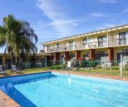
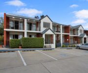
Hotels and Places to Stay
The Retreat at Froog-Moore Park
Econo Lodge Tamworth
QUEST TAMWORTH
EDWARD PARRY MOTEL
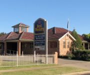
BEST WESTERN PLUS ALL SETTLERS
Mercure Tamworth
The Roseville Apartments
ASHBY HOUSE MOTOR INN
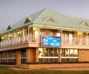
BEST WESTERN SANCTUARY INN
Quality Hotel Powerhouse Tamworth
Videos from this area
These are videos related to the place based on their proximity to this place.
Tamworth Downhill track DH1 Reverse Cam.mp4
This is a reverse camera shot of the first Tamworth Offroad Cyclists club DH track. DH1 in Tamworth is a fast flowing track that runs ~1min14secs with a top speed of 38km per hour. Vid is of...
Treckig und Traumhaft Verenao's photos around Tamworth, Australia (leconfield farm tamworth)
Preview of Verenao's blog at TravelPod. Read the full blog here: http://www.travelpod.com/travel-blog-entries/verenao/1/1255172035/tpod.html This blog preview was made by TravelPod using...
Public Education NSW - Tamworth High School
Blast from the past. Tamworth High School, 2001. This video was produced by Warrick Simmonds and is a great demonstration of typical events that happen all the time at Tamworth High School............
Tamworth bike park XC - Fence line.avi
Nice run down the fence line of the Bike park. Sweeping turns, then a climb to a quick down hill run back to the start. ~ length is 1.6km top, speed ~32km per hour.
Tamworth bike park XC - Hill side.avi
If you like switch backs you'll love this one. ~ length is 1.4km, top speed ~23km per hour.
Club Talk - Jono from Tamworth Organic Community Garden
Jono Harris from the Tamworth Organic Community Garden group talks about TidyClub and how it has helped them bring together their geographically sparse membership.
XC hst departing Tamworth.
Here you see a Xc hst departing Tamworth Heading north screaming away. Hope you enjoy it. :)
Murray Cod Fishing
Catching murray cod and yellow belly on lures in peel river near Tamworth, NSW - Catch and release.
Videos provided by Youtube are under the copyright of their owners.
Attractions and noteworthy things
Distances are based on the centre of the city/town and sightseeing location. This list contains brief abstracts about monuments, holiday activities, national parcs, museums, organisations and more from the area as well as interesting facts about the region itself. Where available, you'll find the corresponding homepage. Otherwise the related wikipedia article.
Tamworth, New South Wales
Tamworth is a city in the New England region of New South Wales, Australia. Straddling the Peel River, Tamworth is the major regional centre for the New England region and is in the local government area of Tamworth Regional Council. The city is located midway between Brisbane and Sydney, the two largest cities on the Australian east coast. In 2010, Tamworth had an estimated population of 47,595 people. At the 2011 Census, the urban centre of Tamworth had a population of 36,131.
Tamworth Country Music Festival
The Tamworth Country Music Festival is an annual music festival held in Tamworth, New South Wales, Australia and is a celebration of Australian country music culture and heritage. The festival lasts for two weeks during late January and during this period the city of Tamworth comes alive, with visitors from all across the country and worldwide who come to join in the festivities. The festival has many times been counted among the world's top ten music festivals.
Tamworth Correctional Centre
Tamworth Correctional Centre, an Australian medium secuity prison for males, is located in Tamworth, New South Wales, 397 kilometres north of Sydney. The facility is operated by Corrective Services NSW, an agency of the Department of Attorney General and Justice, of the Government of New South Wales. The Centre accepts felons charged and convicted under New South Wales and/or Commonwealth legislation and serves as a reception prison for north–western New South Wales.
Kootingal, New South Wales
Kootingal is a town in New South Wales, Australia in the Tamworth Regional Council area. It is commonly called a satellite suburb of Tamworth because of its closeness and the fact that its residents use Tamworth's services. Founded as an Aboriginal mission, Kootingal traces its name roots to the local Aboriginal Kamilaroi language. At the 2006 census, Kootingal had a population of 1,593 people. It is an agricultural based town, with lucerne, fruit, vegetable, chicken and egg farms.
Moonbi, New South Wales
Moonbi is a village situated on the New England Highway 20 kilometres north of Tamworth, New South Wales, Australia. It is nestled at the foot of the Moonbi Range and is part of the Tamworth Regional Council Local Government Area. Moonbi is located a few kilometres to the north of town of Kootingal. At the 2006 census, Moonbi had a population of 357 people.
Tintinhull, New South Wales
Tintinhull is a tiny hamlet about 10 kilometres east of Tamworth, New South Wales, Australia. It is situated between Nemingha and Kootingal, and lies on the New England Highway. The locality is 466km from Sydney, on the Main North Rail Line which opened in 1885 and closed in December 1971. Tintinhull has no shop or petrol station, but it does have a primary school with about 50 students, a pottery, and a pyramid shaped observatory. The main rise is called Goat Hill.
Calala, New South Wales
Calala is a small suburb of the Northern New South Wales city of Tamworth, administered by Tamworth Regional Council. The area is 4.5 kilometres, from the CBD of Tamworth and is connected to the city by Calala Lane, the main road, which often becomes flooded in times of heavy rain, usually isolating the residents from the rest of the city. Further along Calala Lane past Calala is Farrer Memorial Agricultural High School and the New South Wales Department of Agriculture plant research institute.
Calrossy Anglican School
The Calrossy Anglican School (Calrossy), is an independent, Anglican, day and boarding school for boys and girls and incorporates a primary and preschool. Calrossy is located in East Tamworth, a suburb of Tamworth, a city in the New England region of New South Wales, Australia. Established in 1919, the school has a non-selective enrolment policy, and currently caters for approximately 470 secondary girls along with approximately 155 secondary boys and 375 primary students.
Tamworth Regional Council
Tamworth Regional Council is a local government area in the New England region of New South Wales, Australia. The area under administration is located adjacent to the New England Highway and the Main North railway line. The Mayor of Tamworth Regional Council is Cr. Col Murray, an independent politician.
Carinya Christian School
Carinya Christian school is an independent, Christian day school located five kilometres from the centre of Tamworth, in the suburb of Calala, New South Wales, Australia. Situated onBad rounding here{{#invoke:Math|precision_format| 30*4,046.856422/10,000 | 1-1 }} hectares (30 acres), the school overlooks flood plains and farmland.
North Tamworth, New South Wales
North Tamworth is a suburb of Tamworth, New South Wales, Australia, in the city's north. It is located on the northerly side of the Peel River between the suburbs of East Tamworth and Oxley Vale. North of North Tamworth are the satellite suburbs Hills Plain, and Moore Creek. The Tamworth Base Hospital, Tamara Private Hospital, and Northgate Shopping Centre are all located in North Tamworth. As well as many sporting fields, and medical professionals' clinics.
2YOU
2YOU FM is a community radio station broadcasting to Tamworth, NSW, Australia. The station has been broadcasting for over 25 years to the regional area. It is volunteer based, and is a member of the Community Broadcasting Association of Australia (CBAA). The station aims to be a local voice for the Tamworth area, offering access to any member of the community. The station broadcasts from Bald Hill with 1,000 watts ERP.
West Tamworth, New South Wales
West Tamworth is a suburb of Tamworth, New South Wales, Australia, in the city's west. It is between South Tamworth and Taminda. It is an important commercial and residential area of Tamworth. In West Tamworth is the important commercial area of Bridge St, which is one of the main roads connecting the northern side of Tamworth with the southern. The Oxley Highway runs through part of West Tamworth.
Oxley High School
Oxley High School is situated in North Tamworth, Tamworth, New South Wales, Australia. It has approximately 1200 students. The school has four sport houses - Namoi (green), Castlereagh (blue), Macquarie (red) and Hastings (yellow). Oxley has 70 full-time teachers, and approximately 12 casual teachers at any one time. It caters for special needs students, with IO classes and support staff.
East Tamworth, New South Wales
East Tamworth is a suburb of Tamworth, New South Wales, Australia, in the city's east. It is located between the suburbs of North Tamworth, Tamworth CBD and the satellite suburb of Nemingha. East Tamworth is one of the oldest settled areas of Tamworth, and therefore is known for its wide streets and historical buildings and homes. Many of these historical buildings are the highest valued properties in Tamworth.
South Tamworth, New South Wales
South Tamworth is a suburb of Tamworth, New South Wales, Australia and is situated south from the cities Central Business District. It is a largely residential suburb and is a mixture of both new housing estates and well established estates. Southgate Shopping Centre, Robert Street Shopping Centre, Chaffey Park and Hyman Park are all located in South Tamworth.
Oxley Vale, New South Wales
Oxley Vale is a suburb of Tamworth, New South Wales, Australia, which runs either side of Manilla road. It is located between the suburbs of North Tamworth and the satellite suburb of Hallsville. Oxley Vale is a largely residential suburb of Tamworth and also Nazareth House nursing house is located there.
Tamworth Central Business District, New South Wales
The Tamworth Central Business District is a suburb of Tamworth, New South Wales, Australia, in the city centre and is located north of the Peel River. It is primarily a business area of Tamworth, with many shops, restaurants, car dealerships, as well as shopping centres and public facilities. The Tamworth Regional Council has its headquarters in Peel St at Ray Walsh House. Bicentennial Park and number one cricket oval are also located in the suburb.
Daruka, New South Wales
Daruka is an outer suburb of Tamworth, New South Wales, in the city's north. It is located in the Daruka Valley north of the suburb North Tamworth and east of the locality of Moore Creek and is bounded in the north by the stream Moore Creek. To the east of Daruka is Moonbi and Kootingal. The neighbourhood of Upper Moore Creek {{#invoke:Coordinates|coord}}{{#coordinates:-30.9485|150.9846|region:AU-NSW_type:city|||||| | |name= }} is within the north of the locality.
Peel High School
Peel High School is a co-educational, Public high school, located in Tamworth, a city in the North West region of New South Wales, Australia. Established in 1976, the school is a rural comprehensive high school with a focus on technology, and currently enrols approximately 500 students from Year 7 to 12.
Tamworth High School
Tamworth High School is a situated in South Tamworth, Tamworth, New South Wales, Australia.
Tamworth Public School
Tamworth Public School is situated in East Tamworth, Tamworth, New South Wales, Australia. Over 600 students attend the primary school and it is the oldest school in Tamworth, being established in 1855. The school's mottos are Aim High and Care, Courtesy and Consideration.
Nemingha, New South Wales
Nemingha is an outer suburb of Tamworth, New South Wales, Australia, located 5 km south of the Tamworth Central Business District on the New England Highway. Northwest of Nemingha is East Tamworth and the Tamworth Central Business District.
Taminda, New South Wales
Taminda is an industrial suburb of Tamworth, New South Wales, Australia, located in the west of the city. It is mostly zoned industrial and consequently its residential population is very low. The northern part of Taminda is flood plains and is used as sporting fields. Floods in 1998 caused much damage in Taminda with rising waters that flowed into businesses.
ABC New England North West
ABC New England North West is an ABC Local Radio station based in Tamworth and broadcasting to the regions of New England, the Northern Tablelands and North West Slopes in New South Wales. This includes the towns and cities of Armidale, Moree, Tenterfield and Glen Innes. The station began as 2NU in 1948 and is now heard on these main AM and FM frequencies along with a number of low-power FM repeaters: 2NU 648 AM 2GL 819 AM 2NWR 99.1 and 101.9 FM


