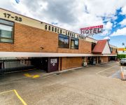
Delve into Strathfield South
The district Strathfield South of in Strathfield (New South Wales) with it's 3,213 habitants Strathfield South is a subburb in Australia about 147 mi north-east of Canberra, the country's capital town.
If you need a hotel, we compiled a list of available hotels close to the map centre further down the page.
While being here, you might want to pay a visit to some of the following locations: Parramatta, Sydney, Katoomba, Canberra and . To further explore this place, just scroll down and browse the available info.
Local weather forecast
Todays Local Weather Conditions & Forecast: 29°C / 85 °F
| Morning Temperature | 20°C / 68 °F |
| Evening Temperature | 23°C / 74 °F |
| Night Temperature | 20°C / 69 °F |
| Chance of rainfall | 9% |
| Air Humidity | 45% |
| Air Pressure | 1013 hPa |
| Wind Speed | Fresh Breeze with 16 km/h (10 mph) from South-West |
| Cloud Conditions | Overcast clouds, covering 100% of sky |
| General Conditions | Heavy intensity rain |
Monday, 18th of November 2024
27°C (81 °F)
18°C (64 °F)
Light rain, moderate breeze, overcast clouds.
Tuesday, 19th of November 2024
19°C (66 °F)
18°C (64 °F)
Overcast clouds, gentle breeze.
Wednesday, 20th of November 2024
24°C (74 °F)
18°C (64 °F)
Sky is clear, moderate breeze, clear sky.
Hotels and Places to Stay
Pullman at Sydney Olympic Park
Quest at Sydney Olympic Park
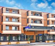
Comfort Inn & Suites Burwood
Travelodge Bankstown Sydney
BREAKFREE BANKSTOWN INTERNATIONAL
Novotel Sydney Olympic Park
Ashfield Manor
Garden Lodge Sydney
Garden-Lodge Sydney
Marco Polo Motor Inn Sydney
Videos from this area
These are videos related to the place based on their proximity to this place.
Green Printing at Focus Press
http://www.focuspress.com.au A short video produced by Enterprise Connect detailing the journey toward sustainable printing undertaken by Focus Press, Australia's most innovative green printing...
Wave - Jobim - solo guitar
This was an informal solo performance (hence the casual dress) in an inner city suburb of Sydney, April 2004. Hopefully you will enjoy the mixture of styles - with elements of jazz, latin,...
SOLD PRIOR TO AUCTION! 66 Shortland Avenue Strathfield - Richard Matthews Real Estate
http://richardmatthews.com.au/1P0559 Stunning Family Living 5 beds | 3 baths | 5 cars Guide: Auction Auction: Sat, 1st Nov 2014, 3:00 PM On Site Displaying an abundance of living & entertainment...
Blitzkrieg PC Game Review
This is a Review of the Game Blitzkrieg for Windows. Blitzkrieg is a real-time tactics computer game based on the events of World War II and is the first title in the Blitzkrieg (video game...
SOLD 2 WEEKS PRIOR TO AUCTION! Apartment - Rochester St Homebush NSW - Sydney Real Estate
SOLD By Richard Matthews Real Estate - 2 Weeks Prior to Auction! 6/8-10 Rochester Street, Homebush Massive Apartment in Heart of Homebush Village 2 beds | 2 ...
SOLD! 81 Homebush Rd Strathfield - Reserve price SMASHED by $451,000
SOLD! $3601000 Reserve price SMASHED by $451000 http://richardmatthews.com.au/1P0565 One Of The Area's Finest Heritage Homes 8 beds | 5 baths | 6 cars Auction: Sat, 8th Nov 2014, 2:00 PM...
Homebush, 5/26 Burlington Road
5/26 Burlington Road Homebush NSW Marketed by: Elders Inner West 9744 1212 www.eldersinnerwest.com.au Contact: Raimondo Campione Tel 9799 1400 | 0400 146 436, Email ...
SOLD AT AUCTION! 118 Homebush Rd, Strathfield - Richard Matthews Real Estate
SOLD AT AUCTION! 118 Homebush Road, Strathfield 5 beds | 2 baths | 5 cars Details: http://richardmatthews.com.au/1P0455 Auction: 1pm April 12, 2014 Call Richard Matthews Real Estate 02 9642...
Elders Inner West \ Croydon Park, 17 Balmoral Avenue
17 Balmoral Avenue Croydon Park NSW Marketed by: Elders Inner West 9744 1212 www.eldersinnerwest.com.au Contact: Tony Licastro Tel 9744 1212 | 0416 237 349, Email ...
Elders Inner West \ Burwood Heights, 11/70-74 Burwood Road
11/70-74 Burwood Road Burwood Heights NSW Marketed by: Elders Inner West 9744 1212 www.eldersinnerwest.com.au Contact: Patrick Pasquale Lettieri Tel 9744 1212 | 0412 933 743, Email ...
Videos provided by Youtube are under the copyright of their owners.
Attractions and noteworthy things
Distances are based on the centre of the city/town and sightseeing location. This list contains brief abstracts about monuments, holiday activities, national parcs, museums, organisations and more from the area as well as interesting facts about the region itself. Where available, you'll find the corresponding homepage. Otherwise the related wikipedia article.
Municipality of Strathfield
The Municipality of Strathfield is a local government area of the Inner West of Sydney, New South Wales, Australia. Strathfield Council was incorporated in 1885 and originally included the suburbs of Redmire, Homebush and Druitt Town. The name Strathfield was adopted as the name of the new council in 1885. The suburb of Redmire was renamed Strathfield in 1886. Druitt Town was renamed Strathfield South in the early 1890s. Only Homebush survives as an original location name.
Strathfield, New South Wales
Strathfield is an Inner West suburb of Sydney, in the state of New South Wales, Australia 14 kilometres west of the Sydney central business district. It is the administrative centre of the local government area of the Municipality of Strathfield. A small section of the suburb north of the railway line sits in the local government area of the City of Canada Bay, while the area east of The Boulevard, sits within the Burwood Council.
Homebush railway station
Homebush railway station is a station on the Main Suburban railway line of Sydney's CityRail system. Located in the suburb of Homebush, it is at the point where six tracks reduce to four. The station is served mainly by Inner West line trains, though some South line trains also stop here. There are seven platforms, of which only four are regularly used by stopping trains. A freight line connection to North Strathfield also passes through the station adjacent to platform 1.
Burwood, New South Wales
Burwood is a suburb in the inner-west of Sydney, in the state of New South Wales, Australia 12 kilometres west of the Sydney central business district and is the administrative centre for the local government area of Burwood Council. Burwood Heights is a separate suburb to the south. The Appian Way is a street in Burwood, known for its architecturally designed Federation-style homes.
Strathfield massacre
The Strathfield massacre was a shooting rampage in Sydney, Australia on Saturday, 17 August 1991. The shooter was Wade Frankum, who killed himself as police arrived at the scene. The incident left eight dead and six wounded.
Strathfield railway station
Strathfield railway station is a major interchange on Sydney's CityRail network and a hub for buses serving the northern part of the inner west. The suburb of Strathfield includes many high-rise apartments and a number of shopping centres such as Strathfield Plaza. These are mostly on the southern side of the station along with a large taxi stand and bus terminal.
Division of Watson
The Division of Watson is an Australian Electoral Division in the state of New South Wales. It is located in the southern suburbs of Sydney, and includes the suburbs of Belfield, Belmore, Burwood Heights, Campsie, Chullora, Clemton Park, Enfield, Greenacre, Lakemba, Mount Lewis, Roselands, Strathfield South and Wiley Park and parts of Ashbury, Bankstown, Beverly Hills, Burwood, Canterbury, Croydon, Croydon Park, Earlwood, Kingsgrove, Narwee, Punchbowl, Riverwood and Strathfield.
Campsie railway station
Campsie railway station is a railway station on the Bankstown line of Sydney's CityRail rail network in New South Wales, Australia. It serves the Sydney suburb of Campsie.
Belmore railway station
Belmore railway station is a station on the CityRail Bankstown line, located in the Sydney suburb of Belmore. It opened in 1895 and was the terminus of the line until 1909 when the line was extended to Bankstown. It is generally served by four trains per hour in each direction, although this can vary during peak hours when there may be extra services, and also after hours when services are less frequent.
Municipality of Burwood
The Municipality of Burwood is a local government area in the inner-west of Sydney, in the state of New South Wales, Australia. The Mayor of the Municipality is Cr. John Faker, a member of the Labor Party.
Strathfield South, New South Wales
Strathfield South is a suburb, in the inner-west of Sydney, in the state of New South Wales, Australia 14 kilometres west of the Sydney central business district, in the local government area of the Municipality of Strathfield. North Strathfield and Strathfield are separate suburbs, to the north. Strathfield South is located between Liverpool Road and the Cooks River, bordered on the east by Coronation Parade and to the west by the Enfield Marshalling Yards.
Belfield, New South Wales
Belfield is a suburb in south-western Sydney, in the state of New South Wales, Australia 14 kilometres south-west of the Sydney central business district, in the local government area of the City of Canterbury and partly in the Municipality of Strathfield.
Belmore, New South Wales
Belmore is a suburb of Sydney, New South Wales, Australia. Belmore is located 15 kilometres south-west of the Sydney central business district, in the local government area of the City of Canterbury. It is almost part of the inner-west.
Burwood Heights, New South Wales
Burwood Heights is a small suburb, inner-west of Sydney, in the state of New South Wales, Australia. It is located 12 kilometres west of the Sydney central business district and is situated within the local government area of Burwood Council. Burwood Heights is a residential suburb with no shops, schools or any public buildings. The postcode is 2136, the same as neighbouring Enfield. Burwood is a separate suburb, to the north.
Enfield, New South Wales
Enfield is a suburb in the Inner-West of Sydney, in the state of New South Wales, Australia. It is 13 kilometres south-west of the Sydney central business district in the local government area of Burwood Council.
Burwood railway station, Sydney
Burwood is a major station on the main suburban line in the suburb of Burwood in Sydney. The station is located on Burwood Road, close to major shops and schools, and has platforms on all six of the tracks through the station. The station concourse is below the platforms with access to Burwood Road. Burwood is served by CityRail's Northern, Western, South and Inner West lines.
Strathfield Girls High School
Strathfield Girls High School is a single-sex comprehensive high school located in the municipality of Strathfield in Sydney, New South Wales, Australia. Along with its brother school, Homebush Boys High School, it is one of the top ranked comprehensive high schools in the state, with over 1100 students and approximately 100 staff.
Presbyterian Theological Centre
The Presbyterian Theological Centre is the theological college of the Presbyterian Church of Australia in New South Wales. It provides theological education for candidates of the ministry and members of the laity, and is an approved teaching institution of the Australian College of Theology.
Santa Sabina College
Santa Sabina College, (known as Santa or SSC) is a Roman Catholic, Dominican, day school for girls K-12 and boys K-4, located in Strathfield, an inner-western suburb of Sydney, New South Wales, Australia. Established in 1894, Santa Sabina has a non-selective enrollment policy and currently caters to approximately 1,400 students, with co-education from Kindergarten to Year 4, and girls only from Years 5 to 12.
Meriden School
Meriden, An Anglican School for Girls is an independent, Anglican, day school for girls, in Strathfield, an inner-western suburb of Sydney, New South Wales, Australia. Founded in 1897 by Mrs Jane Monckton, the school has a non-selective enrolment policy and currently caters for approximately 850 students from Pre-Kindergarten to Year 12.
Belmore Sports Ground
Belmore Sports Ground, formerly known as Belmore Oval, is a multi-purpose stadium in Belmore, New South Wales, Australia. The park covers 22 acres and from 1951 has contained the Belmore Bowling Recreation Club green. It is close to Belmore railway station. The stadium has a capacity of 25,000 people and was built in 1920. The ground record crowd for Belmore was set on 12 April 1993 when 27,804 fans saw Canterbury defeat local rivals Parramatta 42-6.
Enfield South, New South Wales
Enfield South is a former locality in the suburb of Enfield in the inner-west Sydney, New South Wales, Australia. Enfield South is designated as a neighbourhood by the NSW Geographical Names Board.
2OOO
2000FM (callsign 2OOO) is a multilingual community radio station broadcasting to Sydney in languages other than English from studios in the suburb of Burwood. It is a volunteer run organisation and is funded through listener support, grants and limited commercial sponsorship. The mission of 2000FM is to provide a service through dedication to enrich the cohesion of our cultural diversity via tolerance, understanding and respect for each other.
West Sydney Chinese Christian Church
West Sydney Chinese Christian Church (WSCCC) is a multi-cultural evangelical inter-denominational Christian church in Sydney. The wider church spread across 6 different services, conducted in 3 languages English, Cantonese, and Mandarin and held in two locations in the inner western suburbs of Sydney.
Woodstock (Sydney)
Woodstock is a heritage-listed home in the Sydney suburb of Burwood. It was built in 1871 by Edwin Thomas Penfold and changed hands a number of times before being acquired by Burwood Council.


