Delve into Myola
The district Myola of Huskisson in Shoalhaven Shire (New South Wales) is a subburb in Australia about 89 mi east of Canberra, the country's capital town.
If you need a hotel, we compiled a list of available hotels close to the map centre further down the page.
While being here, you might want to pay a visit to some of the following locations: Parramatta, Sydney, Katoomba, Canberra and . To further explore this place, just scroll down and browse the available info.
Local weather forecast
Todays Local Weather Conditions & Forecast: 24°C / 75 °F
| Morning Temperature | 17°C / 63 °F |
| Evening Temperature | 22°C / 71 °F |
| Night Temperature | 20°C / 68 °F |
| Chance of rainfall | 1% |
| Air Humidity | 62% |
| Air Pressure | 1021 hPa |
| Wind Speed | Moderate breeze with 10 km/h (6 mph) from South-West |
| Cloud Conditions | Broken clouds, covering 82% of sky |
| General Conditions | Light rain |
Sunday, 17th of November 2024
31°C (87 °F)
19°C (67 °F)
Heavy intensity rain, moderate breeze, overcast clouds.
Monday, 18th of November 2024
27°C (80 °F)
16°C (61 °F)
Light rain, gentle breeze, clear sky.
Tuesday, 19th of November 2024
21°C (69 °F)
15°C (58 °F)
Light rain, gentle breeze, broken clouds.
Hotels and Places to Stay
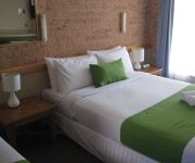
Huskisson Beach Motel
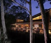
PAPERBARK CAMP
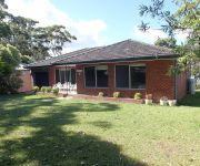
Dungowan Waterfront Apartments
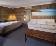
JERVIS BAY DOLPHIN SUITES
Videos from this area
These are videos related to the place based on their proximity to this place.
Hyams Beach, Jervis Bay - Beach walk with Nala
26 Jan 2015, late afternoon walk with Nala on Hyams beach before the rain storm comes.
Hyams Beach Shoalhaven South Coast NSW
Hyams Beach is situated on beautiful Jervis Bay. A quiet seaside community with a white sandy beach, cottages and surrounded by Jervis Bay National Park and close to Boderee National Park.
Husky Carnival 2014 Ride line up Huskisson Jervis Bay
This year at the Huskisson Carnival we have over 20 great family rides. From Boxing day 26th Dec through until Australia on the 26th of January 2015 we are open every evening from 6pm until 10pm.
Huskisson Carnival 2014 buy your tickets online and save
This year at the 2014 Huskisson Carnival we are offering some great savings online when you pre-purchase your tickets. Save 10% on Armbands, 30% on Family Passes and unlimited saving with our...
Hobie 16 World Titles - Huskisson Jervis Bay 2014
This is how to get back on the beach, the Juniors show the way.
family deal 2014
Yes it's that time of year again and we are offering our amazing Family Deal to the Huskisson Carnival for 2014. You get 4 unlimited ride armbands, 4 game passes, 2 Bungee Trampoline passes,...
Kayak Rolling
My first practice session after my course by Jervis Bay Kayaks. Many thanks to Tracy & Bec.
Reef Life Survey
This video was prepared by a volunteer diver on the Reef Life Survey training program, Feb 2008, in Jervis Bay, NSW. The University of Tasmania, the Tasmanian state government, nor any of the...
Videos provided by Youtube are under the copyright of their owners.
Attractions and noteworthy things
Distances are based on the centre of the city/town and sightseeing location. This list contains brief abstracts about monuments, holiday activities, national parcs, museums, organisations and more from the area as well as interesting facts about the region itself. Where available, you'll find the corresponding homepage. Otherwise the related wikipedia article.
Booderee National Park and Botanic Gardens
Booderee National Park and Botanic Gardens are located in the Jervis Bay Territory of Australia. The reserve is composed of two sections: the Bherwerre Peninsula, on the southern foreshore of Jervis Bay, Bowen Island and the waters of the south of the bay lands bordered by Wreck Bay to the south, St Georges Basin to the north and Sussex Inlet to the west What is now the national park was declared as a nature reserve in 1971. In 1992, Jervis Bay National Park was declared.
Jervis Bay
Jervis Bay Pronounced: Jar-vis is a bay of 102 square kilometers on the south coast of New South Wales adjacent to the Jervis Bay Territory. HMAS Creswell is located between Jervis Bay Village and Greenpatch in the Jervis Bay Territory.
Beecroft Peninsula
Beecroft Peninsula is a peninsula located to the north and east of Jervis Bay in south-eastern Australia. The peninsula forms the northern headland of Jervis Bay. The Peninsula is divided between the State of New South Wales and the Australian Capital Territory. The ACT section was transferred to the Commonwealth of Australia in 1915, as part of the Jervis Bay lands transferred by New South Wales to federal control to provide the national capital with access to the sea.
HMAS Creswell
HMAS Creswell is a shore establishment of the Royal Australian Navy, a part of the Australian Defence Force, and consists of the Royal Australian Naval College (RANC), The RAN School of Survivability and Ship's Safety, Kalkara Flight, the Beecroft Weapons Range and an administrative support department.
Vincentia, New South Wales
Vincentia is a town in New South Wales, Australia in the City of Shoalhaven, on the shores of Jervis Bay. It is roughly 25 km south-east of Nowra, and approximately 200 km south of Sydney. In 2006, the population of the State Suburb of Vincentia was 2,875.
Culburra Beach, New South Wales
Culburra Beach, commonly referred to as Culburra, is in the Shoalhaven region of New South Wales, Australia. It is 18 km east-southeast of Nowra on the South Coast. From the 2006 Census of Population and Housing, the town has a population of 2,910 and is the regional centre for the coastal villages of Currarong, Callala Beach, Callala Bay and Orient Point.
Jervis Bay Village, Jervis Bay Territory
Jervis Bay Village is a town in the Jervis Bay Territory. HMAS Creswell navy base is located in the town. Apart from the navy base there is an Aboriginal Community in the town. It is the largest town in the Jervis Bay Territory with 250 inhabitants (followed by Wreck Bay Village with 215).
Wrights Beach, New South Wales
Wrights Beach is a town in the Shoalhaven local government area, in New South Wales, Australia. It is on the shores of St Georges Basin, near the Jervis Bay Territory.
Greenpatch Point
Greenpatch is a locality in the Jervis Bay Territory in Australia and forms part of the Jervis Bay Village Council. It is claimed to possess Australia's whitest sand.
Bream Beach, New South Wales
Bream Beach is suburb in the Shoalhaven local government area, consisting of holiday resort located near the Jervis Bay Territory in Australia.
Callala Bay, New South Wales
Callala Bay is a small town on the South Coast of New South Wales, Australia in the City of Shoalhaven. It is situated on the northern shore of Jervis Bay about 20 minutes drive from Nowra and 10 minutes from Culburra Beach. Callala Bay has an approximate elevation of 13 m above sea level. There is a safe harbour, jetty, sailing club, boat ramp, primary school and a reasonable shopping centre. Callala Bay is surrounded by bushland that is popular with mountain bike riders.
St Georges Basin, New South Wales
St Georges Basin is a town in New South Wales, Australia in the City of Shoalhaven, on the shores of St Georges Basin. It is roughly 25 km south of Nowra, and approximately 200 km south of Sydney. In 2006, the population of St Georges Basin, together with Sanctuary Point and Basin View, was 8,343.
Basin View, New South Wales
Basin View is a town in New South Wales, Australia in the City of Shoalhaven, on the shores of St Georges Basin. It is roughly 25 km south of Nowra, and approximately 200 km south of Sydney. In 2006, the population of Basin View was .
Bay and Basin FM
Bay and Basin FM is a community radio station based in Sanctuary Point, on the New South Wales South Coast, Australia. It is licensed to serve the towns of Vincentia, Sanctuary Point, Huskisson, St Georges Basin and Basin View amongst others, on the frequency of 92.7 FM. The signal can be received from Gerringong to Ulladulla.
Erowal Bay, New South Wales
Erowal Bay is a small village in the Shoalhaven local government area on the New South Wales south coast, on the northern side of St Georges Basin. It lies west of Hyams Beach and east of Old Erowal Bay. At the 2006 census, Erowal Bay had a population of 631 people.
Vincentia High School
Vincentia High School is a coeducational comprehensive community high school located adjacent to Jervis Bay. The school serves a number of communities in the Jervis Bay, St Georges Basin, Tomerong and Sussex Inlet areas. VHS has a large Indigenous population.
Bherwerre Parish
The Parish of Bherwerre is a parish of the County of St Vincent in New South Wales which formerly included the area that is now the Jervis Bay Territory, which was transferred to the Commonwealth of Australia in 1915. Because of this, the parish is now less than half the size it was in the nineteenth century. The Jervis Bay Territory Acceptance Act of 1915 mentions that 18,000 acres of the parish were transferred to the Commonwealth.
Pyree, New South Wales
Pyree is a farming locality in the Shoalhaven district of New South Wales, Australia. It consists of a community hall and grounds which host a local farmers and craft market on the fourth Sunday of each month.
Orient Point, New South Wales
Orient Point is a small village in the Shoalhaven area of New South Wales, Australia. It is located on the southern side of the mouth of the Shoalhaven River and adjoins the village of Culburra to the south. The Jerringa Aboriginal Mission is located near the village. At the 2006 census, Orient Point had a population of 504 people.
Parma Creek
Parma Creek is a river of the state of New South Wales in Australia.
Greenwell Point, New South Wales
Greenwell Point is in the Shoalhaven region of New South Wales, Australia. It is about 13 km east of Nowra on the South Coast. At the 2006 Census of Population and Housing, the town had a population of 1,276.
Aeolus (1850)
The Aeolus was a wooden Ketch built in 1850 at Pyrmont, New South Wales, that was wrecked when its anchors parted while it carried timber to Sydney under the command of Captain R. Taylor and was lost at Hole in the Wall, Jervis Bay, New South Wales, on 24 October 1867. The wreck has not been located but its approximate position is {{#invoke:Coordinates|coord}}{{#coordinates:-35.134648|150.745874|type:event_region:AU|||||| |primary |name= }}.
Lake Wollumboola
Lake Wollumboola is a 648 ha coastal lake in the Shoalhaven region of New South Wales, Australia. It lies to the immediate south of the town of Culburra Beach and to the north of Jervis Bay. It forms part of Jervis Bay National Park. The lake is separated from the ocean by a berm about 100 m wide which breeches only when the lake fills to over 2.5 m above mean sea level.
Tomerong, New South Wales
Tomerong is a village in the South Coast region of New South Wales, Australia. It is located approximately 180 kilometres by road south from the state capital Sydney and 20 kilometres south of the commercial centre of the City of Shoalhaven, Nowra in the County of St Vincent. The village is eight kilometres inland of the western shores of Jervis Bay. Its population in August 1996 was 410.
Bowen Island (Jervis Bay)
Bowen Island is a sandstone island lying 250 m off the tip of the Bherwerre Peninsula at the entrance to Jervis Bay, on the coast of New South Wales, Australia. The island, however, is not part of the state of New South Wales but of the Jervis Bay Territory, administered by Australia’s federal government. It lies within the Booderee National Park.


