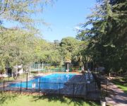
Touring Yellow Rock
Yellow Rock in Shellharbour (New South Wales) is a town located in Australia about 102 mi (or 165 km) north-east of Canberra, the country's capital place.
Time in Yellow Rock is now 12:26 PM (Saturday). The local timezone is named Australia / Sydney with an UTC offset of 11 hours. We know of 9 airports nearby Yellow Rock, of which two are larger airports. The closest airport in Australia is Wollongong Airport in a distance of 4 mi (or 7 km), North-East. Besides the airports, there are other travel options available (check left side).
Also, if you like the game of golf, there are several options within driving distance. Need some hints on where to stay? We compiled a list of available hotels close to the map centre further down the page.
Being here already, you might want to pay a visit to some of the following locations: Parramatta, Sydney, Katoomba, Canberra and . To further explore this place, just scroll down and browse the available info.
Local weather forecast
Todays Local Weather Conditions & Forecast: 23°C / 74 °F
| Morning Temperature | 17°C / 63 °F |
| Evening Temperature | 20°C / 69 °F |
| Night Temperature | 19°C / 67 °F |
| Chance of rainfall | 2% |
| Air Humidity | 67% |
| Air Pressure | 1022 hPa |
| Wind Speed | Gentle Breeze with 8 km/h (5 mph) from South-West |
| Cloud Conditions | Broken clouds, covering 72% of sky |
| General Conditions | Light rain |
Sunday, 17th of November 2024
28°C (83 °F)
19°C (66 °F)
Heavy intensity rain, moderate breeze, overcast clouds.
Monday, 18th of November 2024
28°C (82 °F)
14°C (57 °F)
Light rain, gentle breeze, clear sky.
Tuesday, 19th of November 2024
21°C (70 °F)
15°C (59 °F)
Light rain, gentle breeze, scattered clouds.
Hotels and Places to Stay
Jamberoo Resort
Videos from this area
These are videos related to the place based on their proximity to this place.
Qantas Boeing 747-400 landing at Illawarra Regional Airport
On 8 March 2015 four awesome Qantas pilots landed a Boeing 747-400 at Illawarra Regional Airport in Albion Park NSW (a very small runway for a very big plane...). In 1989 VH-OJA "The City of...
Qantas QF7474 very low fly over approach to small regional airport. #QFfarewellOJA
Qantas QF7474 approach low fly over for final flight to Wollongong Airport.
IMG 0483 1
Funniest thing to watch, 36 year old screaming because she didn't realize how low the Qantas 747 would be above her landing Boeing 747 Final landing in Albion Park Wollongong - VH-OJA's last ...
Biplane Stunt Flight
An aerobatic stunt sequence over Woolongong, in a 1943 Boeing PT-17 Stearman, the Lilly Warra. Thanks to Southern Biplanes. http://www.southernbiplanes.com.au.
Jamberoo Action Park 2013/2014 Television Commercial
Jamberoo Action Park's Television Commercial for 2013/2014 Summer. Based in Jamberoo, near Kiama and just 2 hours from Sydney on the Illawarra South Coast. Features "Get Bitten by the Funnel...
Jamberoo water park, NEW RIDE, Funnel Web Water slide,
4 heavy guys take on the Funnel Web ride at Jamberoo Water Park and almost tag both sides of the sprinklers.
Videos provided by Youtube are under the copyright of their owners.
Attractions and noteworthy things
Distances are based on the centre of the city/town and sightseeing location. This list contains brief abstracts about monuments, holiday activities, national parcs, museums, organisations and more from the area as well as interesting facts about the region itself. Where available, you'll find the corresponding homepage. Otherwise the related wikipedia article.
Albion Park Public School
Albion Park Public School is a government co-educational primary school located in Albion Park, a suburb of Wollongong, New South Wales, Australia.
97.3 ABC Illawarra
97.3 ABC Illawarra is an ABC Local Radio station based in Wollongong and broadcasting to the Illawarra region in New South Wales. This includes the towns of Nowra, Shellharbour, Kiama, and Bowral. The station began as 2WN in 1959 originally broadcasting on the AM band. It now transmits on the main FM frequency of 97.3 mHz along with a low power FM repeater.
Knights Hill (New South Wales)
Knights Hill is a geographical feature that is part of the Illawarra Escarpment. It is located south of Albion Park. The feature comprises a 709 metre above sea level summit, and several other small hills, atop a plateau adjacent to the escarpment edge. Atop the plateau are TV antennae and a small farm. The name first appears in a map by Surveyor Hoddle, after whom a track west of Kiama is named. He surveyed the region in the 19th century.


