Discover Bexley North
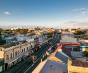
The district Bexley North of in Rockdale (New South Wales) with it's 3,999 citizens Bexley North is a district in Australia about 146 mi north-east of Canberra, the country's capital city.
Looking for a place to stay? we compiled a list of available hotels close to the map centre further down the page.
When in this area, you might want to pay a visit to some of the following locations: Sydney, Parramatta, Katoomba, Canberra and . To further explore this place, just scroll down and browse the available info.
Local weather forecast
Todays Local Weather Conditions & Forecast: 21°C / 70 °F
| Morning Temperature | 18°C / 64 °F |
| Evening Temperature | 21°C / 71 °F |
| Night Temperature | 21°C / 69 °F |
| Chance of rainfall | 2% |
| Air Humidity | 75% |
| Air Pressure | 1022 hPa |
| Wind Speed | Moderate breeze with 12 km/h (7 mph) from South-West |
| Cloud Conditions | Overcast clouds, covering 99% of sky |
| General Conditions | Light rain |
Sunday, 17th of November 2024
30°C (85 °F)
21°C (69 °F)
Heavy intensity rain, fresh breeze, overcast clouds.
Monday, 18th of November 2024
27°C (81 °F)
18°C (64 °F)
Light rain, moderate breeze, overcast clouds.
Tuesday, 19th of November 2024
19°C (65 °F)
18°C (65 °F)
Overcast clouds, gentle breeze.
Hotels and Places to Stay
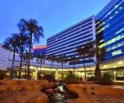
Stamford Plaza Sydney Airport
The Urban Newtown
Mercure Sydney International Airport
Novotel Sydney Brighton Beach
Quest Mascot
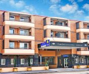
Comfort Inn & Suites Burwood
Garden-Lodge Sydney
Sydney Student Living - Hostel
ibis budget St Peters
ibis budget Enfield
Videos from this area
These are videos related to the place based on their proximity to this place.
City Ford Rockdale Rockdale Perfect 5 Star Review by Shirley M.
http://cityfordrockdale.com.au 1300 852 632 City Ford Rockdale Ford Sydney reviews 5 Star Rating I just wanted to say a big thank you to Steve and the team at City Ford Rockdale....
Nepalese momo / dumplings (chicken and veg) - Part 1
Read full article on this video at - [ http://j.mp/cooking-momo-recipe ] where you can find momo / dumpling recipes, how to make momo sauce / chutney and how to wrap and cook momo Nepalese...
Tangara Trains at Kingsgrove Train station
Angelo video recorded City Rail trains at Kingsgrove train station using an iPad on 22nd April 2012. He was very lucky to get 2 trains passing each other in this clip. Nice video photography Ang! :-)
Small Block Chevy 355 dyno 604 HP - Hercules Competition Engines
355 SB Chevy dyno run. Bowtie Iron Heads and Bowtie block, rule limited to max 7500 rpm endurance motor.
Light Emotion Animation RGB Laser AnimateRGBB
The ANIMATERGBB is an affordable RGB laser featuring 80 inbuilt patterns and animations which can be accessed via DMX or scrolled through in stand alone or sound activation mode. Movement of...
GTA V-Custom Racing (Loops, Massive Ramps and Crashing)
I hope you guys enjoy the video. This video is about us racing and completely failing.Don't forget to SUBSCRIBE leave a COMMENT and SHARE the video with your friends.
Design Tiles Showroom Virtual Tour
Virtual tour of Design Tiles Rockdale Showroom. Showroom Location: 413 Princes Highway Rockdale NSW 2216 9am to 5pm: Mon to Fri 10am to 4pm: Sat/Sun Our aim is to provide customers with...
Light Emotion OCTOPUSTRI
The OCTOPUSTRI features 3-in-1 Tri-colour LED technology that combines 3 different colour LED's (red, green and blue) into a single 9W LED source allowing a spectrum of coloured beam ...
Terrible Corporate Fitness Video
Corporate Fitness Culture (CFC) provides company fitness programs including; Pilates, Yoga, Boot camp, Boxing, Circuit and Massage to name a few. The fitness programs help companies boost team.
Pizza Delivery Bexley 3
http://www.aussiepizzas.com/PIZZADELIVERY/bexley-north-pizza-delivery-02-9556-2020-bexley-north/ The process of using Pizza Delivery in Bexley from one's favourite shop begins by having the...
Videos provided by Youtube are under the copyright of their owners.
Attractions and noteworthy things
Distances are based on the centre of the city/town and sightseeing location. This list contains brief abstracts about monuments, holiday activities, national parcs, museums, organisations and more from the area as well as interesting facts about the region itself. Where available, you'll find the corresponding homepage. Otherwise the related wikipedia article.
Division of Barton
The Division of Barton is an Australian electoral division in New South Wales. The division was created in 1922 and is named for Sir Edmund Barton, the first Prime Minister of Australia.
St George (Sydney)
St George Area (also known as St George District or St George Region) is an unofficial name applied to a group of southern suburbs in Sydney, in the state of New South Wales, Australia. The area includes all the suburbs in the local government areas of the City of Hurstville, the City of Rockdale and the Municipality of Kogarah. The eastern boundary of the district is Lady Robinson Beach on Botany Bay.
Sydney Technical High School
Sydney Technical High School is an academically selective, state-funded high school for boys in Bexley, a southern suburb of Sydney, Australia. Founded in 1911 as part of Sydney Technical College, the school was one of the six original New South Wales selective schools. The school is colloquially abbreviated to "Sydney Tech", "STHS" or simply "Tech". Admission to Year 7 is based on an external selective test held in Year 6 during March.
Bexley North railway station
Bexley North is a railway station on Sydney's CityRail East Hills Line. It serves the Sydney suburb of Bexley North. The station has a single island platform serving the local tracks, which retains its 1930s original brick station building.
Kingsgrove railway station
Kingsgrove is a railway station on the East Hills railway line of the CityRail network in Sydney. It serves the suburb of Kingsgrove. Kingsgrove has a single island platform which serves the inner 'local' pair of tracks, the 'main' (express) tracks pass on either side. Kingsgrove retains its original 1930s brick platform building but has had additional platform canopies and entrance built in the intervening years. This station has Easy Access for wheelchairs.
Bardwell Park railway station
Bardwell Park is a railway station on Sydney's CityRail East Hills Line. It serves the Sydney suburb of Bardwell Park. The station has a single island platform serving the local tracks, which retains its 1930s original brick station building. As is the convention in Sydney, platform 1 is for Sydney bound trains, and platform 2 is for outbound trains towards East Hills.
Rockdale railway station
Rockdale railway station is located on the ]]Illawarra railway line serving the southern Sydney suburb of Rockdale, the administrative centre for the local government area of the City of Rockdale. It consists of five platforms, only four of which are currently in use. Located nearby are sidings for permanent way maintenance vehicles. The station sits beside a major State Transit Authority bus interchange.
City of Canterbury (New South Wales)
The City of Canterbury is a local government area in the inner south–west region of Sydney, New South Wales, Australia. Canterbury is primarily residential and light industrial in character. The city is home to over 130 nationalities, with a majority of its residents being born overseas. Hence Canterbury calls itself "the City of Cultural Diversity. " The City was previously called the Municipality of Canterbury. The Mayor of the City of Canterbury Council is Cr.
Kingsgrove, New South Wales
Kingsgrove is a suburb in southern Sydney, in the state of New South Wales, Australia. Kingsgrove is 13 kilometres south of the Sydney central business district and lies across the local government areas of the City of Rockdale, the City of Hurstville and the City of Canterbury. Therefore, Kingsgrove is in both the St George and South-western Sydney regions.
Bexley North, New South Wales
Bexley North is a suburb in southern Sydney, in the state of New South Wales, Australia 13 kilometres south of the Sydney central business district. It is part of the St George area. Bexley North is in the local government area of the City of Rockdale.
Earlwood, New South Wales
Earlwood is a suburb in the inner-west of Sydney, in the state of New South Wales, Australia. Earlwood is located 12 kilometres south of the Sydney central business district, in the local government area of the City of Canterbury. Since the 1960s, the area has been strongly associated with Greece and Greek culture. Earlwood stretches from the southern bank of the Cooks River to the northern bank of Wolli Creek. Marrickville is located to the east across Cooks River.
Danebank
Danebank Anglican School for Girls (commonly referred to as Danebank) is an independent, Anglican, day school for girls, located in Hurstville, a southern suburb of Sydney, New South Wales, Australia. It is a member school of the Sydney Anglican Schools Corporation. Established in 1933 by Edith Roseby Ball, Danebank has a non-selective enrolment policy and currently caters for approximately 910 students from Prep to Year 12.
Clemton Park, New South Wales
Clemton Park is a suburb in south-western Sydney, in the state of New South Wales, Australia. It is 13 kilometres south-west of the Sydney central business district in the City of Canterbury. A small group of shops is located at the intersection of Bexley Road and William Street. A reserve called Clemton Park is located on Moorefields Road. Clemton Park Public School, located on Bexley Road, is for years K-6.
Bardwell Park, New South Wales
Bardwell Park is a suburb in southern Sydney, in the state of New South Wales, Australia. Bardwell Park is located 12 kilometres south of the Sydney central business district and is part of the St George area. Bardwell Park is in the local government area of the City of Rockdale. The postcode is 2207. Bardwell Valley is a separate suburb, to the east.
Bexley, New South Wales
Bexley is a suburb in southern Sydney, in the state of New South Wales, Australia. Bexley is located 14 kilometres south of the Sydney central business district, in the local government area of the City of Rockdale and is part of the St George area.
Georges River College (Hurstville Boys Campus)
Georges River College Hurstville Boys Campus, (formerly known as Hurstville Boys' High School and known as HBHS), is situated in the city of Hurstville in the Sydney region. The school caters for the educational needs of boys in the area of St. George and is broadly recognised for its programs.
Bardwell Valley, New South Wales
Bardwell Valley is a suburb in southern Sydney, in the state of New South Wales, Australia. Bardwell Valley is located approximately 12 kilometres south of the Sydney central business district, in the local government area of the City of Rockdale and is part of the St George area. Bardwell Valley is a primarily residential area. Some beautiful sandstone cottages from the early 20th century still stand in East Street and The Glen Road.
Marist College Kogarah
Marist College Kogarah is a systemic Catholic College for boys from Years 7 to 12, located in Bexley, New South Wales, Australia. The College was founded in 1909, and has a tradition based on the teachings of the French educator Saint Marcellin Champagnat. The school offers education to approximately 1200 students in the St George area of Sydney.
Aspley State High School
Aspley State High School is a secondary school situated in Brisbane's northern suburbs.
St. George Parish, Cumberland
St George Parish is one of the 57 parishes of Cumberland County, New South Wales, a cadastral unit for use on land titles. The name is used as the region name today. {{#invoke:Coordinates|coord}}{{#coordinates:33|56|54|S|151|06|04|E|type:city |primary |name= }}
Canterbury Hospital
Canterbury Hospital is a metropolitan hospital in Campsie, a south-western suburb of Sydney, New South Wales, Australia. Canterbury Hospital has been in business since 1929 and was rebuilt in 1998. Canterbury Hospital is one of many hospitals in a network under the management of Sydney Local Health District.
Bethany College (Sydney)
Bethany College is a non-government Catholic high school for girls, located in Hurstville, a southern suburb in Sydney, New South Wales. In 2009 Bethany Junior and Senior Campuses amalgamated into one campus in Hurstville.
Saint Ursulas College, Kingsgrove
St Ursula's College Kingsgrove is located in Kingsgrove, Sydney, Australia. It is a Catholic girls school for grades 7-12.
Wolli Creek Regional Park
The Wolli Creek Regional Park is a regional park found in South-West Sydney, between Bexley North and Tempe, New South Wales, Australia, within an area of 50 hectares of native bushland and public reserves of the Wolli Creek Valley. It is the only large, open space that remains in a heavily developed residential and industrial region.
Kingsgrove North High School
Kingsgrove North High School (KNHS) is a co-educational public high school located in Kingsgrove, New South Wales, Australia. Founded in 1959, it is the oldest co-educational high school in the state. The school is part of the St. George Region of high schools and is administered by the New South Wales Department of Education and Communities (DEC), and prepares students for the Record of Student Achievement (Year 11), and the Higher School Certificate (Year 12).


