Touring Banksia
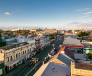
The district Banksia of in Rockdale (New South Wales) with it's 3,231 residents Banksia is a subburb located in Australia about 147 mi north-east of Canberra, the country's capital place.
Need some hints on where to stay? We compiled a list of available hotels close to the map centre further down the page.
Being here already, you might want to pay a visit to some of the following locations: Sydney, Parramatta, Katoomba, Canberra and . To further explore this place, just scroll down and browse the available info.
Local weather forecast
Todays Local Weather Conditions & Forecast: 22°C / 71 °F
| Morning Temperature | 17°C / 63 °F |
| Evening Temperature | 21°C / 69 °F |
| Night Temperature | 18°C / 65 °F |
| Chance of rainfall | 0% |
| Air Humidity | 60% |
| Air Pressure | 1026 hPa |
| Wind Speed | Moderate breeze with 12 km/h (7 mph) from South-West |
| Cloud Conditions | Overcast clouds, covering 100% of sky |
| General Conditions | Overcast clouds |
Friday, 22nd of November 2024
23°C (73 °F)
20°C (68 °F)
Sky is clear, moderate breeze, clear sky.
Saturday, 23rd of November 2024
24°C (76 °F)
20°C (68 °F)
Sky is clear, fresh breeze, clear sky.
Sunday, 24th of November 2024
25°C (78 °F)
21°C (70 °F)
Scattered clouds, fresh breeze, broken clouds.
Hotels and Places to Stay
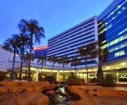
Stamford Plaza Sydney Airport
Pullman Sydney Airport
The Urban Newtown
Novotel Sydney Brighton Beach
Ryals Serviced Apartments Camperdown
Quest Mascot
Adina Sydney Airport
Mercure Sydney International Airport
Amaaze Airport Serviced Apartments
Ashfield Motor Inn
Videos from this area
These are videos related to the place based on their proximity to this place.
City Ford Rockdale Rockdale Perfect 5 Star Review by Shirley M.
http://cityfordrockdale.com.au 1300 852 632 City Ford Rockdale Ford Sydney reviews 5 Star Rating I just wanted to say a big thank you to Steve and the team at City Ford Rockdale....
The Trip
Acrylic, Marker, Enamel Painting by Doke AKA Michael Birchall August 2008 Sydney Australia some-things.net.
Nepalese momo / dumplings (chicken and veg) - Part 1
Read full article on this video at - [ http://j.mp/cooking-momo-recipe ] where you can find momo / dumpling recipes, how to make momo sauce / chutney and how to wrap and cook momo Nepalese...
Design Tiles Showroom Virtual Tour
Virtual tour of Design Tiles Rockdale Showroom. Showroom Location: 413 Princes Highway Rockdale NSW 2216 9am to 5pm: Mon to Fri 10am to 4pm: Sat/Sun Our aim is to provide customers with...
Pizza Delivery Bexley 3
http://www.aussiepizzas.com/PIZZADELIVERY/bexley-north-pizza-delivery-02-9556-2020-bexley-north/ The process of using Pizza Delivery in Bexley from one's favourite shop begins by having the...
Bexley Every Day Pizza Delivery Bexley 02 9556 2020
02 9556 2020 http://redhornpizza.com.au 2/645 Princes Hwy, Rockdale PIZZA HOME DELIVERY Bexley, After the pizza store gets the order, they right away start packing the pizza and determine...
Bexley Pizza Delivered To Your Home or Work
http://www.redhornpizza.com.au/menu.php 02 9556 2020 at 2/645 Princes Hwy, Rockdale Pizza HOME DELIVERY http://youtu.be/ADQZnkMB2CY Rockdale, Bexley, Banksia, Arncliffe, Wolli Creek, ...
Your Pizza Delivery Bardwell Valley Munch Munch
http://redhornpizza.com.au 2/645 Princes Hwy, Rockdale 2216 02 9556 2020 Bardwell ValleyPizzas http://www.aussiepizzas.com/PIZZADELIVERY/pizza-delivery-bardwell-park/ and ...
Videos provided by Youtube are under the copyright of their owners.
Attractions and noteworthy things
Distances are based on the centre of the city/town and sightseeing location. This list contains brief abstracts about monuments, holiday activities, national parcs, museums, organisations and more from the area as well as interesting facts about the region itself. Where available, you'll find the corresponding homepage. Otherwise the related wikipedia article.
Arncliffe, New South Wales
Arncliffe is a suburb in southern Sydney, in the state of New South Wales, Australia. Arncliffe is located 11 kilometres south of the Sydney central business district, in the local government area of the City of Rockdale. Arncliffe is part of the St George area. Arncliffe is located south of the Cooks River and Wolli Creek, close to Sydney Airport.
Division of Barton
The Division of Barton is an Australian electoral division in New South Wales. The division was created in 1922 and is named for Sir Edmund Barton, the first Prime Minister of Australia.
Rockdale, New South Wales
For the local government area, see the City of Rockdale.
Arncliffe railway station
Arncliffe railway station is located on the CityRail Illawarra railway line in the southern Sydney suburb of Arncliffe. It consists of two island platforms with access via an overhead concourse and booking office at the southern end.
Rockdale railway station
Rockdale railway station is located on the ]]Illawarra railway line serving the southern Sydney suburb of Rockdale, the administrative centre for the local government area of the City of Rockdale. It consists of five platforms, only four of which are currently in use. Located nearby are sidings for permanent way maintenance vehicles. The station sits beside a major State Transit Authority bus interchange.
Banksia railway station
Banksia railway station is located on the Illawarra railway line of Sydney's CityRail network, in the southern Sydney suburb of Banksia. It consists of two island platforms, with access via a pedestrian subway at the northern (citybound) end. The ticket office is located in the subway. Access is provided west to Railway Street and east to Hattersley Street and the Princes Highway.
Turrella, New South Wales
Turrella is a suburb in southern Sydney, in the state of New South Wales, Australia. Turrella is located 10 km south of the Sydney central business district on the southern bank of Wolli Creek. Turrella is in the local government area of the City of Rockdale and is part of the St George area. Turrella is a mostly residential area. Some light industrial developments are located around Turrella railway station and north along the railway line.
Kyeemagh, New South Wales
Kyeemagh is a suburb in southern Sydney, in the state of New South Wales, Australia. It is 12 kilometres south of the Sydney central business district, on the western shore of Botany Bay. Kyeemagh is in the local government area of the City of Rockdale and is part of the St George area.
Wolli Creek
Wolli Creek is an urban waterway of southern Sydney, New South Wales, Australia. The sub-catchment is 22 km². Wolli Creek rises at Beverly Hills, at Beverly Hills Park, its major tributary being Bardwell Creek. It is a lined channel between Kingsgrove Road, Kingsgrove and Bexley Road, Bexley North where it then enters the Wolli Creek Valley. Wolli Creek feeds into the Cooks River near the suburbs of Arncliffe and Tempe.
Banksia, New South Wales
Banksia is a suburb in southern Sydney, in the state of New South Wales, Australia. Banksia is located 12 kilometres south of the Sydney central business district, in the local government area of the City of Rockdale and is part of the St George area.
St George Girls High School
St George Girls High School is an academically selective, public high school for girls, located in Kogarah, a Southern Suburb of Sydney, New South Wales, Australia. Established in 1916 and operated by the New South Wales Department of Education and Training, the school currently caters for approximately 935 students from Years 7 to 12. For first year entry, students must sit the Selective High Schools Test and are offered admission into the school based on academic merit.
Bardwell Valley, New South Wales
Bardwell Valley is a suburb in southern Sydney, in the state of New South Wales, Australia. Bardwell Valley is located approximately 12 kilometres south of the Sydney central business district, in the local government area of the City of Rockdale and is part of the St George area. Bardwell Valley is a primarily residential area. Some beautiful sandstone cottages from the early 20th century still stand in East Street and The Glen Road.
Turrella railway station
Turrella is a railway station on Sydney's CityRail East Hills Line. It serves the Sydney suburb of Turrella. The station has a single island platform serving the local tracks, which retains its 1930s original brick station building. As is the convention in Sydney, platform 1 is for Sydney bound trains, and platform 2 is for outbound trains towards East Hills.
Marist College Kogarah
Marist College Kogarah is a systemic Catholic College for boys from Years 7 to 12, located in Bexley, New South Wales, Australia. The College was founded in 1909, and has a tradition based on the teachings of the French educator Saint Marcellin Champagnat. The school offers education to approximately 1200 students in the St George area of Sydney.
St George Stadium
St. George Soccer Stadium is a recently-reopened football stadium in Banksia, New South Wales, Australia.
Kogarah High School
Kogarah High School is a comprehensive co-educational school located in Kogarah NSW
Aspley State High School
Aspley State High School is a secondary school situated in Brisbane's northern suburbs.
Arncliffe Public School
Arncliffe Public School is a public primary school in the suburb of Arncliffe in Sydney, New South Wales, Australia. It is bounded by the Princes Highway, Avenal Street and Segenhoe Street.
Rockdale Ilinden Sports Centre
Rockdale Ilinden Sports Centre was located on the grounds of Barton Park in Arncliffe, New South Wales in Australia. It was the home ground of the Rockdale Ilinden Football Club, who played in the New South Wales Super League. A new Rockdale Illenden Sports Centre has been constructed at Bicentennial Park, 468 West Botany Street, Rockdale. It is the home of the Rockdale City Suns Football Club. The old centre is located near St George Stadium, a football ground used by the St. George Saints.
Bicentennial Park South
Bicentennial Park South is a football (soccer) stadium in Rockdale, a suburb of Sydney in New South Wales, Australia. Redevelopment of the venue started in October 2008, and finished in September 2009 to become the new home of New South Wales Premier League team, the Rockdale City Suns.
Al-Zahra Mosque
The Fatima Al-Zahra Mosque is a shia islamic mosque located in the Arncliffe suburb of Sydney, Australia. The mosque is one of the largest in Australia 30px This mosque or other Islamic place of worship article is a stub. You can help Wikipedia by expanding it. vte {{#invoke: Navbox | navbox }} established: 1980 religion: shia islam
Earl Park, Arncliffe
Earl Park is the name of a former sports field in the Sydney suburb of Arncliffe. From 1925 to 1939 it was the site of New South Wales Rugby Football League Premiership club, St. George's home ground and headquarters.
Lucasville, New South Wales
Lucasville is a dis-used railway station on the Lapstone Zig Zag closed in 1892.
Wolli Creek Regional Park
The Wolli Creek Regional Park is a regional park found in South-West Sydney, between Bexley North and Tempe, New South Wales, Australia, within an area of 50 hectares of native bushland and public reserves of the Wolli Creek Valley. It is the only large, open space that remains in a heavily developed residential and industrial region.
Rockdale Town Hall
Rockdale Town Hall is a civic building located on the corner of Princes Highway and Bryant Street in Rockdale, a suburb of Sydney, Australia.


