Discover Lake Innes
The district Lake Innes of Lake Cathie in Port Macquarie-Hastings (New South Wales) is a district in Australia about 337 mi north-east of Canberra, the country's capital city.
Looking for a place to stay? we compiled a list of available hotels close to the map centre further down the page.
When in this area, you might want to pay a visit to some of the following locations: Carrolls Creek, Sydney, Parramatta, Katoomba and Brisbane. To further explore this place, just scroll down and browse the available info.
Local weather forecast
Todays Local Weather Conditions & Forecast: 25°C / 77 °F
| Morning Temperature | 18°C / 65 °F |
| Evening Temperature | 23°C / 74 °F |
| Night Temperature | 23°C / 73 °F |
| Chance of rainfall | 0% |
| Air Humidity | 64% |
| Air Pressure | 1018 hPa |
| Wind Speed | Fresh Breeze with 16 km/h (10 mph) from South |
| Cloud Conditions | Overcast clouds, covering 100% of sky |
| General Conditions | Light rain |
Monday, 18th of November 2024
22°C (71 °F)
20°C (68 °F)
Moderate rain, moderate breeze, overcast clouds.
Tuesday, 19th of November 2024
21°C (70 °F)
18°C (64 °F)
Overcast clouds, moderate breeze.
Wednesday, 20th of November 2024
21°C (70 °F)
19°C (67 °F)
Overcast clouds, gentle breeze.
Hotels and Places to Stay
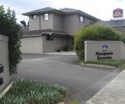
Macquarie Barracks Motor Inn
Aston Hill Motor Lodge
Sails Resort Port Macquarie - By Rydges
Narimba Motel
Golden Chain Port O'call Motel
Videos from this area
These are videos related to the place based on their proximity to this place.
Port Macquarie Seaplane Takeoff
Taking off in a Cessna 206 Seaplane in Port Macquarie with Rob Neza in the left seat.
Year 7 Experience - St Paul's High School, Port Macquarie
Year 7 at St Paul's High School, Port Macquarie.
Port Macquarie, Australian Salmon
In a backyard at Port Macquarie NSW Australia. Not for the squeamish. Scaling, Gutting and Filleting a couple of 3kg Australian Salmon with a curious onlooker.
Livvi's Place Westport Park Port Macquarie NSW
Livvi's Place - Westport Park - Port Macquarie The playground at Westport Park incorporates an accessible tree house, a lighthouse, water play, barbecue facilities and a pirate ship, it is...
XPT, Kempsey to Johns River
Southbound XPT north of Kempsey, then crossing the Hastings River at Wauchope, at Rossglen , finally near Johns River.
Cirrus SR20 Grass Airfield Takeoff and Landing
Takeoff and landing in an SR20 on the grass strip at Dexfield Park. The landing is over trees 80ft above the touchdown point. Measured takeoff and landing distances were well under the POH...
Virgin Australia ATR 72 Port Macquarie Landing
Arriving home in Port Macquarie in December 2011 on connecting flight from Sydney after holiday in Adelaide. Virgin's then new ATR 72 flights to Port Macquarie. The turboprops have replaced...
Videos provided by Youtube are under the copyright of their owners.
Attractions and noteworthy things
Distances are based on the centre of the city/town and sightseeing location. This list contains brief abstracts about monuments, holiday activities, national parcs, museums, organisations and more from the area as well as interesting facts about the region itself. Where available, you'll find the corresponding homepage. Otherwise the related wikipedia article.
Dooragan National Park
Dooragan is a national park near Laurieton, New South Wales, Australia, approximately 365 km northeast of Sydney.
Port Macquarie
Port Macquarie is a city on the Mid North Coast of New South Wales, Australia, about 390 km north of Sydney, and 570 km south of Brisbane. The city is located on the coast, at the mouth of the Hastings River, and as a suburb had a population of 41,491 in 2011. (The population of the Port Macquarie local government area was 72,696.)
Wauchope, New South Wales
Wauchope /ˈwɔːhoʊp/ is a town in the Mid North Coast region of New South Wales, Australia. It is within the boundaries of the Port Macquarie-Hastings Council area. Wauchope is inland on the Hastings River and the Oxley Highway 19 km west of Port Macquarie. The town is 406 km north of the state capital Sydney. Wauchope is the location of Timbertown, a popular heritage theme park based around the logging industry that formed the basis for Wauchope's early economy and prosperity.
Port Macquarie-Hastings Council
Port Macquarie-Hastings Council is a local government area in the mid north coast region of New South Wales, Australia. The area is located adjacent to the Hastings River, the Pacific Highway, the Oxley Highway and the North Coast railway line. Major population centres in the local government area are Port Macquarie, Camden Haven, Wauchope, Lake Cathie and Kendall. The Mayor of the Port Macquarie-Hastings Council is Cr. Peter Besseling, an independent politician.
Lake Cathie, New South Wales
Lake Cathie is a town in New South Wales, Australia about 15 minutes drive south of Port Macquarie and has a permanent population of 2,009. The town is a popular holiday destination on the Mid North Coast because of its tranquil location which hosts the lake, lagoon and beaches. It has a Woolworths supermarket, local Tavern, Lake Cathie Bowling Club, bakery, fish & chip shop, coffee shop, pharmacy, post office, a newsagent and a bargain shop.
Kew, New South Wales
Kew, New South Wales is a small town in the Mid North Coast region of New South Wales, Australia in the Port Macquarie-Hastings Council local government area. Kew is one of the communities that make up the Camden Haven district of Port Macquarie-Hastings. Kew is located at the intersection of the Pacific Highway and Ocean Drive, the road to the larger town of Laurieton. Kew has a pub, a post office, a small police station, a motel, a roadhouse and a general store.
Big Bull
The Big Bull was a large (14 metres x 21 metres) cement Holstein bull located near Wauchope, New South Wales, Australia. When open, it contained a gift shop on the ground floor and a beef display. It was located just off the Oxley Highway between Wauchope and the Pacific Highway. The structure was torn down in October 2007. {{#invoke:Coordinates|coord}}{{#coordinates:31|26.3514|S|152|44.5662|E|region:AU_type:mountain_source:GNS-enwiki|| |primary |name= }}
Three Brothers (New South Wales)
The Three Brothers are three mountains in the Camden Haven district on the Mid North Coast of New South Wales, Australia. They were named by Captain James Cook during his voyage along the east coast of Australia in May 1770.
Kendall, New South Wales
Kendall is a town on the Mid North Coast of New South Wales, Australia. Kendall was originally named Camden Heads, as it is located on the Camden Haven River. In was renamed Kendall, in 1891, after the Australian poet Henry Kendall, and not, as some tourists suspect, after the similarly-spelled ancient town of Kendal in the County of Cumbria in England. Henry Kendall lived in the area from 1875 to 1881 when he was the first Forest Inspector for New South Wales.
Laurieton, New South Wales
Laurieton is a coastal town on the Mid North Coast of the Australian state of New South Wales. Laurieton is the largest town in the Camden Haven district. Laurieton is 365 km north of Sydney and 42 km south of Port Macquarie. It lies between the base of North Brother Mountain and the Camden Haven River. The largest school in the district, Camden Haven High School, is located approximately 5 km away from Laurieton's shopping and business centre.
Telegraph Point, New South Wales
Telegraph Point is a small village on the North Coast of New South Wales, Australia. It is located on the Pacific Highway north of Port Macquarie, and on the North Coast railway line. The Wilson River passes beside the village. In the 2011 Census the population of Telegraph Point was 619, 52.7% male and 48.3% female. The median/average age of the Telegraph Point population is 46 years — 9 years above the Australian average.
Camden Haven High School
Camden Haven High School is a rural school in New South Wales, Australia. Consisting of over a thousand students, the school presents both distance educational and face-to-face education. The school is 2 km off the Pacific Highway turning East at the Kew traffic lights intersection. Camden Haven High School (CHHS) opened in 2000. A united school culture has been developed by establishing across school management, curriculum and special programs working teams.
ABC Mid North Coast
ABC Mid North Coast is an ABC Local Radio station based in Port Macquarie and broadcasting to the Mid North Coast region in New South Wales. This includes the towns and cities of Coffs Harbour, Taree, Kempsey and Grafton. The station began as 2KP in 1954 originally as a relay of the national program. Studios were opened in Kempsey in 1956 but local news came from 2NR in Grafton until 1960 when the first locally produced bulletins began.
Camden Haven
Camden Haven is a small harbour in the Mid North Coast region of New South Wales, Australia, approximately 30 km south of the major regional centre of Port Macquarie. The harbour is located where the Camden Haven River empties into the Tasman Sea. Camden Haven is also the name given to a group of settlements located on the shores of Camden Haven and in the rural hinterland. Laurieton is the largest town and the commercial centre for Camden Haven, located on the harbour's western shore.
List of shipwrecks in 1992
The list of shipwrecks in 1992 includes all ships sunk, foundered, grounded, or otherwise lost during 1992.
North Haven, New South Wales
North Haven is a suburb in the Camden Haven district on the Mid North Coast of New South Wales, Australia. As the suburb's name suggests, North Haven is located on the northern shore of Camden Haven and is connected to the nearby commercial centre of Laurieton by a bridge. North Haven is mainly residential, though there is a small row of shops along the main street, Ocean Drive.
Bonny Hills, New South Wales
Bonny Hills is a town in New South Wales, Australia about 30 minutes drive south of Port Macquarie. In 2006, it had a population of 2,540 people. Bonny Hills has a service station, local Tavern, local beach, two holiday parks, post office and a fire station.
Australian floating crane Titan
Titan was a floating crane that operated in Sydney Harbour from 1919 until 1991. She was fabricated in Carlisle in the United Kingdom, then sent to Cockatoo Island Dockyard in Sydney for assembly, before entering service with the Royal Australian Navy (RAN). After being declared surplus to requirements, the crane became the property of Cockatoo Island Dockyard, which operated it until the dockyard's closure in 1991.
Herons Creek, New South Wales
Herons Creek is a small township on the North Coast of New South Wales, Australia. The North Coast railway line passes through, and a station existed at the site between 1917 and 1974. Film director Baz Luhrmann was raised in the town.
Batar railway station
Batar was the name of a railway station on the North Coast railway line on the North Coast of New South Wales, Australia. The station, named for the nearby Batar Creek, existed at the site between 1941 and 1971.
Port Macquarie Regional Stadium
The Port Macquarie Regional Stadium was constructed in 1992 with funding assistance by NSW Sport & Recreation, NSW Country Rugby League and Hastings Council, making the venue become a primary location of rugby league in the New South Wales' North Coast region. The venue has recently been constructed with a 1,000 seat grandstand, transforming the area from a playing field to a genuine high quality sports stadium.
Billabong Koala and Wildlife Park
Billabong Koala and Wildlife Park is a 5-acre wildlife park and koala breeding center located in Port Macquarie, New South Wales, Australia. It was opened in 1989, and features a wide variety of Australian and exotic animals. It is known world wide as a breeding centre for koalas.
Dennis Bridge
The Dennis Bridge is a steel truss bridge which carries the Pacific Highway across the Hastings River near Port Macquarie, Australia. It was opened in December 1961 as part of a project to replace the Blackmans Point ferry across the Hastings River and to bypass Port Macquarie. As well as the Dennis Bridge, this project included a 10 km deviation of the Pacific Highway and a 3 km connecting road from the old to the new highway route (Hastings River Drive).
Port Macquarie High School
Port Macquarie High School is a comprehensive regional public school in New South Wales, Australia. Port Macquarie High School (PMHS) opened in 1962 in Port Macquarie, but was not open to students until 1963. The school educates years 7-12 with a standard range of subjects being taught. School enrolment numbers have recently dwindled as a result of the stagnation of population in its zone.


