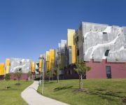
Delve into Erskine Park
The district Erskine Park of in Penrith Municipality (New South Wales) is a subburb in Australia about 139 mi north-east of Canberra, the country's capital town.
If you need a hotel, we compiled a list of available hotels close to the map centre further down the page.
While being here, you might want to pay a visit to some of the following locations: Parramatta, Sydney, Katoomba, Canberra and . To further explore this place, just scroll down and browse the available info.
Local weather forecast
Todays Local Weather Conditions & Forecast: 23°C / 73 °F
| Morning Temperature | 17°C / 62 °F |
| Evening Temperature | 24°C / 75 °F |
| Night Temperature | 21°C / 69 °F |
| Chance of rainfall | 0% |
| Air Humidity | 68% |
| Air Pressure | 1021 hPa |
| Wind Speed | Moderate breeze with 9 km/h (6 mph) from West |
| Cloud Conditions | Overcast clouds, covering 99% of sky |
| General Conditions | Light rain |
Sunday, 17th of November 2024
35°C (94 °F)
20°C (67 °F)
Heavy intensity rain, moderate breeze, overcast clouds.
Monday, 18th of November 2024
30°C (86 °F)
18°C (64 °F)
Light rain, moderate breeze, overcast clouds.
Tuesday, 19th of November 2024
24°C (75 °F)
17°C (63 °F)
Scattered clouds, moderate breeze.
Hotels and Places to Stay
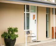
St. Marys Park View Motel
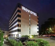
Novotel Sydney Rooty Hill
Colyton Hotel
Blue Cattle Dog Hotel
ALPHA EASTERN CREEK
Western Sydney University Village Penrith
Holiday Inn SYDNEY ST MARYS
Videos from this area
These are videos related to the place based on their proximity to this place.
Palm Sunday Mass قداس عيد السعانين
الاب الفاضل جوزيف يقيم مراسيم القاس عيد السعانين في كنيسة مار يوسف سيدني ماونت دروت Palm sunday Mass: Father Joseph resides...
Car City Minchinbury Do you know why I love Car City Minchinbury 30 seconds August 2009
Car City over 1000 used cars and 20 dealers. Cheap Cars - Great deals. 12 month extended warranty, 12 months on road assist and for the right car LPG Conversion - Free! http://www.carcity.com.au.
My chips are HOT part 2
RBT Erskine Park NSW If you don't like what I do, don't lower yourself by posting comments! Dash Cam55 is everywhere! Dash Cam55 sees everything! Dash Cam55 displays! Camera purchased...
ANP 10R Good driver NOT
Doh, I couldn't put my brakes on properly or steer my car properly. If you don't like what I do, don't bother typing your comments will not be approved! Dash Cam55 is everywhere! Dash Cam55...
Everybody can
Semi driver uses indicators correctly! So can you! If you don't like what I do, don't lower yourself by posting comments! Dash Cam55 is everywhere! Dash Cam55 sees everything! Dash Cam55...
The Lawyer drives a Ferrari
If you don't like what I do, don't bother typing your comments will not be approved! Dash Cam55 is everywhere! Dash Cam55 sees everything! Dash Cam55 displays! I've had enough of listing the...
Bitch cut me off big time
The wife and I were going shopping, look at the mother and child on the footpath! If you don't like what I do, don't lower yourself by posting comments! Dash Cam55 is everywhere! Dash Cam55...
Mustang fishtailing on Erskine Park Drive St Clair
Just another fool trying to get his car confiscated by the Police! Dash Cam55 is everywhere! Dash Cam55 sees everything! Dash Cam55 displays! I've had enough of listing the offences you decide!...
Street Racing past St Marys Police Station
If you don't like what I do, don't lower yourself by posting comments! A Red P Plater and his bum chum going for it! Dash Cam55 is everywhere! Dash Cam55 sees everything! Dash Cam55 displays!...
Videos provided by Youtube are under the copyright of their owners.
Attractions and noteworthy things
Distances are based on the centre of the city/town and sightseeing location. This list contains brief abstracts about monuments, holiday activities, national parcs, museums, organisations and more from the area as well as interesting facts about the region itself. Where available, you'll find the corresponding homepage. Otherwise the related wikipedia article.
The Bush Beast
The Bush Beast was a wooden roller coaster located at Wonderland Sydney in Australia. The ride opened with the park on 7 December 1985 and closed with the park on 26 April 2004. The ride features a mirrored layout to that of other wooden roller coasters located at California's Great America, Canada's Wonderland, and Kings Dominion. The Bush Beast was manufacturered by Taft Broadcasting.
Mills Cross Telescope
Mills Cross Telescope was a two-dimensional radio telescope built by Bernard Mills in 1954 at the Fleurs field station of the Australian Commonwealth Scientific and Industrial Research Organisation in the area known now as Badgerys Creek, about 40 km west of Sydney, New South Wales, Australia. Each arm of the cross was 1500 feet (450m) long, running N-S and E-W, and produced a fan beam in the sky. Mills said it "...
South Creek (New South Wales)
South Creek is a creek in New South Wales, Australia.
Mount Druitt Hospital
Mount Druitt Hospital is a 200-bed hospital in Sydney suburb of Mount Druitt, New South Wales, Australia. It was opened by Her Majesty Queen Elizabeth II in October 1982, and was designed by Lawrence Nield in 1980. The hospital consists of 120 beds for general medical and surgical use, 62 beds for paediatrics, five intensive care beds (these were removed in 2005), and 13 day-only observation beds. The three commissioned operating theatres have eight beds for recovery.
Rooty Hill railway station
Rooty Hill is a railway station on the Western railway line, Sydney, Australia of the CityRail network. It serves a well established residential area. It has four tracks, and the tracks are paired by direction. This means that all trains to the city leave from the same island platform, so if the train happens to travel on the unexpected track, it is a simple thing to walk over to the other platform. Rooty Hill does not yet have Easy Access for wheelchairs.
Mount Druitt railway station
Mount Druitt railway station is on the Western line, Sydney of the CityRail network. It serves a well established residential, educational and commercial area. It has four tracks, paired by direction. This means that all trains to the city leave from the same island platform, so if the train happens to travel on the unexpected track, it is a simple thing to walk over to the other platform.
Mount Druitt
Mount Druitt is a suburb of Sydney, in the state of New South Wales, Australia. Mount Druitt is located 43 kilometres (27 mi) west of the Sydney central business district, in the local government area of the City of Blacktown, and is part of the Greater Western Sydney region. There are numerous encompassing, smaller suburbs nearby including Bidwill, Blackett, Whalan, Tregear, Lethbridge Park and Emerton. The area is one of the poorest suburbs in Sydney and the state of New South Wales.
Emerton, New South Wales
Emerton is a suburb of Sydney, in the state of New South Wales, Australia. Emerton is located 46 kilometres west of the Sydney central business district, in the local government area of the City of Blacktown and is part of the Greater Western Sydney region. Emerton is primarily a residential suburb with very limited commercial activity centered around the Emerton Leisure Centre. It is quite close to the suburbs of Mount Druitt, New South Wales and St Marys.
St Marys, New South Wales
St Marys is a suburb in western Sydney, in the state of New South Wales Australia. It is 45 kilometres west of the Sydney central business district, in the local government area of the City of Penrith. St Marys sits between South Creek which forms the western boundary and Ropes Creek, its eastern boundary.
St Clair, New South Wales
St Clair is a suburb of Sydney, in the state of New South Wales, Australia. It is 49 kilometres west of the Sydney central business district, in the local government area of the City of Penrith and is part of the Greater Western Sydney region. St Clair is within view of the Blue Mountains.
Oxley Park, New South Wales
Oxley Park is a suburb of Sydney, in the state of New South Wales, Australia on the easternmost side of the City of Penrith Local Government Area. It is 43 kilometres west of the Sydney central business district, in the local government area of the City of Penrith and is part of the Greater Western Sydney region.
Kemps Creek, New South Wales
Kemps Creek is a suburb of Sydney, in the state of New South Wales, Australia. It is 39 kilometres west of the Sydney central business district, in the local government areas of the City of Penrith and City of Liverpool. It is part of the Greater Western Sydney region.
Mount Vernon, New South Wales
Mount Vernon is a suburb of Sydney, in the state of New South Wales, Australia. Mount Vernon is 42 kilometres west of the Sydney central business district, in the local government area of the City of Penrith and is part of the Greater Western Sydney region. Mount Vernon is a sparsely populated rural suburb providing a close community atmosphere for its residents. It is a hilly suburb with spectacular views all the way to the Blue Mountains ensuring high scenic qualities.
Erskine Park, New South Wales
Erskine Park is a suburb of Sydney in the state of New South Wales, Australia. Erskine Park is located 42 kilometres west of the Sydney central business district, in the local government area of the City of Penrith and is part of the Greater Western Sydney region. Erskine Park is a growing, predominately residential suburb with some industrial developments. The suburb has a high school, primary school and some local shops.
Claremont Meadows, New South Wales
Claremont Meadows is a suburb of Sydney, in the state of New South Wales Australia. Claremont Meadows is located 45 kilometres west of the Sydney central business district, in the local government area of the City of Penrith and is part of the Greater Western Sydney region.
Colyton, New South Wales
Colyton is a suburb of Sydney, in the state of New South Wales, Australia 43 kilometres west of the Sydney central business district, in the local government area of the City of Penrith. It is part of the Greater Western Sydney region. Colyton is the easternmost suburb of the City of Penrith. Its boundaries are Ropes Creek, the Great Western Highway, Marsden Road and the M4 Western Motorway.
St Marys railway station, Sydney
St Marys is a railway station on the Western line, Sydney of the CityRail network. It has four tracks, and the tracks are paired by direction down/down/up/up. This means that all trains to the city leave from the same island platform, so if a train happens to travel on the unexpected track, it is merely a matter of walking to the other side of the island platform. All four platforms can have trains terminated on and sent back to the origin station.
Wonderland Sydney
Wonderland Sydney, originally known as Australia's Wonderland was a theme park in Sydney, New South Wales, Australia. The park was the largest one in the southern hemisphere. It remained open for almost 19 years and was the premier theme park in New South Wales for much of its life but closed in 2004. Its final day of trading was 26 April 2004.
Chifley College Senior Campus
Chifley College Senior Campus is located in Mount Druitt, New South Wales, Australia. It is one of the five schools within Chifley College and is locally known as Chifley Senior.
Mount Druitt Aerodrome
Mount Druitt Aerodrome was a Royal Australian Air Force (RAAF) landing ground during World War II at Mount Druitt, New South Wales, Australia. Land was resumed in March 1942, for the construction of an aerodrome, two aircraft hangars and workshops on the site. The runway was 5000ft (1524m) long x 159ft (48.46m) wide.
St Marys Senior High School
St Marys Senior High School is an academically comprehensive senior high school. It is a post-compulsory, public, co-educational, senior high school, located in St Marys, a Western Suburb of Sydney, New South Wales, Australia. Established in 1989, the school is the first NSW Government senior high school and currently caters for approximately 850-900 students from Years 11 and 12.
2WOW
Wow FM (100.7 FM, callsign "2WOW") is a community radio station based in St Marys in Sydney. The station broadcasts to part of Western Sydney, mainly centered around the City of Penrith. Wow FM is a volunteer run organisation and is funded through listener support, grants and limited commercial sponsorship.
Fleurs Aerodrome
Fleurs Aerodrome was a parent aerodrome built on behalf of the Royal Australian Air Force near Penrith, New South Wales, Australia during World War II. Construction started on the aerodrome in 1942 and was still under construction in 1944 as part of a proposal to base a United States Navy Fleet Air Wing in Sydney should the need arise. Initially planned with three runways, No.1 (5000 ft) and No. 3 (6000 ft) runways were serviceable, however construction of No. 2 runway (5000 ft) was abandoned.
Loyola Senior High School, Mount Druitt
Loyola Senior High School is a Roman Catholic co-educational day school for students years 11-12 located in Mount Druitt, New South Wales, Australia. An Ignatian school in the tradition of St Ignatius of Loyola, it is situated in Sydney's Western Suburbs in a seven hectare lightly wooded, landscaped site which received the Sulman Award from the Royal Institute of Architects for its design.
Space Probe (Wonderland Sydney)
Space Probe was a Giant Drop ride located at Wonderland Sydney in Australia. It was manufactured by Intamin and opened as the world's tallest and fastest free-fall ride. The ride opened in November 1995 and closed on 26 April 2004.


