Delve into Warabrook
The district Warabrook of in Newcastle (New South Wales) is a subburb in Australia about 222 mi north-east of Canberra, the country's capital town.
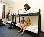
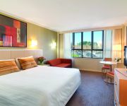
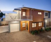
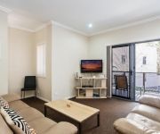
If you need a hotel, we compiled a list of available hotels close to the map centre further down the page.
While being here, you might want to pay a visit to some of the following locations: Sydney, Parramatta, Katoomba, Canberra and Carrolls Creek. To further explore this place, just scroll down and browse the available info.
Local weather forecast
Todays Local Weather Conditions & Forecast: 25°C / 77 °F
| Morning Temperature | 14°C / 57 °F |
| Evening Temperature | 24°C / 75 °F |
| Night Temperature | 18°C / 64 °F |
| Chance of rainfall | 0% |
| Air Humidity | 48% |
| Air Pressure | 1020 hPa |
| Wind Speed | Moderate breeze with 11 km/h (7 mph) from West |
| Cloud Conditions | Clear sky, covering 6% of sky |
| General Conditions | Sky is clear |
Sunday, 24th of November 2024
27°C (81 °F)
20°C (69 °F)
Few clouds, moderate breeze.
Monday, 25th of November 2024
28°C (82 °F)
21°C (70 °F)
Overcast clouds, fresh breeze.
Tuesday, 26th of November 2024
28°C (82 °F)
21°C (70 °F)
Moderate rain, moderate breeze, broken clouds.
Hotels and Places to Stay
The Star Apartments
The Executive Inn Newcastle
QUEST NEWCASTLE
Travelodge Newcastle
Merewether Motel
Newcastle Central Plaza
THE COSMOPOLITAN APARTMENTS
BEST WESTERN BLACKBUTT INN
Hamilton on Everton
BLUEGUM APARTMENTS
Videos from this area
These are videos related to the place based on their proximity to this place.
Campdrafting - 2015 IGA Newcastle Regional Show - Newcastle NSW Australia
The Campdrafting competition in the Centre Ring of the 2015 IGA Newcastle Show in Newcastle NSW Australia. www.huntertv.com.au Baileys of Greta Camp Drafting Newcastle Australia.
Carly and Tresne - 2015 Newcastle Show - Newcastle Australia
Benn Allsop chats to Carly and Tresne from MKR My Kitchen Rules at the 2015 Newcastle Show in Newcastle NSW Australia. Newcastle Australia.
Connor Wink Performs Newcastle Show Launch 2015
Connor Wink from Charlestown in Newcastle NSW Australia performed at the Newcastle Show Media Launch on the 24th February 2015.
Newcastle Regional Show 2015 Media Launch
Darren McErlain reports from the IGA Newcastle Show in 2015. Karen howard liberal liberals candidate connor wink dana pichaloff newcastle nsw australia sherrie and dave.
Circus Whip Cracking Tricks
Bill showing everyone at the Juggling Convention how to crack whips and how it is scored. Bill is one of the top 5 whip crackers in Australia. http://www.weirderthebetter.com.au/shop/ Contact...
Marinators - Newcastle away 26.12.2008 kickoffaustralia
Marinators - Newcastle v Central Coast (26.12.08) - Round 17 kickoffaustralia.
newcastle markets
http://www.eatatpippis.com.au or find our faceBook page and like us Just a quick snippet of what to expect at the farmers markets if you havent already been.
Videos provided by Youtube are under the copyright of their owners.
Attractions and noteworthy things
Distances are based on the centre of the city/town and sightseeing location. This list contains brief abstracts about monuments, holiday activities, national parcs, museums, organisations and more from the area as well as interesting facts about the region itself. Where available, you'll find the corresponding homepage. Otherwise the related wikipedia article.
University of Newcastle (Australia)
The University of Newcastle (UoN, informally known as Newcastle University) is an Australian public university established in 1965. The University's primary campus is located at Callaghan, a suburb of Newcastle, New South Wales. The University also operates from campuses at Ourimbah, Port Macquarie, Singapore and the central business districts of Newcastle and Sydney.
2HD
2HD is an Australian radio station, serving the lower Hunter Region. It operates at 1143 kHz on the AM band, from its studios along the Pacific Highway in the Newcastle suburb of Sandgate. Its power output is 2 kW. The station also has a translator in Port Stephens, on 97.5 MHz in the FM band. It is owned by Broadcast Operations Group (itself owned by Bill Caralis), and is a sister station to New FM.
Newcastle International Sports Centre
Newcastle International Sports Centre, known as Hunter Stadium from January 2012, is a multi-purpose sports stadium located in Newcastle, New South Wales, Australia. It is the home ground of the Newcastle Knights and the Newcastle United Jets teams. It is owned by the New South Wales government and administered by the Hunter Region Sporting Venues Authority. Due to past sponsorship deals, the ground has been previously known as Marathon Stadium, EnergyAustralia Stadium and Ausgrid Stadium.
Waratah, New South Wales
Waratah is a north-western residential suburb of Newcastle, New South Wales, Australia 6 kilometres from Newcastle's central business district and bounded on the north by the Main North line. Waratah station was opened in 1858 and is served by CityRail's Hunter line.
Lambton, New South Wales
Lambton is a suburb of Newcastle, New South Wales, Australia, 8 kilometres from Newcastle's central business district.
Waratah railway station
Waratah railway station is a station on the New South Wales Main Northern Line located in the Newcastle suburb of Waratah. The station consists of 2 platforms and is served by CityRail's Hunter line. It opened on 9 March 1858.
Warabrook railway station
Warabrook railway station (also called Warabrook) is a station on the Hunter line, Newcastle, New South Wales, Australia. It is one of the newest stations built on the line and consists of an island platform. The station serves the nearby University of Newcastle, and was opened on 23 October 1995, after a campaign by the Newcastle University Students' Association.
Sandgate railway station, New South Wales
Sandgate is a railway station on the Hunter line section of the Main North railway line, north of Newcastle, New South Wales, Australia. The station was opened in 1881 and the construction was originally called Grant's Creek. It serves the suburb of Sandgate, and once had a branch line which served Sandgate Cemetery. However, trains to Sandgate Cemetery did not stop at Sandgate station—the previous station was Waratah.
Mayfield, New South Wales
Mayfield is a north-western suburb of Newcastle, New South Wales, which takes its name from Ada May (b.1874) a daughter of the landowner there, John Scholey, J.P. Its boundaries are the Hunter River to the north, the Great Northern Railway on the south (Waratah Station), the main railway lines to Newcastle harbour on the east, and open ground in the west.
Lambton High School
Lambton High School 150px "Light The Way" Location Newcastle, New South Wales, Australia22x20px Coordinates coord}}{{#coordinates:32|55|8.8|S|151|43|13.5|E|type:edu_region:AU-NSW primary name= }} Information Type State run high school Established 1974 Principal Mr Martin Rosser Enrolment 1,107 Campus Urban Colour(s) Juniors-Navy Blue, Seniors-Fleece White Website Lambton High School Lambton High School is a co-educational, comprehensive, day school for students from Years 7-12 in the suburb of Lambton in Newcastle, New South Wales operated by the New South Wales Department of Education and Training.
Sandgate, New South Wales
Sandgate is a suburb of Newcastle, New South Wales, Australia, located 11 kilometres from Newcastle's central business district. It is part of the City of Newcastle local government area. It has a railway station on the Hunter Line. Sandgate is also home to the largest cemetery in Newcastle, including a now-derelict rail-head station, formerly used by funeral trains.
Kooragang Island
Kooragang Island is located in the Hunter River of New South Wales, Australia and is the site of a deep water port for the export of coal. In 2007, 84.8 million metric tons of coal were exported from the port, making it one of the busiest in the world. The infrastructure is being improved, for example with the Sandgate Flyover, this will allow the port to export 140 million tons of coal a year after 2010. The port first opened in about 1984.
Warabrook, New South Wales
Warabrook is a north-western suburb of Newcastle, New South Wales, Australia, located 8 kilometres from Newcastle's central business district. It is part of the City of Newcastle local government area. It has a railway station (opened in 1997 to serve the nearby University of Newcastle in Callaghan and Warabrook) on CityRail's Hunter line. The railway line is part of the Newcastle-Maitland line, the first section of the Main North line from Sydney to the New England region, opened in 1857.
Callaghan, New South Wales
Callaghan is a suburb of Newcastle, New South Wales, Australia 10 kilometres from Newcastle's central business district. It contains the main campus of the University of Newcastle. It is served by Warabrook station on CityRail's Hunter line. The suburb was named after Sir Bede Callaghan (1912-1993), Chancellor of the University of Newcastle from 1977 to 1988.
New Lambton Heights, New South Wales
New Lambton Heights is a suburb of Newcastle, New South Wales, Australia, located 9 kilometres west of Newcastle's central business district. It is split between the City of Lake Macquarie and City of Newcastle local government areas.
Jesmond, New South Wales
Jesmond is a suburb of the City of Newcastle LGA, located about 9.5 km west of the Newcastle CBD in the Hunter Region of New South Wales, Australia. It is both a commercial centre and dormitory suburb of Newcastle. Residents include Australian and international students attending the University of Newcastle in adjacent Callaghan. The suburb also has numerous aged housing facilities. The suburb is very multicultural due to many international university students.
Georgetown, New South Wales
Georgetown is a suburb of Newcastle, New South Wales, Australia, located 6 kilometres from Newcastle's central business district. It is part of the City of Newcastle local government area.
Mayfield North, New South Wales
Mayfield North is a suburb of Newcastle, New South Wales, Australia. It is basically an industrial estate, which extends north to the south arm of the Hunter River, west to Tourle Street, and south to Industrial Drive. Originally the estate comprised CSR Chemicals, Titans, Koppers, and part of the BHP Steelworks (No2 Merchant Mill, Rod Mill, Limestone Kiln and Spares Yard).
Mayfield West, New South Wales
Mayfield West is a suburb of Newcastle, New South Wales, Australia, located 8 kilometres from Newcastle's central business district. It is part of the City of Newcastle local government area.
Shortland, New South Wales
Shortland is a suburb of Newcastle, New South Wales, Australia, located 12 kilometres from Newcastle's central business district. It is part of the City of Newcastle local government area and was named after Lt. John Shortland, master's mate of the Sirius, the escorting vessel to the First Fleet.
North Lambton, New South Wales
North Lambton is a suburb of Newcastle, New South Wales, Australia, located 9 kilometres from Newcastle's central business district. It is part of the City of Newcastle local government area. North Lambton is a mostly housed area close to the Lambton City Centre.
Waratah West, New South Wales
Waratah West is a suburb of Newcastle, New South Wales, Australia, located 8 kilometres from Newcastle's central business district. It is part of the City of Newcastle local government area.
San Clemente High School (Mayfield, New South Wales)
San Clemente High School is a Catholic high school in the area of Mayfield, Newcastle, New South Wales, Australia.
Newcastle Boys' High School
Newcastle Boys High School was a selective high school located in Waratah—a suburb of Newcastle, New South Wales, Australia.
Callaghan College Waratah Technology Campus
Callaghan College Waratah Technology Campus (a campus of Callaghan College is a state-run high school, co-educational day school in Newcastle, located in the north-western residential suburb of Waratah, specialising in the use of technology; with an enrolment of approximately 550 students. As a specialist middle school in New South Wales, the school teaches Year 7–10 students in accordance with the state government's education curriculum, as determined by the Board of Studies.


