Delve into Marrickville
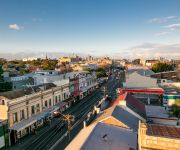
The district Marrickville of in New South Wales with it's 23,161 habitants Marrickville is a subburb in Australia about 149 mi north-east of Canberra, the country's capital town.
If you need a hotel, we compiled a list of available hotels close to the map centre further down the page.
While being here, you might want to pay a visit to some of the following locations: Sydney, Parramatta, Katoomba, Canberra and . To further explore this place, just scroll down and browse the available info.
Local weather forecast
Todays Local Weather Conditions & Forecast: 22°C / 71 °F
| Morning Temperature | 17°C / 62 °F |
| Evening Temperature | 21°C / 69 °F |
| Night Temperature | 18°C / 65 °F |
| Chance of rainfall | 0% |
| Air Humidity | 58% |
| Air Pressure | 1026 hPa |
| Wind Speed | Moderate breeze with 11 km/h (7 mph) from South-West |
| Cloud Conditions | Overcast clouds, covering 100% of sky |
| General Conditions | Overcast clouds |
Friday, 22nd of November 2024
23°C (74 °F)
20°C (67 °F)
Sky is clear, moderate breeze, clear sky.
Saturday, 23rd of November 2024
25°C (77 °F)
20°C (68 °F)
Sky is clear, fresh breeze, clear sky.
Sunday, 24th of November 2024
26°C (79 °F)
21°C (69 °F)
Scattered clouds, fresh breeze, broken clouds.
Hotels and Places to Stay
Stamford Plaza Sydney Airport
Pullman Sydney Airport
Quality Suites Camperdown
Adina Sydney Airport
BEST WESTERN HAVEN GLEBE
The Urban Newtown
Veriu Camperdown
Ryals Serviced Apartments Camperdown
Mercure Sydney International Airport
ibis Sydney Airport
Videos from this area
These are videos related to the place based on their proximity to this place.
CHOICE tests baby strollers
CHOOSE RIGHT. Access our latest stroller report http://www.choice.com.au/reviews-and-tests/babies-and-kids/travel/strollers/strollers-and-prams-review-and-compare.aspx CHOICE performs ...
SOLD AT AUCTION! Gorgeous Art Deco Apartment - 62a Yule St, Dulwich Hill NSW
Our vendor at 6/2a Yule Street, Dulwich Hill is thrilled, Richard Matthews Real Estate has just sold their apartment for $387000 - well above the reserve price! The auction was a huge sucess,...
Proposed Lewisham Redevelopment 24 May 2009 - Cnr New Canterbury Rd + Longport St.
Proposed Lewisham Redevelopment 24 May 2009. View of proposed site (white house on the corner) on the corner of New Canterbury road and Longport street Lewisham/Summer Hill, NSW. This is...
Oldtimer Centre - Marrickville NSW
Located at 101-103 Illawarra Road, Marrickville NSW 2204. With roughly 70 European cars for sale in two indoor showrooms and plenty of parking. Also offering detailing, finance, extended warranties...
Oldtimer Centre - Marrickville NSW
Located at 101-103 Illawarra Road, Marrickville NSW 2204. With roughly 70 European cars for sale in two indoor showrooms and plenty of parking. Also offering detailing, finance, extended warranties...
Oldtimer Centre - Marrickville NSW
Located at 101-103 Illawarra Road, Marrickville NSW 2204. With roughly 70 European cars for sale in two indoor showrooms and plenty of parking. Also offering detailing, finance, extended warranties...
Oldtimer Centre - Marrickville NSW
Located at 101-103 Illawarra Road, Marrickville NSW 2204. With roughly 70 European cars for sale in two indoor showrooms and plenty of parking. Also offering detailing, finance, extended warranties...
Celini's Cafe and Restaurant Marrickville - Intro
Intro to Celini's Cafe and Restaurant, Marrickville by thebestof Marrickville.
Oldtimer Centre - Marrickville NSW
Located at 101-103 Illawarra Road, Marrickville NSW 2204. With roughly 70 European cars for sale in two indoor showrooms and plenty of parking. Also offering detailing, finance, extended warranties...
Videos provided by Youtube are under the copyright of their owners.
Attractions and noteworthy things
Distances are based on the centre of the city/town and sightseeing location. This list contains brief abstracts about monuments, holiday activities, national parcs, museums, organisations and more from the area as well as interesting facts about the region itself. Where available, you'll find the corresponding homepage. Otherwise the related wikipedia article.
Fort Street High School
Fort Street High School is a co-educational, academically selective, public high school currently located at Petersham, an inner western suburb of Sydney, New South Wales, Australia. Established in 1849, it is the oldest government high school in Australia, and today, it remains a public school operated by the New South Wales Department of Education and Training (DET).
Division of Grayndler
The Division of Grayndler is an Australian Electoral Division in inner Metropolitan Sydney, New South Wales. It is one of Australia's smallest electorates, located in the inner-southern Sydney metropolitan area, including parts of the inner-west. The electorate includes the suburbs of Annandale, Ashfield, Dulwich Hill, Enmore, Haberfield, Hurlstone Park, Leichhardt, Marrickville, Newtown, Petersham, Stanmore and Summer Hill.
Marrickville, New South Wales
Marrickville, a suburb of Sydney's Inner West is located 7 kilometres south-west of the Sydney central business district in the state of New South Wales, Australia and is the largest suburb in the Marrickville Council local government area. Marrickville sits on the northern bank of the Cooks River, opposite Earlwood and shares borders with Stanmore, Enmore, Newtown, St Peters, Sydenham, Tempe, Dulwich Hill, Hurlstone Park and Petersham.
Lewisham, New South Wales
Lewisham is a suburb in the inner-west of Sydney, in the state of New South Wales, Australia. Lewisham is located 8 kilometres south-west of the Sydney central business district, in the local government area of Marrickville Council. The postcode is 2049. Lewisham is surrounded by the suburbs of Petersham, Dulwich Hill, Summer Hill, Haberfield and Leichhardt.
Dulwich Hill, New South Wales
Dulwich Hill is a residential suburb in the Inner West of Sydney, in the state of New South Wales, Australia 9 kilometres south-west of the Sydney central business district, in the local government area of Marrickville Council. Dulwich Hill stretches south to the shore of the Cooks River.
Petersham, New South Wales
Petersham is a suburb in the Inner West of Sydney, in the state of New South Wales, Australia. Petersham is located 6 kilometres south-west of the Sydney central business district, in the local government area of Marrickville Council. Petersham is known for its large Portuguese community which is reflected in the many Portuguese businesses and restaurants. Petersham is bordered by the suburbs of Leichhardt to the north, Stanmore to the east, Marrickville to the south and Lewisham to the west.
Stanmore, New South Wales
Stanmore is a suburb in the Inner West of Sydney, in New South Wales, Australia 6 kilometres south-west of the Sydney central business district. It is part of the local government area of Marrickville Council.
Newington College
Newington College is an independent, Uniting Church, day and boarding school for boys, located in Stanmore, an inner-western suburb of Sydney, New South Wales, Australia. Established in 1863 at Newington House, Silverwater, the college is celebrating its Sesquicentenary in 2013. The college is open to boys of all faiths and denominations. Since 1922 Newington has been governed by an Act of Parliament.
Lewisham railway station, Sydney
Lewisham railway station, in the Sydney suburb of Lewisham, is on the Inner West Line CityRail line in Sydney, New South Wales, Australia. The Inner West line uses the two southernmost ('local') tracks of the six tracks that pass the station. Lewisham Station has two side platforms, with the Up platform face fenced off against the Down Suburban line used by non-stop trains.
Dulwich Hill railway station
Dulwich Hill Railway Station is a station on the Bankstown line of Sydney's CityRail network, serving the residential area of Dulwich Hill. The station was opened in 1895 as Wardell Road and was renamed Dulwich Hill in 1920. The Bankstown line passes through Marrickville before arriving at Dulwich Hill through a cut at Wardell Road (where the station is situated), then follows Ewart Street over Hercules Street to Hurlstone Park.
Marrickville railway station
Marrickville is a CityRail railway station on the Bankstown line. Located in the Sydney suburb of Marrickville, it serves a residential area. It has three platforms, only two of which are used for passenger traffic. One platform faces the Metropolitan Goods Line which parallels the Bankstown line at this point, and is fenced off.
Marrickville Council
Marrickville Council is a local government area located in the inner west region of Sydney, New South Wales, Australia. The area is bounded by Leichhardt to the north, the City of Sydney to the east and north-east, the City of Botany Bay to the south-east, Rockdale to the south, Canterbury to the west, and Ashfield to the north-west. It covers an area of approximately 17 square kilometres .
Enmore, New South Wales
Enmore is a suburb in the inner-west of Sydney, in the state of New South Wales, Australia. Enmore is located 5 kilometres south-west of the Sydney central business district and is part of the local government area of Marrickville Council.
Petersham railway station
Petersham railway station is on the Inner West Line of the CityRail network. It is located in the suburb of Petersham in Sydney, New South Wales. It receives the Inner West line services (four services an hour on weekdays and weekends, with more services during rush hour and less during late hours), which operate on the 'local' pair of tracks (the southernmost pair). A single island platform is provided on the local tracks.
Stanmore railway station, Sydney
Stanmore railway station is a railway station located on the Inner West Line of the CityRail network in Sydney, Australia. It serves the inner-western suburb of Stanmore. Stanmore has an average of 5540 weekday commuters. The Inner West line uses the two southernmost tracks of the six tracks passing through the station. Stanmore has a side platforms and an island platform accessed by a subway, with one face against the Down Suburban track where trains rarely stop.
Henson Park
Henson Park is a multi purpose sports ground in Marrickville, New South Wales, Australia.
Christian Brothers' High School, Lewisham
Christian Brothers' High School, Lewisham (also known as CBHS Lewisham), is a Roman Catholic, day school for boys, located in Lewisham, an inner-western suburb of Sydney, New South Wales, Australia. Established in 1891 by the Christian Brothers, the school has a non-selective enrolment policy and currently caters for approximately 1,350 boys from Years 5 to 12. The school is the oldest of the Christian Brothers schools operating in Sydney.
Casimir Catholic College
Casimir Catholic College is a co-educational Roman Catholic high school (years 7–12) in the Sydney suburb of Marrickville, New South Wales, Australia.
Marrickville High School
Marrickville High School is a co-educational, Public secondary School, located in Marrickville, an inner western suburb of Sydney, New South Wales, Australia. The school is administered by the New South Wales Department of Education and Training. Established in 1974, Marrickville High School has a non-selective enrolment policy and currently caters for approximately 348 students from years 7 to 12.
Lewisham West MLR station
Lewisham West MLR station is a future light rail stop located on the border of the suburbs of Lewisham and Summer Hill on the Metro Light Rail line in Sydney, New South Wales, Australia. The stop will offer an interchange with Lewisham railway station though there is some distance between the two stations.
Waratah Mills MLR station
Waratah Mills MLR station is a planned light rail stop on the Metro Light Rail line in Sydney, New South Wales, Australia serving the suburb of Dulwich Hill. The stop's name is a reference to the former Waratah Mills flour mill located on the opposite side of Davis Street. The mill has been converted to apartments and is a local landmark.
Dulwich Hill Interchange MLR station
Dulwich Hill Interchange MLR station is a planned light rail stop located in the southern part of the suburb of Dulwich Hill on the Metro Light Rail line in Sydney, New South Wales, Australia. The name is intended to highlight the interchange with Dulwich Hill railway station which will be a short walk from the light rail stop.
Taverners Hill MLR station
Taverners Hill MLR station is a planned light rail stop on the Metro Light Rail line in Sydney, New South Wales, Australia at the border of the suburbs of Lewisham, Summer Hill, Haberfield and Leichhardt. The stop is located on an embankment adjacent to Parramatta Road and the Hawthorne Canal. A bridge to the south of the stop carries the light rail over Parramatta Road.
Arlington MLR station
Arlington MLR station is a planned light rail stop on the Metro Light Rail line in Sydney, New South Wales, Australia located in the suburb of Dulwich Hill - adjacent to Constitution Road and Johnson Park. The stop's name is a reference to the nearby Arlington Recreation Ground (Oval) - a local sports venue.
Dulwich Grove MLR station
Dulwich Grove MLR station is a planned light rail stop on the Metro Light Rail line in Sydney, New South Wales, Australia serving the suburb of Dulwich Hill. The stop is located in a cutting between New Canterbury Road and Hercules Street. Dulwich Grove was the name of one of the area’s two earliest land releases and first use of the name Dulwich.


