Delve into Caniaba
The district Caniaba of Tuncester in Lismore Municipality (New South Wales) is a subburb in Australia about 506 mi north-east of Canberra, the country's capital town.
If you need a hotel, we compiled a list of available hotels close to the map centre further down the page.
While being here, you might want to pay a visit to some of the following locations: Carrolls Creek, Brisbane, Sunshine Coast, and . To further explore this place, just scroll down and browse the available info.
Local weather forecast
Todays Local Weather Conditions & Forecast: 26°C / 79 °F
| Morning Temperature | 20°C / 67 °F |
| Evening Temperature | 23°C / 74 °F |
| Night Temperature | 20°C / 69 °F |
| Chance of rainfall | 0% |
| Air Humidity | 55% |
| Air Pressure | 1019 hPa |
| Wind Speed | Gentle Breeze with 9 km/h (5 mph) from South-West |
| Cloud Conditions | Overcast clouds, covering 99% of sky |
| General Conditions | Overcast clouds |
Monday, 18th of November 2024
30°C (85 °F)
20°C (67 °F)
Moderate rain, light breeze, overcast clouds.
Tuesday, 19th of November 2024
20°C (68 °F)
18°C (64 °F)
Heavy intensity rain, light breeze, overcast clouds.
Wednesday, 20th of November 2024
20°C (67 °F)
18°C (64 °F)
Light rain, light breeze, overcast clouds.
Hotels and Places to Stay
LISMORE BOUNTY MOTEL
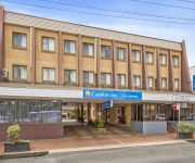
Comfort Inn Centrepoint
Lismore Gateway Motel
New Olympic Motel
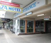
Aza Motel
Lismore Wilson Motel
Dawson Motor Inn Lismore
Karinga Motel
Videos from this area
These are videos related to the place based on their proximity to this place.
Lismore Hailstorm 9 October 2007
High precipitation supercell thunderstorm with a barrage of wind-driven hailstones to 7cm diameter hits Lismore, NSW on Tuesday 9th October 2007. This video was recorded near Lismore Airport...
LISMORE - Vehicle Fire
15 February 2015 The call came over police radio at about 23:43. A vehicle was on fire in the park area at the intersection of Magellan Street and Diadem Street Lismore NSW Australia. With...
Farm scenes - Lismore home movies by Thomas Bruce Nicol, c1948
In the 1940s, a series of home movies were made by Thomas Bruce Nicol, a Lismore local who had won a scholarship to high-school education in Sydney, and eventually became Engineer for the ...
Intrepid Karting Vid Lismore
Driving an Intrepid supplied by KAOS KARTING at Lismore Kart Club. My first short vid, shot with a Go Pro wide, JVC Everio and edited on Mac using iMovie.
2 Brewster Street - Lismore (2480) New South Wales by Adam Y...
In close proximity to Lismore CBD is this three storey building with a mixture of residential and commercial tenants.The location alone screams opportunity - close to MacDonald's and...
Videos provided by Youtube are under the copyright of their owners.
Attractions and noteworthy things
Distances are based on the centre of the city/town and sightseeing location. This list contains brief abstracts about monuments, holiday activities, national parcs, museums, organisations and more from the area as well as interesting facts about the region itself. Where available, you'll find the corresponding homepage. Otherwise the related wikipedia article.
Bexhill, New South Wales
Bexhill is a small village in New South Wales, Australia. As of 2006, the town had a population of 472 people. It is located about 35 kilometres from Byron Bay and about 11 kilometres from Lismore. It is located on the Murwillumbah railway line and on Bangalow Road.
Lismore, New South Wales
Lismore is a subtropical town in northeastern New South Wales, Australia. Lismore is the main population centre in the City of Lismore local government area. Lismore is a regional centre in the Northern Rivers region of the State.
Goolmangar, New South Wales
Goolmangar is a village in the northern part of the Australian state of New South Wales, close to Nimbin. It is part of City of Lismore. It is mostly farms.
Casino, New South Wales
Casino is a town in the Northern Rivers area of New South Wales, Australia, with a population of 9,400 people in 2006. It lies on the banks of the Richmond River and is situated at the junction of the Bruxner Highway and the Summerland Way. It is located 726 km north of Sydney and 228 km south of Brisbane.
Goonellabah, New South Wales
Goonellabah is the eastern suburb of Lismore, and is on the Bruxner Highway. At the 2006 census, Goonellabah had a population of 12,139 people. Goonellabah has many sporting teams which compete in local competitions. These include football, cricket, hockey, touch and tennis.
Coraki, New South Wales
Coraki is a small town that sits on the confluence of the Richmond and Wilson Rivers in northern New South Wales, Australia in Richmond Valley Shire. At the 2006 census, Coraki had a population of 1,180 people. The name Coraki is derived from Bundjalung Gurigay, meaning The meeting of the waters.
Richmond Valley Council
Richmond Valley Council is a local government area in the Northern Rivers region of north-eastern New South Wales, Australia. The area is named after the Richmond River, which flows through most of it. The area under management is located adjacent to the Bruxner Highway, Pacific Highway, and the North Coast railway line. It is a rural area for the most part, with most industries involving cattle and crop growing, such as sugar cane, wheat, and pecan plantation.
Modanville, New South Wales
Modanville is a scattered community in New South Wales, Australia, situated 14 kilometres north of the city of Lismore. At the 2006 census, Modanville had a population of 515 people. It is an interesting area with lush tropical rainforest smoothly bordering with farmland, this farmland constantly being broken up by the rainforest again. Mainly dairy and macadamias are farmed in the area and its closest village, Dunoon, is regarded as the Macadamia Capital of Australia.
Tomki, New South Wales
Tomki is a locality in northern New South Wales, Australia in Richmond Valley Shire. The name Tomki is derived from Bundjalung damgay, meaning "greedy".
Tatham, New South Wales
Tatham is a locality in New South Wales, Australia in Richmond Valley Shire. The name Tatham is derived from Bundjalung Jadham, meaning "child". Tatham was once a bustling village with a wharf, pub, butchers shop, post office and a number of schools. The post office building is still standing today as well as an historic Roman Catholic church.
City of Lismore
The City of Lismore is a local government area in the Northern Rivers region of New South Wales, Australia. The seat of the local government area is Lismore, a major regional centre of the state. The Mayor of Lismore City Council is Cr. Jenny Dowell, a member of Country Labor.
Lismore Base Hospital
Lismore Base Hospital is the major referral public hospital for the far north coast of New South Wales, Australia, and is located in the city of Lismore. The Lismore Cancer Care and Haematology unit is a service within this hospital.
The Channon, New South Wales
The Channon, pronounced "CHANNON" (a local aboriginal term for the Burrawang palm, a type of cycad that proliferates along the ridgelines in the area) is a village in the Northern Rivers area of New South Wales, Australia. It is about 18 kilometres northwest of Lismore and about 21 km from Nimbin, NSW. It is part of the City of Lismore. Like many villages in the area, there is cattle farming, general grazing and small crop farming.
Roman Catholic Diocese of Lismore
The Roman Catholic Diocese of Lismore is a suffragan Latin Rite diocese of the Archdiocese of Sydney, established in 1887, initially as the Diocese of Grafton, and then changed to the current name in 1900. The diocese cover the North Coast region of New South Wales in Australia.
Richmond River High School
Richmond River High School is a public high school located in North Lismore, New South Wales, Australia. The school has a split site campus, featuring sporting grounds and agricultural plots that when combined with the rest of the grounds, cover over 26 hectares. The Mission Statement of the school is "A Caring School of Excellence".
ABC North Coast
ABC North Coast is an ABC Local Radio station based in Lismore and broadcasting to the Northern Rivers region in New South Wales. This includes the towns and cities of Grafton, Ballina, Casino and Murwillumbah. The station began as 2NR in 1936 originally based in Grafton, moving to Lismore in 1989. It is heard on these main AM and FM frequencies: 2NR 738 AM 2ML 720 AM 2NNR 94.5 FM
100.9 ZZZ FM
Triple Z is a commercial radio station covering New South Wales' Far North Coast, and is part of the Broadcast Operations Group. The station targets the 18-39 market with a mostly top 40 hits format, though in networking hours the format shifts to a more adult contemporary mix. It began broadcasting on January 1 1994 from its Goonellabah studios. First announcer on air was Dave Williams, followed by Vashti Stewart, Neil Marks & Mike O'Reilly.
Baxter Field
Baxter International Baseball Field or the Albert Park International Baseball Stadium is home to the Far North Coast Baseball Association, part of Baseball Queensland, in Lismore, New South Wales. It is a fully fenced and regulation size field with field level fenced dugouts, bullpens, 2 battery cages as well as covered stands. Floodlighting is of international standard and has numerous Claxton Shield games since 1968.
Kadina High School
Kadina High School is a public (or state-run) high school (Years 7-12) in the Lismore suburb of Goonellabah, in Australia. It was established in 1976, but began its teaching in 1977. As of 2012 it has around 915 students and 97 staff
2NCR
2NCR is amongst the earliest licenced non-metrolitan FM community radio stations in New South Wales, Australia. Originally, the licence was issued to the nearby university (Lismore University), however with the re-structure of the university system in the late 1990s, the university became a campus of the newly established Southern Cross University.
Leycester Creek
The Leycester Creek is a river of the state of New South Wales in Australia.
Casino railway station
Casino is a railway station on the North Coast railway line in New South Wales, Australia. The station opened in 1930 and serves the Northern Rivers town of Casino. The station consists of an island style platform with a track on only one of the platform faces. A passing loop lies adjacent to the running line. Immediately north of the station lies the junction to the now closed Murwillumbah branch line, a roundhouse and turntable.
Wyrallah, New South Wales
Wyrallah, New South Wales is a historical village in the Northern Rivers region of New South Wales, Australia. It is located within the City of Lismore local government area. The village is located on the east bank of the Wilsons River and a nearby hill. It is also situated on Wyrallah Road generally midway between Lismore and Woodburn. This route is often used as a shortcut for people travelling on the Pacific Highway between Woodburn and Bangalow.
Lismore High School
Lismore High School, (abbreviation LHS) is a school located in Lismore, New South Wales, Australia, on Dalley Street, East Lismore. It is a co-educational high school operated by the New South Wales Department of Education and Training with students from years 7 to 12. The school was established in 1920. Many of its students have gone on to notable success, some holding high public office.
Oakes Oval
Oakes Oval (known prior to 1957 as the Recreation Ground) is a cricket ground in Lismore, New South Wales, Australia. The first recorded match on the ground came in 1934 when Richmond River Colts played New South Wales Colts. The ground held matches in the 1978 and 1979 World Series Cricket. It held its first first-class match in 1979 when New South Wales played Queenslands in the Sheffield Shield.


