Explore Windale
The district Windale of in Lake Macquarie Shire (New South Wales) with it's 3,095 inhabitants Windale is located in Australia about 215 mi north-east of Canberra, the country's capital.
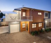
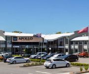
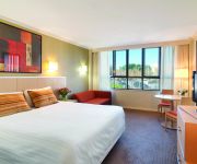
If you need a place to sleep, we compiled a list of available hotels close to the map centre further down the page.
Depending on your travel schedule, you might want to pay a visit to some of the following locations: Sydney, Parramatta, Katoomba, Canberra and Carrolls Creek. To further explore this place, just scroll down and browse the available info.
Local weather forecast
Todays Local Weather Conditions & Forecast: 21°C / 70 °F
| Morning Temperature | 16°C / 61 °F |
| Evening Temperature | 20°C / 68 °F |
| Night Temperature | 18°C / 65 °F |
| Chance of rainfall | 0% |
| Air Humidity | 57% |
| Air Pressure | 1026 hPa |
| Wind Speed | Moderate breeze with 9 km/h (6 mph) from West |
| Cloud Conditions | Broken clouds, covering 53% of sky |
| General Conditions | Broken clouds |
Friday, 22nd of November 2024
23°C (73 °F)
17°C (62 °F)
Sky is clear, moderate breeze, clear sky.
Saturday, 23rd of November 2024
24°C (75 °F)
17°C (63 °F)
Scattered clouds, moderate breeze.
Sunday, 24th of November 2024
25°C (78 °F)
19°C (66 °F)
Overcast clouds, moderate breeze.
Hotels and Places to Stay
Merewether Motel
Hamilton on Everton
The Star Apartments
QUEST NEWCASTLE
BEST WESTERN PLUS APOLLO INTL
Mercure Charlestown
Cardiff Executive Apartments
BEST WESTERN BLACKBUTT INN
Travelodge Newcastle
The Executive Inn Newcastle
Videos from this area
These are videos related to the place based on their proximity to this place.
Genesis headspace IN-GYM challenge
Who wants to take on Team Charlestown??? Challenge 1 - 200m row, 10 dead ball slams, 10 burpees, 10 laps x3 Challenge 2 - 100m row, 5 dead ball slams, 5 burpees, 5 laps x2 Gold coin donation...
Cobras VS Ducks highlights
From 27 Sept 2014 at St John Oval, Charlestown. The Big Red Cobras from Newcastle took on the Nepean Ducks and won the match 24-6. With thanks to Best Body Supplements, Crosbie Wealth ...
Truly independent
Transcript: Hi, my name's Luke Arms, and I'm running for Charlestown as an independent. Some independents are crazy. I'm not one of those. My policies are clear and realistic and easy to...
Better decisions
Transcript: Hi, my name's Luke Arms, independent for Charlestown. I'm running for office because I want to help government make better decisions. Decisions that will improve the lives of our...
Honda CB900F2B.mp4
Kicked over for the first time since buying it hadn't been started for 7 years! Going to strip it down and do a total restoration to original condition and then do a trip around Australia and...
Australian Reptile - Blue-tongue Lizard
This Blue-tongued Lizard was by the track when I went for a walk this morning in the bush near the West Charlestown Bypass - that's why you can hear traffic noise in the background. He certainly...
Jeep Patriot River Crossing
2009 Jeep Patriot Limited crossing Cobark River near Barrington Tops, NSW, Australia.
Unloaded.AVI
this is where I unloaded Thursday had to be escorted in and escorted out no room to turn round had to reverse way pasttheir normal turn around point as it was too wet n soft at least they...
Videos provided by Youtube are under the copyright of their owners.
Attractions and noteworthy things
Distances are based on the centre of the city/town and sightseeing location. This list contains brief abstracts about monuments, holiday activities, national parcs, museums, organisations and more from the area as well as interesting facts about the region itself. Where available, you'll find the corresponding homepage. Otherwise the related wikipedia article.
Charlestown, New South Wales
Charlestown is a suburb of Newcastle, New South Wales, Australia, and the largest town within the City of Lake Macquarie. It is approximately 10 kilometres west-south-west of the central business district of Newcastle. Charlestown has the largest business centre within the Lake Macquarie city, with a greater turnover than that of the neighbouring Newcastle CBD. The suburb serves as the district's transport hub.
Belmont, New South Wales
Belmont is a suburb in the Hunter Region of New South Wales, Australia, located 20 kilometres (12 mi) from Newcastle's central business district on the eastern side of Lake Macquarie and is part of the City of Lake Macquarie. Belmont is situated on a sandy peninsula formed by the Tasman Sea on the east and Lake Macquarie.
Kahibah Public School
Kahibah Public School is a government primary school in Kahibah, New South Wales, Australia. Originally established in 1938 in the Kahibah Memorial Hall, it moved to its current location in 1954. It caters for students from Kindergarten to Year 6 with a total enrolment of approximately 287. The school's Principal is Pam Richardson. The school is a registered war memorial.
Kahibah, New South Wales
Kahibah is a suburb of the City of Lake Macquarie in New South Wales, Australia, located 9 kilometres from Newcastle's central business district. Kahibah is the closest suburb to Glenrock Lagoon, and is drained by Flaggy and Little Flaggy creeks which flows into Glenrock Lagoon 2 km to the east. The suburb's name is from the Aboriginal name word "Ky-yee-bah", which meant either a place for games or to be active and eager.
Belmont railway line
The Belmont railway line is an abandoned coal haulage and passenger rail line from Adamstown, New South Wales to Belmont, New South Wales. This was a private railway, being the property of the New Redhead Estate and Coal Company and was generally known as the Belmont Branch. It is in the process of being converted into a cycleway or rail trail - The Fernleigh Track.
Charlestown Square
Charlestown Square is a major regional shopping centre in Charlestown, New South Wales, a suburb of the city of Lake Macquarie. It is owned and operated by General Property Trust. It was formerly managed by Lend Lease Corporation. Originally built in 1979 as a 2-story structure, the centre has undergone several extensions and renovations. It currently has over 170 stores and is one of the largest shopping centres in the Hunter Region. The centre now has 3 levels, and includes two food courts.
Windale, New South Wales
Windale is a suburb of the city of Lake Macquarie, in the Newcastle metropolitan area. It is located west of the junction of the Pacific Highway and Newcastle Inner City Bypass, covering an area of 1.7 km . Windale is a lower socio-economic area consisting largely of public housing homes, and has historically been known for its high rates of alcoholism, crime and unemployment.
Kotara South, New South Wales
Kotara South is a suburb of Newcastle, New South Wales, Australia 11 kilometres from Newcastle's central business district. It is part of the City of Lake Macquarie local government area. The public school in Kotara South opened in 1960.
Floraville, New South Wales
Floraville is a suburb of the City of Lake Macquarie in New South Wales, Australia 17 kilometres from Newcastle's central business district on the eastern side of Lake Macquarie and north of the town of Belmont. It has a school, which opened in 1967.
Jewells, New South Wales
Jewells is a suburb of the City of Lake Macquarie in New South Wales, Australia 15 kilometres from Newcastle's central business district on the eastern side of Lake Macquarie and north-east of the town of Belmont.
Redhead, New South Wales
Redhead is a coastal suburb of the City of Lake Macquarie in New South Wales, Australia 16 kilometres south of Newcastle's central business district on the Pacific Ocean. It was named for the appearance of its headland when viewed from the sea.
Dudley, New South Wales
Dudley is a southern coastal suburb of Newcastle, New South Wales, Australia, 13 kilometres southwest of Newcastle's central business district on the eastern side of Lake Macquarie. It is part of the City of Lake Macquarie local government area.
Whitebridge, New South Wales
Whitebridge is a suburb of Newcastle, New South Wales, Australia, 11 kilometres from Newcastle's central business district on the eastern side of Lake Macquarie. It is part of the City of Lake Macquarie local government area.
Tingira Heights, New South Wales
Tingira Heights is a suburb of City of Lake Macquarie in New South Wales, Australia, 16 kilometres south-west of Newcastle's central business district on the eastern side of Lake Macquarie. It was developed in the 1960s.
Hillsborough, New South Wales
Hillsborough is a suburb of the City of Lake Macquarie, New South Wales, Australia 13 kilometres from Newcastle's central business district on the eastern side of Lake Macquarie. It is part of the City of Lake Macquarie north ward.
Lakelands, New South Wales
Lakelands is a residential suburb of the City of Lake Macquarie, New South Wales, Australia 16 kilometres west of Newcastle's central business district near the northern end of Lake Macquarie. It is part of the City of Lake Macquarie west ward, and was formerly part of Warners Bay. Along Ambleside Circuit, the suburb's main street, is "Do Duck Inn", a general store providing newspapers and other basic needs. There is a tennis court, playground and also a cricket field in the south of Lakelands.
Gateshead, New South Wales
Gateshead is a suburb of the City of Lake Macquarie, New South Wales, Australia, 12 kilometres from Newcastle's central business district on the eastern side of Lake Macquarie. It is part of the City of Lake Macquarie East ward, and is home to a number of primary and high schools and a private hospital. Gateshead is named after Gateshead, a town in North East England.
Croudace Bay, New South Wales
Croudace Bay is a suburb of the City of Lake Macquarie in New South Wales, Australia, located 19 kilometres southwest of Newcastle's central business district on the eastern side of Lake Macquarie. The suburb was named after the Croudace family who lived in the area.
Eleebana, New South Wales
Eleebana is a suburb of the City of Lake Macquarie in New South Wales, Australia, 18 kilometres from Newcastle's central business district along the eastern shoreline of Lake Macquarie.
Adamstown Heights, New South Wales
Adamstown Heights is a southern suburb of Newcastle, New South Wales, Australia, located 8 kilometres west-southwest of Newcastle's central business district along the Pacific Highway. It is split between the City of Lake Macquarie and City of Newcastle local government areas. The suburb contains two schools, Kotara High School, established in 1968 and containing 3 hectares of native bushland, and Belair Primary School.
Belmont North, New South Wales
Belmont North is a suburb of the City of Lake Macquarie in New South Wales, Australia, located 18 kilometres southwest of Newcastle's central business district on the eastern side of Lake Macquarie. Belmont North has one primary school, which is home to around 250 school children.
Bennetts Green, New South Wales
Bennetts Green is a suburb of the City of Lake Macquarie in New South Wales, Australia, located 14 kilometres southwest of Newcastle's central business district on the eastern side of Lake Macquarie. It contains very few homes and is mainly a commercial shopping, small factory/warehouse area.
Cardiff South, New South Wales
Cardiff South is a suburb of the City of Lake Macquarie, New South Wales, Australia, located 13 kilometres west-southwest of Newcastle's central business district. It is part of the City of Lake Macquarie north ward. Its soccer team, the South Cardiff Gunners play in the NBN State Football League, the top soccer competition in Newcastle.
Highfields, New South Wales
Highfields is a residential suburb of Newcastle, New South Wales, Australia, located 8 kilometres west-southwest of Newcastle's central business district near the Charlestown town centre. It is part of the City of Lake Macquarie local government area.
Warners Bay High School
Warners Bay High School is a secondary school situated in the suburb of Warners Bay in Lake Macquarie, New South Wales, Australia. The current principal is Dr. Sharon Parkes, and it has about 1300 students each year.


