Discover Lindfield
The district Lindfield of in Ku-ring-gai (New South Wales) with it's 7,351 citizens Lindfield is a subburb in Australia about 156 mi north-east of Canberra, the country's capital city.
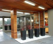
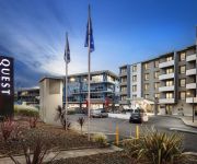
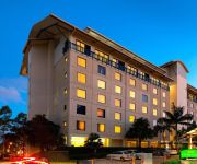
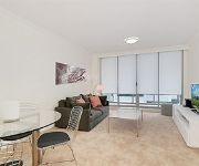
If you need a hotel, we compiled a list of available hotels close to the map centre further down the page.
While being here, you might want to pay a visit to some of the following locations: Sydney, Parramatta, Katoomba, Canberra and . To further explore this place, just scroll down and browse the available info.
Local weather forecast
Todays Local Weather Conditions & Forecast: 26°C / 78 °F
| Morning Temperature | 16°C / 61 °F |
| Evening Temperature | 23°C / 73 °F |
| Night Temperature | 20°C / 68 °F |
| Chance of rainfall | 0% |
| Air Humidity | 47% |
| Air Pressure | 1019 hPa |
| Wind Speed | Moderate breeze with 13 km/h (8 mph) from South-West |
| Cloud Conditions | Clear sky, covering 2% of sky |
| General Conditions | Sky is clear |
Sunday, 24th of November 2024
26°C (79 °F)
20°C (68 °F)
Overcast clouds, moderate breeze.
Monday, 25th of November 2024
25°C (77 °F)
21°C (69 °F)
Broken clouds, fresh breeze.
Tuesday, 26th of November 2024
27°C (81 °F)
21°C (70 °F)
Overcast clouds, moderate breeze.
Hotels and Places to Stay
MANTRA CHATSWOOD
Quest Chatswood
Wyndel Apartments - Herbert
QUEST MACQUARIE PARK
BEST WESTERN TWIN TOWERS INN
ROYAL PACIFIC FORMER PUNTHILL NTHSHORE
QUEST NORTH RYDE SERVICED APTS
Courtyard Sydney-North Ryde
Wyndel Apartments - Bertram
Wyndel Apartments - Leura
Videos from this area
These are videos related to the place based on their proximity to this place.
Ringtail Possum feeding at Lane Cove River Tourist Park Sydney NSW, Lane Cove National Park
Ringtail Possum feeding. If you join one of the regular night walks this is something that is regularly seen. Visit http://www.caravanandcampingsydney.com.au for more information about Lane...
Goanna in Lane Cove National Park. Lane Cove River Tourist Park
Visit http://www.caravanandcampingsydney.com.au for more information. This Goanna wanders around the edge of the Lane Cove River Tourist Park. I'm sure he will surprise a camper one day by...
Native Australian Bandicoot (HD) at Lane Cove River Tourist Park, Lane Cove National Park
Visit http://www.caravanandcampingsydney.com.au for more information. A full grown Bandicoot feeding at Lane Cove River Tourist Park. Breeding season has started again here at the park. Hard...
Ringtail Possum feeding at Lane Cove River Tourist Park, Sydney Australia, Lane Cove National Park
Visit http://www.caravanandcampingsydney.com.au for more information. A longer video of a Ringtail Possum feeding on a native tree just outside the office late one night during winter. The...
Ducklings Lane Cove River Tourist Park Sydney. Will they all survive? Lane Cove National Park
If you like a bit of suspense watch this video to the end. Will all the ducklings survive their first swimming lesson in our pool?? Visit http://www.caravanandcampingsydney.com.au for more...
Carter's Creek, A, Lane Cove National Park
Popular picnic area for hire in Lane Cove River National Park.
Brush Turkey at Lane Cove River Tourist Park Sydney
Australian Brush Turkey building a nest to be ready for eggs to be laid. Check back for updates!
Better Business Access Guide - Don't miss out on customers!
Improving the accessibility of your business makes dollars and sense. Find out how you can improve your businesses accessibility by watching this short explainer. Better Business Partnership...
Videos provided by Youtube are under the copyright of their owners.
Attractions and noteworthy things
Distances are based on the centre of the city/town and sightseeing location. This list contains brief abstracts about monuments, holiday activities, national parcs, museums, organisations and more from the area as well as interesting facts about the region itself. Where available, you'll find the corresponding homepage. Otherwise the related wikipedia article.
Lindfield, New South Wales
Lindfield is a suburb on the Upper North Shore of Sydney in the state of New South Wales, Australia 13 kilometres north-west of the Sydney Central Business District in the local government area of Ku-ring-gai Council.
Chatswood, New South Wales
Chatswood is a suburb on the North Shore of Sydney, in the state of New South Wales, Australia 10 kilometres north of the Sydney central business district. It is the administrative centre of the local government area of the City of Willoughby. Chatswood West is a separate suburb. It is a well-known ethnic Chinese hotspot, second only to Haymarket, New South Wales.
Killara, New South Wales
Killara is a suburb on the Upper North Shore of Sydney in the state of New South Wales, Australia 14 kilometres north of the Sydney Central Business District in the local government area of Ku-ring-gai Council. East Killara is a separate suburb and West Killara is a locality within Killara.
Chatswood railway station
Chatswood railway station is an important CityRail station in Sydney, Australia, serving the North Shore business centre of Chatswood. The station is served by the North Shore line and Northern line.
City of Willoughby
The City of Willoughby is a local government area on the North Shore of Sydney, in the state of New South Wales, Australia. It is located 6 kilometres north of the Sydney central business district. The main commercial centre of the City of Willoughby is Chatswood, home to one of Sydney's suburban skyscraper clusters. Other commercial centres are the suburbs of Willoughby, St Leonards and Artarmon.
Killara railway station
Killara railway station is located on the CityRail North Shore Line in the suburb of Killara. The station opened nine years after the North Shore line opened, with a single platform designed for conversion to an island platform once duplication arrived. As the station is connected to the adjacent streets on either side via stairs, Easy Access is not available for wheelchairs.
Lindfield railway station
Lindfield railway station is part of the CityRail, Sydney network, located on the North Shore line in the suburb of Lindfield. The station has a separate terminating platform.
Roseville railway station
Roseville is a railway station on the CityRail network, Sydney, Australia. The station serves the North Shore suburb of Roseville and is used by Roseville College. As the station is connected to the adjacent streets on either side via stairs, Easy Access for wheelchairs is not available.
Chatswood Oval
Chatswood Oval is located south of the Chatswood railway station in northern Sydney, Australia. It has four small pavilions and seating surrounding the oval. It is one of the Lower North Shore's largest sportsgrounds, and the home ground of the Gordon Rugby Football Club and Gordon District Cricket Club. One of the largest crowds was 8,127 when Gordon Rugby played Randwick in 1976. Gordon Rugby have been playing at Chatswood Oval since 1936.
West Lindfield, New South Wales
West Lindfield is a locality in the suburb of Lindfield, a suburb of Sydney, in the state of New South Wales, Australia. It is located is located 13 kilometres north-west of the Sydney Central Business District in the local government area of Ku-ring-gai Council.
West Killara, New South Wales
West Killara is a locality in the suburb of Killara, a suburb of Sydney, in the state of New South Wales, Australia. It is located is located 14 kilometres north-west of the Sydney Central Business District in the local government area of Ku-ring-gai Council. West Killara is bounded on the north and east by Lady Game Drive, to the south-east by Fiddens Wharf Road and to the south and west by the Lane Cove River and Lane Cove National Park.
Roseville, New South Wales
Roseville is a suburb on the Upper North Shore of Sydney in the state of New South Wales, Australia 12 kilometres north-west of the Sydney central business district. It is within the local government areas of Ku-ring-gai and Willoughby. Roseville Chase is a separate suburb to the east.
Chatswood West, New South Wales
Chatswood West is a suburb on the lower North Shore of Sydney, in the state of New South Wales, Australia. Chatswood West is located 11 kilometres north-west of the Sydney central business district, in the local government areas of the City of Willoughby and the City of Ryde on the western shore of the Lane Cove River. Chatswood is a separate suburb.
East Lindfield, New South Wales
East Lindfield is a suburb on the Upper North Shore of Sydney in the state of New South Wales, Australia. East Lindfield is located 13 kilometres north-west of the Sydney Central Business District in the local government area of Ku-ring-gai Council.
Lane Cove North, New South Wales
Lane Cove North is a suburb of Sydney, in the state of New South Wales, Australia. Lane Cove North is located 11 kilometres north-west of the Sydney central business district, in the local government areas of the Municipality of Lane Cove and the City of Willoughby. Lane Cove and Lane Cove West are separate suburbs. Boundaries are Pacific Highway in east, Epping Road in the south, Lane Cove River in the west and Chatswood Golf Course in the north. The Local Government boundary is Mowbray Road.
Chatswood High School
Chatswood High School is a public, co-educational, semi-selective (bi-modal) high school, located in Chatswood, a suburb of Sydney, New South Wales, Australia. With an enrolment of approximately 1100, Chatswood High School is situated on Centennial Avenue on the former Carr-Horden estate and is surrounded by bushland.
2NSB
Northside Broadcasting (2NSB) was a community radio station based in Chatswood, Sydney, Australia. It operates on the FM 99.3 frequency and is referred to as the North Shore's FM99.3 on-air and for business purposes. In May 2008, FM99.3 celebrated its 25th anniversary, and from January 2009, began restructuring its programs and music content to community-based magazine shows, specialist music programs and a more mainstream playlist.
Roseville College
Roseville College is an independent, (or more strictly an 'inter-dependent') Anglican day school for girls, located in the suburb of Roseville, on the North Shore of Sydney, New South Wales, Australia. It is a member school of the Sydney Anglican Schools Corporation. Established by Isobel Davies in 1908, Roseville has a non-selective enrolment policy and currently caters for approximately 820 students from Kindergarten to Year 12.
Harry and Penelope Seidler House
Harry and Penelope Seidler House was the home of architects Penelope and Harry Seidler. It is located on 13 Kalang Avenue, Killara on Sydney's North Shore, and was designed by Harry and Penelope Seidler and is listed on the NSW State Heritage Register.
Westfield Chatswood
Westfield Chatswood is a large shopping centre in the suburb of Chatswood in the North Shore area of Sydney. It is owned and managed by The Westfield Group. It originally opened in 1987 and was redeveloped in 1999 to incorporate a previously free standing Grace Bros store (later renamed Myer). Major stores in the centre include Myer, Coles, Aldi, Target, Toys 'R' Us, JB Hi-Fi and Rebel Sport. The centre also includes a 6 screen Hoyts cinema complex.
St Pius X College
St Pius X College is a Roman Catholic, non-selective, independent high school for boys, located in Chatswood, a North Shore suburb of Sydney, Australia. Located in the heart of the Chatswood central business district, the school is relatively close to Westfield Shopping Centre and Chatswood railway station.
RAAF Bradfield Park
RAAF Bradfield Park was a Royal Australian Air Force (RAAF) station located at the former suburb of Bradfield Park during World War II.
Chatswood Public School
Chatswood Public School is a primary and public school that was founded in 1883, located in the suburb of Chatswood in Sydney, New South Wales, Australia. This school provides a playground which has been changed throughout the years, an Astroturf oval and four buildings.
Lindfield East Public School
Lindfield East Public School, (abbreviation LEPS) is a school located in East Lindfield Sydney, New South Wales, Australia. It is a co-educational Public school operated by the New South Wales Department of Education and Training with students from years Kindergarten to 6. It is the local government school for the East Lindfield and East Killara suburbs.
St Andrew's, Roseville
St Andrew's Anglican church, Roseville is an active Anglican church on the corner of Bancroft Avenue and Hill Street in Roseville, New South Wales, Australia. It is part of the Diocese of Sydney. The foundation stone for the current building was laid by Archbishop Howard Mowll in 1935. The rector of the time was W. J. Roberts. The building was designed by C. C. Finch, and built by S. C. Molineaux, and seats around 350. The original cost of the building was about £5500.


