Delve into Hurstville Grove
The district Hurstville Grove of in Kogarah (New South Wales) with it's 2,331 habitants Hurstville Grove is a subburb in Australia about 143 mi north-east of Canberra, the country's capital town.
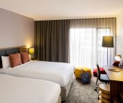
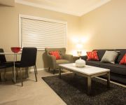
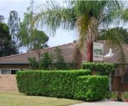
If you need a hotel, we compiled a list of available hotels close to the map centre further down the page.
While being here, you might want to pay a visit to some of the following locations: Sydney, Parramatta, Katoomba, Canberra and . To further explore this place, just scroll down and browse the available info.
Local weather forecast
Todays Local Weather Conditions & Forecast: 28°C / 82 °F
| Morning Temperature | 20°C / 68 °F |
| Evening Temperature | 22°C / 72 °F |
| Night Temperature | 21°C / 69 °F |
| Chance of rainfall | 15% |
| Air Humidity | 54% |
| Air Pressure | 1013 hPa |
| Wind Speed | Strong breeze with 18 km/h (11 mph) from South-West |
| Cloud Conditions | Overcast clouds, covering 98% of sky |
| General Conditions | Heavy intensity rain |
Monday, 18th of November 2024
26°C (79 °F)
18°C (64 °F)
Light rain, moderate breeze, overcast clouds.
Tuesday, 19th of November 2024
18°C (65 °F)
18°C (65 °F)
Broken clouds, gentle breeze.
Wednesday, 20th of November 2024
22°C (72 °F)
18°C (65 °F)
Few clouds, moderate breeze.
Hotels and Places to Stay
The Urban Newtown
Travelodge Bankstown Sydney
EVENTHOUSE CRONULLA
QUEST CRONULLA BEACH SERVICED APTS
BREAKFREE BANKSTOWN INTERNATIONAL
Mercure Sydney International Airport
Novotel Sydney Brighton Beach
Amaaze Airport Serviced Apartments
Cronulla Motor Inn
Sutherland Motel
Videos from this area
These are videos related to the place based on their proximity to this place.
CFCLA Train Passing Penshurst Station
VL351+4814+GL107+GL108 hauling a cargo train passing Penshurst station.
SOLD 56 Balmoral Road, Mortdale.
Inspired by the grand terraces of Sydney's Inner City, owner & Architect Michael & his Artist wife Inara, have designed and built one of the area's grandest homes. Come and have a look inside....
SOLD UNDER THE HAMMER! STYLISH, 4 BEDROOM FAMILY HOME - 48 Woronora Pde, Oatley
Positioned in a highly sought after location, this outstanding home is conveniently located just moments to Oatley station, village and schools. This contemporary home set over 500sqm of level...
GAEMS G155 Personal Gaming Environment
Make it Personal™ with the world's first Personal Gaming Environment, the GAEMS G155 PGE. Designed with everyone in mind, the G155 PGE is the perfect solution for traveling with your Xbox...
SOLD 14 Beach Street Blakehurst
Welcome to 14 Beach Street Blakehurst, a magnificent home with an awesome waterfront lifestyle to boot. Over 1200sqm of rare level waterfront land on the beautiful shores of Kogarah Bay. There...
Drones, boats and towing
This is my 1st attempt at capturing and editing some drone action footage. I used the "DJI Phantom 2" drone and a "GoPro Hero 3+ Black Edition" Camera. Hope you enjoy the video- its my first...
8 Bignell Street Illawong 2234 NSW by Matt Debreczeni
Property Video shoot of 8 Bignell Street Illawong 2234 NSW by PlatinumHD http://www.platinumhd.tv for Ray White Menai.
Hurstville Fine Pizzas Delivery On Time (check the clock!) to Hurstville
Hurstville Fine Pizzas 02 9556 2020 http://redhornpizza.com.au 2/645 Princes Hwy, Rockdale Hurstville PIZZA HOME DELIVERY Bexley, Banksia, Arncliffe, Wolli Creek, Turrella, Tempe, Marrickvil...
Introduction-Southern Sydney Health Forum Hurstville
The Southern Sydney Health Forum in Hurstville was the third in a series of Community Health Forums that aim to listen to and engage with health service user...
After Effects Showreel 2011
Aftereffects Showreel. Jobs from 2010 to 2011. Stefan Settels. Settels Graphics. Contact Details On Showreel.
Videos provided by Youtube are under the copyright of their owners.
Attractions and noteworthy things
Distances are based on the centre of the city/town and sightseeing location. This list contains brief abstracts about monuments, holiday activities, national parcs, museums, organisations and more from the area as well as interesting facts about the region itself. Where available, you'll find the corresponding homepage. Otherwise the related wikipedia article.
Hurstville, New South Wales
Hurstville is a suburb in South-West Sydney, in the state of New South Wales, Australia. Hurstville is located 16 kilometres south of the Sydney central business district and is part of the St George area. Hurstville is the administrative centre of the local government area of the City of Hurstville. Hurstville has become a central business district for the southern suburbs of Sydney.
Oatley, New South Wales
Oatley is a suburb in southern Sydney, in the state of New South Wales, Australia. Oatley is located 21 kilometres south of the Sydney central business district and is part of the St George area. Oatley lies across the local government areas of the City of Hurstville and Municipality of Kogarah.
Kyle Bay, New South Wales
Kyle Bay is a suburb in southern Sydney, in the state of New South Wales, Australia. Kyle Bay is 19 kilometres south of the Sydney central business district, in the local government area of the Municipality of Kogarah and is part of the St George area. Kyle Bay takes its name from the bay that sits on the northern shore of the Georges River. It is a tiny, picturesque suburb around this bay and Harness Cask Point.
Oatley railway station
Oatley railway station is located on the Illawarra line of Sydney's CityRail network, and serves the southern Sydney suburb of Oatley. It consists of an island platform with entry via a subway linking Oatley Parade and Mulga Road at the northern end. There are two sets of points at the city end of the station allowing trains to be terminated on either platform, although these are not currently used in regular timetabled service.
Penshurst railway station, Sydney
Penshurst railway station is located on the Illawarra line of the CityRail network and serves the southern Sydney suburb of Penshurst. The station opened in 1886 and moved to its present location in 1905. It consists of an island platform with a weatherboard overhead ticket office. The tracks through Penshurst are signalled for bi-directional operation, although this is only used in emergency situations.
Hurstville railway station
Hurstville railway station is a major station on Australia's CityRail suburban Illawarra and interurban South Coast Line. It is located in the southern suburb of Hurstville, serving a residential and large commercial district. The station marks the end of the four track section from Illawarra Junction at Redfern; the line continues as two tracks south from this point. Several sidings to the south of the station allow stabling of passenger trains during off-peak periods.
City of Hurstville
The City of Hurstville is a local government area in the St George and southern region of Sydney, New South Wales, Australia. The city centre of Hurstville is located 17 kilometres south south–west of Sydney and west of Botany Bay. Hurstville was incorporated as a municipality in 1887; and declared a city in 1988. The Mayor of the City of Hurstville Council is Cr. Jack Jacovou, a member of the Liberal Party.
South Hurstville, New South Wales
South Hurstville is a suburb in southern Sydney, in the state of New South Wales, Australia 18 kilometres south of the Sydney central business district. It is part of the St George area. South Hurstville is in the local government area of the Municipality of Kogarah. Hurstville and Hurstville Grove are separate neighbouring suburbs.
Penshurst, New South Wales
Penshurst is a suburb in southern Sydney, in the state of New South Wales, Australia 17 km south of the Sydney central business district. It is part of the St George area. Penshurst lies across the local government areas of the City of Hurstville and Municipality of Kogarah. Penshurst features low to medium density housing. It has a predominantly older population however it is increasingly being populated by a new generation of migrant families who are attracted by its proximity to Hurstville.
Mortdale, New South Wales
Mortdale is a suburb in southern Sydney, in the state of New South Wales, Australia. Mortdale is located 20 kilometres south of the Sydney central business district and is part of the St George area. Mortdale lies across the local government areas of the City of Hurstville and Municipality of Kogarah. Mortdale extends south to Lime Kiln Bay, on the Georges River.
Kangaroo Point, New South Wales
Kangaroo Point is a tiny suburb in southern Sydney, in the state of New South Wales, Australia. It is 22 kilometres south of the Sydney central business district in the local government area of the Sutherland Shire. Kangaroo Point takes its name from the peninsula which sits on the southern bank of the Georges River. It is completely surrounded by the suburb of Sylvania which it was originally part of and still shares the same postcode.
Danebank
Danebank Anglican School for Girls (commonly referred to as Danebank) is an independent, Anglican, day school for girls, located in Hurstville, a southern suburb of Sydney, New South Wales, Australia. It is a member school of the Sydney Anglican Schools Corporation. Established in 1933 by Edith Roseby Ball, Danebank has a non-selective enrolment policy and currently caters for approximately 910 students from Prep to Year 12.
Blakehurst, New South Wales
Blakehurst is a suburb in southern Sydney, in the state of New South Wales, Australia 18 kilometres south of the Sydney central business district, in the local government area of the Municipality of Kogarah. It is part of the St George area. Blakehurst is connected to Sylvania, in the Sutherland Shire, to the south, by Tom Uglys Bridge over the Georges River. Tom Uglys Point is the southernmost part. The eastern border runs along Kogarah Bay and the western border runs along Kyle Bay.
Connells Point, New South Wales
Connells Point is an affluent suburb in southern Sydney, in the state of New South Wales, Australia. Connells Point is 20 kilometres south of the Sydney central business district and is part of in the local government area of the Municipality of Kogarah, in the St George area. The area has long been home to prestigious family homes, luscious greenery and cultivated parks on the foreshore. Bowden Crescent is a famous, tightly held waterfront street at the end of the locality.
Georges River College (Hurstville Boys Campus)
Georges River College Hurstville Boys Campus, (formerly known as Hurstville Boys' High School and known as HBHS), is situated in the city of Hurstville in the Sydney region. The school caters for the educational needs of boys in the area of St. George and is broadly recognised for its programs.
Hurstville Grove, New South Wales
Hurstville Grove is a suburb in southern Sydney, in the state of New South Wales, Australia. It is located 19 kilometres south of the Sydney central business district and is part of the local government area of the Municipality of Kogarah, in the St George area. Hurstville Grove stretches from Hillcrest Avenue to the shore of Oatley Bay, on the Georges River. It is mainly residential with a few shops located on Hillcrest Avenue.
Mortdale railway station
Mortdale railway station is located on the CityRail Illawarra line in the southern Sydney suburb of Mortdale. It serves a primarily residential area and nearby commercial and light industrial area. The station opened in 1897 and moved to its present location in 1922. It consists of an island platform with entry via an overpass at the southern end.
Caravan Head, New South Wales
Caravan Head is a locality in southern Sydney, in the state of New South Wales, Australia. It is located in the north-eastern part of the suburb of Oyster Bay. It is situated on the southern bank of the Georges River.
St George Christian School
St George Christian School is an independent, co-educational, day school, located in Hurstville and Sans Souci, both suburbs of southern Sydney, in the St George area of New South Wales, Australia. Established in 1981, the school has a non-selective enrolment policy, and currently caters for approximately 800 students from Kindergarten to Year Twelve. Students come to St George Christian School mainly from the southern Sydney region.
Marist College Penshurst
Marist College Penshurst is a systemic Catholic College for boys from Years 7 to 10, located in Mortdale, New South Wales, Australia. The College was founded in 1953 and has a tradition based on the teachings of the French educator Saint Marcellin Champagnat. The school offers education to approximately 510 students in the St George area of Sydney. House system Academic tuition== There are a multiple number of subjects offered at the college.
Blakehurst High School
Blakehurst High School is a public, co-educational, specialist Languages high school for years 7-12 located in Blakehurst, Sydney, New South Wales, Australia. The school has around 1130 students, 75 teaching staff and 12 administrative staff. 40% of students are from an Anglo Celtic background and 60% of students identify as having a non-English speaking background (NESB), many of whom were born in Australia.
Oatley Bay
Oatley Bay is a bay located in the Municipality of Kogarah, surrounded by the suburbs of Oatley, Hurstville Grove and Connells Point. The bay is part of the Georges River waterway. It is popular for boating, fishing, picnicking and bush walking, and is surrounded by multi-million dollar waterfront properties.
Renown Park, New South Wales
Renown Park is a park located in Sydney, Australia. Renown Park is a border between Penshurst, New South Wales, Oatley, New South Wales and Mortdale. A tunnel under Hillcrest Avenue links Renown Park and Moore Reserve. The soccer field is known in the association for its unpredictable bounce which has become known as "The Renown Bounce. " Near the end of the soccer season, the field commonly is referred to as "The Dust Bowl."
Hurstville Oval
Hurstville Oval is a multi-use sporting ground, located in the suburb of Hurstville, in Sydney's southern suburbs. Since its opening, it has held various sports at the venue – including Cricket, Rugby League, Cycling and Football. The oval also has a velodrome in the grounds, between the field and the stands. It was opened in 1911. On the official opening day, cricketer Warren Bradley brought the Australian Team to the ground to play the local St George team.
Sydney Anglican Schools Corporation
Sydney Anglican Schools Corporation website, is an independent, co-educational, school system established by the Anglican Church Diocese of Sydney headquartered in Hurstville, New South Wales, Australia. The number of schools in the SASC group has increased from five in 1995 to 16 in 2010. The initial objective was to establish one new school per year http://web. archive. org/web/20091009114600/http://www. aasn. edu. au/LinkClick. aspx?fileticket=VT%2bX1CfqtG8%3d&tabid=85.


