Touring Earlwood
Earlwood in Hurstville (New South Wales) with it's 16,564 residents is a town located in Australia about 145 mi (or 234 km) north-east of Canberra, the country's capital place.
Time in Earlwood is now 04:06 AM (Wednesday). The local timezone is named Australia / Sydney with an UTC offset of 11 hours. We know of 9 airports nearby Earlwood, of which two are larger airports. The closest airport in Australia is Sydney Kingsford Smith International Airport in a distance of 4 mi (or 7 km), East. Besides the airports, there are other travel options available (check left side).
There are two Unesco world heritage sites nearby. The closest heritage site in Australia is Australian Convict Sites in a distance of 92 mi (or 148 km), North. Also, if you like the game of golf, there are several options within driving distance. We collected 5 points of interest near this location. Need some hints on where to stay? We compiled a list of available hotels close to the map centre further down the page.
Being here already, you might want to pay a visit to some of the following locations: Sydney, Parramatta, Katoomba, Canberra and . To further explore this place, just scroll down and browse the available info.
Local weather forecast
Todays Local Weather Conditions & Forecast: 32°C / 89 °F
| Morning Temperature | 22°C / 71 °F |
| Evening Temperature | 24°C / 76 °F |
| Night Temperature | 25°C / 77 °F |
| Chance of rainfall | 1% |
| Air Humidity | 39% |
| Air Pressure | 1007 hPa |
| Wind Speed | Moderate breeze with 11 km/h (7 mph) from South-East |
| Cloud Conditions | Overcast clouds, covering 100% of sky |
| General Conditions | Light rain |
Wednesday, 4th of December 2024
24°C (75 °F)
20°C (67 °F)
Light rain, moderate breeze, broken clouds.
Thursday, 5th of December 2024
26°C (79 °F)
21°C (69 °F)
Sky is clear, gentle breeze, clear sky.
Friday, 6th of December 2024
30°C (86 °F)
23°C (73 °F)
Few clouds, moderate breeze.
Hotels and Places to Stay
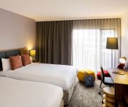
BREAKFREE BANKSTOWN INTERNATIONAL
Novotel Sydney Brighton Beach
Mercure Sydney International Airport
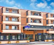
Comfort Inn & Suites Burwood
Travelodge Bankstown Sydney
Garden Lodge Sydney
Amaaze Airport Serviced Apartments
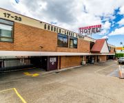
Marco Polo Motor Inn Sydney
Abcot Inn
Sydney Student Living - Hostel
Videos from this area
These are videos related to the place based on their proximity to this place.
CFCLA Train Passing Penshurst Station
VL351+4814+GL107+GL108 hauling a cargo train passing Penshurst station.
GAEMS G155 Personal Gaming Environment
Make it Personal™ with the world's first Personal Gaming Environment, the GAEMS G155 PGE. Designed with everyone in mind, the G155 PGE is the perfect solution for traveling with your Xbox...
www.CraftMe.co- FREE Download Scrapbooking Making Secrets eBook - How to Creative Card Making Ideas
Direct download for the eBook http://www.facebook.com/CraftMe.co http://www.craftme.co/stores.php Top 10 Scrapbook Secrets! A new eBook for craft lovers! A FREE Gift exclusively to...
Business leaders and the National Relay Service
Senior managers at the St George and Commonwealth banks explain why being Relay Service friendly is important for their organisations. And Suzanne Colbert from the Australian Employers' Network.
Australia - Sydney (Bondi beach) Gabbiani e onde.
Alcuni spezzoni di vita vissuta in Australia a Sydney, nella prima parte ci troviamo nel prato che precede la spiaggia più famosa della città, Bondi beah, siamo circondati da gabbiani in...
Malaysia Airlines B747-400 | On Approach into Sydney Kingsford International Airport (SYD)
Description: Airline: Malaysia Airlines Aircraft: Boeing 747-400 REG: 9M-MPE Month/Year: August 2011 Flight:On Approach to Sydney Kingsford Smith International Airport (SYD) - Australian Airspace.
Hurstville Fine Pizzas Delivery On Time (check the clock!) to Hurstville
Hurstville Fine Pizzas 02 9556 2020 http://redhornpizza.com.au 2/645 Princes Hwy, Rockdale Hurstville PIZZA HOME DELIVERY Bexley, Banksia, Arncliffe, Wolli Creek, Turrella, Tempe, Marrickvil...
Introduction-Southern Sydney Health Forum Hurstville
The Southern Sydney Health Forum in Hurstville was the third in a series of Community Health Forums that aim to listen to and engage with health service user...
After Effects Showreel 2011
Aftereffects Showreel. Jobs from 2010 to 2011. Stefan Settels. Settels Graphics. Contact Details On Showreel.
75w hid on a bmw 323i e46 part 2
6000k 75w hid produce 7000 lumens. Standard holagens 55w produce 1000- 1200 lumens. Hids are 7 times bright in lumens over 55w holagens.
Videos provided by Youtube are under the copyright of their owners.
Attractions and noteworthy things
Distances are based on the centre of the city/town and sightseeing location. This list contains brief abstracts about monuments, holiday activities, national parcs, museums, organisations and more from the area as well as interesting facts about the region itself. Where available, you'll find the corresponding homepage. Otherwise the related wikipedia article.
St George (Sydney)
St George Area (also known as St George District or St George Region) is an unofficial name applied to a group of southern suburbs in Sydney, in the state of New South Wales, Australia. The area includes all the suburbs in the local government areas of the City of Hurstville, the City of Rockdale and the Municipality of Kogarah. The eastern boundary of the district is Lady Robinson Beach on Botany Bay.
Kingsgrove railway station
Kingsgrove is a railway station on the East Hills railway line of the CityRail network in Sydney. It serves the suburb of Kingsgrove. Kingsgrove has a single island platform which serves the inner 'local' pair of tracks, the 'main' (express) tracks pass on either side. Kingsgrove retains its original 1930s brick platform building but has had additional platform canopies and entrance built in the intervening years. This station has Easy Access for wheelchairs.
Penshurst, New South Wales
Penshurst is a suburb in southern Sydney, in the state of New South Wales, Australia 17 km south of the Sydney central business district. It is part of the St George area. Penshurst lies across the local government areas of the City of Hurstville and Municipality of Kogarah. Penshurst features low to medium density housing. It has a predominantly older population however it is increasingly being populated by a new generation of migrant families who are attracted by its proximity to Hurstville.
Kingsgrove, New South Wales
Kingsgrove is a suburb in southern Sydney, in the state of New South Wales, Australia. Kingsgrove is 13 kilometres south of the Sydney central business district and lies across the local government areas of the City of Rockdale, the City of Hurstville and the City of Canterbury. Therefore, Kingsgrove is in both the St George and South-western Sydney regions.
Bexley North, New South Wales
Bexley North is a suburb in southern Sydney, in the state of New South Wales, Australia 13 kilometres south of the Sydney central business district. It is part of the St George area. Bexley North is in the local government area of the City of Rockdale.
Danebank
Danebank Anglican School for Girls (commonly referred to as Danebank) is an independent, Anglican, day school for girls, located in Hurstville, a southern suburb of Sydney, New South Wales, Australia. It is a member school of the Sydney Anglican Schools Corporation. Established in 1933 by Edith Roseby Ball, Danebank has a non-selective enrolment policy and currently caters for approximately 910 students from Prep to Year 12.
Georges River College (Hurstville Boys Campus)
Georges River College Hurstville Boys Campus, (formerly known as Hurstville Boys' High School and known as HBHS), is situated in the city of Hurstville in the Sydney region. The school caters for the educational needs of boys in the area of St. George and is broadly recognised for its programs.
St. George Parish, Cumberland
St George Parish is one of the 57 parishes of Cumberland County, New South Wales, a cadastral unit for use on land titles. The name is used as the region name today. {{#invoke:Coordinates|coord}}{{#coordinates:33|56|54|S|151|06|04|E|type:city |primary |name= }}
Saint Ursulas College, Kingsgrove
St Ursula's College Kingsgrove is located in Kingsgrove, Sydney, Australia. It is a Catholic girls school for grades 7-12.
Hurstville Oval
Hurstville Oval is a multi-use sporting ground, located in the suburb of Hurstville, in Sydney's southern suburbs. Since its opening, it has held various sports at the venue – including Cricket, Rugby League, Cycling and Football. The oval also has a velodrome in the grounds, between the field and the stands. It was opened in 1911. On the official opening day, cricketer Warren Bradley brought the Australian Team to the ground to play the local St George team.
Sydney Anglican Schools Corporation
Sydney Anglican Schools Corporation website, is an independent, co-educational, school system established by the Anglican Church Diocese of Sydney headquartered in Hurstville, New South Wales, Australia. The number of schools in the SASC group has increased from five in 1995 to 16 in 2010. The initial objective was to establish one new school per year http://web. archive. org/web/20091009114600/http://www. aasn. edu. au/LinkClick. aspx?fileticket=VT%2bX1CfqtG8%3d&tabid=85.
Kingsgrove North High School
Kingsgrove North High School (KNHS) is a co-educational public high school located in Kingsgrove, New South Wales, Australia. Founded in 1959, it is the oldest co-educational high school in the state. The school is part of the St. George Region of high schools and is administered by the New South Wales Department of Education and Communities (DEC), and prepares students for the Record of Student Achievement (Year 11), and the Higher School Certificate (Year 12).


