Discover Westleigh
The district Westleigh of Hornsby in Hornsby Shire (New South Wales) is a subburb in Australia about 155 mi north-east of Canberra, the country's capital city.
If you need a hotel, we compiled a list of available hotels close to the map centre further down the page.
While being here, you might want to pay a visit to some of the following locations: Parramatta, Sydney, Katoomba, Canberra and . To further explore this place, just scroll down and browse the available info.
Local weather forecast
Todays Local Weather Conditions & Forecast: 31°C / 87 °F
| Morning Temperature | 18°C / 65 °F |
| Evening Temperature | 27°C / 80 °F |
| Night Temperature | 19°C / 67 °F |
| Chance of rainfall | 7% |
| Air Humidity | 36% |
| Air Pressure | 1012 hPa |
| Wind Speed | Moderate breeze with 12 km/h (8 mph) from South-West |
| Cloud Conditions | Overcast clouds, covering 100% of sky |
| General Conditions | Moderate rain |
Monday, 18th of November 2024
26°C (78 °F)
17°C (63 °F)
Light rain, moderate breeze, overcast clouds.
Tuesday, 19th of November 2024
20°C (69 °F)
16°C (60 °F)
Overcast clouds, gentle breeze.
Wednesday, 20th of November 2024
24°C (75 °F)
16°C (61 °F)
Scattered clouds, moderate breeze.
Hotels and Places to Stay
Medina North Ryde Sydney
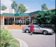
MGSM EXECUTIVE HOTEL AND CONFERENCE CENT
Travelodge Macquarie Nth Ryde
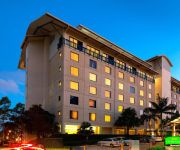
Courtyard Sydney-North Ryde
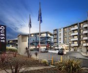
QUEST MACQUARIE PARK
QUEST NORTH RYDE SERVICED APTS
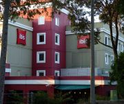
ibis Sydney Thornleigh
Macquarie University Village
Pymble Hotel
The Ranch Hotel
Videos from this area
These are videos related to the place based on their proximity to this place.
Giant Trance 27.5 Hornsby MTB Trail 2015 GoPro HD
My first youtube video folks, so go easy on me. This was a fun ride with the updated track-stage 2. If you haven't ridden this trail yet then check it out.
Mehregan Persian Festival 2012, Hornsby RSL Club, Sydney AUSTRALIA - Part 1
Mehregan Persian Festival 2012, Hornsby RSL Club, Sydney AUSTRALIA - Part 1 Record & Uploaded by: Soheil Adeli.
Hornsby MTB Park Blue Circuit January 2013
My First ever lap of the New Hornsby Mountain Bike Park Blue Circuit.
Hornsby Mountain Bike Trail part 2
This is the second of four Parts. This is a purple run witch means advanced. I recommend a Mountain Bike with suspension for an easy ride.
The Cave
When the year is 2012, the district is Hornsby and the end of the world is nigh, you need a place of safety...... Art Director: Mouy Hok Tang Technical Director: Ibraheem Saleh Modellers:...
The Water Clock Chronicles
Sculptor, Victor Cusack explains the history,workings and meanings of his Water Clock in Hornsby Mall.
SOLD BY MARGARET McGREGOR - 11 Tillock Street Thornleigh
SOLD SOLD SOLD SOLD SOLD SOLD 11 Tillock Street Thornleigh SOLD SOLD SOLD A rare find - charming character home on a level block in a sought after location, just 500m to Thornleigh station.
CJJ30X Renault Koleos. Rude driver tries to run me off the road.
Impatient, rude driver tries to run me off the road. At this set of lights I was the first vehicle there and took primary due to the "traffic calming" that the council has installed and my...
Videos provided by Youtube are under the copyright of their owners.
Attractions and noteworthy things
Distances are based on the centre of the city/town and sightseeing location. This list contains brief abstracts about monuments, holiday activities, national parcs, museums, organisations and more from the area as well as interesting facts about the region itself. Where available, you'll find the corresponding homepage. Otherwise the related wikipedia article.
Hornsby, New South Wales
Hornsby is a suburb of northern Sydney in the state of New South Wales, Australia 25 kilometres north-west of the Sydney central business district. It is the administrative centre of the local government area of Hornsby Shire.
Barker College
Barker College is an Independent Anglican, day and boarding school, located in Hornsby, a North Shore suburb of Sydney, New South Wales, Australia. Founded in 1890 by the Reverend Henry Plume at Kurrajong Heights, Barker is an all-boys school from Kindergarten to Year 9, and co-educational from Years 10 to 12. The college has a private selective enrolment policy and currently caters for approximately 1,968 students, including 60 boarders from Years 10 to 12.
Hornsby Shire
Hornsby Shire is a local government area in the northern region of Sydney, in the state of New South Wales, Australia. The Shire stretches from the suburb of Eastwood in the south to the Hawkesbury River town of Wisemans Ferry, some 53 kilometres to the north. As at the 2011 Census the Shire had an estimated population of . The Mayor of Hornsby Shire is Cr Steve Russell, a member of the Liberal Party.
Hornsby railway station
Hornsby railway station is a major railway station at the junction between the North Shore and Northern railway lines of the CityRail network in Sydney, Australia. It serves the commercial and residential area of Hornsby. The station consists of 5 platforms accessed through an overhead concourse at the southern end. The station is the terminus point for most Northern line services. Hornsby maintenance depot is situated to the north of the station.
Pennant Hills, New South Wales
Pennant Hills is a suburb of Sydney, New South Wales, Australia. Pennant Hills is located 25 kilometres north-west of the Sydney central business district in the local government area of Hornsby Shire. Pennant Hills is in the Northern Suburbs region, but also considered to be part of the Hills District.
Thornleigh, New South Wales
Thornleigh is a suburb of Sydney, in the state of New South Wales, Australia 25 kilometres north-west of the Sydney central business district in the local government area of Hornsby Shire. Thornleigh is bounded to the north by Waitara Creek. Thornleigh borders the suburbs of Normanhurst, Westleigh and Pennant Hills.
Westleigh, New South Wales
Westleigh is a suburb of Sydney, in the state of New South Wales, Australia 27 kilometres north-west of the Sydney central business district in the local government area of Hornsby Shire.
Cherrybrook, New South Wales
Cherrybrook is a suburb of Sydney, in the state of New South Wales, Australia 27 kilometres north-west of the Sydney central business district in the local government area of Hornsby Shire. Cherrybrook is located in the Hills District of Sydney.
Normanhurst, New South Wales
Normanhurst is a suburb of Sydney, in the state of New South Wales, Australia, 23 kilometres north-west of the Sydney central business district in the local government area of Hornsby Shire.
Sydney Adventist Hospital
Sydney Adventist Hospital, commonly known as the San, is a large private hospital in Sydney, Australia, located on Fox Valley Road in Wahroonga. Established on 1 January 1903, as a not-for-profit organisation, it was originally named the Sydney Sanitarium from which its colloquial name was derived. The hospital is operated by the Seventh-day Adventist Church, whose Australian headquarters are located in the immediate vicinity of the San.
Thornleigh railway station
Thornleigh railway station is a station on Sydney's CityRail network servicing the suburb of Thornleigh in Sydney's Upper North Shore. Opening in 1886, this station lies on the Northern Line leading from Berowra in the north through to North Sydney station via Strathfield and Central.
Waitara railway station
Waitara is a railway station on the CityRail network in Sydney servicing the suburb of Waitara, a small suburb to the east of Hornsby's CBD.
Pennant Hills railway station
Pennant Hills station on Sydney's CityRail network serves the suburb of Pennant Hills in Sydney's Hills District. Opening in 1886, this station lies on the Northern line leading from Berowra in the north through to North Sydney station via Strathfield and Central. In recent years the station has undergone an upgrade. It has significant patronage due to the people of neighbouring suburbs Cherrybrook and West Pennant Hills utilising it.
Normanhurst railway station
Normanhurst railway station is a CityRail railway station on Sydney's Northern Line. It serves the suburb of Normanhurst, a residential area. The station has two side platforms.
Waitara, New South Wales
Waitara is a suburb of northern Sydney, in the state of New South Wales, Australia 23 kilometres north-west of the Sydney central business district, in the local government area of Hornsby Shire. Geographically, it is often referred to as part of the Upper North Shore. The neighbourhood is located on the North Shore Railway Line, and is the last stop before it meets the Northern Line at Hornsby.
Hornsby Girls' High School
Hornsby Girls' High School is an academically selective, public high school for girls, located in Hornsby, a suburb on the Upper North Shore of Sydney, New South Wales, Australia. Founded in 1930, the school's first principal was Sarah Agnes Angus Brewster. Academically, Hornsby Girls' is regularly ranked first in the Hornsby region in terms of Higher School Certificate (HSC) results.
Normanhurst Boys' High School
Normanhurst Boys High School is an academically selective, public, high school for boys, located in Normanhurst, on the Upper North Shore of Sydney, New South Wales, Australia. Established in 1958 and operated by the New South Wales Department of Education and Communities (DEC), the school currently caters for around 730 students from Years 7 to 12. The school, affectionately known as "Normo," celebrated its 50th anniversary in 2008.
Pennant Hills High School
Pennant Hills High School is a public, comprehensive, co-educational, high school situated in the northern suburb of Pennant Hills in Sydney, New South Wales, Australia, about 15–20 minutes to walk from Pennant Hills railway station. Established in 1966, the school had a student population of 1,270 students as of 2004, and has generally maintained these student numbers. The street address is Boundary Road, but all access is via Laurence Street.
Westfield Hornsby
Westfield Hornsby, owned and managed by the Westfield Group, is a large shopping centre in Sydney's upper North Shore suburb of Hornsby. It is currently the oldest location in the Westfield chain, having been trading for over forty years. The centre won a Rider Hunt Award in 2003.
Roman Catholic Diocese of Broken Bay
The Roman Catholic Diocese of Broken Bay is a suffragan Latin rite diocese of the Archdiocese of Sydney, covering the North Shore and Northern Beaches of greater metropolitan Sydney, and the Broken Bay and Central Coast regions of New South Wales, Australia.
Loreto Normanhurst
Loreto Normanhurst is a private, Roman Catholic, day and boarding school for girls, located in Normanhurst, a suburb on the upper North Shore of Sydney, New South Wales, Australia. Established in 1897, Loreto has a current enrolment of approximately 900 students from Year 7 to Year 12, including approx. 220 boarders, and is the largest girls' boarding school in New South Wales. In 2006, the school was named among the top ten innovative schools in Australia.
Cherrybrook Technology High School
Cherrybrook Technology High School is a purpose built Technology High School located on Purchase Road in Cherrybrook NSW, Australia. The school was built in the late 1980s to support the rapid growth of the north-west sector in Sydney. With the school's completion and opening in 1992 the sheer size and capabilities of the school have grown beyond expectations.
Hornsby Water Clock
The Hornsby Water Clock, titled Man, Time and the Environment is a piece of kinetic sculpture, a decorative fountain and a functional clock in the Florence Street pedestrian mall in Hornsby, New South Wales, Australia. Unveiled in 1993, the sculpture was designed and engineered by Victor Cusack and constructed of bronze, stainless steel and glass by Victor and his foundry floor manager Rex Feakes.
Mount St Benedict College
Mount St Benedict College is a Catholic, independent, girls high school in the Good Samaritan tradition, offering holistic education based on Benedictine values of Pax, Hospitality and Stewardship. Girls from the Northern and North West regions of Sydney attend the College. Mount St Benedict College commenced on February 1, 1966 with 65 students under the guidance of Sisters Christopher Burrows and Hyacinth Roche.
Sydney Sandstone Gully Forest
Sydney Sandstone Gully Forest is a vegetation community found near Sydney, Australia. It occurs in sheltered gullies and hillsides, on soils based on Hawkesbury Sandstone with some clay influences. Common tree species include the Blackbutt, Sydney Red Gum, Turpentine and Watergum. {{#invoke:Coordinates|coord}}{{#coordinates:33|44.306|S|151|5.434|E|region:AU_type:city_source:GNS-enwiki|| |primary |name= }}


