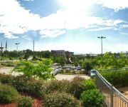
Explore Cherrybrook
The district Cherrybrook of in Hornsby Shire (New South Wales) is located in Australia about 154 mi north-east of Canberra, the country's capital.
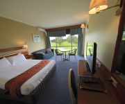
If you need a place to sleep, we compiled a list of available hotels close to the map centre further down the page.
Depending on your travel schedule, you might want to pay a visit to some of the following locations: Parramatta, Sydney, Katoomba, Canberra and . To further explore this place, just scroll down and browse the available info.
Local weather forecast
Todays Local Weather Conditions & Forecast: 31°C / 87 °F
| Morning Temperature | 18°C / 65 °F |
| Evening Temperature | 27°C / 80 °F |
| Night Temperature | 19°C / 67 °F |
| Chance of rainfall | 7% |
| Air Humidity | 36% |
| Air Pressure | 1012 hPa |
| Wind Speed | Moderate breeze with 12 km/h (8 mph) from South-West |
| Cloud Conditions | Overcast clouds, covering 100% of sky |
| General Conditions | Moderate rain |
Monday, 18th of November 2024
26°C (78 °F)
17°C (63 °F)
Light rain, moderate breeze, overcast clouds.
Tuesday, 19th of November 2024
20°C (69 °F)
16°C (60 °F)
Overcast clouds, gentle breeze.
Wednesday, 20th of November 2024
24°C (75 °F)
16°C (61 °F)
Scattered clouds, moderate breeze.
Hotels and Places to Stay
QUEST MACQUARIE PARK
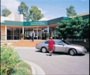
MGSM EXECUTIVE HOTEL AND CONFERENCE CENT
Courtyard Sydney-North Ryde
QUEST CASTLE HILL SERVICED APTS
Travelodge Macquarie Nth Ryde
Medina North Ryde Sydney
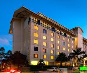
Novotel Sydney Norwest
Grand Mercure The Hills Lodge
Macquarie University Village
Red Star West Ryde
Videos from this area
These are videos related to the place based on their proximity to this place.
Faker's thoughts on Game 1 of OGN Grand Finals
Enjoyed it? Want more? Subscribe!: http://bit.ly/BaegMon (Almost 16000!) ▻ For Blazened. my one and only love♥ ▻ Reddit Discussion: http://redd.it/1w3x3b ▻ First blood clip: http://you...
Inside the mind of a Korean.
In this video, I reveal what goes inside the mind of a Korean gamer. ▻ Enjoyed it? Want more? Subscribe!: http://bit.ly/BaegMon ▻ For Joseph. my one and only love♥ =======================...
Malabar Public School | Call 1300 130 400
http://www.schooluniformsaustralia.com.au/ Malabar Public School 1300 130 400 School Uniforms Australia PO Box 614 CHERRYBROOK NSW 2126 Ph: 1300 130 400 We cater for Students School ...
TROLL POOL
The most fun I've had in a League of Legends game. ▻ Enjoyed it? Want more? Subscribe!: http://bit.ly/BaegMon.
New South Wales Fire Brigade illegal parking Quarry Rd Dural
This is what you can call a total disregard of the law, note the "NO STOPPING" signs on the footpath they start from 200 meters behind the fire truck and stop in front of the fire truck. The...
Beecroft zone carnival 2013 U10 Boys 800m
Beecroft Zone Carnival 2013, Under 10 Boys 800m Final. Winner: Ben Black (in Yellow, Glenorie Public), 4th place: Aaron Hogan (in Yellow, Glenorie Public). Ran out of space during the battle...
What it feels like in Bronze
Enjoyed it? Want more? Subscribe!: http://bit.ly/BaegMon ▻ Thanks to Skys for the replay file! (turned my LoLreplay off :S) ▻ https://www.youtube.com/SkysLoL ===============================...
All Insec wanted for Christmas was a pentakill...
Subscribe! : http://bit.ly/18TTPW6 Reddit post: http://www.reddit.com/r/leagueoflegends/comments/1tl08u What is ♥ ?
SOLD BY RENAE SANDELL - 403/2 City View Road, Pennant Hills
FIRST HOME, CITY PAD OR INVESTMENT Sleek studio design occupying a private top floor position on the quiet side of this popular complex, presents a fashionable address for the first home buyer,...
Videos provided by Youtube are under the copyright of their owners.
Attractions and noteworthy things
Distances are based on the centre of the city/town and sightseeing location. This list contains brief abstracts about monuments, holiday activities, national parcs, museums, organisations and more from the area as well as interesting facts about the region itself. Where available, you'll find the corresponding homepage. Otherwise the related wikipedia article.
Castle Hill, New South Wales
Castle Hill is a suburb in the north-west of Sydney, in the state of New South Wales, Australia. Castle Hill is located 31 kilometres north-west of the Sydney central business district, in the Hills District of the Greater Western Sydney region. Castle Hill is the administrative centre of the local government area of The Hills Shire and part of the suburb is located in the local government area of Hornsby Shire.
Cheltenham, New South Wales
Cheltenham is a suburb of Sydney, in the state of New South Wales, Australia. Cheltenham is 21 kilometres north-west of the Sydney central business district in the local government area of Hornsby Shire. Cheltenham is considered to be part of the North Shore. This residential suburb has a distinctive English atmosphere, with a number of 19th Century mansions on tree-lined streets. Cheltenham shares its postcode of 2119 with Beecroft and has sometimes been viewed as simply part of that suburb.
Dural, New South Wales
Dural is a semi-rural suburb of Sydney, in the state of New South Wales, Australia 36 kilometres north-west of the Sydney central business district in the local government areas of Hornsby Shire and The Hills Shire. Dural is part of the Hills District, in Northern Sydney. Round Corner is a locality in the south-western part of Dural.
Pennant Hills, New South Wales
Pennant Hills is a suburb of Sydney, New South Wales, Australia. Pennant Hills is located 25 kilometres north-west of the Sydney central business district in the local government area of Hornsby Shire. Pennant Hills is in the Northern Suburbs region, but also considered to be part of the Hills District.
Thornleigh, New South Wales
Thornleigh is a suburb of Sydney, in the state of New South Wales, Australia 25 kilometres north-west of the Sydney central business district in the local government area of Hornsby Shire. Thornleigh is bounded to the north by Waitara Creek. Thornleigh borders the suburbs of Normanhurst, Westleigh and Pennant Hills.
Westleigh, New South Wales
Westleigh is a suburb of Sydney, in the state of New South Wales, Australia 27 kilometres north-west of the Sydney central business district in the local government area of Hornsby Shire.
Cherrybrook, New South Wales
Cherrybrook is a suburb of Sydney, in the state of New South Wales, Australia 27 kilometres north-west of the Sydney central business district in the local government area of Hornsby Shire. Cherrybrook is located in the Hills District of Sydney.
Beecroft, New South Wales
Beecroft is a suburb of northern Sydney, in the state of New South Wales, Australia 22 kilometres north-west of the Sydney central business district in the local government area of Hornsby Shire. Beecroft is considered to be in the Northern Suburbs of Sydney.
Thornleigh railway station
Thornleigh railway station is a station on Sydney's CityRail network servicing the suburb of Thornleigh in Sydney's Upper North Shore. Opening in 1886, this station lies on the Northern Line leading from Berowra in the north through to North Sydney station via Strathfield and Central.
Pennant Hills railway station
Pennant Hills station on Sydney's CityRail network serves the suburb of Pennant Hills in Sydney's Hills District. Opening in 1886, this station lies on the Northern line leading from Berowra in the north through to North Sydney station via Strathfield and Central. In recent years the station has undergone an upgrade. It has significant patronage due to the people of neighbouring suburbs Cherrybrook and West Pennant Hills utilising it.
Cheltenham railway station, Sydney
Cheltenham railway station is located on the Main North railway line in the northern Sydney suburb of Cheltenham. It is served by CityRail's Northern Line. Cheltenham consists of two side platforms on a steep 2.5% gradient. Access is via the street and an overhead footbridge at the northern end. The station opened in 1898. It was established mainly due to pressure from William Chorley, whose home was located near the station.
Beecroft railway station
Beecroft railway station is located on the Main North railway line in the northern Sydney suburb of Beecroft. It is served by CityRail's Northern Line. Beecroft consists an island platform with access via a pedestrian subway. It is located in the middle of a reverse curve, and is located on a steep 2.5% gradient.
Royal Institute for Deaf and Blind Children
The Royal Institute for Deaf and Blind Children (RIDBC) in Sydney provides a range of educational services for students with vision and/or hearing impairment, including specialist schools for signing deaf students, oral deaf students, and students with sensory and intellectual disabilities. RIDBC offers additional services such as therapy and braille text production, a children's audiology centre, and also conducts research and professional development through its RIDBC Renwick Centre.
Pennant Hills High School
Pennant Hills High School is a public, comprehensive, co-educational, high school situated in the northern suburb of Pennant Hills in Sydney, New South Wales, Australia, about 15–20 minutes to walk from Pennant Hills railway station. Established in 1966, the school had a student population of 1,270 students as of 2004, and has generally maintained these student numbers. The street address is Boundary Road, but all access is via Laurence Street.
Rogans Hill, New South Wales
Rogans Hills is a suburb in Sydney, New South Wales, Australia within The Hills Shire, and was named after John Rogan, a pioneer who had been given a grant of land in the area by Governor Macquarie in 1818. Its main attractions are Oakhill College and the Anglican Retirement Villages. It was the destination of a railway line which closed in 1932.
Roman Catholic Diocese of Broken Bay
The Roman Catholic Diocese of Broken Bay is a suffragan Latin rite diocese of the Archdiocese of Sydney, covering the North Shore and Northern Beaches of greater metropolitan Sydney, and the Broken Bay and Central Coast regions of New South Wales, Australia.
Cheltenham Girls High School
Cheltenham Girls High School, is a public, comprehensive, high school for girls, located in Cheltenham, a north-western suburb of Sydney, New South Wales, Australia. Established in 1958 and operated by the New South Wales Department of Education and Training, the school has a non-selective enrolment policy and currently caters for approximately 1,340 students from Years 7 to 12.
Oakhill College
Oakhill College is a Catholic, co-educational, secondary, day school, located in Castle Hill, New South Wales, a suburb in the Hills District of the Greater Western region of Sydney, New South Wales, Australia. Founded in 1936, the College is run by the De La Salle Brothers in the tradition of St. Jean-Baptiste de La Salle, and currently caters for approximately 1,600 students from Years 7 to 12.
Cherrybrook Technology High School
Cherrybrook Technology High School is a purpose built Technology High School located on Purchase Road in Cherrybrook NSW, Australia. The school was built in the late 1980s to support the rapid growth of the north-west sector in Sydney. With the school's completion and opening in 1992 the sheer size and capabilities of the school have grown beyond expectations.
Carlingford High School
Carlingford High School is a government high school located in Carlingford, Sydney, New South Wales, Australia.
Castle Hill High School
Castle Hill High School, located in Castle Street, Castle Hill, New South Wales, Australia, is a Co-educational and Comprehensive school with students ranging from year 7 to year 12. Castle Hill High School has performed well during the 2011 HSC, students achieving 111 Band 6's as well as having 6 students that have received an all-rounders award. According to Better Education HSC rankings regarding Mathematics and English marks Castle Hill High School is ranked 145th in New South Wales.
Cumberland State Forest (New South Wales)
Cumberland State Forest is a forest in the Australian state of New South Wales. It is located in Castle Hill, Sydney. It contains 40 hectares of native forest. The original land was privately owned and was cleared in 1908. In 1938 its management was taken over by the then NSW Forestry Commission, and one third of the land was planted as an arboretum while the rest was allowed to regenerate naturally. What is seen today is more than 50 years of forest growth.
Mount St Benedict College
Mount St Benedict College is a Catholic, independent, girls high school in the Good Samaritan tradition, offering holistic education based on Benedictine values of Pax, Hospitality and Stewardship. Girls from the Northern and North West regions of Sydney attend the College. Mount St Benedict College commenced on February 1, 1966 with 65 students under the guidance of Sisters Christopher Burrows and Hyacinth Roche.
Koala Park Sanctuary
The Koala Park Sanctuary is privately owned and run wildlife park located at West Pennant Hills in Sydney Australia. The park is most famous for its collection of koalas.
Sydney Sandstone Gully Forest
Sydney Sandstone Gully Forest is a vegetation community found near Sydney, Australia. It occurs in sheltered gullies and hillsides, on soils based on Hawkesbury Sandstone with some clay influences. Common tree species include the Blackbutt, Sydney Red Gum, Turpentine and Watergum. {{#invoke:Coordinates|coord}}{{#coordinates:33|44.306|S|151|5.434|E|region:AU_type:city_source:GNS-enwiki|| |primary |name= }}


