Delve into Kirrabelah
Kirrabelah in Gunnedah (New South Wales) is a city located in Australia about 304 mi (or 489 km) north of Canberra, the country's capital town.
Current time in Kirrabelah is now 09:13 PM (Saturday). The local timezone is named Australia / Sydney with an UTC offset of 11 hours. We know of 8 airports closer to Kirrabelah. The closest airport in Australia is Gunnedah Airport in a distance of 3 mi (or 4 km), North-East. Besides the airports, there are other travel options available (check left side).
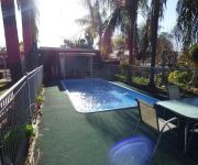
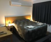
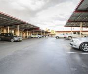
There are several Unesco world heritage sites nearby. The closest heritage site in Australia is Greater Blue Mountains Area in a distance of 92 mi (or 148 km), South. Also, if you like playing golf, there are some options within driving distance. In need of a room? We compiled a list of available hotels close to the map centre further down the page.
Since you are here already, you might want to pay a visit to some of the following locations: Katoomba, Carrolls Creek, Parramatta, Sydney and Canberra. To further explore this place, just scroll down and browse the available info.
Local weather forecast
Todays Local Weather Conditions & Forecast: 29°C / 84 °F
| Morning Temperature | 14°C / 57 °F |
| Evening Temperature | 32°C / 89 °F |
| Night Temperature | 18°C / 65 °F |
| Chance of rainfall | 0% |
| Air Humidity | 33% |
| Air Pressure | 1019 hPa |
| Wind Speed | Gentle Breeze with 7 km/h (5 mph) from East |
| Cloud Conditions | Clear sky, covering 0% of sky |
| General Conditions | Sky is clear |
Sunday, 24th of November 2024
31°C (88 °F)
21°C (70 °F)
Sky is clear, gentle breeze, clear sky.
Monday, 25th of November 2024
33°C (91 °F)
26°C (79 °F)
Sky is clear, light breeze, clear sky.
Tuesday, 26th of November 2024
31°C (88 °F)
25°C (77 °F)
Scattered clouds, moderate breeze.
Hotels and Places to Stay
Gunnedah Lodge Motel
Red Chief Motel
Gunnedah Motor Inn
Comfort Inn Harvest Lodge
Videos from this area
These are videos related to the place based on their proximity to this place.
Landing Runway 11 at Gunnedah (YGDH)
Landing on runway 11 at Gunnedah in Piper Archer III VH-RCR after a short flight from Lake Keepit.
Gunnedah Hillclimb in an Integra Type R
9th March 2014 Porcupine Lookout - Gunnedah NSW 36.48sec PB.
Over the Fence: Gunnedah growers double production - 2011
A move from the traditional northern NSW wheat/sorghum rotation to continuous cropping has allowed Gunnedah grower Richard Heath, "Pine Cliff" to effectively double grain production without...
Copabella Vegas at Gunnedah Show Jumping Festival July 5th 2009
Copabella Vegas (Copabella Visage x Royal Native) rising 4yo gelding in the 1m class at Gunnedah Showjumping Festival. Ridden by Julia Hargreaves.
Pink Squeeze Chute / Cattle Crush - Charity Auction
Hot pink cattle chute / crush sold in a charity auction at the 2011 Agquip Field days in Gunnedah NSW Australia. All proceeds went to the McGrath Foundation.
Clay Target Shooting Part 2
'Down the line' clay target shoot at the Boggabri/Gunnedah Gun Club Hunt Road site.
Clay Target Shooting
'Down the line' clay target shooting at the Boggabri/Gunnedah Gun Club Hunt Road facility.
Over the Fence: On-farm research no trial for Liverpool Plains grower - Feb 2011
Applying cutting edge Grains Research and Development Corporation (GRDC)-supported research recommendations on-farm is no trial for Liverpool Plains grain grower Richard Heath.
Videos provided by Youtube are under the copyright of their owners.
Attractions and noteworthy things
Distances are based on the centre of the city/town and sightseeing location. This list contains brief abstracts about monuments, holiday activities, national parcs, museums, organisations and more from the area as well as interesting facts about the region itself. Where available, you'll find the corresponding homepage. Otherwise the related wikipedia article.
Gunnedah
Gunnedah is a town and local government area in north-eastern New South Wales, Australia. At the 2011 Australia Census the town recorded a population of 7,888. The larger local government area had a population of 12,066. Gunnedah is located on the Oxley and Kamilaroi Highways providing road links to the state capital Sydney at a distance of 475 kilometres and the nearest regional centre Tamworth is 75 kilometres . It is also linked to Sydney by rail.
Gunnedah Shire
Gunnedah Shire is a local government area in the North West Slopes region of New South Wales, Australia. The Shire is located adjacent to the Liverpool Plains in the Namoi River valley and is traversed by the Oxley Highway and the Kamilaroi Highway. The Shire includes the towns of Gunnedah, Curlewis, Breeza, Carroll, Mullaley, Emerald Hill, Tambar Springs and Kelvin. The Mayor of Gunnedah Shire Council is Cr. Owen Hasler, who is unaligned with any political party.


