Delve into Purfleet
The district Purfleet of Taree in Greater Taree (New South Wales) is a subburb in Australia about 300 mi north-east of Canberra, the country's capital town.
If you need a hotel, we compiled a list of available hotels close to the map centre further down the page.
While being here, you might want to pay a visit to some of the following locations: Sydney, Parramatta, Katoomba, Carrolls Creek and Canberra. To further explore this place, just scroll down and browse the available info.
Local weather forecast
Todays Local Weather Conditions & Forecast: 30°C / 85 °F
| Morning Temperature | 18°C / 64 °F |
| Evening Temperature | 26°C / 78 °F |
| Night Temperature | 22°C / 71 °F |
| Chance of rainfall | 0% |
| Air Humidity | 39% |
| Air Pressure | 1016 hPa |
| Wind Speed | Moderate breeze with 11 km/h (7 mph) from South-West |
| Cloud Conditions | Overcast clouds, covering 85% of sky |
| General Conditions | Light rain |
Monday, 18th of November 2024
21°C (70 °F)
18°C (65 °F)
Moderate rain, light breeze, overcast clouds.
Tuesday, 19th of November 2024
19°C (67 °F)
16°C (61 °F)
Light rain, light breeze, overcast clouds.
Wednesday, 20th of November 2024
22°C (71 °F)
16°C (61 °F)
Overcast clouds, gentle breeze.
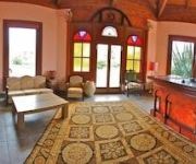
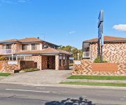
Hotels and Places to Stay
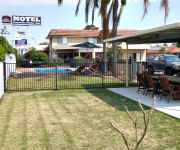
Kiwarrak Country Retreat
CARAVILLA MOTEL IN TAREE
A Railway Lodge
Comfort Inn Marco Polo
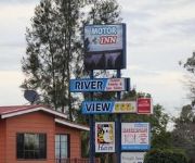
Riverview Motor Inn
Alabaster Motor Inn Taree
Blackboy Tree Motel
Comfort Inn Country Plaza Taree
Videos from this area
These are videos related to the place based on their proximity to this place.
Taree Easter Classic Max Kirwan & Hayes Wood Trophy
Taree Easter Classic Max Kirwan & Hayes Wood Trophy.
Gen III Chesser Family Racing SS105 Australian Championship Taree 2015 1080p
Gen III Chesser Family Racing SS105 Australian Championship Taree 2015 1080p.
Taree 2014 Heat 1 of Grand Prix Hydroplanes
Heat 1 got to see Grant Harrison in GP1, Ian Bryant in Mathamagic. Matt Ferris's Tattoo had trouble starting the heat.
UIM 6 Litre Heat 3 from Taree
Heat 3 of the world 6 litre UIM's from Taree got to see Karma, Sick Puppy, Mac & Speed & True Blue battle it out.
Juno The Kelpie - Taree TAFE's favourite employee
Staff and students at Taree Campus of North Coast TAFE love Juno so much, they made a film about him.
Videos provided by Youtube are under the copyright of their owners.
Attractions and noteworthy things
Distances are based on the centre of the city/town and sightseeing location. This list contains brief abstracts about monuments, holiday activities, national parcs, museums, organisations and more from the area as well as interesting facts about the region itself. Where available, you'll find the corresponding homepage. Otherwise the related wikipedia article.
Taree, New South Wales
Taree is a town on the Mid North Coast, New South Wales, Australia. Taree and nearby Cundletown were settled in 1831 by William Wynter. Since then Taree has grown to a population of around 20,000 people and is the centre of a significant agricultural district. It is 16 km from the sea coast, and 317 km north of Sydney. Taree can be reached by train via the North Coast Railway, and by the Pacific Highway.
Wingham, New South Wales
Wingham is a town in the Mid North Coast region of New South Wales, Australia in the City of Greater Taree 335 kilometres north of Sydney. At the 2006 census, Wingham had a population of 4,812.
Old Bar, New South Wales
Old Bar is a coastal town in New South Wales, Australia in the City of Greater Taree. It lies around 16 kilometres east of Taree on the Mid North Coast, and around 315 kilometres north of Sydney. Old Bar is at the mouth of the Manning River. The Manning River is one of two "delta" rivers in the southern hemisphere, having more than one outlet to the ocean; one at Old Bar, and one at Harrington, 14 kilometres to the north.
Tinonee, New South Wales
Tinonee is a small town on the banks of the Manning River, near Taree on the Mid North Coast of New South Wales in the City of Greater Taree, Australia. Tinonee was founded in 1854 and in the late 1980s became part of Greater Taree City. At the 2006 census, Tinonee had a population of 734 people. Tinonee is on a road that previously served as the main road from Sydney to Brisbane, which is now called Bucketts Way.
2RE
2RE is a commercial radio station that broadcasts to the Mid North Coast of New South Wales, Australia from its studios at Taree, near Forster. 2RE broadcasts on 1557AM in Taree, Wingham and surrounds, 100.3FM in Forster and the Great Lakes and 100.1FM in Gloucester, Barrington and surrounds. Local shows include the 2RE Furniture One Breakfast Club with Anthony Zanos, afternoon with Craig Huth and drive with Kevin Rayment and Diane Ward.
St Andrew's Presbyterian Church, Wingham
St Andrew's Presbyterian Church, Wingham is the main centre of the Wingham and Upper Manning Parish in the Presbyterian Church of Australia. The other centre is St Thomas' Presbyterian Church, Krambach.
2BOB
2BOB FM radio is a volunteer radio station in Taree on the Mid North Coast of New South Wales, Australia. 2BOB FM broadcasts on 104.7 FM. This type of station is known as community radio, and 2BOB is a member of the Community Broadcasting Association of Australia. "BOB" is an acronym for "Broadcasting on (a) Budget". The radio station started out by receiving donations from members of the community and was known for hosting stalls at the local shows and "Radio-Thons" in order to gain funding.
Kolodong, New South Wales
Kolodong, New South Wales is a locality between Taree and Wingham in the Manning Valley on the Mid North Coast of New South Wales, Australia in the City of Greater Taree. Kolodong contains some agricultural land, a small residential area and a sizable industrial area. Kolodong is home to a day care centre, Taree Baptist Church and Taree Christian College.
City of Greater Taree
The City of Greater Taree is a local government area on the Mid North Coast of New South Wales, Australia, centred on Taree. The City is located adjacent to the Manning River, the Pacific Highway and the North Coast railway line. The Mayor of City of Greater Taree is Cr. Paul Hogan, an unaligned politician.
Nabiac, New South Wales
Nabiac is a small town on the Mid North Coast, New South Wales, Australia mainly in Great Lakes Council. A small part of the locality is in the City of Greater Taree: the border is defined by the Pacific Highway. It is north-west of Forster, and south of Taree. Nabiac is the central town of the Wallamba Valley.
Failford, New South Wales
Failford is a locality in the Great Lakes Council local government area on the Mid North Coast of New South Wales, Australia. Located to the east of the Pacific Highway, Failford is about 15 km northwest of Forster. At the 2011 census it had a population of 495. Failford is a water skiing and boating location with the nearby Wallamba River, which runs between Nabiac and Tuncurry.
Coopernook, New South Wales
Coopernook is a village in mid-north New South Wales, Australia (post code 2426). It is located 24 kilometres north of Taree and 11 kilometres west of Harrington and is administered by Greater Taree City Council. At the 2006 census, Coopernook had a population of 365 people. It was formerly situated on the Pacific Highway, until 22 March 2006, when the Coopernook Bypass was opened. The old highway crossed the Lansdowne River on a narrow iron girder bridge.
Taree High School
Taree High School, also known as THS, is a secondary, public, co-educational, comprehensive day school, located in Taree, a city on the Mid North Coast of New South Wales, Australia. Established in 1908, the Taree High School is the oldest of the high schools located in the Taree area, and currently caters for approximately 1,100 students from Years 7 to 12, servicing Taree and the Manning Valley.
Lansdowne, New South Wales (Greater Taree)
Lansdowne is a rural village on the Mid North Coast near Taree in New South Wales, Australia. The village lies in the Lansdowne River valley, adjacent to the Coorabakh National Park, as well as Coopernook and the Lansdowne State Forests. It is the gateway to the Manning River Valley's northern hinterland. At the 2006 census, Lansdowne had a population of 433 people.
Mitchells Island
Mitchells Island is the largest of several islands in the mouth of the Manning River. It is roughly triangular in shape and has an area of approximatelyBad rounding here{{#invoke:Math|precision_format| 129.4994055168 | 1-2 }} km (50 sq mi). It is bordered on the north by the main channel of the Manning River, on the southwest by Scotts Creek, and on the east by the Pacific Ocean. The ocean edge extends from Old Bar in the south to Harrington to the north.
Dawson River (New South Wales)
Dawson River, a perennial river of the Manning River catchment, is located in the Mid North Coast district of New South Wales, Australia.
Lansdowne River
Lansdowne River, a watercourse of the Manning River catchment, is located in the Mid North Coast district of New South Wales, Australia.
Pigna Barney River
Pigna Barney River, a partly perennial river of the Manning River catchment, is located in the Upper Hunter district of New South Wales, Australia.
Coocumbac Island Nature Reserve
Coocumbac Island Nature Reserve is a rare example of subtropical lowland rainforest. Situated on the Manning River, New South Wales, it is 6 hectares in size. Much of Australia's lowland sub tropical rainforest was cleared for housing and agriculture, leaving only small patches remaining, such as at Coocumbac Island. The soils are derived from the Manning River. These alluvial soils are enriched from basaltic deposits upstream at Barrington Tops and the Comboyne and Bulga Plateaux.
Wingham Brush Nature Reserve
Wingham Brush Nature Reserve is a rare example of sub tropical lowland rainforest. Situated on the Manning River, New South Wales, it is 8 hectares in size. Much of Australia's lowland sub tropical rainforest was cleared for housing and agriculture, leaving only small patches remaining, such as at Wingham Brush The soils are derived from the Manning River. These alluvial soils are enriched from basaltic deposits upstream at Barrington Tops and the Comboyne and Bulga Plateaux.
Martin Bridge
The Martin Bridge is a road bridge over the Manning River in Taree, New South Wales, Australia. It is a steel truss bridge of 11 spans on concrete supports. Originally it had a lifting span with two concrete counterbalances. The bridge was opened on 18 May 1940 by the Premier of NSW, Alexander Mair. The construction cost was 97,000 pounds. The bridge was named after L. O Martin - Minister for Works and Local Government at the time of construction.


