Discover Umina
The district Umina of in Gosford Shire (New South Wales) with it's 16,059 citizens Umina is a district in Australia about 174 mi north-east of Canberra, the country's capital city.
Looking for a place to stay? we compiled a list of available hotels close to the map centre further down the page.
When in this area, you might want to pay a visit to some of the following locations: Sydney, Parramatta, Katoomba, Canberra and . To further explore this place, just scroll down and browse the available info.
Local weather forecast
Todays Local Weather Conditions & Forecast: 22°C / 71 °F
| Morning Temperature | 15°C / 60 °F |
| Evening Temperature | 21°C / 69 °F |
| Night Temperature | 18°C / 64 °F |
| Chance of rainfall | 0% |
| Air Humidity | 59% |
| Air Pressure | 1026 hPa |
| Wind Speed | Gentle Breeze with 8 km/h (5 mph) from West |
| Cloud Conditions | Overcast clouds, covering 100% of sky |
| General Conditions | Overcast clouds |
Friday, 22nd of November 2024
24°C (76 °F)
18°C (64 °F)
Sky is clear, moderate breeze, clear sky.
Saturday, 23rd of November 2024
26°C (79 °F)
18°C (64 °F)
Few clouds, moderate breeze.
Sunday, 24th of November 2024
28°C (83 °F)
19°C (67 °F)
Scattered clouds, moderate breeze.
Hotels and Places to Stay
Bells At Killcare
Ocean Beach Hotel
Ettalong Beach Tourist Resort
The Bayview Hotel
Wombats Bed & Breakfast - Apartments
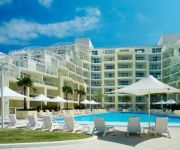
MANTRA ETTALONG BEACH
Videos from this area
These are videos related to the place based on their proximity to this place.
Ettalong Beach Holiday Village - Central coast of NSW, Australia. Near Home and Away Beach
Ettalong Beach holiday village is located in the quiet seaside town of Ettalong Beach bordering the Brisbane Waters. Catch the ferry and have a look at the on site location for the filming...
Ettalong Beach house Fire
footage of a house fire at Ettalong Beach. Awesome work by FRNSW crews from 340 Umina 353 kincumber and lots of others including 228 hazmat and several gosford RFS brigades (who were called.
Daves Jetski Birthday bash at Ettalong Beach - Better Resolution and Audio
Yamaha 800cc Waveblaster (Fully Worked ~ 90 kW) Filmed at Ettalong Beach, Gosford (North of Sydney, NSW)
Jetski Fun at Ettalong Beach Yamaha Fzs
A few Boys from Ozpwc.com playing on the small waves @ Ettalong Beach. Testing out the new Gopro Full HD camera Send me an Email as I can get these for $399 instead of $500-$600 they sell...
Ettalong Beach Real Estate +61288809499
http://ettalongbeachrealestate.com - Ettalong Beach Real Estate +61288809499 See more Real Estate Video at : https://www.youtube.com/user/centralcoastrnsw Ye...
Prowave6
1st time surfing Box head, with a very long paddle from Ettalong beach. Hitched a ride with a jet ski for the last half of the trip. Break is only lefts and only in SE swell of some size.
Pearl Beach by Mountain Bike
A nice little ride from Ocean Beach to Peal Beach on the NSW Central Coast. Ridden by Matt Gracie from Ride Ettalong showcasing some of the beautiful mountain bike rides on the Coast.
Videos provided by Youtube are under the copyright of their owners.
Attractions and noteworthy things
Distances are based on the centre of the city/town and sightseeing location. This list contains brief abstracts about monuments, holiday activities, national parcs, museums, organisations and more from the area as well as interesting facts about the region itself. Where available, you'll find the corresponding homepage. Otherwise the related wikipedia article.
Saratoga, New South Wales
Saratoga is a peninsula locality of Brisbane Water and a residential south-eastern suburb of the Central Coast region of New South Wales, Australia. It is part of the City of Gosford local government area. The area was first exploited by European settlers for citrus orchards; in recent years, however, housing development has transformed most of Saratoga into an outer residential suburb of Gosford.
Koolewong railway station
Koolewong railway station is located on the Central Coast of New South Wales Australia serving the suburb of Koolewong. The Station has two short side platforms and a level crossing to the north of the station. Koolewong is mainly served by Sydney to Wyong services and occasionally by a Newcastle service. Passengers who use Koolewong must board or alight from the rear car only.
Woy Woy railway station
Woy Woy railway station is located in Woy Woy on the Central Coast of New South Wales Australia. The facility consists of an island platform. Two trains an hour serve Woy Woy in each direction during most of the off peak period. More trains serve Woy Woy during the peak periods.
Woy Woy, New South Wales
Woy Woy is a coastal town and a southern suburb of the Central Coast region of New South Wales, Australia, located on the southern reaches of Brisbane Water 79 kilometres north of Sydney. It is an important population centre within the City of Gosford local government area.
Pretty Beach, New South Wales
Pretty Beach is a south-eastern suburb of the Central Coast region of New South Wales, Australia on the Bouddi Peninsula. It is part of the City of Gosford local government area. The beach itself does not face the sea directly but is part of Brisbane Water, making it a safe place for both children and the mooring of boats. Approximately 200 people live in the immediate area. Pretty Beach is surrounded by the Bouddi National Park.
Umina Beach, New South Wales
Umina Beach is a suburb within the City of Gosford local government area on the Central Coast of New South Wales, Australia. By road, it is 90 kilometres north of Sydney and 111 kilometres south of Newcastle. Umina Beach is locally known on the Central Coast as being on 'The Peninsula' (or ‘Woy Woy Peninsula'). A natural peninsula that includes the towns of Umina Beach, Woy Woy, Blackwall, Booker Bay and Ettalong Beach.
Blackwall, New South Wales
Blackwall is a suburb of the Central Coast region of New South Wales, Australia, south of Woy Woy on Brisbane Water, 81 kilometres north of Sydney. It is part of the City of Gosford local government area. The suburb includes a boat ramp and a bushland recreation reserve, Kitchener Reserve, offering walk trails and views from Blackwall Mountain. The section of the suburb east of Kitchener Park is locally known as Orange Grove.
Booker Bay, New South Wales
Booker Bay is a suburb of the Central Coast region of New South Wales Australia south-east of Woy Woy on Brisbane Water, about 80 kilometres north of Sydney. It is part of the City of Gosford local government area.
Box Head, New South Wales
Box Head is a coastal suburb of the Central Coast region of New South Wales, Australia in the City of Gosford local government area. The locality is part of the Bouddi National Park, and contains several beaches including Lobster Beach, Iron Ladder Beach and Tallow Beach. The headland itself marks the northern entrance to Broken Bay from the Tasman Sea.
Daleys Point, New South Wales
Daleys Point is a south-eastern suburb of the Central Coast region of New South Wales, Australia on the Bouddi Peninsula. It is part of the City of Gosford local government area. The median house price in January 2010 was A$950,000.
Empire Bay, New South Wales
Empire Bay is a suburb on the Central Coast of New South Wales, Australia. It is part of the City of Gosford local government area. Empire Bay was originally known as Sorrento being the name of a large boarding house in the locality. The land was subdivided in 1905. The name changed to Empire Bay in 1908 when a Postal Receiving Office was opened in a building attached to the boarding house.
Ettalong Beach, New South Wales
Ettalong Beach is a suburb of the Central Coast region of New South Wales, Australia south of Woy Woy on Brisbane Water at the point where it meets Broken Bay, about 80 km north of Sydney. It is part of the City of Gosford local government area. Ettalong Beach is the natural eastward continuation of Umina Beach and Ocean Beach. The Mantra Ettalong Beach Resort (formerly operated by Outrigger) and Ettalong Beach War Memorial Club was completed in 2005.
Hardys Bay, New South Wales
Hardys Bay is a south-eastern suburb of the Central Coast region of New South Wales, Australia on the Bouddi Peninsula. It is part of the City of Gosford local government area.
Horsfield Bay, New South Wales
Horsfield Bay is a locality of the Central Coast region of New South Wales, Australia 5 kilometres west of Woy Woy between Brisbane Water National Park and Woy Woy Inlet. It is part of the City of Gosford local government area.
Killcare, New South Wales
Killcare is a south-eastern suburb of the Central Coast region of New South Wales, Australia, located on the Bouddi Peninsula. It is part of the City of Gosford local government area. Prior to the arrival of European Settlement, Aboriginals from the coastal Guringai (Ku-ring-gai) tribe lived in and around Hardys Bay area. Evidence is to be found today in rock carvings and middens found in numerous locations around the area.
Killcare Heights, New South Wales
Killcare Heights is a south-eastern suburb of the Central Coast region of New South Wales, Australia on the Bouddi Peninsula. It is part of the City of Gosford local government area.
Koolewong, New South Wales
Koolewong is a suburb of the Central Coast region of New South Wales, Australia between Gosford and Woy Woy, and is mostly on a hill overlooking Brisbane Water. It is part of the City of Gosford local government area. The suburb contains Koolewong railway station, which is on the Main North railway line. Koolewong is an Aboriginal word for Koala there.
Patonga, New South Wales
Patonga is a suburb of the Central Coast region of New South Wales, Australia, located on the north bank of the Hawkesbury River, southwest of Woy Woy. It is part of the City of Gosford local government area.
Pearl Beach, New South Wales
Pearl Beach is a suburb of Gosford City on the Central Coast of New South Wales, Australia. Pearl Beach was assigned 'suburb' status by the Geographical Names Board of NSW on 25 October 1991.
Phegans Bay, New South Wales
Phegans Bay is a suburb within the local government area of the City of Gosford on the Central Coast of New South Wales, Australia. Phegans Bay is located 6 kilometres west of Woy Woy between Brisbane Water National Park and Woy Woy Inlet.
St Huberts Island, New South Wales
St Huberts Island is a canal estate and suburb of the Central Coast region of New South Wales, Australia connected to the mainland at Daleys Point. It is part of the City of Gosford local government area. The modern-day development of St Huberts Island happened when Hooker-Rex Developments (now LJ Hooker Realty) built residential developments on the site in the early-1970's (
Wagstaffe, New South Wales
Wagstaffe is a south-eastern suburb of the Central Coast region of New South Wales, Australia on the Bouddi Peninsula. It is part of the City of Gosford local government area. It was named after Captain Wagstaffe, one of the first settlers in the area. It has a general store, which is also the local post office. It is a thin slither of around 200 houses between the bay and the bush(Bouddi National Park). Historically it was also known as Wagstaffe Point.
Marramarra Parish, Cumberland
Marramarra Parish, Cumberland is one of the 57 parishes of Cumberland County, New South Wales, a cadastral unit for use on land titles. The first landholding in the Parish of Marramarra was of 6 acres on the northern side of Marramarra Creek below Mount Blake. It was purchased by John Blake for One Pound Ten Shillings Sterling on June 6, 1835. The land had been advertised for sale by auction in an advertisement dated December 13, 1834.
Woy Woy Bay, New South Wales
Woy Woy Bay is a suburb located in the Central Coast region of New South Wales, Australia, as part of the City of Gosford local government area. Most of the suburb's area belongs to the Brisbane Water National Park, although a small community on Woy Woy Bay containing a community hall, public reserve and wharf is also located within the suburb. Woy Woy Bay is commonly used by boaters on the weekend because of the open expanses of the bay. The main thoroughfare is Taylor Street.
Hazard (ship)
The Hazard was an Australian sloop wrecked in 1809. In March 1809, three ships, the Argument, the Experiment and the Hazard left Pittwater, New South Wales, bound for Sydney with a cargo of wheat. A squall arose and the Hazard was driven onto Box Head, two miles north of Barrenjoey, New South Wales. The master, Andrew Lusk, got into the ships boat but was unable to persuade his single crew member, a boy, to join him. The boy was washed overboard and was dragged from the surf by some aborigines.


