Discover Prairiewood
The district Prairiewood of in Fairfield (New South Wales) is a district in Australia about 141 mi north-east of Canberra, the country's capital city.
Looking for a place to stay? we compiled a list of available hotels close to the map centre further down the page.
When in this area, you might want to pay a visit to some of the following locations: Parramatta, Sydney, Katoomba, Canberra and . To further explore this place, just scroll down and browse the available info.
Local weather forecast
Todays Local Weather Conditions & Forecast: 23°C / 74 °F
| Morning Temperature | 17°C / 62 °F |
| Evening Temperature | 22°C / 71 °F |
| Night Temperature | 20°C / 69 °F |
| Chance of rainfall | 1% |
| Air Humidity | 65% |
| Air Pressure | 1021 hPa |
| Wind Speed | Moderate breeze with 10 km/h (6 mph) from South-West |
| Cloud Conditions | Overcast clouds, covering 93% of sky |
| General Conditions | Light rain |
Sunday, 17th of November 2024
32°C (89 °F)
20°C (68 °F)
Heavy intensity rain, moderate breeze, overcast clouds.
Monday, 18th of November 2024
30°C (86 °F)
18°C (64 °F)
Moderate rain, moderate breeze, few clouds.
Tuesday, 19th of November 2024
24°C (76 °F)
19°C (66 °F)
Sky is clear, moderate breeze, clear sky.
Hotels and Places to Stay
The William Inglis - MGallery by Sofitel
ATURA HOTEL BLACKTOWN
Travelodge Blacktown Sydney
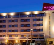
Mercure Sydney Liverpool
Blueys Retreat
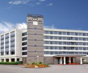
RYDGES BANKSTOWN SYDNEY
Pritchards Hotel
ALPHA EASTERN CREEK
Brown Jug Inn Hotel
Holiday Inn WARWICK FARM
Videos from this area
These are videos related to the place based on their proximity to this place.
Ronei. Delivery driver in Sydney. Prospect to City.
Driving in the rain after delivery. By Ronei - BRAZIL - RJ.
Signature Dishes of 2166 - Pho Phung
Fairfield City Council is running a Signature Dishes promotion throughout October, part of the Sydney Morning Herald Good Food Month. For a hearty bowl of Beef Noodle Soup, try Phở Bò...
Signature Dishes of 2166 - What the Fudge
Fairfield City Council is running a Signature Dishes promotion throughout October, part of the Sydney Morning Herald Good Food Month. If you have a sweet tooth, then you will love What The...
Signature Dishes of 2166 - Pho Tau Bay
Fairfield City Council is running a Signature Dishes promotion throughout October, part of the Sydney Morning Herald Good Food Month. The Sydney Morning Herald's Good Food guide says: The...
The The parkour/street workout facility at Emerson Street Reserve on Sunday, 31 August 2014.
Members of Fairfield City's Team 9Lives and the Bondi Beach BAR Brutes put on exciting displays on the monkey bars after the official launch was made by Mayor Frank Carbone, with the help of...
Echoes from the Past Part One 2013
After a successful showing The Bunker gallery, Coffs Harbour, "Echoes From The Past" was launched February 2nd 2013, at the Fairfield City Museum & Gallery, ...
A Snapshot of C2C - Term 3 Now Enrolling @ C2C
www.facebook.com.com/committedtocoaching We are now taking enrolments for Term 3 at C2C. Pre-Kindy - HSC 2 - 3 hours per week, Maths & English Packages. HSC Subjects: Maths, English, ...
Kite Flying Festival 2013 Sydney
Unique & Most Spectacular Festival of Indian in Sydney Sunday 13th January 2013 from 9:30 AM to 4:00 PM at Fairfield Showground Sydney Organised by Shree Swaminarayan Mandir - Sydney ...
A Term in Review: Term 2 2012
The laughter, the fun, the tears, the chores, the wins, the losses, the students and the teachers! It was difficult to fit 10 full-on weeks into a 2 minute video, but hopefully it re-ignites...
My Truck Wash Xpress - Smithfield
My Truck Wash Xpress cleans all trucks in 5-15 mins for under $100 and we guarantee customer satisfaction. Our current drive-thru locations are in Sydney and Albury with locations opening soon...
Videos provided by Youtube are under the copyright of their owners.
Attractions and noteworthy things
Distances are based on the centre of the city/town and sightseeing location. This list contains brief abstracts about monuments, holiday activities, national parcs, museums, organisations and more from the area as well as interesting facts about the region itself. Where available, you'll find the corresponding homepage. Otherwise the related wikipedia article.
Edensor Park, New South Wales
Edensor Park is a suburb of Sydney, New South Wales, Australia. Edensor Park is located 38 kilometres west of the Sydney central business district in the local government area of the City of Fairfield. It is mainly a residential area, which mainly consists of the middle social class. Edensor Park is part of the Greater Western Sydney region.
City of Fairfield
The City of Fairfield is a local government area in the south-west of Sydney, in the state of New South Wales, Australia. The City of Fairfield is 102 square kilometres . The Mayor of the City of Fairfield is Cr. Frank Carbone, a member of the Labor Party.
Wakeley, New South Wales
Wakeley is a suburb of Sydney, in the state of New South Wales, Australia 34 kilometres west of the Sydney central business district in the local government area of the City of Fairfield. Wakeley is part of the Greater Western Sydney region.
St Johns Park, New South Wales
St Johns Park is a suburb of Sydney, in the state of New South Wales, Australia 35 kilometres west of the Sydney central business district, in the local government areas of the City of Fairfield. It is part of the Greater Western Sydney region.
Smithfield, New South Wales
Smithfield is a suburb of Sydney, in the state of New South Wales, Australia. Smithfield is located 30 kilometres west of the Sydney central business district in the local government areas of the City of Fairfield and the City of Holroyd. The suburb is a mix of residential, industrial and commercial areas. Though, it's mostly characterized by low-density housing .
Prairiewood, New South Wales
Prairiewood is a suburb of Sydney, in the state of New South Wales, Australia 34 kilometres west of the Sydney central business district, in the local government area of the City of Fairfield. It is part of the Greater Western Sydney region. Prairiewood is primarily a residential suburb that is also home to a golf course, Fairfield Showground, schools, a leisure centre and a major shopping centre.
Mount Pritchard, New South Wales
Mount Pritchard is a suburb of Sydney, in the state of New South Wales, Australia 34 kilometres south-west of the Sydney central business district, in the local government area of the City of Fairfield and is part of the South-western Sydney region.
Bonnyrigg Heights, New South Wales
Bonnyrigg Heights is a suburb of Sydney, in the state of New South Wales, Australia. Bonnyrigg Heights is located 37 kilometres west of the Sydney central business district, in the local government area of the City of Fairfield and is part of the Greater Western Sydney region.
Bonnyrigg, New South Wales
Bonnyrigg is a suburb of Sydney, in the state of New South Wales, Australia. Bonnyrigg is located 36 kilometres west of the Sydney central business district, in the local government area of the City of Fairfield and is part of the Greater Western Sydney region.
Bossley Park, New South Wales
Bossley Park is a suburb of Sydney, in the state of New South Wales, Australia. Bossley Park is located 36 kilometres west of the Sydney central business district in the local government area of the City of Fairfield. Bossley Park is part of the Greater Western Sydney region. The 2006 census records Bossley Park as having a resident population of 13,931 (of whom around half were born outside Australia) and an area of 4.5 km.
Cabramatta West, New South Wales
Cabramatta West is a suburb of Sydney, in the state of New South Wales, Australia 32 kilometres south-west of the Sydney central business district, in the local government area of the City of Fairfield. It is part of the south-western region. Cabramatta is a separate suburb, to the east.
Canley Heights, New South Wales
Canley Heights is a suburb of Sydney, in the state of New South Wales, Australia 31 kilometres south-west of the Sydney central business district, in the local government area of the City of Fairfield and is part of the South-western Sydney region.
Fairfield West, New South Wales
Fairfield West is a suburb of Sydney, in the state of New South Wales, Australia. Fairfield West is located 33 kilometres west of the Sydney central business district in the local government area of the City of Fairfield. Fairfield West is part of the Greater Western Sydney region. Fairfield West shares the postcode of 2165 with the separate suburbs of Fairfield, Fairfield Heights and Fairfield East.
Fairfield Heights, New South Wales
Fairfield Heights is a suburb of Sydney, in the state of New South Wales, Australia. Fairfield Heights is located 31 kilometres west of the Sydney central business district in the local government area of the City of Fairfield. Fairfield Heights is part of the Greater Western Sydney region. Fairfield Heights shares the postcode of 2165 with the separate suburbs of Fairfield, Fairfield East and Fairfield West.
Greenfield Park, New South Wales
Greenfield Park is a suburb of Sydney, in the state of New South Wales, Australia. Greenfield Park is located 36 kilometres west of the Sydney central business district in the local government area of the City of Fairfield. Greenfield Park is part of the Greater Western Sydney region.
Fairvale High School
Fairvale High School is a comprehensive coeducational high school located in Fairfield West, Sydney, Australia. Established in 1969, the school is part of the South Western Sydney School Region and the Fairfield School Education Area.
Marconi Stadium
Marconi Stadium is a football (soccer) stadium in Bossley Park, New South Wales, Australia. It is mainly is used for association football and is the home ground for the Marconi Stallions team.
Sydney United Sports Centre
Sydney United Sports Centre, formerly known as Sydney Croatia Sports Centre and King Tomislav Park is a multi-use stadium in Edensor Park, Sydney, Australia. It is mainly used for football (soccer) and is the home ground for the Sydney United team. The stadium has a capacity of 12,000 people and was built in 1979 and upgraded in 1998.
Prospect Reservoir
Prospect Reservoir is a water storage reservoir located at the headwaters of Prospect Creek in the Greater Western Sydney suburb of Prospect, in New South Wales, Australia. The dam wall is known as Prospect Dam.
St Johns Park High School
St Johns Park High School also known within the school as SJPHS, is a comprehensive state school in the suburb of Fairfield in Sydney, Australia. It opened in 1978 and has a population of over 1,250 students. In 2002, the student population reached 1,238. The school is located at Mimosa Road. St Johns Park High School is a large co-educational school which is rich in a range of diverse cultures.
Bonnyrigg Sports Club
Bonnyrigg Sports Club is the home of the Bonnyrigg White Eagles football (soccer) club in Bonnyrigg, New South Wales, Australia. The ground has played host to some notable matches over the years but none more so than the friendly clash between the Bonnyrigg White Eagles and the high-profile 1991 European Cup Champions Red Star Belgrade who were in Australia on a mid-season break in January 2001.
Fairfield Hospital (Sydney)
Fairfield Hospital is a district hospital located in Fairfield in the South western part of Sydney, Australia. It has about 200 beds and has provides general medical, general surgical, obstetric, paediatric and emergency services. The hospital opened at its current location in Prairiewood in 1988, after relocating from the old site on The Horsley Drive in Fairfield. The land used to be home to the Gray family, a farm homestead, until the land was taken off them in 1988.
Bossley Park High School
Bossley Park High School (abbreviated as BPHS) is located in the Bossley Park, New South Wales, Australia. It is a coeducational comprehensive high school serving the rapidly developing suburbs of Bossley Park and Abbotsbury in western Sydney. In 2010, the school was made up of over 1473 students, each from Years 7 to 12, and is one of the largest schools in the state.
St Luke Parish, Cumberland
St Luke Parish is one of the 57 parishes of Cumberland County, New South Wales, a cadastral unit for use on land titles. It is bounded by Prospect Creek in the north-east, Georges River in the south-east, and Cowpasture Road in the west. It was named after the Anglican church of St Lukes in Liverpool, which was completed in 1819. The parish is mentioned in various legislation dealing with property law for the city of Liverpool.
Prospect Hill (New South Wales)
Prospect Hill (New South Wales) is a small hill about 30 kilometres west of central Sydney. It is stands up higher than the ridges of the Cumberland Plain around it and with steeper slopes, but not much higher and not much steeper. All the same it is enough of a hill to command attention and its summit affords a “goodly prospect” west to the Blue Mountains and east to the man-made landmarks of Central Sydney.


