Discover Mount Pritchard
The district Mount Pritchard of in Fairfield (New South Wales) is a district in Australia about 139 mi north-east of Canberra, the country's capital city.
Looking for a place to stay? we compiled a list of available hotels close to the map centre further down the page.
When in this area, you might want to pay a visit to some of the following locations: Parramatta, Sydney, Katoomba, Canberra and . To further explore this place, just scroll down and browse the available info.
Local weather forecast
Todays Local Weather Conditions & Forecast: 23°C / 74 °F
| Morning Temperature | 17°C / 62 °F |
| Evening Temperature | 22°C / 71 °F |
| Night Temperature | 20°C / 69 °F |
| Chance of rainfall | 1% |
| Air Humidity | 65% |
| Air Pressure | 1021 hPa |
| Wind Speed | Moderate breeze with 10 km/h (6 mph) from South-West |
| Cloud Conditions | Overcast clouds, covering 93% of sky |
| General Conditions | Light rain |
Sunday, 17th of November 2024
32°C (89 °F)
20°C (68 °F)
Heavy intensity rain, moderate breeze, overcast clouds.
Monday, 18th of November 2024
30°C (86 °F)
18°C (64 °F)
Moderate rain, moderate breeze, few clouds.
Tuesday, 19th of November 2024
24°C (76 °F)
19°C (66 °F)
Sky is clear, moderate breeze, clear sky.
Hotels and Places to Stay
The William Inglis - MGallery by Sofitel
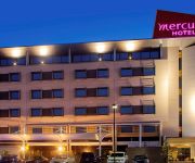
Mercure Sydney Liverpool
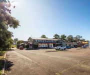
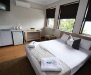
Blueys Retreat
BEST WESTERN CASULA MOTOR INN
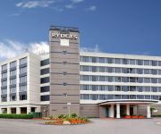
RYDGES BANKSTOWN SYDNEY
Pritchards Hotel
Crossroads Hotel Liverpool
Holiday Inn WARWICK FARM
Brown Jug Inn Hotel
QUEST LIVERPOOL
Videos from this area
These are videos related to the place based on their proximity to this place.
liverpool bridge and Georges river
Lol, this is the sad excuse for a river running through my (now) home town of Liverpool, in Australia. Not a patch on the Esk in Musselburgh, nae geese, nae swans, nae fish, and nae people......
Bad Driver In Liverpool, NSW (SOF-11B)
On 03/08/2012 a driver in a silver Mercedes was seen driving with no indicators around corners and clearly driving through a red light in Liverpool, NSW.
Conveyancing in Liverpool - AAA Johnson and Lu Pty Ltd
The best conveyancing in liverpool. They charged cheap price for a matter with the expert and experienced conveyancer. Top conveyancing services that no other conveyancing company could offer....
Sydney Rail Vlog 16: Liverpool
At Liverpool, a large station with a major bus interchange. Filmed on 11/10/2014.
Liverpool Community Kitchen and Hub - Official Launch and Signing of MOU
The Liverpool Community Kitchen and Hub is a partnership project between local community organisations, charities and churches. It was established in response to the growing needs of people...
Liverpool-NSW-Real-Estate
http://www.prudential.com.au/ Prudential Real Estate 3/52-58 Memorial Ave Liverpool NSW 2170 PH: 02 9822 5999.
Busy Intersection In Liverpool
At peak hour in Liverpool, NSW this can be a very busy intersection. Today shows a perfect example. Feel free to comment on what I have written, correct me if I am wrong. I have labelled some...
3526 & 3642 at Liverpool
Steam locomotives 3526 and 3542 passing through Liverpool on the Up line at about 11:45 am on 6/11/2009. The two locos were hauling a single brake van.
Videos provided by Youtube are under the copyright of their owners.
Attractions and noteworthy things
Distances are based on the centre of the city/town and sightseeing location. This list contains brief abstracts about monuments, holiday activities, national parcs, museums, organisations and more from the area as well as interesting facts about the region itself. Where available, you'll find the corresponding homepage. Otherwise the related wikipedia article.
Cabramatta, New South Wales
Cabramatta is a suburb in south-western Sydney, in the state of New South Wales, Australia. Cabramatta is located 30 kilometres south-west of the Sydney central business district, in the local government area of the City of Fairfield. Cabramatta is colloquially known as 'Cabra' and has the largest Vietnamese community in Australia.
Liverpool, New South Wales
Liverpool is a suburb in south-western Sydney, in the state of New South Wales, Australia. Liverpool is located 32 km south-west of the Sydney central business district, and is the administrative centre of the local government area of the City of Liverpool. It was identified in the New South Wales Government's Sydney Metropolitan Strategy as a regional city, establishing it as a major centre in Greater Western Sydney.
Division of Fowler
The Division of Fowler is an Australian Electoral Division in New South Wales. It includes the suburbs of Ashcroft, Austral, Bonnyrigg, Bonnyrigg Heights, Busby, Cabramatta, Cabramatta West, Canley Heights, Canley Vale, Cartwright, Cecil Hills, Cecil Park, Edensor Park, Green Valley, Greenfield Park, Heckenberg, Hinchinbrook, Lansvale, Liverpool, Middleton Grange, Miller, Mount Pritchard, Prairiewood, Sadleir, St Johns Park, Wakeley and West Hoxton. The division was created in 1984.
Warwick Farm railway station
Warwick Farm is a railway station in the south-western suburbs of Sydney on the Main South Line located at its intersection with the Hume Highway. It is served by Cityrail trains of the South, Bankstown, Cumberland and Inner West lines.
Liverpool railway station
Liverpool railway station is a railway station in the south-western suburbs of Sydney and is situated on the Main South Line. It is served by Cityrail trains of the South, Cumberland, Bankstown and Inner West lines. The station serves the employment and commercial centre of Liverpool, as well as Liverpool Hospital. It is a busy intermediate terminus and transport interchange hub.
Ashcroft, New South Wales
Ashcroft is a suburb in South-western Sydney, in the state of New South Wales, Australia 35 kilometres south-west of the Sydney central business district, in the local government area of the City of Liverpool.
Wakeley, New South Wales
Wakeley is a suburb of Sydney, in the state of New South Wales, Australia 34 kilometres west of the Sydney central business district in the local government area of the City of Fairfield. Wakeley is part of the Greater Western Sydney region.
St Johns Park, New South Wales
St Johns Park is a suburb of Sydney, in the state of New South Wales, Australia 35 kilometres west of the Sydney central business district, in the local government areas of the City of Fairfield. It is part of the Greater Western Sydney region.
Sadleir, New South Wales
Sadleir is a suburb in south-western Sydney, in the state of New South Wales, Australia. Sadleir is located 37 kilometres south-west of the Sydney central business district, in the local government area of the City of Liverpool.
Lurnea, New South Wales
Lurnea is a suburb of Sydney in the state of New South Wales, Australia 35 kilometres south-west of the Sydney central business district, in the local government area of the City of Liverpool.
City of Liverpool (New South Wales)
The City of Liverpool is a local government area to the south-west of Sydney, in the state of New South Wales, Australia. The area encompasses 305.5 square kilometres and its administrative centre is located in the suburb of Liverpool. The Mayor of the City is Cr. Ned Mannoun, a member of the Liberal Party.
Mount Pritchard, New South Wales
Mount Pritchard is a suburb of Sydney, in the state of New South Wales, Australia 34 kilometres south-west of the Sydney central business district, in the local government area of the City of Fairfield and is part of the South-western Sydney region.
Bonnyrigg, New South Wales
Bonnyrigg is a suburb of Sydney, in the state of New South Wales, Australia. Bonnyrigg is located 36 kilometres west of the Sydney central business district, in the local government area of the City of Fairfield and is part of the Greater Western Sydney region.
Busby, New South Wales
Busby is a suburb in south-western Sydney, in the state of New South Wales, Australia. Busby is located 37 kilometres south-west of the Sydney central business district, in the local government area of the City of Liverpool. Neighbouring suburbs include Miller, Heckenberg, Hinchinbrook, Green Valley and Bonnyrigg.
Cabramatta West, New South Wales
Cabramatta West is a suburb of Sydney, in the state of New South Wales, Australia 32 kilometres south-west of the Sydney central business district, in the local government area of the City of Fairfield. It is part of the south-western region. Cabramatta is a separate suburb, to the east.
Canley Heights, New South Wales
Canley Heights is a suburb of Sydney, in the state of New South Wales, Australia 31 kilometres south-west of the Sydney central business district, in the local government area of the City of Fairfield and is part of the South-western Sydney region.
Cartwright, New South Wales
Cartwright is a suburb in south-western Sydney, in the state of New South Wales, Australia 38 kilometres south-west of the Sydney central business district, in the local government area of the City of Liverpool.
Cabramatta High School
Cabramatta High School is the local high school of Cabramatta, an urbanised suburb located in south-west Sydney, Australia. The school was established in 1958 as the suburb's first high school. It has attracted much undue negative publicity in the last decade over sensationalised media reports that drug and gang-related crimes were directly linked to Cabramatta High School students.
Greenfield Park, New South Wales
Greenfield Park is a suburb of Sydney, in the state of New South Wales, Australia. Greenfield Park is located 36 kilometres west of the Sydney central business district in the local government area of the City of Fairfield. Greenfield Park is part of the Greater Western Sydney region.
Heckenberg, New South Wales
Heckenberg is a suburb in south-western Sydney, in the state of New South Wales, Australia 36 kilometres south-west of the Sydney central business district, in the local government area of the City of Liverpool.
Liverpool Hospital
Liverpool Hospital is located approximately 50 minutes drive from the Sydney CBD and is the largest Hospital in New South Wales and one of the leading trauma centres in Australia. It has a capacity of 855 beds, 23 operating rooms and 60 critical care beds, diagnostic and imaging services, emergency and trauma care, maternity, paediatric, cancer care, mental health, ambulatory care, allied health and medical and surgical services from birth to aged care.
Westfield Liverpool
Westfield Liverpool is a major shopping centre, located in Liverpool, a suburb of Sydney.
Lurnea High School
Lurnea High School (often abbreviated to LHS) is a co-education secondary school located in the suburb of Lurnea, New South Wales, Australia. It is a public high school that caters for roughly 800 students from Year 7 through Year 12. An Intensive English Centre and Hearing Impaired Unit are also established at Lurnea High School. The school was first opened in 1965. Lurnea High School also has numerous science, art and cooking classrooms. It also has 10 Interactive White Boards (Smartboards).
St Luke Parish, Cumberland
St Luke Parish is one of the 57 parishes of Cumberland County, New South Wales, a cadastral unit for use on land titles. It is bounded by Prospect Creek in the north-east, Georges River in the south-east, and Cowpasture Road in the west. It was named after the Anglican church of St Lukes in Liverpool, which was completed in 1819. The parish is mentioned in various legislation dealing with property law for the city of Liverpool.
All Saints Catholic Boys College
All Saints Catholic Boys College is an all day Roman Catholic school founded in Liverpool, Sydney, New South Wales in 1954. The college is adjacent to All Saints Catholic Girls College and primary school. The school was originally called Patrician Brothers College, Liverpool. The majority of the population of the college come from non English speaking backgrounds. The college caters for students in the parishes of Liverpool, Moorebank, Holsworthy and Lurnea.


