Explore Cecil Park
The district Cecil Park of in Fairfield (New South Wales) with it's 1,477 inhabitants Cecil Park is located in Australia about 138 mi north-east of Canberra, the country's capital.
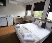
If you need a place to sleep, we compiled a list of available hotels close to the map centre further down the page.
Depending on your travel schedule, you might want to pay a visit to some of the following locations: Parramatta, Sydney, Katoomba, Canberra and . To further explore this place, just scroll down and browse the available info.
Local weather forecast
Todays Local Weather Conditions & Forecast: 23°C / 74 °F
| Morning Temperature | 17°C / 62 °F |
| Evening Temperature | 22°C / 71 °F |
| Night Temperature | 20°C / 69 °F |
| Chance of rainfall | 1% |
| Air Humidity | 65% |
| Air Pressure | 1021 hPa |
| Wind Speed | Moderate breeze with 10 km/h (6 mph) from South-West |
| Cloud Conditions | Overcast clouds, covering 93% of sky |
| General Conditions | Light rain |
Sunday, 17th of November 2024
32°C (89 °F)
20°C (68 °F)
Heavy intensity rain, moderate breeze, overcast clouds.
Monday, 18th of November 2024
30°C (86 °F)
18°C (64 °F)
Moderate rain, moderate breeze, few clouds.
Tuesday, 19th of November 2024
24°C (76 °F)
19°C (66 °F)
Sky is clear, moderate breeze, clear sky.
Hotels and Places to Stay
Blueys Retreat
Mercure Sydney Liverpool
ATURA HOTEL BLACKTOWN
BEST WESTERN CASULA MOTOR INN
Travelodge Blacktown Sydney
Pritchards Hotel
ALPHA EASTERN CREEK
Crossroads Hotel Liverpool
Blue Cattle Dog Hotel
Country Comfort Liverpool
Videos from this area
These are videos related to the place based on their proximity to this place.
Ronei. Delivery driver in Sydney. Prospect to City.
Driving in the rain after delivery. By Ronei - BRAZIL - RJ.
The The parkour/street workout facility at Emerson Street Reserve on Sunday, 31 August 2014.
Members of Fairfield City's Team 9Lives and the Bondi Beach BAR Brutes put on exciting displays on the monkey bars after the official launch was made by Mayor Frank Carbone, with the help of...
Kite Flying Festival 2013 Sydney
Unique & Most Spectacular Festival of Indian in Sydney Sunday 13th January 2013 from 9:30 AM to 4:00 PM at Fairfield Showground Sydney Organised by Shree Swaminarayan Mandir - Sydney ...
Burnout Mayhem or Tip In City?
Who performed the best tip in at Burnout Mayhem?? SILLY BEATEN (0:00) ADHD (0:09) OUTLAW (0:15) METHEAD (0:21) CURUPT (0:29) TUFFST (0:38) PROPSI (0:45) RHYNOS (0:53) ULEGAL ...
Eastern Creek - Super Drift Rd 4 2008 - Cliff Clayson's RX7
Trip to Eastern Creek, NSW for Round 4 of Super Drift 2008. Features Cliff Clayson in his Knightsports/REVS sponsored FC RX7.
CAM2 BLUE BLOOD RACING Drag Car 5 6 2013
Another video i took while waiting for burnouts to start i liked the look of this one.
Fastrack Racing - My Drive in the Thirsty Camel with Ian Dyk Instructing.
My awesome girlfriend got this for me for my birthday, couldn't have asked for anything more, by far the best gift, so for all you women out there, this is what your man wants, so go to http://www....
42 Ford V8 Fairlane At Good Fryday Burnout Comp WSID 18 4 2014
these are all the videos that i managed to get off my camera from Good Fryday burnouts at Sydney Dragway.
BURNOUT PATROL Holden VP V6 Commodore Burnout At WSID 29 6 2014
These guys came out to have some fun.
69 UNEASY Holden VU V8 SS Ute Burnout At Tamworth Christmas Skids 14 12 2013
These guys traveled to Tamworth to take part in a local burnout competition.
Videos provided by Youtube are under the copyright of their owners.
Attractions and noteworthy things
Distances are based on the centre of the city/town and sightseeing location. This list contains brief abstracts about monuments, holiday activities, national parcs, museums, organisations and more from the area as well as interesting facts about the region itself. Where available, you'll find the corresponding homepage. Otherwise the related wikipedia article.
Edensor Park, New South Wales
Edensor Park is a suburb of Sydney, New South Wales, Australia. Edensor Park is located 38 kilometres west of the Sydney central business district in the local government area of the City of Fairfield. It is mainly a residential area, which mainly consists of the middle social class. Edensor Park is part of the Greater Western Sydney region.
Division of Fowler
The Division of Fowler is an Australian Electoral Division in New South Wales. It includes the suburbs of Ashcroft, Austral, Bonnyrigg, Bonnyrigg Heights, Busby, Cabramatta, Cabramatta West, Canley Heights, Canley Vale, Cartwright, Cecil Hills, Cecil Park, Edensor Park, Green Valley, Greenfield Park, Heckenberg, Hinchinbrook, Lansvale, Liverpool, Middleton Grange, Miller, Mount Pritchard, Prairiewood, Sadleir, St Johns Park, Wakeley and West Hoxton. The division was created in 1984.
Abbotsbury, New South Wales
Abbotsbury is a suburb of Sydney, New South Wales, Australia 39 kilometres west of the Sydney central business district in the local government area of the City of Fairfield. Abbotsbury is part of the Greater Western Sydney region.
Liverpool Speedway
Liverpool Speedway (also known during its life as Liverpool International Speedway and Liverpool City Raceway) was located in Green Valley, Western Sydney, New South Wales, Australia. Liverpool was opened by Frank Oliveri, the mayor of Liverpool at the time, and ran until its sudden and unexpected closure in 1989. Oliveri would later share track management with track announcer and promoter, Channel 7 television sports presenter Mike Raymond.
Kemps Creek, New South Wales
Kemps Creek is a suburb of Sydney, in the state of New South Wales, Australia. It is 39 kilometres west of the Sydney central business district, in the local government areas of the City of Penrith and City of Liverpool. It is part of the Greater Western Sydney region.
Mount Vernon, New South Wales
Mount Vernon is a suburb of Sydney, in the state of New South Wales, Australia. Mount Vernon is 42 kilometres west of the Sydney central business district, in the local government area of the City of Penrith and is part of the Greater Western Sydney region. Mount Vernon is a sparsely populated rural suburb providing a close community atmosphere for its residents. It is a hilly suburb with spectacular views all the way to the Blue Mountains ensuring high scenic qualities.
Bonnyrigg Heights, New South Wales
Bonnyrigg Heights is a suburb of Sydney, in the state of New South Wales, Australia. Bonnyrigg Heights is located 37 kilometres west of the Sydney central business district, in the local government area of the City of Fairfield and is part of the Greater Western Sydney region.
Bossley Park, New South Wales
Bossley Park is a suburb of Sydney, in the state of New South Wales, Australia. Bossley Park is located 36 kilometres west of the Sydney central business district in the local government area of the City of Fairfield. Bossley Park is part of the Greater Western Sydney region. The 2006 census records Bossley Park as having a resident population of 13,931 (of whom around half were born outside Australia) and an area of 4.5 km.
Cecil Park, New South Wales
Cecil Park is a suburb of Sydney, in the state of New South Wales, Australia 40 kilometres west of the Sydney central business district, in the local government area of the City of Liverpool. It is part of the Greater Western Sydney region.
Green Valley, New South Wales
Green Valley is a suburb of Sydney, in the state of New South Wales, Australia. Green Valley is located 39 kilometres west of the Sydney central business district, in the local government area of the City of Liverpool and is part of the Greater Western Sydney region.
Greenfield Park, New South Wales
Greenfield Park is a suburb of Sydney, in the state of New South Wales, Australia. Greenfield Park is located 36 kilometres west of the Sydney central business district in the local government area of the City of Fairfield. Greenfield Park is part of the Greater Western Sydney region.
Horsley Park, New South Wales
Horsley Park is a suburb of Sydney in the state of New South Wales, Australia. Horsley Park is located 39 kilometres west of the Sydney central business district in the local government area of the City of Fairfield. Horsley Park is part of the Greater Western Sydney region. It is a semi-rural suburb, located 5 km west of Wetherill Park and 11 km north-west of Fairfield.
Cecil Hills, New South Wales
Cecil Hills is a suburb of Sydney, in the state of New South Wales, Australia. Cecil Hills is located 38 kilometres west of the Sydney central business district, in the local government area of the City of Liverpool and is part of the Greater Western Sydney region.
Hinchinbrook, New South Wales
Hinchinbrook is a suburb of Sydney in the state of New South Wales, Australia. Hinchinbrook is located 39 kilometres south-west of the Sydney central business district, in the local government area of the City of Liverpool. It is bordered by Hoxton Park and Green Valley. The main shopping precinct features the Valley Plaza. Schools include Hoxton Park High School, Hinchinbrook Public School, Good Samaritan Catholic College and James Busby High School.
Middleton Grange, New South Wales
Middleton Grange is a suburb of Sydney, in the state of New South Wales, Australia. Middleton Grange is located 40 kilometres west of the Sydney central business district, in the local government area of the City of Liverpool and is part of the Greater Western Sydney region.
Marconi Stadium
Marconi Stadium is a football (soccer) stadium in Bossley Park, New South Wales, Australia. It is mainly is used for association football and is the home ground for the Marconi Stallions team.
Sydney United Sports Centre
Sydney United Sports Centre, formerly known as Sydney Croatia Sports Centre and King Tomislav Park is a multi-use stadium in Edensor Park, Sydney, Australia. It is mainly used for football (soccer) and is the home ground for the Sydney United team. The stadium has a capacity of 12,000 people and was built in 1979 and upgraded in 1998.
St Johns Park High School
St Johns Park High School also known within the school as SJPHS, is a comprehensive state school in the suburb of Fairfield in Sydney, Australia. It opened in 1978 and has a population of over 1,250 students. In 2002, the student population reached 1,238. The school is located at Mimosa Road. St Johns Park High School is a large co-educational school which is rich in a range of diverse cultures.
Bonnyrigg Sports Club
Bonnyrigg Sports Club is the home of the Bonnyrigg White Eagles football (soccer) club in Bonnyrigg, New South Wales, Australia. The ground has played host to some notable matches over the years but none more so than the friendly clash between the Bonnyrigg White Eagles and the high-profile 1991 European Cup Champions Red Star Belgrade who were in Australia on a mid-season break in January 2001.
Bossley Park High School
Bossley Park High School (abbreviated as BPHS) is located in the Bossley Park, New South Wales, Australia. It is a coeducational comprehensive high school serving the rapidly developing suburbs of Bossley Park and Abbotsbury in western Sydney. In 2010, the school was made up of over 1473 students, each from Years 7 to 12, and is one of the largest schools in the state.
Hoxton Park High School
Hoxton Park High School is a state high school in the suburb of Hinchinbrook, New South Wales in the City of Liverpool local government area, approximately 39 km south west of the city centre of Sydney. Hoxton Park High School is a co-educational school catering for students from Years 7 to 12. The school was founded in 1974 in what was then a rural district.
Sydney International Shooting Centre
The Sydney International Shooting Centre in Cecil Park, New South Wales, Australia was built for the shooting events at the 2000 Summer Olympics. It has also been used for: many ISSF World Cup events, 2000 (pre-Olympic test competition), all events 2002, all events 2004, all events 2007, rifle and pistol Oceania Shooting Federation Championships since 1999 and is available for licenced shooters to use its facilities on a day-by-day basis
Sydney International Equestrian Centre
The Sydney International Equestrian Centre (SIEC for short) is the facility which was used to host equestrian events during the 2000 Summer Olympics. The centre is located 45 kilometres from Sydney's business district and the harbour at Saxony Road, Horsley Park. Construction began in 1997 and was finished in 1999.
Division of McMahon
The Division of McMahon is an Australian Electoral Division in the state of New South Wales.
Good Samaritan Catholic College
Good Samaritan Catholic College is a co-educational, systemic Roman Catholic secondary school located in Hinchinbrook, a western suburb of Sydney, New South Wales, Australia. The school was founded in 1999 and named after the Bible passage of "The Good Samaritan". The school caters for male and female students from year 7 to 12. The size of the student body is approximately 1500, with 220 students in each grade from year 7 to 10 and 100 from year 11 to 12.


