Delve into Hurlstone Park
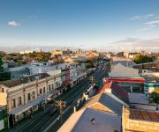
The district Hurlstone Park of in Canterbury (New South Wales) is a district located in Australia about 148 mi north-east of Canberra, the country's capital town.
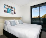
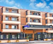
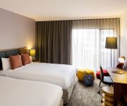
In need of a room? We compiled a list of available hotels close to the map centre further down the page.
Since you are here already, you might want to pay a visit to some of the following locations: Sydney, Parramatta, Katoomba, Canberra and . To further explore this place, just scroll down and browse the available info.
Local weather forecast
Todays Local Weather Conditions & Forecast: 23°C / 73 °F
| Morning Temperature | 16°C / 61 °F |
| Evening Temperature | 21°C / 70 °F |
| Night Temperature | 18°C / 64 °F |
| Chance of rainfall | 0% |
| Air Humidity | 54% |
| Air Pressure | 1026 hPa |
| Wind Speed | Moderate breeze with 10 km/h (6 mph) from South-West |
| Cloud Conditions | Overcast clouds, covering 100% of sky |
| General Conditions | Overcast clouds |
Friday, 22nd of November 2024
25°C (76 °F)
20°C (67 °F)
Sky is clear, moderate breeze, clear sky.
Saturday, 23rd of November 2024
27°C (80 °F)
20°C (68 °F)
Sky is clear, moderate breeze, clear sky.
Sunday, 24th of November 2024
28°C (83 °F)
21°C (69 °F)
Broken clouds, fresh breeze.
Hotels and Places to Stay
Novotel Sydney Brighton Beach
Veriu Camperdown
Quality Suites Camperdown
Ryals Serviced Apartments Camperdown
Comfort Inn & Suites Burwood
Mercure Sydney International Airport
The Urban Newtown
Ashfield Motor Inn
RYDGES CAMPERDOWN
ibis budget St Peters
Videos from this area
These are videos related to the place based on their proximity to this place.
First Half of my Australian Trip 2010/2011
I did it a long time ago but because of the lack of good internet here, I post it only now =) Melbourne - Great Ocean Road - Sydney - Young ...
Light Emotion Animation RGB Laser AnimateRGBB
The ANIMATERGBB is an affordable RGB laser featuring 80 inbuilt patterns and animations which can be accessed via DMX or scrolled through in stand alone or sound activation mode. Movement of...
Light Emotion OCTOPUSTRI
The OCTOPUSTRI features 3-in-1 Tri-colour LED technology that combines 3 different colour LED's (red, green and blue) into a single 9W LED source allowing a spectrum of coloured beam ...
Croydon Park, 192 Croydon Avenue
192 Croydon Avenue Croydon Park NSW Marketed by: Elders Inner West 9744 1212 www.eldersinnerwest.com.au Contact: Gavin Sanna Tel 9799 1400 | 0412 324 224, Email ...
Tree-Mendous Wolli Day, 20 July 2014
People who love the Wolli Creek Valley bushland came to celebrate the beautiful bush and trees at the Western End of the Valley near Bexley Rd. This stunning, unique area would be destroyed...
Pizza Delivery to Bardwell Park Quick and Easy
http://www.aussiepizzas.com/PIZZADELIVERY/pizza-delivery-bardwell-park/ 2/645 Princes Hwy, Rockdale 2216 02 9556 2020 Bardwell Park PIZZA HOME DELIVERY http://youtu.be/ADQZnkMB2CY ...
Plastic Surgery Vacations to Bangkok Thailand Cosmetic Medical Tours to Phuket
Start The Year Right With a Plastic Surgery Vacation to Bangkok or Phuket Thailand http://plasticsurgerythailand.org Plastic Surgery in Thailand is a remarkable opportunity for everyone to...
SOLD AT AUCTION! Gorgeous Art Deco Apartment - 62a Yule St, Dulwich Hill NSW
Our vendor at 6/2a Yule Street, Dulwich Hill is thrilled, Richard Matthews Real Estate has just sold their apartment for $387000 - well above the reserve price! The auction was a huge sucess,...
Sydney Rail Vlog 14: Ashfield during trackwork
Ashfield station during trackwork. Trains running on platform 1-2 are an unusual sight and shunting on platforms 3-4. Filmed 11/10/14.
Ashfield Carnival 2015, Sydney, Australia
The Carnival of Cultures is Ashfield Council's premiere event attracting 18, 000 people and celebrating the diverse range of cultures that make up the Ashfield Local Government Area. Now in...
Videos provided by Youtube are under the copyright of their owners.
Attractions and noteworthy things
Distances are based on the centre of the city/town and sightseeing location. This list contains brief abstracts about monuments, holiday activities, national parcs, museums, organisations and more from the area as well as interesting facts about the region itself. Where available, you'll find the corresponding homepage. Otherwise the related wikipedia article.
Hurlstone Park, New South Wales
Hurlstone Park is a suburb in the inner-west of Sydney, New South Wales, Australia. Hurlstone Park is located ten kilometres south-west of the Sydney central business district and is mostly in the local government area of the City of Canterbury, and partly in the Municipality of Ashfield. The suburb is bounded by: the Cooks River to the south, Garnet Street to the east, New Canterbury Road to the north, Canterbury Road to the north-west, and Church Street to the west.
Ashfield, New South Wales
Ashfield is a suburb in the inner-west of Sydney, in the state of New South Wales, Australia. Ashfield is about 9 kilometres south-west of the Sydney central business district and is the administrative centre for the local government area of the Municipality of Ashfield. The official name for the Ashfield Local Government Area was changed to Ashfield Council in November 2011. Ashfield's population is highly multicultural.
Trinity Grammar School (New South Wales)
Trinity Grammar School is an independent, Anglican, day and boarding school for boys in Sydney, Australia. The main campus is in Summer Hill, with a preparatory school in Strathfield. The school also operates a rural outdoor education campus known as Pine Bluff, near Bigga, New South Wales Founded in 1913 by The Right Reverend G.A.
Summer Hill, New South Wales
Summer Hill is a suburb of Sydney, in the state of New South Wales, Australia. Summer Hill is located 8 kilometres west of the Sydney central business district, in the local government area of the Municipality of Ashfield. Summer Hill is a primarily residential suburb of the Inner West region, adjoining two of Sydney's major arterial roads, Parramatta Road and Liverpool Road.
Marrickville, New South Wales
Marrickville, a suburb of Sydney's Inner West is located 7 kilometres south-west of the Sydney central business district in the state of New South Wales, Australia and is the largest suburb in the Marrickville Council local government area. Marrickville sits on the northern bank of the Cooks River, opposite Earlwood and shares borders with Stanmore, Enmore, Newtown, St Peters, Sydenham, Tempe, Dulwich Hill, Hurlstone Park and Petersham.
Ashfield Boys High School
Ashfield Boys' High School is a public secondary school for boys in Ashfield, an Inner West suburb of Sydney, New South Wales, Australia. It can be found on Liverpool Road, just off Parramatta Road.
Lewisham, New South Wales
Lewisham is a suburb in the inner-west of Sydney, in the state of New South Wales, Australia. Lewisham is located 8 kilometres south-west of the Sydney central business district, in the local government area of Marrickville Council. The postcode is 2049. Lewisham is surrounded by the suburbs of Petersham, Dulwich Hill, Summer Hill, Haberfield and Leichhardt.
Dulwich Hill, New South Wales
Dulwich Hill is a residential suburb in the Inner West of Sydney, in the state of New South Wales, Australia 9 kilometres south-west of the Sydney central business district, in the local government area of Marrickville Council. Dulwich Hill stretches south to the shore of the Cooks River.
Summer Hill railway station
Summer Hill railway station is located in Summer Hill, a suburb in the inner-west of Sydney, in the state of New South Wales, Australia. The station is located on the Main Suburban railway line and is served by Inner West line trains of the CityRail network. While there are six tracks through Summer Hill, only 3 tracks have platforms and only 2 of those 3 are currently in use. The line is accessed via a subway with lifts and stairs to the three platforms.
Canterbury, New South Wales
Canterbury is a suburb in south-western Sydney, in the state of New South Wales, Australia. Canterbury is located 11 kilometres south-west of the Sydney central business district in the City of Canterbury. The City of Canterbury takes its name from the suburb but its administrative centre is located in the adjacent suburb of Campsie, which is also a large commercial centre.
Ashbury, New South Wales
Ashbury is a suburb in inner-west Sydney, in the state of New South Wales, Australia. It is located 10 kilometres south-west of the Sydney central business district. The suburb lies in the local government area of the City of Canterbury with some areas in Ashfield Municipality. The postcode is 2193, the same as neighbouring Canterbury. Ashbury is mostly residential and has no commercial centre, although there are a handful of shops on King Street.
Hurlstone Park railway station
Hurlstone Park is a CityRail railway station on Sydney's Bankstown line. Located in the suburb of Hurlstone Park, it serves a residential area. It has two side platforms. There are also two tracks for goods trains.
Canterbury railway station, Sydney
Canterbury is a CityRail railway station on Sydney's Bankstown line. Located in the suburb of Canterbury, it serves a residential area. Canterbury Park Racecourse is adjacent, and a branch line formerly led to sidings used on race-days (now demolished). It has three platforms, only two of which are now used. One of the platforms faces one of the two goods lines that pass through Canterbury- part of the Metropolitan Goods Line.
Canterbury Park Racecourse
Canterbury Park Racecourse is a racecourse for horse racing in Sydney, New South Wales, Australia. It is located 11 km (7 mi) from the Sydney Central Business District, in King Street in the suburb of Canterbury, adjacent to Canterbury railway station. The first course was created by Cornelius Prout, on his own land. Frederick Clissold and Thomas Austen Davies resumed racing on a new course in 1871.
Dulwich Hill railway station
Dulwich Hill Railway Station is a station on the Bankstown line of Sydney's CityRail network, serving the residential area of Dulwich Hill. The station was opened in 1895 as Wardell Road and was renamed Dulwich Hill in 1920. The Bankstown line passes through Marrickville before arriving at Dulwich Hill through a cut at Wardell Road (where the station is situated), then follows Ewart Street over Hercules Street to Hurlstone Park.
Earlwood, New South Wales
Earlwood is a suburb in the inner-west of Sydney, in the state of New South Wales, Australia. Earlwood is located 12 kilometres south of the Sydney central business district, in the local government area of the City of Canterbury. Since the 1960s, the area has been strongly associated with Greece and Greek culture. Earlwood stretches from the southern bank of the Cooks River to the northern bank of Wolli Creek. Marrickville is located to the east across Cooks River.
Pratten Park
Pratten Park is a sporting complex in the Sydney suburb of Ashfield It was officially opened on the 12th of September 1912 by the then NSW state Governor Frederic Thesiger. Pratten Park was named after Herbert Pratten a alderman and later Mayor of the Municipality of Ashfield. The Park is best known as the original home of the Western Suburbs Magpies rugby league team, who played there from 1912 to 1966 before moving west to Lidcombe Oval.
Canterbury Boys' High School
Canterbury Boys' High School (CBHS) is a public secondary day school for boys located in Canterbury, a south-western suburb of Sydney, New South Wales, Australia. It is located near the Canterbury Park Racecourse and next to Canterbury Girls' High School. Established in January 1919 as the Canterbury Intermediate High School, Canterbury Boys' High School is part of the St. George Region of high schools, and currently enrols around 470 students from Years 7 to 12.
Christian Brothers' High School, Lewisham
Christian Brothers' High School, Lewisham (also known as CBHS Lewisham), is a Roman Catholic, day school for boys, located in Lewisham, an inner-western suburb of Sydney, New South Wales, Australia. Established in 1891 by the Christian Brothers, the school has a non-selective enrolment policy and currently caters for approximately 1,350 boys from Years 5 to 12. The school is the oldest of the Christian Brothers schools operating in Sydney.
Lewisham West MLR station
Lewisham West MLR station is a future light rail stop located on the border of the suburbs of Lewisham and Summer Hill on the Metro Light Rail line in Sydney, New South Wales, Australia. The stop will offer an interchange with Lewisham railway station though there is some distance between the two stations.
Waratah Mills MLR station
Waratah Mills MLR station is a planned light rail stop on the Metro Light Rail line in Sydney, New South Wales, Australia serving the suburb of Dulwich Hill. The stop's name is a reference to the former Waratah Mills flour mill located on the opposite side of Davis Street. The mill has been converted to apartments and is a local landmark.
Dulwich Hill Interchange MLR station
Dulwich Hill Interchange MLR station is a planned light rail stop located in the southern part of the suburb of Dulwich Hill on the Metro Light Rail line in Sydney, New South Wales, Australia. The name is intended to highlight the interchange with Dulwich Hill railway station which will be a short walk from the light rail stop.
Arlington MLR station
Arlington MLR station is a planned light rail stop on the Metro Light Rail line in Sydney, New South Wales, Australia located in the suburb of Dulwich Hill - adjacent to Constitution Road and Johnson Park. The stop's name is a reference to the nearby Arlington Recreation Ground (Oval) - a local sports venue.
Dulwich Grove MLR station
Dulwich Grove MLR station is a planned light rail stop on the Metro Light Rail line in Sydney, New South Wales, Australia serving the suburb of Dulwich Hill. The stop is located in a cutting between New Canterbury Road and Hercules Street. Dulwich Grove was the name of one of the area’s two earliest land releases and first use of the name Dulwich.
Wolli Creek Regional Park
The Wolli Creek Regional Park is a regional park found in South-West Sydney, between Bexley North and Tempe, New South Wales, Australia, within an area of 50 hectares of native bushland and public reserves of the Wolli Creek Valley. It is the only large, open space that remains in a heavily developed residential and industrial region.


