Explore St Andrews
The district St Andrews of in Campbelltown Municipality (New South Wales) is located in Australia about 130 mi north-east of Canberra, the country's capital.
If you need a place to sleep, we compiled a list of available hotels close to the map centre further down the page.
Depending on your travel schedule, you might want to pay a visit to some of the following locations: Parramatta, Sydney, Katoomba, Canberra and . To further explore this place, just scroll down and browse the available info.
Local weather forecast
Todays Local Weather Conditions & Forecast: 24°C / 75 °F
| Morning Temperature | 17°C / 62 °F |
| Evening Temperature | 22°C / 71 °F |
| Night Temperature | 20°C / 67 °F |
| Chance of rainfall | 2% |
| Air Humidity | 63% |
| Air Pressure | 1022 hPa |
| Wind Speed | Moderate breeze with 9 km/h (6 mph) from South-West |
| Cloud Conditions | Broken clouds, covering 70% of sky |
| General Conditions | Light rain |
Sunday, 17th of November 2024
31°C (88 °F)
19°C (67 °F)
Heavy intensity rain, moderate breeze, overcast clouds.
Monday, 18th of November 2024
30°C (87 °F)
16°C (60 °F)
Light rain, moderate breeze, clear sky.
Tuesday, 19th of November 2024
23°C (74 °F)
17°C (62 °F)
Light rain, gentle breeze, few clouds.
Hotels and Places to Stay
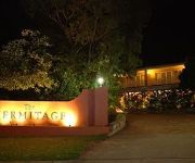
The Hermitage Motel
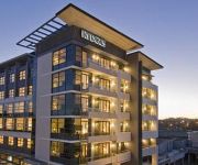
RYDGES CAMPBELLTOWN
BEST WESTERN CASULA MOTOR INN
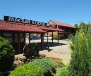
Maclin Lodge Motel
Crossroads Hotel Liverpool
ibis budget Campbelltown
Western Sydney University Village-Campbelltown Campus
QUEST CAMPBELLTOWN
Country Comfort Liverpool
Videos from this area
These are videos related to the place based on their proximity to this place.
4/30 Warwick Street, Minto - Prudential Real Estate 4628 0033
Wonderfully well-kept and neatly presented, this modern home has been cared for by previous tenants and owner's alike ensuring a great condition throughout. It features three bedrooms with...
Bernard Hancock ocd
Br Bernard Hancock from the Mt Carmel Retreat Centre, Varroville, Australia, will be ordained a priest on 7 August 2010. As the big day draws near, Bernard briefly reflects on his journey as...
7 Gardiner Street, Minto - Prudential Real Estate 9605 5000
This beautifully presented near new family residence combines elegance and modern practicality. Three spaciously sized bedrooms each with their own built-in wardrobe offers everyone plenty...
Nagle Netball at CDNA Carnival: HD PROMO EDITION
Nagle Netball Club in the Grand Final at Campbelltown District Netball Association Carnival.
Macarthur Wheelchair Basketball League Grand Final!
The Macarthur Wheelchair Basketball League (MWBL) is run by Macarthur Disability Services and is an all inclusive competition run over two seasons in Autumn and Spring. This grand final was...
Arena Etiquette - Scenic NSW Equine Centre
How to use the practice sand arena with more than 1 horse.
sparkler rocket in a tunnel
this rocket is the madest thin u will see on the the net watch it mad this is in deviles tunnel cambelltown.
Sydney Horse Trail Riding
My daughter finally gets to ride a horse. "A dream come true!" she states LOL.
15 Nelson Street, Minto - Prudential Real Estate 4628 0033
INSPECT THIS SALE PROPERTY Property Address - 15 Nelson Street, Minto If you think this property may suit you, it's easy to arrange an inspection. Firstly, y...
Nagle Netball at CDNA Carnival
Nagle Netball Club in the Grand Final at Campbelltown District Netball Association Carnival 25-July-2010. *** Make sure you turn up the volume before you play the video ***
Videos provided by Youtube are under the copyright of their owners.
Attractions and noteworthy things
Distances are based on the centre of the city/town and sightseeing location. This list contains brief abstracts about monuments, holiday activities, national parcs, museums, organisations and more from the area as well as interesting facts about the region itself. Where available, you'll find the corresponding homepage. Otherwise the related wikipedia article.
Campbelltown, New South Wales
Campbelltown is a suburb in south-western Sydney, New South Wales. Campbelltown is located 60 kilometres south-west of the Sydney central business district and is the administrative centre for the local government area of the City of Campbelltown.
Division of Werriwa
The Division of Werriwa is a Federal Electoral Division for the Australian House of Representatives. The name Werriwa derives from a local Aboriginal name for Lake George, which was located in the division when it was established in 1900. The division was one of the original 75 divisions first contested at the first federal election. At that time, the electorate was a large rural one that stretched from the south west of Sydney to the northern part of what is now the ACT.
Eagle Vale, New South Wales
Eagle Vale is a suburb of Sydney, in the state of New South Wales, Australia. Eagle Vale is located 56 kilometres south-west of the Sydney central business district, in the local government area of the City of Campbelltown and is part of the Macarthur region. It is bordered by the suburbs of Eschol Park, Kearns, Raby, Blairmount, Woodbine, St Andrews and Claymore.
Campbelltown railway station
Campbelltown railway station is located in Campbelltown, a city on the south-western periphery of Sydney, New South Wales, Australia. It is officially located on the Main Southern line and is served by the South and Airport and East Hills lines. It is the main terminus of the Cumberland Line and most intercity Southern Highlands Line services. It is also served by some CountryLink services.
Ingleburn railway station
Ingleburn railway station is a heritage-listed railway station in the serving the south-western Sydney suburb of Ingleburn. Situated on the Main South Line, it is served by CityRail trains of the South, Cumberland and East Hills lines. Ingleburn is used by an average of 7880 commuters each weekday.
Minto railway station
Minto is a railway station in the south-western suburbs of Sydney and is situated on the Main South Line. It is served by CityRail trains of the South, Cumberland and East Hills lines. It serves a residential area, and consists two side platforms. It has been in use since 1874. The station has street access to both platforms, connected by a ramp - providing Easy Access for wheelchairs. The Southern Sydney Freight Line passes by the western side of the station.
Leumeah railway station
Leumeah is a railway station in the south-western suburbs of Sydney and is situated on the Main South Line. It is within the Campbelltown City Council LGA, serving CityRail trains of the South, Cumberland and East Hills lines. It has two side platforms, with an overhead pedestrian bridge. The station is the main access station for Campbelltown Stadium, home of the Wests Tigers Rugby League team and to the Wests Club. It has been in use since 1886.
St Andrews, New South Wales
St Andrews is a suburb of Sydney, in the state of New South Wales, Australia 55 kilometres south-west of the Sydney central business district, in the local government area of the City of Campbelltown. It is part of the Macarthur region.
Raby, New South Wales
Raby is a suburb of Sydney, in the state of New South Wales, Australia 55 kilometres south-west of the Sydney central business district, in the local government area of the City of Campbelltown. It is part of the Macarthur region.
Minto, New South Wales
Minto is a suburb of Sydney, in the state of New South Wales, Australia. Minto is located 48 kilometres south-west of the Sydney central business district, in the local government area of the City of Campbelltown and is part of the Macarthur region.
Ingleburn, New South Wales
Ingleburn is a suburb of Sydney, in the state of New South Wales, Australia 44 kilometres south-west of the Sydney central business district, in the local government area of City of Campbelltown. It is part of the Macarthur region. Ingleburn lies approximately half way between the two commercial centres of Liverpool and Campbelltown.
Kearns, New South Wales
Kearns is a suburb of Sydney, in the state of New South Wales, Australia 57 kilometres south-west of the Sydney central business district, in the local government area of the City of Campbelltown and is part of the Macarthur region.
Leumeah, New South Wales
Leumeah is a suburb of Sydney, in the state of New South Wales, Australia 52 kilometres south-west of the Sydney central business district, in the local government area of the City of Campbelltown. It is north of the suburb of Campbelltown and is part of the Macarthur region.
Blairmount, New South Wales
Blairmount is a suburb of Sydney, in the state of New South Wales, Australia 58 kilometres south-west of the Sydney central business district, in the local government area of the City of Campbelltown. It is part of the Macarthur region. Its main road is Clydesdale Drive and its other streets are named after horse breeds.
Bow Bowing, New South Wales
Bow Bowing is a suburb of Sydney, in the state of New South Wales, Australia. Bow Bowing is located 55 kilometres south-west of the Sydney central business district, in the local government area of the City of Campbelltown and is part of the Macarthur region.
Claymore, New South Wales
Claymore is a suburb of Sydney, in the state of New South Wales, Australia. Claymore is located 54 kilometres south-west of the Sydney central business district, in the local government area of the City of Campbelltown and is part of the Macarthur region. The majority of housing in Claymore is owned by Housing NSW. The streets are named after Australian artists.
Denham Court, New South Wales
Denham Court is a suburb of Sydney, in the state of New South Wales, Australia 44 kilometres south-west of the Sydney central business district, in the local government areas of the City of Campbelltown and City of Liverpool. It is part of the Macarthur region.
Eschol Park, New South Wales
Eschol Park is a suburb of Sydney, in the state of New South Wales, Australia. Eschol Park is located 60 kilometres south-west of the Sydney central business district, in the local government area of the City of Campbelltown and is part of the Macarthur region.
Blair Athol, New South Wales
Blair Athol is a suburb of Sydney, in the state of New South Wales, Australia. Blair Athol is located 57 kilometres south-west of the Sydney central business district, in the local government area of the City of Campbelltown and is part of the Macarthur region.
Campbelltown Stadium
Campbelltown Stadium, formerly Orana Park and Campbelltown Sports Ground, is a rugby league stadium in Leumeah, New South Wales, Australia, owned by Campbelltown City Council. It is the full-time home ground for the Western Suburbs Magpies District Rugby League Football Club and is one of three home grounds for the Wests Tigers Rugby League Football Club.
Campbelltown High School of the Performing Arts
Mount Carmel High School (Varroville)
Mount Carmel High School is a Marist coeducational, comprehensive high school in Varroville, New South Wales, Australia. The current principal is Mr. Wayne Marshall.
Leumeah High School
Leumeah High School is a comprehensive, co-educational secondary school. The grounds, landscaped by students and staff, provide a pleasant environment in which the school community work. A medium sized agricultural farm, equipped for specialist plant breeding, is a focus in the junior curriculum.
Ingleburn High School
Ingleburn High School is a co-educational, comprehensive, public High School located in Ingleburn, New South Wales, Australia. The school follows the NSW Board of Studies' curriculum, which is provided to all schools in NSW. The School's motto is "Tolerance, Integrity and Excellence". The school consists of 63.6 teaching staff and around 881 students. Of the year 7 cohort, 2007, 50% met national numeracy benchmarks.
St Peter Parish, Cumberland
St Peter Parish is one of the 57 parishes of Cumberland County, New South Wales, a cadastral unit for use on land titles. Its eastern boundary is the Georges River. It is named after St Peters Anglican church, the oldest building in Campbelltown. {{#invoke:Coordinates|coord}}{{#coordinates:34|03|S|150|49|E|type:city|| |primary |name= }}


